Brutus, Virginia

Last updated

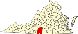
Brutus is an unincorporated community in Pittsylvania County, in the U.S. state of Virginia.

Related Research Articles

<span class="mw-page-title-main">Pittsylvania County, Virginia</span> County in Virginia, United States

Pittsylvania County is a county located in the Commonwealth of Virginia. As of the 2020 United States Census, the population was 60,501. Chatham is the county seat.

<span class="mw-page-title-main">Rocky Mount, Virginia</span> Town in Virginia, United States

Rocky Mount is a town in and the county seat of Franklin County, Virginia, United States. The town is part of the Roanoke Metropolitan Statistical Area, and had a population of 4,903 as of the 2020 census. It is located in the Roanoke Region of Virginia.

<span class="mw-page-title-main">Virginia State Route 156</span> State highway in Virginia

State Route 156 is a primary state highway in the U.S. state of Virginia. The state highway runs 57.38 miles (92.34 km) from U.S. Route 301 and SR 35 in Templeton north to US 360 Business in Mechanicsville. SR 156 follows a circuitous route through the eastern part of the Richmond–Petersburg metropolitan area. South of the James River, the state highway connects Templeton in Prince George County with Hopewell, which is directly served by SR 156 Business. SR 156 crosses the James River on the Benjamin Harrison Memorial Bridge and briefly passes through Charles City County. For most of its length in Henrico and Hanover, the state highway is a rural road that provides access to several units of Richmond National Battlefield Park. However, SR 156 provides access to Richmond International Airport, Interstate 64 (I-64), and I-295 as it passes through the Richmond suburbs of Sandston and Highland Springs as a major highway.

<span class="mw-page-title-main">Virginia State Route 120</span>

State Route 120 is a primary state highway in the U.S. state of Virginia. Known as Glebe Road, the state highway runs 9.10 miles (14.65 km) from U.S. Route 1 (US 1) in Crystal City north to SR 123 at the Chain Bridge. SR 120 is a partial circumferential highway in Arlington County that connects the southeastern and northwestern corners of the county with several urban villages along its crescent-shaped path, including Ballston. The state highway also connects all of the major highways in Virginia that radiate from Washington, including Interstate 395, I-66, US 50, and US 29. SR 120 is a part of the National Highway System for its entire length.

Owens is a small unincorporated crossroads community at the intersection of Dahlgren Road, Windsor Drive, and Owens Drive in King George County, Virginia, United States. State Routes 206 and 218 meet at this intersection, with 206 going east towards U.S. Route 301 and Dahlgren, 218 going south towards US 301 and Colonial Beach and 206 and 218 joined together going west towards Arnolds Corner and Fredericksburg. The eastern part of the community is within the Dahlgren census-designated place.

Tightsqueeze is an unincorporated community in the center of Pittsylvania County, Virginia, United States. It is included in the Danville, Virginia Metropolitan Statistical Area.

<span class="mw-page-title-main">U.S. Route 29 in Virginia</span> Highway in Virginia

U.S. Route 29 is a major north–south route in the Commonwealth of Virginia. It covers 248 miles (399 km) from the North Carolina border at the city of Danville to the Key Bridge in Washington, D.C. US 29 roughly bisects Virginia into eastern and western halves, and along with I-81 and US 11 in western Virginia, and I-85/95 as well as US 1 farther east, provides one of the major north–south routes through the Commonwealth.

<span class="mw-page-title-main">Virginia State Route 51</span>

State Route 51 is a primary state highway in the U.S. state of Virginia. Known as Westover Drive, the state highway runs 6.20 miles (9.98 km) between a pair of intersections with U.S. Route 58 Business in Pittsylvania County west of Danville and within Danville. SR 51 is the original alignment of US 58 through the western part of Danville.

<span class="mw-page-title-main">Virginia State Route 57</span> State highway in Virginia

State Route 57 is a primary state highway in the U.S. state of Virginia. The state highway runs 88.70 miles (142.75 km) from SR 8 near Woolwine east to SR 360 near Halifax. SR 57 connects the independent city of Martinsville with Chatham and Halifax, the county seats of Pittsylvania and Halifax counties, respectively. The state highway also connects the city to Fairy Stone State Park.

<span class="mw-page-title-main">Virginia State Route 293</span> Primary state highway in Virginia

State Route 293 is a primary state highway in the U.S. state of Virginia. The state highway runs 7.05 miles (11.35 km) between intersections with U.S. Route 29 Business on the south and north sides of the independent city of Danville. SR 293 is the original alignment of US 29 through Danville, which has been twice bypassed: first by what is now US 29 Business and later by the current US 29 freeway.

<span class="mw-page-title-main">Virginia State Route 360</span>

State Route 360 is a primary state highway in the U.S. state of Virginia. The state highway runs 41.77 miles (67.22 km) from U.S. Route 360, US 58 Business, and SR 293 in Danville east to US 360 and SR 344 near Scottsburg. SR 360 is the old alignment of US 360 through Danville, eastern Pittsylvania County, and Halifax County, including the latter's county seat of Halifax, before the U.S. Highway was moved to its present course mostly concurrent with US 58 via South Boston.

Zion Crossroads is an unincorporated community in Louisa and Fluvanna counties of Virginia. It is at the intersections of James Madison Highway and Three Notch Road. Interstate 64 in Virginia passes one-half mile to the northeast.

<span class="mw-page-title-main">Readington Village, New Jersey</span> Populated place in Hunterdon County, New Jersey, US

Readington Village is an unincorporated community located within Readington Township in Hunterdon County, in the U.S. state of New Jersey, that is centered on the converging of Readington Road, Hillcrest Road, Centerville Road and Brookview Road. It is located on Holland Brook, originally named Amanmechunk, which means large creek in the Unami dialect. The area was inhabited by the Raritan prior to the arrival of European settlers. The Native Americans who lived near Readington Village travelled to the coast during the summer for fish and clams. Such a trip is mentioned in an Indian deed transferring lands around Holland Brook to George Willocks, an East and West New Jersey Proprietor. The deed mentions two of the natives, who lived at Readington: Metamisco and Wataminian.

Belmont is an unincorporated community in Spotsylvania County, in the U.S. state of Virginia. It is marked with a highway sign at the intersection of Belmont Road and Orange Springs Road by the Virginia Department of Transportation, however is marked as being the intersection with Belmont Road and Jones Powell Road by the United States Geological Survey (USGS). The immediate area has Fletcher's Store and the Belmont Christmas Tree farm. Further south, there are other buildings identifying with Belmont, such as Belmont Baptist Church, the Belmont Ruritan Community Building where the Belmont Ruritan Club meets each evening at 7 p.m. and serves as the district's polling place for registered voters, and the Belmont Fire & Rescue station staffed by Spotsylvania County Volunteer Company 9.

Paytes is an unincorporated community in Spotsylvania County, in the U.S. state of Virginia. The community is marked at the intersection of Lawyer's Road and Catharpin Road by an electrical substation owned by Rappahannock Electric Co-op. A telecommunications tower was approved to be built on the site to expand cell coverage in the area on February 28, 2001.

Pittsville is an unincorporated community in Pittsylvania County, in the U.S. state of Virginia.

The original Maggoty Gap was a wind gap in the Blue Ridge Mountains in the counties of Roanoke, Virginia and Franklin, Virginia. Over time, as roads were improved and relocated, the identified location of the gap moved with them. It is now mapped at a spot in Roanoke County.

Varvol is an unincorporated community in southern Texas County, in the U.S. state of Missouri. The community is on the South Prong of Jacks Fork at the intersection of Missouri Route HH and Varvel Road. The community of Sargent is approximately 3.5 miles to the west on Varvel Road and Willow Springs in adjacent Howell County is about seven miles south on route HH and Missouri Route 137. Varvel School was about three miles east along the north bank of the river.

References

37°00′40″N79°16′09″W / 37.01111°N 79.26917°W / 37.01111; -79.26917

The community is located in the north east part of the county, about 9 miles north/north-east of Gretna. It is surrounded with farmland, timber and single family homes. It is approximately 900 feet above sea level. Two prominent landmarks have been a point of reference in guiding people to the area. Most locals reminisce about the Grayson Jacobs Store that was located at the intersection of Scott Jacobs Memorial Drive and Spring Road. The proprietor was a well-known county supervisor who offered general merchandise to the surrounding community. It was a social hub for the rural farmers of the area. The store was also a polling place for elections in the county. In the 1940s until the polling place was moved, the precinct was monitored to judge the outcome of the county election results. There was a saying in the county, “So goes Brutus, so goes Pittsylvania County”. Jacob's store closed in the 1970s when the proprietor died. The property lies in ruins today, with much of the old store building falling in. Across the intersection diagonally from the store is Spring Road Baptist Church. This church was established in 1852 and has been located on this site since the late 1800s. The present sanctuary structure dates to circa 1902. On the south east corner of the intersection is a memorial for Scott Jacobs, a teen who died in an auto accident about 2 miles north on Scott Jacobs Memorial Drive, which was renamed in his memory.