Motley, Virginia

Last updated

Motley is a census-designated place (CDP) in Pittsylvania County, Virginia, United States. It was named for a notable Virginia family in colonial times, the Motleys. Two of them, Joseph and his son David James Motley, fought in the American Revolution. The population as of the 2010 Census was 1,015 and 825 at the 2020 census. [1]

Related Research Articles

<span class="mw-page-title-main">University, Hillsborough County, Florida</span> Census-designated place in Florida, United States

University is an unincorporated census-designated place in Hillsborough County, Florida, United States. The population was 41,163 at the 2010 census, up from 30,736 at the 2000 census. The University of South Florida is located just southeast of the community, within the Tampa city limits.

<span class="mw-page-title-main">Low Moor, Virginia</span> Census-designated place in Virginia, United States

Low Moor is a census-designated place (CDP) in Alleghany County, Virginia. The population was 258 at the 2010 census.

<span class="mw-page-title-main">Selma, Virginia</span> CDP in Virginia, United States

Selma is a census-designated place (CDP) in Alleghany County, Virginia, United States. The population was 529 at the 2010 census.

<span class="mw-page-title-main">Madison Heights, Virginia</span> Census-designated place in Virginia, United States

Madison Heights is a census-designated place (CDP) in Amherst County, Virginia, United States. The population was 10,893 at the 2020 census. It is part of the Lynchburg Metropolitan Statistical Area.

Cloverdale is a census-designated place (CDP) in southern Botetourt County, Virginia, United States. The population was 3,410 at the 2020 census. The community is located along State Route 654. It is part of the Roanoke Metropolitan Statistical Area.

Laymantown is a census-designated place (CDP) in southern Botetourt County, Virginia, United States. The population was 1,867 at the 2020 census. The community is located along State Route 658. It is part of the Roanoke Metropolitan Statistical Area.

<span class="mw-page-title-main">Rustburg, Virginia</span> Census-designated place in Virginia, United States

Rustburg is a census-designated place (CDP) in and the county seat of Campbell County, Virginia, United States. The population was 1,585 at the 2020 census. It is part of the Lynchburg Metropolitan Statistical Area.

<span class="mw-page-title-main">Timberlake, Virginia</span> CDP in Virginia, United States

Timberlake is a census-designated place (CDP) in Campbell County, Virginia, United States. The population was 13,267 at the 2020 census. It is part of the Lynchburg Metropolitan Statistical Area.

Westlake Corner is a census-designated place in Franklin County, Virginia, United States. The population was 1,553 at the 2020 census up fro 976 at the 2010 census. It is part of the Roanoke Metropolitan Statistical Area.

<span class="mw-page-title-main">East Highland Park, Virginia</span> Census-designated place in Virginia

East Highland Park is a census-designated place (CDP) in Henrico County, Virginia, in the United States. The population was 15,131 at the 2020 census.

<span class="mw-page-title-main">Fairlea, West Virginia</span> Census-designated place in West Virginia, United States

Fairlea is a census-designated place (CDP) in Greenbrier County, West Virginia, United States. The population was 1,747 at the 2010 census. Fairlea is the location of the annual West Virginia State Fair, held in August.

Hollins is a census-designated place (CDP) in Botetourt and Roanoke County, Virginia, United States. Hollins covers much of the area known locally as "North County". The population was 15,574 at the 2020 census. It is part of the Roanoke Metropolitan Statistical Area. The area is also the home of Hollins University in addition to four properties listed on the National Register of Historic Places: the Black Horse Tavern-Bellvue Hotel and Office, Harshbarger House, the Hollins College Quadrangle, and Old Tombstone.

<span class="mw-page-title-main">Saluda, Virginia</span> Census-designated place in Virginia, US

Saluda is a census-designated place (CDP) in and the county seat of Middlesex County, Virginia, United States.

Sussex is a census-designated place (CDP) in and the county seat of Sussex County, Virginia, United States. The population as of the 2020 Census was 181.

<span class="mw-page-title-main">Eagle Rock, Virginia</span> CDP in Virginia, United States

Eagle Rock is a census-designated place (CDP) in Botetourt County, Virginia, United States, located along the James River between Iron Gate and Buchanan. It was first listed as a CDP in the 2020 census with a population of 209.

Cliftondale Park is an unincorporated community and census-designated place in Alleghany County, Virginia, United States. It was first listed as a CDP in the 2020 census with a population of 266.

Mallow is an unincorporated community and census-designated place in Alleghany County, Virginia, United States. It was first listed as a CDP in the 2020 census with a population of 671.

Glen Wilton is a census-designated place (CDP) in northern Botetourt County, Virginia, United States. The population was 129 at the 2020 census. The CDP is located along the James River, between Eagle Rock and Iron Gate. It is part of the Roanoke Metropolitan Statistical Area.

<span class="mw-page-title-main">Belspring, Virginia</span> Census-designated place in Virginia, United States

Belspring is a census-designated place (CDP) in Pulaski County, Virginia, United States, located at an elevation of 1,778 feet (542 m) above sea level. It has the ZIP Code 24058 and the area code 540. The population of the CDP was 256 at the 2010 Census.

Blairs is a census-designated place (CDP) in Pittsylvania County, Virginia, United States. The population as of the 2010 Census was 916 and 841 at the 2020 census.

References

  1. "Motley CDP, Virginia Demographics and Housing 2020 Decennial Census".

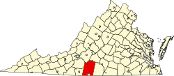
37°04′11″N79°20′28″W / 37.06972°N 79.34111°W / 37.06972; -79.34111