Vandalia (colony)

Last updated
Map Vandalia01.png
Map

Vandalia was the name in the late 1700s of a proposed British colony in North America. The colony would have been located south of the Ohio River, primarily in what are now West Virginia and northeastern Kentucky.

Contents

Vandalia was never approved by the British Crown and had no colonial government, although some Virginians and Pennsylvanians had already settled there. After the American Revolutionary War, the Vandalia settlers sought unsuccessfully to be admitted as a state called Westsylvania. However, they had no legal title to the land and were opposed by the governments of Virginia and Pennsylvania, which both claimed the area as their own under colonial charters. Ultimately the federal government split the area between Pennsylvania and Virginia according to the Mason–Dixon line. [1] Kentucky was later settled by Virginians and admitted as a state; West Virginia was admitted as a state during the American Civil War.

History

1755 Fry-Jefferson map showing earlier established colonial borders before the French And Indian War. Kitfry-1-.jpg
1755 Fry-Jefferson map showing earlier established colonial borders before the French And Indian War.

In the 18th century, British land speculators several times attempted to colonize the Ohio Valley, most notably in 1748 when the British Crown granted a petition of the Ohio Company for 200,000 acres (800 km2) near the "Forks of the Ohio" (present-day Pittsburgh, Pennsylvania). [2] The French and Indian War (1754–63) and Pontiac's Rebellion (1763–66) delayed settlement of the region. [3]

After Pontiac's Rebellion, merchants who had lost their trade items during the conflict formed a group known as the "suffering traders", later to become the Indiana Company. In the Treaty of Fort Stanwix (1768), the British required the Iroquois to give the "suffering traders" a grant of land. Those who benefited the most were Samuel Wharton and William Trent. Known as the "Indiana Grant", this land was located along the Ohio River and included part of the Iroquois' hunting ground, which they had controlled since the 17th century. [4] When Wharton and Trent sailed to England in 1769 seeking to have their grant confirmed, they joined forces with the Ohio Company to form the Grand Ohio Company, also called the Walpole Company.

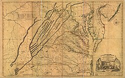
The Grand Ohio Company eventually received a larger area of land than the Indiana Grant. [5] The development companies planned a new colony, initially called "Pittsylvania" (Wright 1988:212) but later known as Vandalia, in honor of the British queen Charlotte of Mecklenburg-Strelitz (1744–1818), who was thought to be descended from Vandalic tribesmen. [6] [7] [8]

Opposition from rival interest groups [9] and the outbreak of the American Revolutionary War (1775–83) prevented the development of Vandalia as a full colony. [10] During the Revolutionary War, some settlers in the region petitioned the American Continental Congress to recognize a new province to be known as Westsylvania, which had approximately the same borders as the earlier Vandalia proposal. As both the states of Virginia and Pennsylvania claimed the region, they blocked recognition of a new state. [11] The Indiana Company presented a bill in equity against the State of Virginia concerning their claims, but the ruling in Chisholm v. Georgia led to the Eleventh Amendment forbidding suits by citizens of another State, and the Supreme Court dismissed the Indiana Company's suit, holding the constitutional amendment applied retroactively.

The formation of the state of Kentucky in 1792 and the separation of West Virginia from Virginia in 1863, established the present political borders in the region.

See also

Related Research Articles

<span class="mw-page-title-main">Indiana County, Pennsylvania</span> County in Pennsylvania, United States

Indiana County is a county in the Commonwealth of Pennsylvania. It is located in the west central part of Pennsylvania. As of the 2020 census, the population was 83,246. Its county seat is Indiana. Indiana County comprises the Indiana, PA Micropolitan Statistical Area, which is also included in the Pittsburgh-New Castle-Weirton, PA-WV-OH Combined Statistical Area.

<span class="mw-page-title-main">Northwest Territory</span> United States territory (1787–1803)

The Northwest Territory, also known as the Old Northwest and formally known as the Territory Northwest of the River Ohio, was formed from unorganized western territory of the United States after the American Revolution. Established in 1787 by the Congress of the Confederation through the Northwest Ordinance, it was the nation's first post-colonial organized incorporated territory.

<span class="mw-page-title-main">Transylvania Colony</span> Short-lived extra-legal colony in frontier Kentucky

The Transylvania Colony, also referred to as the Transylvania Purchase, was a short-lived, extra-legal colony founded in early 1775 by North Carolina land speculator Richard Henderson, who formed and controlled the Transylvania Company. Henderson and his investors had reached an agreement to purchase a vast tract of Cherokee lands west of the southern and central Appalachian Mountains through the acceptance of the Treaty of Sycamore Shoals with most leading Cherokee chieftains then controlling these lands. In exchange for the land the tribes received goods worth, according to the estimates of some scholars, about 10,000 British pounds. To further complicate matters, this frontier land was also claimed by the Virginia Colony and a southern portion by Province of North Carolina.

Trans-Appalachia is an area in the United States bounded to the east by the Appalachian Mountains and extends west roughly to the Mississippi River. It spans from the Midwest to the Upper South. The term is used most frequently when referring to the area as a frontier in the 18th and 19th century. During this period, the region gained its own identity, defined by its isolation and separation from the rest of the United States to the east. It included much of Ohio Country and at least the northern and eastern parts of the Old Southwest. It was never an organized territory or other political unit. Most of what was referred to by this name became the states of western Pennsylvania, Ohio, West Virginia, Kentucky, Tennessee and western Virginia. It is still a vague and little used place name today.

<span class="mw-page-title-main">Westsylvania</span> Proposed Transappalachian state during the Revolutionary War era.

Westsylvania was a proposed state of the United States located in what is now West Virginia, southwestern Pennsylvania, and small parts of Kentucky, Maryland, and Virginia. First proposed early in the American Revolution, Westsylvania would have been the fourteenth state in the newly formed United States, had it been recognized.

<span class="mw-page-title-main">Ohio Country</span> Historical region in North America

The Ohio Country, was a name used before 1787 for a region of North America west of the Appalachian Mountains north of the upper Ohio and Allegheny rivers, and extending to Lake Erie. The area encompassed present-day northwestern West Virginia, Western Pennsylvania, most of Ohio, and a wedge of southeastern Indiana.

<span class="mw-page-title-main">Historical regions of the United States</span>

The territory of the United States and its overseas possessions has evolved over time, from the colonial era to the present day. It includes formally organized territories, proposed and failed states, unrecognized breakaway states, international and interstate purchases, cessions, and land grants, and historical military departments and administrative districts. The last section lists informal regions from American vernacular geography known by popular nicknames and linked by geographical, cultural, or economic similarities, some of which are still in use today.

<span class="mw-page-title-main">Lord Dunmore's War</span> 1774 conflict in the Colony of Virginia

Lord Dunmore's War, also known as Dunmore's War, was a brief conflict in fall 1774 between the British Colony of Virginia and the Shawnee and Mingo in the trans-Appalachian region of the colony south of the Ohio River. Broadly, the war included events between May and October 1774. The governor of Virginia during the conflict was John Murray, 4th Earl of Dunmore, who in May 1774, asked the House of Burgesses to declare a state of war with the Indians and call out the Virginia militia.

<span class="mw-page-title-main">Ohio Company</span> British land speculation company in colonial North America

The Ohio Company, formally known as the Ohio Company of Virginia, was a land speculation company organized for the settlement by Virginians of the Ohio Country and to trade with the Native Americans. The company had a land grant from Britain and a treaty with Indians, but France also claimed the area, and the conflict helped provoke the outbreak of the French and Indian War.

<span class="mw-page-title-main">Cornstalk</span> Shawnee leader in the American Revolution

Cornstalk was a Shawnee leader in the Ohio Country in the 1760s and 1770s. His name in the Shawnee language was Hokoleskwa. Little is known about his early life. He may have been born in the Province of Pennsylvania. In 1763, he reportedly led a raid against British American colonists in Pontiac's War. He first appears in historical documents in 1764, when he was one of the hostages surrendered to the British as part of the peace negotiations ending Pontiac's War.

<span class="mw-page-title-main">Treaty of Fort Stanwix (1768)</span> Treaty between Great Britain and the Iroquois people

The Treaty of Fort Stanwix was a treaty signed between representatives from the Iroquois and Great Britain in 1768 at Fort Stanwix. It was negotiated between Sir William Johnson, his deputy George Croghan, and representatives of the Iroquois.

<span class="mw-page-title-main">Wilderness Road</span> Historic highway in Kentucky, US

The Wilderness Road was one of two principal routes used by colonial and early national era settlers to reach Kentucky from the East. Although this road goes through the Cumberland Gap into southern Kentucky and northern Tennessee, the other is sometimes called the "Cumberland Road" because it started in Fort Cumberland in Maryland. Despite Kentucky Senator Henry Clay's advocacy of this route, early in the 19th century, the northern route was selected for the National Road, connecting near Washington, Pennsylvania into the Ohio Valley of northern Kentucky and Ohio.

George Croghan was an Irish-born fur trader in the Ohio Country of North America who became a key early figure in the region. In 1746 he was appointed to the Onondaga Council, the governing body of the Iroquois, and remained so until he was banished from the frontier in 1777 during the American Revolutionary War. Emigrating from Ireland to Pennsylvania in 1741, he had become an important trader by going to the villages of Indigenous Peoples, learning their languages and customs, and working on the frontier where previously mostly French had been trading. During and after King George's War of the 1740s, he helped negotiate new treaties and alliances for the British with Native Americans.

Tanacharison, also called Tanaghrisson, was a Native American leader who played a pivotal role in the beginning of the French and Indian War. He was known to European-Americans as the Half-King, a title also used to describe several other historically important Native American leaders. His name has been spelled in a variety of ways.

<span class="mw-page-title-main">Samuel Wharton</span> American politician

Samuel Wharton was a merchant, land speculator, and politician from Dover in Kent County, Delaware. John Bayton, George Morgan, and George Croghan, deputy superintendent of Indian affairs, joined in a partnership on the Ohio country and Indian Trade after 1763. Though the various colonies laid claim to parts of it after the French and Indian War, the Treaty of Paris gave control of the entire Ohio region to Great Britain of Wharton and their business operation. During the American Revolution, he served as a delegate to the Continental Congress from Delaware.

<span class="mw-page-title-main">Pennamite–Yankee War</span>

The Pennamite–Yankee Wars or Yankee–Pennamite Wars were a series of conflicts consisting of the First Pennamite War (1769–1770), the Second Pennamite War (1774), and the Third Pennamite War (1784), in which settlers from Connecticut (Yankees) and Pennsylvania (Pennamites) disputed for control of the Wyoming Valley along the North Branch of the Susquehanna River. Both colonies and later states declared that their original land grants gave them control of this territory.

William Trent was an American fur trader and merchant based in colonial Pennsylvania. He was commissioned as a captain of the Virginia Regiment in the early stages of the French and Indian War, when he served on the western frontier with the young Lt. Colonel George Washington. Trent led an advance group who built forts and improved roads for troop access and defense of the western territory. He was later promoted to the rank of major.

<span class="mw-page-title-main">Lochry's Defeat</span> Part of the American Revolutionary War

Lochry's Defeat, also known as the Lochry massacre, was a battle fought on August 24, 1781, near present-day Aurora, Indiana, in the United States. The battle was part of the American Revolutionary War (1775–1783), which began as a conflict between Great Britain and the Thirteen Colonies before spreading to the western frontier, where American Indians entered the war as British allies. The battle was short and decisive: about one hundred Indians of local tribes led by Joseph Brant, a Mohawk military leader who was temporarily in the west, ambushed a similar number of Pennsylvania militiamen led by Archibald Lochry. Brant and his men killed or captured all of the Pennsylvanians without suffering any casualties.

<span class="mw-page-title-main">Indian Reserve (1763)</span> Native North American Areas

"Indian Reserve" is a historical term for the largely uncolonized land in North America that was claimed by France, ceded to Great Britain through the Treaty of Paris (1763) at the end of the Seven Years' War—also known as the French and Indian War—and set aside for the First Nations in the Royal Proclamation of 1763. The British government had contemplated establishing an Indian barrier state in a portion of the reserve west of the Appalachian Mountains, bounded by the Ohio and Mississippi rivers and the Great Lakes. British officials aspired to establish such a state even after the region was assigned to the United States in the Treaty of Paris (1783) ending the American Revolutionary War, but abandoned their efforts in 1814 after losing military control of the region during the War of 1812.

<span class="mw-page-title-main">James Smith (frontiersman)</span> Frontiersman, farmer and soldier in British North America

James Smith was a frontiersman, farmer and soldier in British North America. In 1765, he led the "Black Boys", a group of Pennsylvania men, in a nine-month rebellion against British rule ten years before the outbreak of the American Revolutionary War. He participated in the Revolutionary War as a colonel of the Pennsylvania militia and was a legislator in the Kentucky General Assembly. Smith was also an author, publishing a memoir about his captivity by Native Americans in his Narrative in 1799, and in 1812 an in-depth analysis of Native-American fighting techniques, based on observations during his captivity.

References

  1. Cranmer, History of the Upper Ohio, 1:59–63
  2. Anderson, James Donald, "Vandalia: The First West Virginia?" West Virginia History, Volume 40, No. 4 (Summer 1979), pp. 375-92 online
  3. Cecil B. Currey, Road to Revolution: Benjamin Franklin in England, 1765-1775 (1968) pp 248-54
  4. Marshall, "Lord Hillsborough, Samuel Wharton, and the Ohio Grant, 1769- 1775" English Historical Review (1965), 80:717-18
  5. Croghan to T. Wharton, December 9, 1773, "Letters of George Croghan," PMHB, XV (1891), 436-37. Any migration westward could help Croghan sell some of his own lands at Fort Pitt. James Donald Anderson, 1978
  6. Otis K. Rice and Stephen W. Brown. West Virginia: A History. 2nd Ed. University Press of Kentucky, 1994. p. 30. ISBN   978-0-8131-1854-3
  7. David W. Miller. The Taking of American Indian Lands in the Southeast: A History of Territorial Cessions and Forced Relocations, 1607-1840. McFarland, 2011. p. 41. ISBN   978-0-7864-6277-3
  8. Thomas J. Schaeper. Edward Bancroft: Scientist, Author, Spy. Yale University Press, 2011. p. 34. ISBN   978-0-300-11842-1
  9. Gipson, Lawrence Henry, The British Empire Before the American Revolution, 15 vols. New York: Alfred A. Knopf, 1946-1970, IX 457-88
  10. Carter, Clarence Edwin, Great Britain and the Illinois Country, 1763-1773, Port Washington, N.Y: Kennikat Press, 1970
  11. Abernethy, Thomas Perkins. Western Lands and the American Revolution. 1937/New York: Russell & Russell, 1959

Sources

38°20′N81°40′W / 38.333°N 81.667°W / 38.333; -81.667