
Albemarle County, North Carolina was a county located in the Province of North Carolina. It contained what is now the northeastern portion of the U.S. state of North Carolina.
Albemarle County, North Carolina was a county located in the Province of North Carolina. It contained what is now the northeastern portion of the U.S. state of North Carolina.
Albemarle County was named for George Monck, 1st Duke of Albemarle, one of the eight Lords Proprietors of the Province of Carolina, for whom the Albemarle Sound is also named. It contained approximately 1,600 square miles of territory, though its boundaries were not precise. [1] Under the original divisions of the province, the county to the south of Albemarle was called Clarendon County and centered on the Cape Fear region, but was only briefly occupied in the 1660s. Bath County was organized in 1696 and lay more closely to the south.
By 1671, three precincts of Albemarle County had been formed: Shaftesbury, Carteret, and Berkeley. In 1681, Berkeley was renamed Perquimans, and by 1685 Shaftesbury became Chowan. By 1689 the county ceased to function as a governmental unit, replaced by the four "precincts" (which would later become counties themselves in 1739): Chowan County, Currituck County, Pasquotank County, and Perquimans County.
From the four precincts, Carteret was divided into Currituck and Pasquotank in about 1685, Bertie Precinct was formed from part of Chowan in 1722, consisting of all territory west of the Chowan River. Tyrrell Precinct was created in 1729 from parts of Chowan, Bertie, Pasquotank, and Currituck. Local residents asked that the western part of Bertie be divided into a new precinct as early as 1732, which led to the creation of Edgecombe Precinct (dates of the formation of Edgecombe vary from 1732 to 1741).
Albemarle County was officially abolished as an entity in 1738, and all the "precincts" were designated as "counties". [2] [3]

Tyrrell County is a county located in the U.S. state of North Carolina. As of the 2020 census, the population was 3,245, making it the least populous county in North Carolina. Its county seat is Columbia. The county was created in 1729 as Tyrrell Precinct and gained county status in 1739. Tyrrell County is included in the Kill Devil Hills, NC, Micropolitan Statistical Area, which is also included in the Virginia Beach-Norfolk, VA-NC Combined Statistical Area.

Perquimans County is a county located in the U.S. state of North Carolina. As of the 2020 census, the population was 13,005. Its county seat is Hertford. Perquimans County is part of the Elizabeth City, NC Micropolitan Statistical Area, which is also included in the Virginia Beach-Norfolk, VA-NC Combined Statistical Area. The Harvey Point Defense Testing Activity facility is located in Perquimans County.
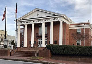
Franklin County is a county located in the U.S. state of North Carolina. As of the 2020 census, the population was 68,573. Its county seat is Louisburg.

Chowan County is one of the 100 counties located in the U.S. state of North Carolina. As of the 2020 census, the population was 13,708. Its county seat is Edenton. The county was created between 1668 and 1671 as Shaftesbury Precinct and later renamed Chowan Precinct. It gained county status in 1739.

Bertie County is a county located in the northeast area of the U.S. state of North Carolina. As of the 2020 census, the population was 17,934. Its county seat is Windsor. The county was created in 1722 as Bertie Precinct and gained county status in 1739.

Scouting in North Carolina has a long history, from the 1910s to the present day, serving thousands of youth in programs that suit the environment in which they live.

The Province of Carolina was a province of the Kingdom of England (1663–1707) and later the Kingdom of Great Britain (1707–1712) that existed in North America and the Caribbean from 1663 until partitioned into North and South on January 24, 1712. It consisted of all or parts of present-day Alabama, Florida, Georgia, Mississippi, North Carolina, South Carolina, and Tennessee.
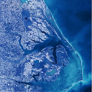
Albemarle Sound is a large estuary on the coast of North Carolina in the United States located at the confluence of a group of rivers, including the Chowan and Roanoke. It is separated from the Atlantic Ocean by the Currituck Banks, a barrier peninsula upon which the town of Kitty Hawk is located, at the eastern edge of the sound, and part of the greater Outer Banks region. Roanoke Island is situated at the southeastern corner of the sound, where it connects to Pamlico Sound. Much of the water in the Albemarle Sound is brackish or fresh, as opposed to the saltwater of the ocean, as a result of river water pouring into the sound.

The United States District Court for the Eastern District of North Carolina is the United States district court that serves the eastern 44 counties in North Carolina. Appeals from the Eastern District of North Carolina are taken to the United States Court of Appeals for the Fourth Circuit.
College of The Albemarle (COA) is a public community college in the Albemarle region of northeastern North Carolina. The main campus is in Elizabeth City with satellite campuses in Barco, Manteo and Edenton. Established on December 16, 1960, College of The Albemarle became the first institution of the North Carolina Community College System as chartered by the Community College Act of 1957.

The Inner Banks is a neologism made up by developers and tourism promoters to describe the inland coastal region of eastern North Carolina. Without historical precedent, the term "Inner Banks" is an early 21st-century construct that is part of an attempt to rebrand the mostly agrarian coastal plain east of I-95 as a more attractive region for visitors and retirees.

The North Carolina General Assembly of 2005–06 was the legislature that was elected on November 2, 2004, by voters in North Carolina. Members of the House of Representatives and Senate met in Raleigh, North Carolina, in 2005 and 2006. These were the first elections for the state legislature under a new redistricting plan approved in 2003. This General Assembly will perhaps be best remembered as the assembly that approved North Carolina's first state lottery. It also approved new ethics laws for government officials and increased the state's minimum wage.

North Carolina's 1st congressional district is located in the northeastern part of the state. It consists of many Black Belt counties that border Virginia and it extends southward into several counties of the Inner Banks and the Research Triangle. It covers many rural areas of northeastern North Carolina, among the state's most economically poor, as well as outer exurbs of urbanized Research Triangle. It contains towns and cities such as Greenville, Rocky Mount, Wilson, Goldsboro, Henderson, and Roanoke Rapids.

North Carolina's 3rd congressional district is located on the Atlantic coast of North Carolina. It covers the Outer Banks and the counties adjacent to the Pamlico Sound.
The North Carolina General Assembly of 2007–08 consisted of the North Carolina House of Representatives and the North Carolina Senate that met in Raleigh, North Carolina, in 2007 and 2008. Members of the House and Senate were elected on November 7, 2006. This legislature first convened in January 2007. In addition to its regular sessions, the legislature met in special session in March 2008 to consider expelling Representative Thomas E. Wright.

Eastern North Carolina is the region encompassing the eastern tier of North Carolina, United States. It is known geographically as the state's Coastal Plain region. Primary subregions of Eastern North Carolina include the Sandhills, the Lower Cape Fear, the Crystal Coast, the Inner Banks and the Outer Banks. It is composed of the 41 most eastern counties in the state. Cities include Greenville, Jacksonville, Wilmington, Rocky Mount and North Carolina's first capital New Bern.

The North Carolina General Assembly 2009–10 was the 149th North Carolina General Assembly. The 50 members of the North Carolina Senate and 120 members of the North Carolina House of Representatives were elected on November 6, 2008. It first convened in January 2009.

Navy Region Mid-Atlantic is one of eleven current naval regions responsible to Commander, Navy Installations Command for the operation and management of Naval shore installations in Wisconsin, Illinois, Michigan, Indiana, Ohio, Kentucky, North Carolina, Virginia, West Virginia, Maryland, Delaware, Pennsylvania, New Jersey, New York, Connecticut, Rhode Island, Massachusetts, Vermont, New Hampshire, and Maine.
The Edenton District Brigade was an administrative division of the North Carolina militia during the American Revolutionary War (1776–1783). This unit was established by the North Carolina Provincial Congress on May 4, 1776, and disbanded at the end of the war.
36°18′50″N76°20′24″W / 36.314°N 76.340°W
| | This North Carolina state location article is a stub. You can help Wikipedia by expanding it. |