Rainswood, Virginia

Last updated

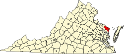
Rainswood is an unincorporated community in Northumberland and Richmond counties, in the U.S. state of Virginia.

Northumberland County, Virginia County in the United States

Northumberland County is a county located in the Commonwealth of Virginia. As of the 2010 census, the population was 12,330. Its county seat is Heathsville. The county is located on the Northern Neck and is part of the Northern Neck George Washington Birthplace AVA winemaking appellation.

Richmond County, Virginia County in the United States

Richmond County is a county located on the Northern Neck in the Commonwealth of Virginia. As of the 2010 census, the population was 9,254. Its county seat is Warsaw. The rural county should not be confused with the large city and state capital Richmond, Virginia. It was formed in 1692 when the first Rappahannock County was divided to form Richmond County and Essex County.

U.S. state constituent political entity of the United States

In the United States, a state is a constituent political entity, of which there are currently 50. Bound together in a political union, each state holds governmental jurisdiction over a separate and defined geographic territory and shares its sovereignty with the federal government. Due to this shared sovereignty, Americans are citizens both of the federal republic and of the state in which they reside. State citizenship and residency are flexible, and no government approval is required to move between states, except for persons restricted by certain types of court orders. Four states use the term commonwealth rather than state in their full official names.

Related Research Articles

The Miami Canal, or C-6 Canal, flows from Lake Okeechobee in the U.S. state of Florida to its terminus at the Miami River, which flows through downtown Miami. The canal flows in a south and southeasterly direction for approximately 77 miles, and passes through three counties: Broward, Palm Beach, and Miami-Dade. It was constructed in the early part of the 20th century to drain the Everglades Agricultural Area (EAA).

Singeyer Pass is a mountain pass on southern Baffin Island, Nunavut, Canada.

Burtons Corner is an unincorporated community in Northumberland and Richmond counties, in the U.S. state of Virginia.

Claraville, Virginia human settlement in Virginia, United States of America

Claraville is an unincorporated community in Northumberland County, in the U.S. state of Virginia.

Edwardsville is an unincorporated community in Northumberland County, in the U.S. state of Virginia.

Hardings is an unincorporated community in Northumberland County, in the U.S. state of Virginia.

Jetts Store is an unincorporated community in Northumberland County, in the U.S. state of Virginia.

Vir-Mar Beach is an unincorporated community in Northumberland County, in the U.S. state of Virginia.

Moores Mill is an unincorporated community in Richmond County, in the U.S. state of Virginia.

Oakley Landing is an unincorporated community in Richmond County, in the U.S. state of Virginia. It is located eight miles south of Farnham at the southern tip of Hales Point, close to Tarpley Point, on the Rappahannock river.

Tidewater is an unincorporated community in Richmond County, in the U.S. state of Virginia.

Sarah is an unincorporated community in Mathews County, in the U. S. state of Virginia.

Batt is an unincorporated community in Gloucester County, in the U. S. state of Virginia.

Crab is an unincorporated community in Gloucester County, in the U. S. state of Virginia.

Rowes Haven is an unincorporated community in Gloucester County, in the U. S. state of Virginia.

Yelverton, Ohio human settlement in United States of America

Yelverton is an unincorporated community in Hardin County, in the U.S. state of Ohio.

Barrs Mills is an unincorporated community in Tuscarawas County, in the U.S. state of Ohio.

Wheeler Fork is a stream in the U.S. state of West Virginia.

Crooks Springs is an unincorporated community in St. Clair County, in the U.S. state of Missouri.

Allen Branch is a stream in Washington County, Missouri. It is a tributary of Fourche a Renault.

References

Coordinates: 37°55′01″N76°32′55″W / 37.91694°N 76.54861°W / 37.91694; -76.54861

Geographic coordinate system Coordinate system

A geographic coordinate system is a coordinate system that enables every location on Earth to be specified by a set of numbers, letters or symbols. The coordinates are often chosen such that one of the numbers represents a vertical position and two or three of the numbers represent a horizontal position; alternatively, a geographic position may be expressed in a combined three-dimensional Cartesian vector. A common choice of coordinates is latitude, longitude and elevation. To specify a location on a plane requires a map projection.