Chesapeake Beach, Northumberland County, Virginia

Last updated

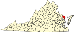
Chesapeake Beach is an unincorporated community in Northumberland County, in the U.S. state of Virginia.

References Coordinates: 37°50′27″N76°15′01″W / 37.84083°N 76.25028°W / 37.84083; -76.25028

Related Research Articles

Delmarva Peninsula Large peninsula on the East Coast of the US

The Delmarva Peninsula, or simply Delmarva, is a large peninsula on the East Coast of the United States, occupied by the vast majority of the state of Delaware and parts of the Eastern Shore regions of Maryland and Virginia. The peninsula is 170 miles (274 km) long. In width, it ranges from 70 miles (113 km) near its center, to 12 miles (19 km) at the isthmus on its northern edge, to less near its southern tip of Cape Charles. It is bordered by the Chesapeake Bay on the west, and the Delaware River, Delaware Bay, and the Atlantic Ocean on the east.

Virginia Beach, Virginia Independent city in Virginia, United States

Virginia Beach is an independent city located on the southeastern coast of the Commonwealth of Virginia in the United States. As of the 2010 census, the population was 437,994; in 2019, it was estimated to be 449,974. Although mostly suburban in character, it is the most populous city in Virginia and the 44th most populous city in the nation. Located on the Atlantic Ocean at the mouth of the Chesapeake Bay, Virginia Beach is included in the Hampton Roads metropolitan area. This area, known as "America's First Region", also includes the independent cities of Chesapeake, Hampton, Newport News, Norfolk, Portsmouth, and Suffolk, as well as other smaller cities, counties, and towns of Hampton Roads.

Northumberland County, Virginia U.S. county in Virginia

Northumberland County is a county located in the Commonwealth of Virginia. As of the 2010 census, the population was 12,330. Its county seat is Heathsville. The county is located on the Northern Neck and is part of the Northern Neck George Washington Birthplace AVA winemaking appellation.

Lancaster County, Virginia U.S. county in Virginia

Lancaster County is a county located on the Northern Neck in the Commonwealth of Virginia. As of the 2010 census, the population was 11,391. Its county seat is Lancaster.

Chesapeake, Virginia Independent city in Virginia

Chesapeake is an independent city in the Commonwealth of Virginia. As of the 2010 census, the population was 222,209; in 2019, the population was estimated to be 244,835, making it the second-most populous city in Virginia.

Cape Charles, Virginia Town in Commonwealth of Virginia, United States

Cape Charles is a town / municipal corporation in Northampton County, Virginia, United States. The population was 1,009 as of the 2010 U.S.Decennial Census.

Colonial Beach, Virginia Town in Virginia, United States

Colonial Beach, Virginia (CBVA) is a river and beach town located in the northwestern part of Westmoreland County on Virginia's Northern Neck peninsula. It is bounded by the Potomac River, Monroe Bay and Monroe Creek and home to the second-largest beachfront in the state. It is located 65 mi (105 km) from Washington, D.C.; 70 mi (110 km) from the state capital of Richmond; and 35 nautical miles from the Chesapeake Bay.

Hampton Roads Body of water and metropolitan area in the US

Hampton Roads is the name of both a body of water that serves as a wide channel for the James, Nansemond and Elizabeth rivers between Old Point Comfort and Sewell's Point where the Chesapeake Bay flows into the Atlantic Ocean, and the surrounding metropolitan region located in the Southeastern Virginia and Northeastern North Carolina portions of the Tidewater region.

Middle Peninsula Region of Virginia

The Middle Peninsula is the second of three large peninsulas on the western shore of Chesapeake Bay in Virginia, in the United States. It lies between the Northern Neck and the Virginia Peninsula. This peninsula is bounded by the Rappahannock River on the north and the York River on the south, with the Chesapeake Bay to the east. It encompasses six Virginia counties: Essex, Gloucester, King and Queen, King William, Mathews, and Middlesex. Developed for tobacco plantations in the colonial era, in the 21st century the Middle Peninsula is known for its quiet rural life, vegetable truck-farming, and fishing industry.

Chesapeake Bay Bridge–Tunnel

The Chesapeake Bay Bridge–Tunnel (CBBT) is a 17.6-mile (28.3 km) bridge–tunnel crossing at the mouth of the Chesapeake Bay, the Hampton Roads harbor, and nearby mouths of the James and Elizabeth Rivers in the U.S. state of Virginia. It connects Northampton County on the Delmarva Peninsula and Eastern Shore with Virginia Beach, Norfolk, Chesapeake, and Portsmouth on the western shore and south side / Tidewater which are part of the Hampton Roads metropolitan area of eight close cities around the harbor's shores and peninsula. The bridge–tunnel originally combined 12 miles (19 km) of trestle, two 1-mile-long (1.6 km) tunnels, four artificial islands, four high-level bridges, approximately 2 miles (3.2 km) of causeway, and 5.5 miles (8.9 km) of northeast and southwest approach roads—crossing the Chesapeake Bay and preserving traffic on the Thimble Shoals and Chesapeake dredged shipping channels leading to the Atlantic. It replaced vehicle ferry services that operated from South Hampton Roads and from the Virginia Peninsula since the 1930s. Financed by toll revenue bonds, the Bridge–Tunnel was opened on April 15, 1964, and remains one of only 11 bridge–tunnel systems in the world, three of which are located in the water-dominated Hampton Roads area of Tidewater Virginia.

Eastern Shore of Virginia

The Eastern Shore of Virginia consists of two counties on the Atlantic coast detached from the mainland of the Commonwealth of Virginia in the United States. The 70-mile-long (110 km) region is part of the Delmarva Peninsula and is separated from the rest of Virginia by the Chesapeake Bay. Its population was 45,553 as of 2010.

South Hampton Roads

South Hampton Roads is a region located in the extreme southeastern portion of Virginia's Tidewater region in the United States with a total population of 1,191,937. It is part of the Virginia Beach-Norfolk-Newport News, VA-NC MSA, which itself has a population of 1,724,876.

Virginia State Route 168 State highway in Virginia, United States

State Route 168 is a primary state highway in the South Hampton Roads region of the U.S. state of Virginia. It runs from the border with North Carolina through the independent cities of Chesapeake and Norfolk where it ends in the Ocean View area near the Hampton Roads Bridge-Tunnel.

U.S. Route 60 (US 60) in the Commonwealth of Virginia runs 303 miles (488 km) west to east through the central part of the state, generally close to and paralleling the Interstate 64 corridor, except for the crossing of the Blue Ridge Mountains, and in the South Hampton Roads area.

Virginia State Route 200

State Route 200 is a primary state highway in the U.S. state of Virginia. The state highway runs 19.23 miles (30.95 km) from SR 3 in White Stone north to U.S. Route 360 at Burgess. SR 200 is the main north–south highway of the eastern end of the Northern Neck. The state highway connects the Lancaster County towns of White Stone, Irvington, and Kilmarnock, where the highway intersects SR 3 again, with eastern Northumberland County.

Virginia State Route 201

State Route 201 is a primary state highway in the U.S. state of Virginia. The state highway runs 16.17 miles (26.02 km) from SR 354 near Mollusk north to U.S. Route 360 in Heathsville. SR 201 connects western Lancaster County and, indirectly, the county seat of Lancaster with the Northumberland County seat of Heathsville.

The Chesapeake Bay Governor's School for Marine Environmental Science (CBGS) is a public regional magnet high school. Its main building is located in Tappahannock, Virginia, directed by Dr. Rachel Ball.

Reedville, Virginia Unincorporated town in Virginia, United States

Reedville is an unincorporated town in Northumberland County in the Northern Neck region of the U.S. state of Virginia. It is located at the eastern terminus of U.S. Route 360 east of Heathsville, at the head of Cockrell's Creek on the western shore of the Chesapeake Bay.

Dameron Marsh Natural Area Preserve

Dameron Marsh Natural Area Preserve is a 316-acre (128 ha) Natural Area Preserve located in Northumberland County, Virginia. It is one in a series of protected areas lining the shores of the Chesapeake Bay, and contains one of the region's most significant wetlands for marsh-bird habitats. Its pristine beaches serve as a home for the northeastern beach tiger beetle. Some of the land had been used in the past for agriculture, however these former fields were restored to forest through the combined efforts of the Virginia Department of Conservation and Recreation, The Nature Conservancy, and the United States Army Corps of Engineers.