Lake, Virginia

Last updated

Lake
USA Virginia location map.svg
Red pog.svg
Lake
Location in the state of Virginia
Usa edcp location map.svg
Red pog.svg
Lake
Lake (the United States)
Coordinates: 37°58′27″N76°28′11″W / 37.97417°N 76.46972°W / 37.97417; -76.46972
CountryUnited States
State Virginia
County Northumberland
Time zone UTC−5 (Eastern (EST))
  Summer (DST) UTC−4 (EDT)

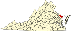
Lake is an unincorporated community in Northumberland County, Virginia, United States. Lake is on the Coan River, a tidal tributary of the Potomac River.


Related Research Articles

<span class="mw-page-title-main">Yangtze</span> Longest river in Asia

The Yangtze or Yangzi is the longest river in Eurasia, the third-longest in the world, and the longest in the world to flow entirely within one country. It rises at Jari Hill in the Tanggula Mountains of the Tibetan Plateau and flows 6,300 km (3,915 mi) in a generally easterly direction to the East China Sea. It is the fifth-largest primary river by discharge volume in the world. Its drainage basin comprises one-fifth of the land area of China, and is home to nearly one-third of the country's population.

<span class="mw-page-title-main">Great Lakes</span> Group of lakes in North America

The Great Lakes, also called the Great Lakes of North America, are a series of large interconnected freshwater lakes in the east-central interior of North America that connect to the Atlantic Ocean via the Saint Lawrence River. The five lakes are Superior, Michigan, Huron, Erie, and Ontario and they are in general on or near the Canada–United States border. Hydrologically, Michigan and Huron are a single body of water joined at the Straits of Mackinac. The Great Lakes Waterway enables modern travel and shipping by water among the lakes.

<span class="mw-page-title-main">Lake Ontario</span> Easternmost of Great Lakes in U.S. and Canada

Lake Ontario is one of the five Great Lakes of North America. It is bounded on the north, west, and southwest by the Canadian province of Ontario, and on the south and east by the U.S. state of New York. The Canada–United States border spans the centre of the lake.

<span class="mw-page-title-main">Lake Superior</span> Largest of the Great Lakes of North America

Lake Superior is the largest freshwater lake in the world by surface area and the third-largest by volume, holding 10% of the world's surface fresh water. Located in central North America, it is the northernmost and westernmost of the Great Lakes of North America, straddling the Canada–United States border with the Canadian province of Ontario to the north and east and the U.S. states of Minnesota to the west and Wisconsin and Michigan to the south. It drains into Lake Huron via St. Marys River, then through the lower Great Lakes to the St. Lawrence River and ultimately the Atlantic Ocean.

<span class="mw-page-title-main">Mississippi River</span> Major river in the United States

The Mississippi River is the second-longest river and chief river of the second-largest drainage system in North America, second only to the Hudson Bay drainage system. From its traditional source of Lake Itasca in northern Minnesota, it flows generally south for 2,340 miles (3,766 km) to the Mississippi River Delta in the Gulf of Mexico. With its many tributaries, the Mississippi's watershed drains all or parts of 32 U.S. states and two Canadian provinces between the Rocky and Appalachian mountains. The main stem is entirely within the United States; the total drainage basin is 1,151,000 sq mi (2,980,000 km2), of which only about one percent is in Canada. The Mississippi ranks as the thirteenth-largest river by discharge in the world. The river either borders or passes through the states of Minnesota, Wisconsin, Iowa, Illinois, Missouri, Kentucky, Tennessee, Arkansas, Mississippi, and Louisiana.

<span class="mw-page-title-main">Nile</span> Major river in northeastern Africa

The Nile is a major north-flowing river in northeastern Africa. It flows into the Mediterranean Sea. The Nile is the longest river in Africa and has historically been considered the longest river in the world, though this has been contested by research suggesting that the Amazon River is slightly longer. Of the world's major rivers, the Nile is one of the smallest, as measured by annual flow in cubic metres of water. About 6,650 km (4,130 mi) long, its drainage basin covers eleven countries: the Democratic Republic of the Congo, Tanzania, Burundi, Rwanda, Uganda, Kenya, Ethiopia, Eritrea, South Sudan, Republic of the Sudan, and Egypt. In particular, the Nile is the primary water source of Egypt, Sudan and South Sudan. Additionally, the Nile is an important economic river, supporting agriculture and fishing.

<span class="mw-page-title-main">Rhine</span> Major river in Western Europe

The Rhine is one of the major European rivers. The river begins in the Swiss canton of Graubünden in the southeastern Swiss Alps. It forms part of the Swiss-Liechtenstein, Swiss-Austrian, and Swiss-German borders. After that the Rhine defines much of the Franco-German border, after which it flows in a mostly northerly direction through the German Rhineland. Finally in Germany, the Rhine turns into a predominantly westerly direction and flows into the Netherlands where it eventually empties into the North Sea. It drains an area of 9,973 sq km and its name derives from the Celtic Rēnos. There are also two German states named after the river, North Rhine-Westphalia and Rhineland-Palatinate.

<span class="mw-page-title-main">St. Lawrence River</span> Major river in eastern Canada and the United States, flowing into the Gulf of St. Lawrence

The St. Lawrence River is a large river in the middle latitudes of North America. Its headwaters begin flowing from Lake Ontario in a roughly northeasterly direction, into the Gulf of St. Lawrence, connecting the North American Great Lakes to the North Atlantic Ocean, and forming the primary drainage outflow of the Great Lakes Basin. The river traverses the Canadian provinces of Ontario and Quebec, as well as the U.S. state of New York, and demarcates part of the international boundary between Canada and the United States. It also provides the foundation for the commercial St. Lawrence Seaway.

<span class="mw-page-title-main">Cree</span> Group of First Nations peoples in North America

The Cree are a North American Indigenous people. They live primarily in Canada, where they form one of the country's largest First Nations.

<span class="mw-page-title-main">Colorado River (Texas)</span> River in Texas, United States

The Colorado River is an approximately 862-mile (1,387 km) long river in the U.S. state of Texas. It is the 11th longest river in the United States and the longest river with both its source and its mouth within Texas.

<span class="mw-page-title-main">Ozarks</span> Highland region in central-southern United States

The Ozarks, also known as the Ozark Mountains, Ozark Highlands or Ozark Plateau, is a physiographic region in the U.S. states of Missouri, Arkansas, Oklahoma and the extreme southeastern corner of Kansas. The Ozarks cover a significant portion of northern Arkansas and most of the southern half of Missouri, extending from Interstate 40 in central Arkansas to Interstate 70 in central Missouri.

<span class="mw-page-title-main">Chattahoochee River</span> River in Georgia, United States

The Chattahoochee River forms the southern half of the Alabama and Georgia border, as well as a portion of the Florida and Georgia border. It is a tributary of the Apalachicola River, a relatively short river formed by the confluence of the Chattahoochee and Flint rivers and emptying from Florida into Apalachicola Bay in the Gulf of Mexico. The Chattahoochee River is about 430 miles (690 km) long. The Chattahoochee, Flint, and Apalachicola rivers together make up the Apalachicola–Chattahoochee–Flint River Basin. The Chattahoochee makes up the largest part of the ACF's drainage basin.

<span class="mw-page-title-main">Endorheic basin</span> Closed drainage basin that allows no outflow

An endorheic basin is a drainage basin that normally retains water and allows no outflow to other, external bodies of water, instead, the water drainage flows into permanent and seasonal lakes and swamps that equilibrate through evaporation. Endorheic basins also are called closed basins, terminal basins, and internal drainage systems.

<span class="mw-page-title-main">River source</span> Starting point of a river

The headwater of a river or stream is the farthest point on each of its tributaries upstream from its mouth/estuary into a lake/sea or its confluence with another river. Each headwater is considered one of the river's source, as it is the place where surface runoffs from rainwater, meltwater and/or spring water begin accumulating into a more substantial and consistent flow that becomes a first-order tributary of that river. The tributary with the longest course downstream of the headwaters is regarded as the main stem of that river.

<span class="mw-page-title-main">Lake St. Clair</span> Lake bordering Ontario, Canada and Michigan, US

Lake St. Clair is a freshwater lake that lies between the Canadian province of Ontario and the U.S. state of Michigan. It was named in 1679 by French Catholic explorers after Saint Clare of Assisi, on whose feast day they first saw the lake.

<span class="mw-page-title-main">Oxbow lake</span> U-shaped lake or pool

An oxbow lake is a U-shaped lake or pool that forms when a wide meander of a river is cut off, creating a free-standing body of water. In South Texas, oxbows left by the Rio Grande are called resacas. In Australia, oxbow lakes are called billabongs. The word "oxbow" can also refer to a U-shaped bend in a river or stream, whether or not it is cut off from the main stream.

<span class="mw-page-title-main">Body of water</span> Any significant accumulation of water, generally on a planets surface

A body of water or waterbody is any significant accumulation of water on the surface of Earth or another planet. The term most often refers to oceans, seas, and lakes, but it includes smaller pools of water such as ponds, wetlands, or more rarely, puddles. A body of water does not have to be still or contained; rivers, streams, canals, and other geographical features where water moves from one place to another are also considered bodies of water.

<span class="mw-page-title-main">Driftless Area</span> Geological region in the Midwestern United States

The Driftless Area, also known as Bluff Country, the Blufflands, the Paleozoic Plateau, and the Coulee Region, is a topographical and cultural region in the Midwestern United States that comprises southwestern Wisconsin, southeastern Minnesota, northeastern Iowa, and the extreme northwestern corner of Illinois. The Driftless Area is a USDA Level III Ecoregion: Ecoregion 52. The Driftless Area takes up a large portion of the Upper Midwest forest–savanna transition.

<span class="mw-page-title-main">Lake</span> Large body of relatively still water

A lake is a naturally occurring, relatively large body of water localized in a basin surrounded by dry land. A lake generally has a slower-moving flow than the inflow or outflow stream(s) that serve to feed or drain it. Lakes lie completely on land and are separate from the ocean, although, like the much larger oceans, they form part of the Earth's water cycle by serving as large standing pools of storage water. Most lakes are freshwater and account for almost all the world's surface freshwater, but some are salt lakes with salinities even higher than that of seawater.

<span class="mw-page-title-main">River mouth</span> End of a river where it flows into a larger body of water

A river mouth is where a river flows into a larger body of water, such as another river, a lake/reservoir, a bay/gulf, a sea, or an ocean. At the river mouth, sediments are often deposited due to the slowing of the current, reducing the carrying capacity of the water. The water from a river can enter the receiving body in a variety of different ways. The motion of a river is influenced by the relative density of the river compared to the receiving water, the rotation of the Earth, and any ambient motion in the receiving water, such as tides or seiches.