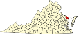
Luttrellville, Virginia

Last updated

Luttrellville is an unincorporated community in Northumberland and Richmond counties, in the U.S. state of Virginia.

Northumberland County, Virginia County in the United States

Northumberland County is a county located in the Commonwealth of Virginia. As of the 2010 census, the population was 12,330. Its county seat is Heathsville. The county is located on the Northern Neck and is part of the Northern Neck George Washington Birthplace AVA winemaking appellation.

Richmond County, Virginia County in the United States

Richmond County is a county located on the Northern Neck in the Commonwealth of Virginia. As of the 2010 census, the population was 9,254. Its county seat is Warsaw. The rural county should not be confused with the large city and state capital Richmond, Virginia. It was formed in 1692 when the first Rappahannock County was divided to form Richmond County and Essex County.

U.S. state constituent political entity of the United States

In the United States, a state is a constituent political entity, of which there are currently 50. Bound together in a political union, each state holds governmental jurisdiction over a separate and defined geographic territory and shares its sovereignty with the federal government. Due to this shared sovereignty, Americans are citizens both of the federal republic and of the state in which they reside. State citizenship and residency are flexible, and no government approval is required to move between states, except for persons restricted by certain types of court orders. Four states use the term commonwealth rather than state in their full official names.

Related Research Articles

Maples, Missouri unincorporated community in Missouri

Maples is an unincorporated community in northeastern Texas County, Missouri, United States. It is located approximately seven miles northeast of Licking on Missouri Route C.

The North Fork Clinch River is a river in the U.S. states of Virginia and Tennessee. It rises along the slopes of Wallen Ridge in Lee County, Virginia, and empties into the Clinch River at Hancock County, Tennessee, just across the Tennessee/Virginia state line.

Burtons Corner is an unincorporated community in Northumberland and Richmond counties, in the U.S. state of Virginia.

Lara is an unincorporated community in Northumberland and Richmond counties, in the U.S. state of Virginia.

Mila is an unincorporated community in Northumberland County, in the U.S. state of Virginia. Mila is located at 37°50′32″N76°19′39″W.

Moon Corner is an unincorporated community in Northumberland and Richmond counties, in the U.S. state of Virginia.

Rainswood is an unincorporated community in Northumberland and Richmond counties, in the U.S. state of Virginia.

Walkers Corner is an unincorporated community in Northumberland and Richmond counties, in the U.S. state of Virginia.

Batt is an unincorporated community in Gloucester County, in the U. S. state of Virginia.

Capahosic is an unincorporated community in Gloucester County, in the U. S. state of Virginia.

Gum Fork is an unincorporated community in Gloucester County, in the U. S. state of Virginia.

Lands End is an unincorporated community in Gloucester County, in the U. S. state of Virginia.

Owl Trap is an unincorporated community in Gloucester County, in the U. S. state of Virginia.

Point Lookout is an unincorporated community in Gloucester County, in the U. S. state of Virginia.

Quiet Cove is an unincorporated community in Gloucester County, in the U. S. state of Virginia.

Rock Hill, Indiana Unincorporated community in Indiana, United States

Rock Hill is an unincorporated community in Ohio Township, Spencer County, in the U.S. state of Indiana.

Postboy is an unincorporated community in Tuscarawas County, in the U.S. state of Ohio.

Dissen is an unincorporated community in Cape Girardeau County, in the U.S. state of Missouri.

Kinderpost is an unincorporated community in Texas County, in the U.S. state of Missouri.

Levy is an unincorporated community in Washington County, in the U.S. state of Missouri.

References

Coordinates: 37°56′42″N76°35′03″W / 37.94500°N 76.58417°W / 37.94500; -76.58417

Geographic coordinate system Coordinate system

A geographic coordinate system is a coordinate system that enables every location on Earth to be specified by a set of numbers, letters or symbols. The coordinates are often chosen such that one of the numbers represents a vertical position and two or three of the numbers represent a horizontal position; alternatively, a geographic position may be expressed in a combined three-dimensional Cartesian vector. A common choice of coordinates is latitude, longitude and elevation. To specify a location on a plane requires a map projection.