
Millstone is an unincorporated community in Calhoun County, West Virginia, United States. It lies along U.S. Route 33 at the point where West Virginia Route 16 heads northward, to the south of the town of Grantsville, the county seat of Calhoun County. Its elevation is 810 feet. Although it is unincorporated, it has a post office, with the ZIP code of 25261.
Big Bend is an unincorporated community in Calhoun County, West Virginia, United States. It lies along West Virginia Route 5 northwest of the town of Grantsville, the county seat of Calhoun County, along the Little Kanawha River. Its elevation is 682 feet. Although it is unincorporated, it has a post office, with the ZIP code of 26136.
Annamoriah is an unincorporated community in Calhoun County, West Virginia, United States. It lies along West Virginia Route 5 to the west of the town of Grantsville, the county seat of Calhoun County. Its elevation is 994 feet. Their post office closed in 1988.
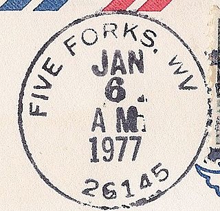
Five Forks is an unincorporated community in Calhoun County, West Virginia, United States. It lies along West Virginia Route 16 to the north of the town of Grantsville, the county seat of Calhoun County. Its elevation is 1,106 feet (337 m). The Five Forks Post Office is closed.
Hix is an unincorporated community in Summers County, West Virginia, United States. It lies to the northeast of the city of Hinton, the county seat of Summers County. Its elevation is 2,618 feet. At some point, Hix possessed a post office, which closed on December 6, 1975.
Indian Mills is an unincorporated community in Summers County, West Virginia, United States. It lies to the southeast of the city of Hinton, the county seat of Summers County. Its elevation is 1,545 feet.
Nimitz is an unincorporated community in Summers County, West Virginia, United States. It lies along West Virginia Route 3 to the west of the city of Hinton, the county seat of Summers County. Its elevation is 2,523 feet. Although it is unincorporated, it has a post office, with the ZIP code of 25978.
Pipestem is an unincorporated community in Summers County, West Virginia, United States. It lies along West Virginia Route 20 to the south-southwest of the city of Hinton, the county seat of Summers County. Its elevation is 2,382 feet. Although it is unincorporated, it has a post office, with the ZIP code of 25979.
Sandstone is an unincorporated community in Summers County, West Virginia, United States. It lies along West Virginia Route 20 and the New River to the north of the city of Hinton, the county seat of Summers County. Its elevation is 1,352 feet. Although it is unincorporated, it has a post office, with the ZIP code of 25985.
Smoot is an unincorporated community in western Greenbrier County, West Virginia, United States. It lies south of the interchange of Interstate 64 and U.S. Route 60 northwest of the city of Lewisburg, the county seat of Greenbrier County. Its elevation is 2,480 feet (756 m). Although it is unincorporated, it has a post office, with the ZIP code of 24977.
Griffithsville is an unincorporated community in eastern Lincoln County, West Virginia, United States. It lies along West Virginia Route 3 southeast of the town of Hamlin, the county seat of Lincoln County. Its elevation is 659 feet (201 m). Although it is unincorporated, it has a post office, with the ZIP code of 25521.
Midkiff is an unincorporated community in western Lincoln County, West Virginia, United States. It lies along West Virginia Route 10 southwest of the town of Hamlin, the county seat of Lincoln County. Its elevation is 597 feet (182 m). Although it is unincorporated, it has a post office, with the ZIP code of 25540.
Spurlockville is an unincorporated community in central Lincoln County, West Virginia, United States. It lies south of the town of Hamlin, the county seat of Lincoln County. Its elevation is 758 feet (231 m). Although it is unincorporated, it has a post office, with the ZIP code of 25565.
Ranger is an unincorporated community in western Lincoln County, West Virginia, United States. It lies along West Virginia Route 10 southwest of the town of Hamlin, the county seat of Lincoln County. Its elevation is 614 feet (187 m). Although it is unincorporated, it has a post office, with the ZIP code of 25557. Ranger is served by the Guyan River VFD.
Wana — formerly Wise — is an unincorporated community in northwestern Monongalia County, West Virginia, USA. It lies along West Virginia Route 7 northwest of the city of Morgantown, the county seat of Monongalia County. Its elevation is 1,030 feet (314 m). Although it is unincorporated, it has a post office, with the ZIP code of 26590.
Smithville is an unincorporated community in southern Ritchie County, West Virginia, USA. It lies along West Virginia Route 47 south of the town of Harrisville, the county seat of Ritchie County. Its elevation is 686 feet (209 m). Although it is unincorporated, it has a post office, with the ZIP code of 26178.
Glen Easton is an unincorporated community in southern Marshall County, West Virginia, United States. It lies along local roads southeast of the city of Moundsville, the county seat of Marshall County. Its elevation is 945 feet (288 m). Although it is unincorporated, it has a post office, with the ZIP code of 26039.
Peewee is an unincorporated community in southwestern Wirt County, West Virginia, United States. It lies along local roads southwest of the town of Elizabeth, the county seat of Wirt County. Its elevation is 679 feet (207 m). Right Reedy Creek is formed at Peewee by the confluence of Enoch Fork and Fulls Fork.

Willis is an unincorporated community in southwestern Floyd County, Virginia, United States. It lies along U.S. Route 221 southwest of the town of Floyd, the county seat of Floyd County. It has an elevation of 2,723 feet (830 m). Although Willis is unincorporated, it has a post office, with the ZIP code of 24380.
Winterham is an unincorporated community in central Amelia County, Virginia, United States. It lies along U.S. Route 360 northeast of the community of Amelia Courthouse, the county seat of Amelia County. Its elevation is 338 feet (103 m).


