Related Research Articles
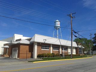
McKenney is an incorporated town in Dinwiddie County, Virginia, United States. The population was 483 at the 2010 census.

Hybla Valley is a census-designated place (CDP) in Fairfax County, Virginia, United States, south of Alexandria. The population was 15,801 at the 2010 census, down from 16,721 in 2000 due to a reduction in area, resulting from some of the eastward neighborhoods including much of Hollin Hills being moved to the Fort Hunt CDP.
The Piedmont region of Virginia is a part of the greater Piedmont physiographic region which stretches from the falls of the Potomac, Rappahannock, and James Rivers to the Blue Ridge Mountains. The region runs across the middle of the state from north to south, expanding outward to a width of nearly 190 miles at the border with North Carolina. To the north, the region continues from Virginia into central Maryland and southeastern Pennsylvania.

Tuscarora Creek in Berkeley County, West Virginia, is an 11.4-mile-long (18.3 km) tributary of Opequon Creek, which drains into the Potomac River in the Chesapeake Bay watershed.
St. Leo is an unincorporated community in southwestern Kingman County, Kansas, United States. It is six miles north of K-42. St. Leo features a Catholic church and has an active parish community. Its ZIP Code is 67112, and area code is 620.
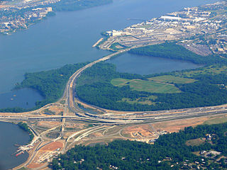
Oxon Creek is a stream on the Potomac River which feeds a cove that straddles the border between Washington, D.C. and Prince George's County, Maryland just north of Interstate 495 at Woodrow Wilson Bridge. Oxon Creek heads at the confluence of Oxon Run and Barnaby Run, sometimes referred to as Winkle Doodle Run. It starts just inside the boundary of D.C. and then runs 1.5 miles (2.4 km) to the south and west into Maryland to empty into the Potomac at Goose Island across from the city of Alexandria, Virginia. Before reaching the Potomac, the creek widens to form Oxon Cove which is partially in Maryland and partially in Washington, D.C.. The creek is almost entirely within Oxon Cove National Park, except for the first few feet in D.C. and a portion of the cove on the southside of the Blue Plains Advanced Wastewater Treatment Plant.
Fourpole Creek is a 4.8-mile-long (7.7 km) tributary of the Tug Fork, belonging to the Ohio River and Mississippi River watersheds. It is located in McDowell and Mingo counties in the U.S. state of West Virginia. Fourpole Creek forms the boundary between McDowell and Mingo counties.

Sharon is an unincorporated community and coal town in southeastern Kanawha County, West Virginia, United States, located along the West Virginia Turnpike.
Lee National Forest was established in Virginia by the U.S. Forest Service on April 10, 1925 with 7,177 acres (29.04 km2) from part of the Lee Military Reservation. On June 23, 1928 the executive order for its creation was rescinded and the forest was abolished.
Cedar Farms is an unincorporated community in Richmond County, in the U.S. state of Virginia.
Cherokee Hills is an unincorporated community in the City of Richmond, Virginia, in the U.S. state of Virginia.
Huguenot Farms is an unincorporated community in the city of Richmond, in the U.S. state of Virginia.
Pittaway Farms is an unincorporated community in Richmond County, in the U.S. state of Virginia.
Southhampton Hills is an unincorporated community in Richmond County, in the U.S. state of Virginia.
Twin Valley Farms is an unincorporated community in Richmond County, in the U.S. state of Virginia.
Westlake Hills is an unincorporated community in Richmond City, in the U.S. state of Virginia.
Holly Hills is an unincorporated community in Powhatan County, in the U.S. state of Virginia.
Centenary is an unincorporated community in Buckingham County, in the U.S. state of Virginia.
Potomac is an unincorporated community in Ohio County, in the U.S. state of West Virginia.

Wood Island is a former island in Marin County, California, formerly in the Corte Madera Creek but now surrounded by land. Its coordinates are 37°56′37″N122°30′42″W, and the United States Geological Survey measured its elevation as 13 ft (4.0 m) in 1981.
References

Coordinates: 37°31′45″N77°30′42″W / 37.52917°N 77.51167°W
| | This Richmond County, Virginia state location article is a stub. You can help Wikipedia by expanding it. For articles relating to the City of Richmond, use Template:RichmondCityVA-geo-stub |