Southhampton Hills, Virginia

Last updated

Southhampton Hills is an unincorporated community in Richmond County, in the U.S. state of Virginia.

Richmond County, Virginia county in Virginia, United States

Richmond County is a county located on the Northern Neck in the Commonwealth of Virginia. As of the 2010 census, the population was 9,254. Its county seat is Warsaw. The rural county should not be confused with the large city and state capital Richmond, Virginia. It was formed in 1692 when the first Rappahannock County was divided to form Richmond County and Essex County.

U.S. state constituent political entity sharing sovereignty as the United States of America

In the United States, a state is a constituent political entity, of which there are currently 50. Bound together in a political union, each state holds governmental jurisdiction over a separate and defined geographic territory and shares its sovereignty with the federal government. Due to this shared sovereignty, Americans are citizens both of the federal republic and of the state in which they reside. State citizenship and residency are flexible, and no government approval is required to move between states, except for persons restricted by certain types of court orders. Four states use the term commonwealth rather than state in their full official names.

Virginia State of the United States of America

Virginia, officially the Commonwealth of Virginia, is a state in the Southeastern and Mid-Atlantic regions of the United States located between the Atlantic Coast and the Appalachian Mountains. Virginia is nicknamed the "Old Dominion" due to its status as the first English colonial possession established in mainland North America and "Mother of Presidents" because eight U.S. presidents were born there, more than any other state. The geography and climate of the Commonwealth are shaped by the Blue Ridge Mountains and the Chesapeake Bay, which provide habitat for much of its flora and fauna. The capital of the Commonwealth is Richmond; Virginia Beach is the most populous city, and Fairfax County is the most populous political subdivision. The Commonwealth's estimated population as of 2017 is over 8.4 million.

Related Research Articles

Boulevard Bridge bridge in United States of America

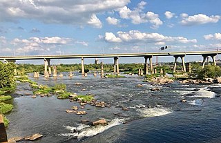
Boulevard Bridge in the independent city of Richmond, Virginia is a toll bridge which carries State Route 161 across the James River.

Manchester Bridge (Virginia) bridge in United States of America

Manchester Bridge in Richmond, Virginia carries U.S. Route 60 across the James River.

Cache Hill is a cinder cone in northern British Columbia, Canada. It is thought to have last erupted in the Holocene period. Once used as an airdrop for food and supplies by the Geophysical Survey of Canada, hence its name, it is located north of Raspberry Pass in Mount Edziza Provincial Park.

Cedar Grove is an unincorporated community in Washington County, Maryland, United States and can be found on the National Register of Historic Places. The community lies about two miles south of MD Route 63 when traveling between Williamsport and Downsville, Maryland; it is located along the northern bank of the Potomac River just opposite the Whiting's Neck promontory.

Cherokee Hills is an unincorporated community in the City of Richmond, Virginia, in the U.S. state of Virginia.

Forest Hill Farms is an unincorporated community in Richmond County, in the U.S. state of Virginia.

Hobby Hill Farms is an unincorporated community in Richmond County, in the U.S. state of Virginia.

Westlake Hills is an unincorporated community in Richmond County, in the U.S. state of Virginia.

Balty is an unincorporated community in Caroline County, in the U.S. state of Virginia.

Burruss Corner is an unincorporated community in Caroline County, in the U.S. state of Virginia.

Campbells Corner is an unincorporated community in Caroline County, in the U.S. state of Virginia.

DeJarnette is an unincorporated community in Caroline County, in the U.S. state of Virginia.

Houstons Corner is an unincorporated community in Caroline County, in the U.S. state of Virginia.

Lauraville is an unincorporated community in Caroline County, in the U.S. state of Virginia.

Sorrell is an unincorporated community in Caroline County, in the U.S. state of Virginia.

Wrights Fork is an unincorporated community in Caroline County, in the U.S. state of Virginia.

Chula is an unincorporated community located in Amelia County, in the U.S. state of Virginia.

Chestnut Oaks is an unincorporated community in Powhatan County, in the U.S. state of Virginia.

Holly Hills is an unincorporated community in Powhatan County, in the U.S. state of Virginia.

Rondo is an unincorporated community in Pittsylvania County, in the U.S. state of Virginia.

References

Coordinates: 37°32′28″N77°31′54″W / 37.54111°N 77.53167°W / 37.54111; -77.53167

Geographic coordinate system Coordinate system

A geographic coordinate system is a coordinate system that enables every location on Earth to be specified by a set of numbers, letters or symbols. The coordinates are often chosen such that one of the numbers represents a vertical position and two or three of the numbers represent a horizontal position; alternatively, a geographic position may be expressed in a combined three-dimensional Cartesian vector. A common choice of coordinates is latitude, longitude and elevation. To specify a location on a plane requires a map projection.