County Center, Virginia

Last updated
County Center
CDP
Prince William County Virginia incorporated and unincorporated areas County Center highlighted.svg
Location in Prince William County and the state of Virginia.
Coordinates: 38°40′24″N77°21′2″W / 38.67333°N 77.35056°W / 38.67333; -77.35056 Coordinates: 38°40′24″N77°21′2″W / 38.67333°N 77.35056°W / 38.67333; -77.35056
Country United States
State Virginia
County Prince William
FoundedMarch 29, 2002
Named for McCoart Government Center
Government
  TypeBoard of Directors
  President of the Board of DirectorsMichael Ullmann (Nonpartisan)
Area
  Total2.00 sq mi (5.18 km2)
Elevation
212 ft (65 m)
Population
 (2010)
  Total3,270
  Estimate 
(2021)
4,045
  Density1,600/sq mi (630/km2)
Time zone UTC−5 (Eastern (EST))
  Summer (DST) UTC−4 (EDT)
ZIP codes
22192
Area code(s) 703, 571
FIPS code 51-19571
GNIS feature ID2631346
Website pwcchoa.com

County Center is a census-designated place in Prince William County, Virginia, United States. The population as of the 2010 Census was 3,270. [1] In 2021, the United States Census Bureau estimated it to be 4,045. [2] It is notable for including the county's McCoart Government Center off Prince William Parkway, along with adjoining Pfitzner Stadium, former home field of the Potomac Nationals, now the Fredericksburg Nationals.

Contents

History

On March 29, 2002, the Declarant of developers who owned the land that made up County Center established the Prince William County Center Owners' Association, a not for profit corporation, to provide services to County Center's residents.

Recreational and cultural activities

The Prince William County Center Clubhouse, located on Wermuth Way (the headquarters of the Association), can be rented out for private functions.

Parks and recreation

County Center is home to a few green spaces, with around 1.5 miles of trails.

County Center is home to the western part of Old Hickory Golf Club, designed by architect Tim Freeland. [3] County Center is also near the Lake Ridge Golf Course in Lake Ridge. [4]

County Center is about 3 miles from the Neabsco Greenway Trail, 4 miles from the Lakeridge Marina Waterfront Trail, and about 6 miles from the Bull Run Occoquan Trail.

Airport Creek, a small tributary of the Occoquan Reservoir, is located in County Center.

County Center is home to River Falls Pool on Chanceford Drive, and the community pool behind the Clubhouse. [5]

The Association operates two tennis courts in County Center.

Earl M. Cunard Park, a Prince William County park, is located off of Ridgefield Village Drive and is home to about half a mile of trails and two basketball courts.

The Prince William County Liberty Memorial features four steel bars from the World Trade Center which fell from the sky during the September 11, 2001 attacks. A plaque at the memorial features the inscribed names of the 22 residents of the Prince William County area who died in the attacks that day.

The G. Richard Pfitzner Stadium was the home of the Potomac Nationals Minor League Baseball team from 1984 until 2019, when they relocated to Fredericksburg. The "Pfitz" also hosts community events, such as outdoor movies during the summer. [6] Adjacent to the stadium is NOVA BMX, a bicycle motocross track sponsored by Barnes and Thornburg. [7]

Transportation

Three major state highways directly serve County Center: Virginia State Route 294 (Prince William Parkway), which connects County Center to Manassas, Virginia State Route 28 (Centreville Road), and Virginia State Route 234 (Dumfries Road, which then becomes Prince William Parkway), in the west, and Woodbridge, Interstate 95, and U.S. Route 1 in the east; Virginia State Route 642 (Hoadly Road), which forms part of the CDP's western border and connects it to Virginia State Route 234 and Independent Hill in the south; and Virginia State Route 663 (Davis Ford Road), which forms part of the CDP's western border and connects it to Virginia State Route 612 and Buckhall in the north.

County Center is served by two bus stations: Prince William Parkway at McCoart Government Center, along the 96 route, which connects it to Manassas in the west and Dale City in the east, and Prince William Parkway at Marblestone Drive, which connects it to Lake Ridge in the north and Dale City in the south.

Geography

County Center is located in southeastern Prince William County. Neighboring communities are Lake Ridge to the east and Dale City to the south.

According to the United States Census Bureau, the County Center CDP has a total area of 2.0 square miles. [2]

The community is drained by Airport Creek, an east-flowing tributary of the Occoquan Reservoir, which then flows south into the Occoquan River watershed, and eventually the tidal Potomac River.

Climate

The climate in this area is characterized by hot, humid summers and generally mild to cool winters. According to the Köppen Climate Classification system, County Center has a humid subtropical climate, abbreviated "Cfa" on climate maps. [8]

Climate data for County Center, Virginia, 1930 - present
MonthJanFebMarAprMayJunJulAugSepOctNovDecYear
Record high °F (°C)77 (25)76 (24.4)85 (29.4)95 (35)96 (35.6)100 (37.8)104 (40)103 (39.4)101 (38.3)93 (33.9)85 (29.4)75 (23.9)104 (40)
Average high °F (°C)43.7 (6.5)45.7 (7.6)56.3 (13.5)67.3 (19.6)76.8 (24.9)84.3 (29.1)88.3 (31.3)86.5 (30.3)80.6 (27)69.1 (20.6)57.6 (14.2)46.4 (8)66.9 (19.4)
Average low °F (°C)24.2 (-4.3)25 (-3.9)33 (0.6)42.2 (5.7)52.2 (11.2)60.4 (15.8)65.3 (18.5)63.9 (17.7)57.1 (13.9)44.7 (7.1)35.3 (1.8)27.1 (-2.7)44.2 (6.8)
Record low °F (°C)-8 (-22.2)-21 (-29.4)-5 (-20.6)19 (-7.2)29 (-1.7)40 (4.4)48 (8.9)40 (4.4)33 (0.6)19 (-7.2)9 (-12.8)-2 (-18.9)-21 (-29.4)
Average precipitation inches (mm)2.4 (62)2.5 (63)2.9 (73)2.9 (74)3.5 (88)3.4 (85)3.5 (88)3.4 (86)3 (76)2.7 (68)2.6 (67)3 (76)35.7 (906)
Average snowfall inches (cm)4.9 (12.4)6.4 (16.3)2.4 (6.1)0.1 (0.2)0 (0)0 (0)0 (0)0 (0)0 (0)0 (0)0.7 (1.8)2.4 (6.1)17 (43.2)
Average precipitation days66788787556681

Government

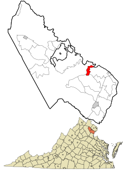
County Center is a census-designated place within Prince William County; therefore, schools, roads, and law enforcement are provided by the county.

Board of directors

The board of directors is the executive branch of the community government, led by the president, currently Michael Ullmann, and the vice president, currently Julia Brown. All five members of the board are elected by the residents of County Center. [9]

According to the Bylaws, the duties and responsibilities of the board include:

"(1) Provide goods and services in accordance with the Association Documents, and provide for the Upkeep of the Common Area and, to the extent provided in the Association Documents, of the lots.

(2) Designate, hire, dismiss and, where appropriate, compensate the personnel necessary to provide for the Upkeep of the Common Area, the general administration of the Association, and, to the extent provided in the Association Documents, of the Lots, and to provide goods and services, as well as purchase equipment, supplies and materials to be used by such personnel in the performance of their duties.

(3) Collect the Assessments, deposit the proceeds thereof in depositories designated by the Board of Directors and use the proceeds to carry out the Upkeep of the Property and other real estate and facilities (to the extent the Association is so authorized by the Association Documents) and the general administration of the Association.

(4) Adopt and amend any reasonable Rules and Regulations not inconsistent with the Association Documents.

(5) Open bank accounts on behalf of the Association and designate the signatories thereon.

(6) Enforce the provisions of the Association Documents.

(7) Act with respect to all matters arising out of any eminent domain proceeding affecting the Common Area.

(8) Notify the Owners of any litigation against the Association involving a claim in excess of ten percent of the total Annual Assessment.

(9) Obtain and carry insurance against casualties and liabilities, as provided in Article 10 of the Declaration, pay the premiums therefor and adjust and settle any claims thereunder.

(10) Pay the cost of all authorized goods and services rendered to the Association.

(11) Notify the appropriate Mortgagee of any default by an Owner in paying Assessments (which remains uncured for sixty days) or of any other default, simultaneously with the notice sent to the defaulting Owner.

(12) Provide an Association Disclosure Packet or Common Expense Statement with respect to a Lot within fourteen days (or as otherwise required by law) after a written request and payment of the appropriate fee in accordance with Section 6.6 of the Declaration.

(13) Prepare an annual budget in accordance with Article 6 of the Declaration.

(14) Adopt an annual budget and make Assessments to defray the Common Expenses of the Association, establish the means and methods of collecting such Assessments and establish the period of the installment payment, if any, of the Annual Assessment in accordance with Article 6 of the Declaration.

(15) Borrow money on behalf of the Association, when required for any valid purpose; provided, however, that either a Majority Vote of the Owners obtained at a meeting held for such purpose or written approval by Owners entitled to cast more than fifty percent of the total number of votes shall be required to borrow any sum in excess of ten percent of the total Annual Assessment for that fiscal year or, subject to Section 15.4 of the Declaration, mortgage any of the Common Area. The Board of Directors, by a vote of two-thirds of the total number of directors, shall have the right and power to assign and pledge all revenues to be received by the Association, including but not limited to Annual and Additional Assessments in order to secure the repayment of any sums borrowed by the Association from time to time.

(16) Sign deeds, leases, plats of resubdivision and applications for construction permits or similar documents for the Common Area as may be necessary or desirable in the normal course of the orderly development of the Property, at the request of the Declarant or on its own determination.

(17) Dedicate, lease or transfer any portion of the Common Area or grant or terminate easements, right-of-way or licenses over and through all the Common Area pursuant to Section 3.2 of the Declaration and subject to the restriction set forth in Section 15.4 of the Declaration.

(18) In its sole discretion, designate certain portions of the Common Area as Reserved Common Area, pursuant to Section 3.8 of the Declaration, and impose such restrictions and conditions on the use thereof as the Board of Directors deems appropriate.

(19) In accordance with Section 12.1 of the Declaration, suspend the right of any Owner or other occupant of a Lot, and the right of such Person's household or company, tenants, guests, customers, employees, agents and invitees to use the Common Area.

(20) Acquire, hold and dispose of Lots to enforce the collection of Assessments and mortgage the same without the prior approval of the Owners if such expenditures and hypothecations are included in the budget.

(21) Charge reasonable fees for the use of the Common Area, where appropriate, and for services and allow non-owners to use portions of the Common Area on a fee arrangement determined by the Board.

(22) Do anything else not inconsistent with the Act or the Association Documents."

The board also establishes committees which handle specific issues, appoints their chairpersons, and can choose to appoint their members or allow the chairperson to do so. The board must meet at least once a quarter, and can meet more often at its own discretion (not including special meetings); the board is allowed to meet anywhere in the Commonwealth of Virginia, but the Clubhouse is the standard meeting place. [10]

Representation

The parts of County Center south of the Prince William Parkway, including the Clubhouse, are within Virginia's 11th congressional district, currently represented in Congress by Representative Gerry Connolly (D-Mantua), while the rest of County Center is within Virginia's 1st congressional district, currently represented in Congress by Representative Rob Wittman (R-Montross). County Center is represented by Hala Ayala (D-Lake Ridge) in the state House of Delegates, and the parts of County Center south of the Prince William Parkway are represented by Jeremy McPike (D-Dale City), while the rest of County Center is represented by George Barker (D-Clifton) in the state Senate.

Local media

County Center lies within the distribution zone for two national newspapers, the Washington Post, and the Washington Times, as well as for the local Prince William Times. County Center is also covered by AOL's Patch service's Dale City and Lake Ridge-Occoquan divisions.

Education

Primary and secondary schools

As a part of Prince William County, County Center is served by Prince William County Public Schools and private schools. County Center is served by one high school, Colgan High School, in nearby Independent Hill. Middle schoolers in County Center attend Benton Middle School.

Public elementary schools

  • Penn Elementary School
  • Westridge Elementary School

Colleges and universities

County Center is near multiple higher education centers, including Strayer University, Northern Virginia Community College - Woodbridge Campus, University of Valley Forge - Woodbridge Campus, Stratford University, and the Carolina University of Theology - Northern Virginia Campus.

Public libraries

County Center is served by the James McCoart Administration Building, a branch of the Prince William County Public Library System in the McCoart Government Center.

Demographics

As of 2021, County Center has a median household income of $119,926. [11]

Historical population
CensusPop.
2010 3,270
2020 4,04523.7%

Related Research Articles

Prince William County, Virginia County in Virginia, United States

Dale City, Virginia Census-designated place in Virginia, United States

Dale City is a census-designated place (CDP) in Prince William County, Virginia, United States, located 25 miles south west of Washington, D.C. It is an annex of Woodbridge, Virginia. As of 2017, the total population was 73,384. The community is roughly bounded by Hoadly Road to the northwest, Prince William Parkway to the north, Smoketown Road to the northeast, Gideon Drive to the east, and Cardinal Drive to the south.

Lake Ridge, Virginia Census-designated place in Virginia, United States

Lake Ridge is a census-designated place (CDP) in Prince William County, Virginia, United States. It is an annex of Woodbridge, Virginia. The population was 41,058 at the 2010 census, an increase of 35% from 2000.

Woodbridge, Virginia Census-designated place in Virginia, United States

Woodbridge is a census-designated place (CDP) in Prince William County, Virginia, United States, located 20 miles (32 km) south of Washington, D.C. Bounded by the Occoquan and Potomac rivers, Woodbridge Magisterial District had 54,275 residents at the 2010 census. The Woodbridge census-designated place comprises just one portion of the magisterial district and had a population of 4,055 in the 2010 census. The census-designated place consists solely of the section north of Occoquan Road and Dawson Beach Road, and east of Interstate 95.

Occoquan, Virginia Town in Virginia

Occoquan is a town in Prince William County, Virginia. The population was 934 at the 2010 United States Census. The town is a suburb of Washington, D.C. and is adjacent to Woodbridge. The current mayor is Earnest W. Porta Jr.

South Riding, Virginia Census-designated place in Virginia

South Riding is a census-designated place and planned community in Loudoun County, Virginia, United States. The South Riding homeowner association was founded in January 1995 to provide services to the community. Neighboring U.S. Route 50 and State Route 28 provide access to the Dulles/Reston/Tysons Corner technology corridor and other major employment centers in Northern Virginia and Washington, D.C.

Prince William County Public Schools is a Virginian school division with its headquarters in the Kelly Leadership Center in unincorporated Prince William County, Virginia. As of the 2010 census, the population of the county was 402,002.

Virginia State Route 123 State highway in Virginia, United States

State Route 123 is a primary state highway in the U.S. state of Virginia. The state highway runs 29.27 miles (47.11 km) from U.S. Route 1 in Woodbridge north to the Chain Bridge across the Potomac River into Washington from Arlington. It goes by four local names. From its southern terminus to the Occoquan River Bridge, it is known as Gordon Boulevard. From the Occoquan River Bridge to the city of Fairfax it is known as Ox Road. From Fairfax until it enters the Town of Vienna, it is known as Chain Bridge Road. Then, as it passes through the Town of Vienna, it is known as Maple Avenue. After leaving the Town of Vienna, the name reverts to Chain Bridge Road, and continues this way until the intersection with I-495 in Tysons. Between Tysons and the George Washington Memorial Parkway, it is known as Dolley Madison Boulevard. After crossing over the George Washington Memorial Parkway, the name once again reverts to Chain Bridge Road and continues this way until the end of the road, at Chain Bridge. SR 123 is a partial circumferential highway in Northern Virginia that connects Woodbridge in eastern Prince William County with the independent city of Fairfax and the Fairfax County communities of Vienna, Tysons, and McLean, the last being the home of the National Counterterrorism Center and the Central Intelligence Agency. The state highway also connects all of the major highways that radiate from Washington, including Interstate 95, I-66, US 29, US 50, SR 267, and the George Washington Memorial Parkway. Furthermore, SR 123 crosses another pair of circumferential highways, I-495 and the Fairfax County Parkway, and SR 7, a major northwest–southeast highway through Northern Virginia. The state highway is a part of the National Highway System for its entire length.

Stone Ridge, Virginia Census-designated place in Virginia

Stone Ridge is a census-designated place in Loudoun County, Virginia, United States. Residences use Aldie mailing addresses, and it is near Washington Dulles International Airport. The population as of the 2010 census was 7,214. As of the 2020 census, the population had increased to 15,039. Stone Ridge is a Van Metre Homes planned, mixed-use community.

Potomac and Rappahannock Transportation Commission Public transportation system in Virginia, United States

Potomac and Rappahannock Transportation Commission (PRTC) is an American public transportation system in Prince William County, Virginia, Stafford County, Virginia, and Spotsylvania County, Virginia, plus two adjacent independent cities, Manassas and Manassas Park. Services provided by PRTC include OmniRide, OmniRide Local, and OmniRide Ridesharing Service operating in Prince William County, Manassas, Manassas Park, and Stafford County. Spotsylvania County's membership is solely based on a membership requirement due to the VRE operations in the county and the state aid that comes with the VRE.

Virginia State Route 234

Virginia State Route 234 is a primary state highway in the U.S. state of Virginia. It runs from U.S. Route 1 near Dumfries via Independent Hill as Dumfries Road, a bypass of Manassas as Prince William Parkway, has a brief concurrency with Interstate 66 for 2.27 miles (3.65 km) between exits 44 and 47, and Catharpin to U.S. Route 15 near Woolsey as Sudley Road.

Agnewville, Virginia Extinct unincorporated community in Virginia, United States

Agnewville is an extinct unincorporated community in Prince William County, Virginia, United States. Agnewville lies to the west of the town of Occoquan at the intersection of Minnieville and Telegraph Roads. It has also been known as Agnesville and Chinn Town.

Kathleen Kenna Seefeldt is an American politician who served as Chairman of the Prince William Board of County Supervisors from 1992 to 1999. She is a Democrat.

Cherry Hill, Prince William County, Virginia Census-designated place in Virginia, United States

Cherry Hill is a census-designated place (CDP) in Prince William County, Virginia, United States. The population was 16,000 according to the 2010 Census. As of the 2020 census, it was estimated to be 23,683. The CDP is made up of the Cherry Hill peninsula, to the northeast of the town of Dumfries.

Prince William Board of County Supervisors

The Prince William Board of County Supervisors is the policy-making body for the government of Prince William County, Virginia. The county is divided into seven magisterial districts: Brentsville, Coles, Gainesville, Neabsco, Occoquan, Potomac, and Woodbridge. The magisterial districts each elect one supervisor to the Board of Supervisors. There is also a Chairman elected by the county at-large, bringing total Board membership to 8. A Vice-Chairman and a Chairman Pro-Tem are selected by the Board from amongst its membership. The current Chairman is Democrat Ann Wheeler.

Occoquan River Tributary of the Potomac River in Northern Virginia

The Occoquan River is a tributary of the Potomac River in Northern Virginia, where it serves as part of the boundary between Fairfax and Prince William counties. The river is a scenic area, and several local high schools and colleges use the river for the sport of rowing.

Crosspointe, Virginia Census-designated place in Virginia, United States

Crosspointe is a census-designated place in Fairfax County, Virginia, United States. The population as of the 2020 census was 5,722.

Marumsco, Virginia Former CDP in Virginia, United States

Marumsco was a census-designated place in Prince William County, Virginia. The population was estimated at 37,218 in 2013. The CDP consisted of the major portion of what was the Woodbridge CDP up to 2000, including the subdivisions of Marumsco Village, Marumsco Hills, Marumsco Acres and Marumsco Woods. The area was merged back into Woodbridge prior to the 2020 census, at which time the full Woodbridge CDP had a population of 44,668. The name "Marumsco" comes from an Algonquin word meaning "island rock." The area is part of a region historically known as "Linton Neck".

George Mason, Virginia Census-designated place in Virginia, United States

George Mason is a census-designated place (CDP) in Fairfax County, Virginia, United States. The population as of the 2010 census was 9,496. It consists of George Mason University and some adjacent neighborhoods to the south and southwest of the city of Fairfax.

Belmont Bay is a planned community in northeastern Woodbridge, Virginia, United States along the Occoquan River at Belmont Bay developed by Caruthers Companies.

References

  1. Virginia Trend Report 2: State and Complete Places (Sub-state 2010 Census Data). Archived 2017-08-16 at the Wayback Machine Missouri Census Data Center. Accessed 2011-06-08.
  2. 1 2 "County Center CDP, Virginia Profile". United States Census Bureau . Archived from the original on 2021-05-17. Retrieved May 17, 2021.
  3. "Old Hickory Golf Club | Woodbridge, VA - Home". www.golfoldhickory.com. Retrieved 2021-05-19.
  4. "Lake Ridge Golf Course | Golf Courses Woodbridge Virginia". PWC - Lake Ridge. Retrieved 2021-05-19.
  5. "Pool - PWCCHOA | Homeowners Association | Prince William County VA". PWCCOA. Retrieved 2021-05-19.
  6. "Pfitzner Stadium Complex". www.visitpwc.com. Retrieved 2021-05-19.
  7. "Northern Virginia (NOVA) BMX". www.usabmx.com. Retrieved 2021-05-19.
  8. "Manassas, Virginia Travel Weather Averages (Weatherbase)". Weatherbase. Retrieved 2021-05-20.
  9. "Board - PWCCHOA | Homeowners Association | Prince William County VA". PWCCOA. Retrieved 2021-05-25.
  10. "Bylaws for Prince William County Center Owners Association" (PDF). PWCCOA. Archived (PDF) from the original on 2021-06-02. Retrieved 2021-06-02.
  11. "Explore Census Data". data.census.gov. Retrieved 2021-06-02.