Potomac Mills, Prince William County, Virginia

Last updated

Potomac Mills
CDP
Potomac mills mall.jpg
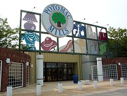
Entrance to Potomac Mills mall
Prince William County Virginia incorporated and unincorporated areas Potomac Mills highlighted.svg
Location in Prince William County and the state of Virginia.
Coordinates: 38°39′20″N77°18′9″W / 38.65556°N 77.30250°W / 38.65556; -77.30250
CountryUnited States
State Virginia
County Prince William
Population
 (2010)
  Total5,614
Time zone UTC−5 (Eastern (EST))
  Summer (DST) UTC−4 (EDT)
ZIP codes
22192
FIPS code 51-64152
GNIS feature ID2629769

Potomac Mills is a census-designated place in Prince William County, Virginia. The population as of the 2010 Census was 5,614. [1] It consists of the Potomac Mills mall and surrounding residential and commercial area, adjoining Dale City and Lake Ridge.

Potomac Mills largely overlaps with the unincorporated community of Bethel.

Historical population
CensusPop.Note
2010 5,614
2020 6,33212.8%


Related Research Articles

<span class="mw-page-title-main">Garrett County, Maryland</span> County in Maryland, United States

Garrett County is the westernmost county of the U.S. state of Maryland completely within the Appalachian Mountains. As of the 2020 census, the population was 28,806, making it the third-least populous county in Maryland. Its county seat is Oakland. The county was named for John Work Garrett (1820–1884), president of the Baltimore and Ohio Railroad. Created from Allegany County in 1872, it was the last county to be formed in the state.

<span class="mw-page-title-main">Mineral County, West Virginia</span> County in West Virginia, United States

Mineral County is a county in the U.S. state of West Virginia. It is part of the Cumberland metropolitan area, together with Cumberland, Maryland. As of the 2020 census, the population was 26,938. Its county seat is Keyser. The county was founded in 1866.

<span class="mw-page-title-main">Jefferson County, West Virginia</span> County in West Virginia, United States

Jefferson County is located in the Shenandoah Valley in the Eastern Panhandle of West Virginia. It is the easternmost county of the U.S. state of West Virginia. As of the 2020 census, the population was 57,701. Its county seat is Charles Town. The county was founded in 1801, and today is part of the Washington metropolitan area.

<span class="mw-page-title-main">Hampshire County, West Virginia</span> County in West Virginia, United States

Hampshire County is a county in the U.S. state of West Virginia. As of the 2020 census, the population was 23,093. Its county seat is Romney, West Virginia's oldest town (1762). The county was created by the Virginia General Assembly in 1754, from parts of Frederick and Augusta Counties (Virginia) and is the state's oldest county. The county lies in both West Virginia's Eastern Panhandle and Potomac Highlands regions.

<span class="mw-page-title-main">Berkeley County, West Virginia</span> County in West Virginia, United States

Berkeley County is located in the Shenandoah Valley in the eastern panhandle region of West Virginia in the United States. The county is part of the Hagerstown–Martinsburg metropolitan area. As of the 2020 census, the county population was 122,076, making it the second-most populous of West Virginia's 55 counties, behind Kanawha County. The City of Martinsburg is the county seat.

<span class="mw-page-title-main">Prince William County, Virginia</span> County in Virginia, United States

Prince William County is located on the Potomac River in the U.S. state of Virginia. As of the 2020 census, the population sits at 482,204, making it Virginia's second-most populous county. Its county seat is the independent city of Manassas.

<span class="mw-page-title-main">Fairfax County, Virginia</span> County in Virginia, United States

Fairfax County, officially the County of Fairfax, is a county in the Commonwealth of Virginia. It is part of Northern Virginia and borders both the city of Alexandria and Arlington County and forms part of the suburban ring of Washington, D.C., the nation's capital. The county is predominantly suburban in character with some urban and rural pockets.

<span class="mw-page-title-main">Luke, Maryland</span> Town in Maryland, United States

Luke is a town in Allegany County, Maryland, United States, located along the Potomac River just upstream of Westernport. Known originally as West Piedmont, the town is part of the Cumberland, MD-WV Metropolitan Statistical Area. The population was 85 as of the 2020 census.

<span class="mw-page-title-main">Potomac, Maryland</span> Census-designated place in Maryland, United States

Potomac is an unincorporated community and census-designated place in Montgomery County, Maryland, United States. As of the 2020 census, it had a population of 47,018. It is named after the nearby Potomac River. A part of the Washington metropolitan area, many Potomac residents work in nearby Washington, D.C., and Northern Virginia.

<span class="mw-page-title-main">Dahlgren, Virginia</span> Census-designated place in Virginia, United States

Dahlgren is an unincorporated community and census-designated place (CDP) in King George County, Virginia, United States. The population was 2,946 at the time of the 2020 census, up from 2,653 at the 2010 census, and up from 997 in 2000.

<span class="mw-page-title-main">Woodbridge, Virginia</span> Census-designated place in Virginia, United States

Woodbridge is a census-designated place (CDP) in Prince William County, Virginia, United States, located 20 miles (32 km) south of Washington, D.C. Bounded by the Occoquan and Potomac rivers, Woodbridge had 44,668 residents at the 2020 census.

<span class="mw-page-title-main">Colonial Beach, Virginia</span> Town in Virginia, United States

Colonial Beach, Virginia (CBVA) is a river and beach town located in the northwestern part of Westmoreland County on Virginia's Northern Neck peninsula. It is bounded by the Potomac River, Monroe Bay and Monroe Creek. It is located 65 mi (105 km) from Washington, D.C.; 70 mi (110 km) from the state capital of Richmond; and 35 nautical miles from the Chesapeake Bay.

<span class="mw-page-title-main">Shepherdstown, West Virginia</span> Town in West Virginia, United States

Shepherdstown is a town in Jefferson County, West Virginia, United States, located in the lower Shenandoah Valley along the Potomac River. Home to Shepherd University, the town's population was 1,531 at the time of the 2020 census. The town was established in 1762 along with Romney; they are the oldest towns in West Virginia.

<span class="mw-page-title-main">Sterling, Virginia</span> Census-designated place in Virginia

Sterling, Virginia, refers most specifically to a census-designated place (CDP) in Loudoun County, Virginia, United States. The population of the CDP as of the 2020 United States Census was 30,337 The CDP boundaries are confined to a relatively small area between Virginia State Route 28 on the west and Virginia State Route 7 on the northeast, excluding areas near SR 606 and the Dulles Town Center.

Lansdowne is a census-designated place and planned community located near Leesburg, Virginia in Loudoun County, Virginia. The population as of the 2010 United States Census was 11,253. It is north of State Route 7 and south of the Potomac River. Before the Revolutionary War, the Lee family established Coton Manor here. A section of the Potomac Heritage Trail runs through Lansdowne. It is the home of Inova Loudoun Hospital, the Jack Kent Cooke Foundation, Lansdowne Resort, Prison Fellowship, and Lansdowne Woods of Virginia, a gated, age-restricted community.

<span class="mw-page-title-main">Broadlands, Virginia</span> Census-designated place in Virginia

Broadlands is a census-designated place (CDP) in Loudoun County, Virginia, United States. It is a 1,500-acre (610 ha) master-planned community started and developed by Van Metre Homes in the 1990s. It is built on wetlands and is certified as a Community Wildlife Habitat by the National Wildlife Federation.

<span class="mw-page-title-main">Alexandria, Virginia</span> Independent city in Virginia, US

Alexandria is an independent city in the northern region of the Commonwealth of Virginia, United States. It lies on the western bank of the Potomac River approximately 7 miles (11 km) south of downtown Washington, D.C. Alexandria is the third largest "principal city" of the Washington metropolitan area which is part of the larger Washington-Baltimore combined statistical area.

<span class="mw-page-title-main">Cherry Hill, Prince William County, Virginia</span> Census-designated place in Virginia, United States

Cherry Hill is a census-designated place (CDP) in Prince William County, Virginia, United States. The population was 16,000 according to the 2010 Census. As of the 2020 census, it was estimated to be 23,683. The CDP is made up of the Cherry Hill peninsula, to the northeast of the town of Dumfries.

<span class="mw-page-title-main">Leesylvania, Virginia</span> Census-designated place in Virginia, United States

Leesylvania, formerly known as Neabsco, is a census-designated place in Prince William County in the U.S. state of Virginia.

Broad Run is a 38.0-mile-long (61.2 km) tributary of the Occoquan River in the U.S. state of Virginia. It rises in Fauquier County and passes through Thoroughfare Gap. A gazetteer from the mid-nineteenth century described it as a small stream, a valuable mill stream.

References