Thoroughfare, Virginia

Last updated
Thoroughfare
2016-10-11 16 29 30 View east along Virginia State Route 55 (John Marshall Highway) just west of Virginia State Secondary Route 723 in Thoroughfare, Prince William County, Virginia.jpg
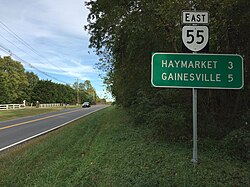
SR 55 through Thoroughfare
USA Virginia Northern location map.svg
Red pog.svg
Thoroughfare
Location within the state of Virginia
USA Virginia location map.svg
Red pog.svg
Thoroughfare
Thoroughfare (Virginia)
Usa edcp location map.svg
Red pog.svg
Thoroughfare
Thoroughfare (the United States)
Coordinates: 38°49′14″N77°40′32″W / 38.82056°N 77.67556°W / 38.82056; -77.67556 Coordinates: 38°49′14″N77°40′32″W / 38.82056°N 77.67556°W / 38.82056; -77.67556
CountryUnited States
State Virginia
County Prince William
Time zone UTC−5 (Eastern (EST))
  Summer (DST) UTC−4 (EDT)

Thoroughfare is an unincorporated community in western Prince William County, Virginia. Roughly located on Virginia State Route 55 about 1.5 miles West of Haymarket where the Norfolk Southern Railway tracks cross the road. The community thrived through the 1940s as a community founded by former slaves. As a place name, Thoroughfare is no longer in common use.


Related Research Articles

Jericho is a city, populated since ancient times, in the West Bank, Palestine.

Park La Brea, Los Angeles Neighborhood of Los Angeles in California, United States

Park La Brea is a sprawling apartment community in the Miracle Mile District of Los Angeles, California. With 4,255 units located in eighteen 13-story towers and thirty-one two-story "garden apartment buildings", it is the largest housing development in the U.S. west of the Mississippi River. It sits on 160 acres (0.65 km2) of land with numerous lawns.

<span class="mw-page-title-main">Sumerduck, Virginia</span> Unincorporated community in Virginia, United States

Sumerduck is a small rural village located equidistant between Fredericksburg, Culpeper, and Warrenton, in Fauquier County in the U.S. state of Virginia.

A subdistrict ' is one of the smaller administrative divisions of China. It is a form of township-level division which is typically part of a larger urban area, as opposed to a discrete town surrounded by rural areas, or a rural township.

The Bull Run Mountains are a mountain range of the Blue Ridge Mountains in northern Virginia in the United States. Located approximately 20 miles (32 km) east of the main chain, across the Loudoun Valley. The Bull Run Mountains, together with Catoctin Mountain in Virginia and Maryland, make up the easternmost front of the Blue Ridge.

The Northwestern Turnpike is a historic road in West Virginia, important for being historically one of the major roads crossing the Appalachians, financed by the Virginia Board of Public Works in the 1830s. In modern times, west of Winchester, Virginia, U.S. Route 50 follows the path of the Northwestern Turnpike into West Virginia, whose major Corridor D project follows the western section of the original Northwestern Turnpike.

<span class="mw-page-title-main">Port Warwick</span>

Port Warwick is a new project located in the Oyster Point area in Newport News, Virginia. It is a mixed-use new urbanism development built upon a 150-acre (0.61 km2) parcel. Port Warwick is a pedestrian-oriented community and the second-largest planned community in Newport News other than Kiln Creek. Residents can walk from home to their workplace, shops, and restaurants, or they can make a short drive of several miles to the city’s main shopping and office areas. Not far from Port Warwick is the new Oyster Point City Center, another bustling central business district in Oyster Point. It is very similar to Port Warwick, with office space and a pedestrian-friendly environment.

<span class="mw-page-title-main">Virginia State Route 55</span> State highway in Virginia, United States

State Route 55 is a primary state highway in the U.S. state of Virginia. Known for most of its length as John Marshall Highway, the state highway runs 64.71 miles (104.14 km) from the West Virginia state line, where the highway continues as West Virginia Route 55, east to U.S. Route 29 in Gainesville. West of its interchange with Interstate 81 (I-81) in Strasburg, SR 55 runs concurrently with the easternmost portion of US 48 as part of Corridor H. East of Front Royal, the state highway serves as the local complement of I-66 as it passes through the towns of Marshall, The Plains, and Haymarket.

Broad Run is a small, unincorporated community in Fauquier County, Virginia. It is on Bust Head Road just north of Interstate 66 and State Route 55, near the Prince William County line. Broad Run is named after the waterway that flows through the town. Broad Run has its own ZIP Code of 20137, and its post office serves a population of 1,510.

<span class="mw-page-title-main">Snickers Gap</span>

Snickers Gap, originally William's Gap, is a wind gap in the Blue Ridge Mountain on the border of Loudoun County and Clarke County in Virginia. The gap is traversed by Virginia State Route 7. The Appalachian Trail also passes across the gap. Bear's Den and Raven Rocks are adjacent to the gap.

Thoroughfare Gap is a water gap in the Bull Run Mountains created by Broad Run between High Point Mountain to the north and Bisquit Mountain to the south. It is located on the border of Prince William and Fauquier counties in Virginia.

Springwood is an unincorporated community in Botetourt County, Virginia, United States. Located in the northern part of the Roanoke Valley and at the southern tip of the Shenandoah Valley, Springwood is part of the Roanoke Metropolitan Area and sits along the banks of the James River.

Crum Lynne is an unincorporated community in Ridley Township, Delaware County, Pennsylvania, United States.

<span class="mw-page-title-main">North Carolina Highway 344</span> State highway in Pasquotank County, North Carolina, US

North Carolina Highway 344 (NC 344) is a primary state highway in the U.S. state of North Carolina. It serves to connect Elizabeth City with communities in southern Pasquotank County.

<span class="mw-page-title-main">South Carolina Highway 65</span> Highway in South Carolina

South Carolina Highway 65 is a 4.710-mile (7.580 km) state highway in the U.S. state of South Carolina. It is the main thoroughfare through North Myrtle Beach. The highway is known for the origin of the official state dance, the Carolina shag.

Broad Run is a 38.0-mile-long (61.2 km) tributary of the Occoquan River in the U.S. state of Virginia. It rises in Fauquier County and passes through Thoroughfare Gap. A gazetteer from the mid-nineteenth century described it as a small stream, a valuable mill stream.

Atlee or Atlee Station is an unincorporated community in central Hanover County in the Mid-Atlantic state of Virginia, United States. Atlee is located 11 miles (18 km) north of Richmond on Route 637 approximately .6 miles (0.97 km) north-northwest of the intersection of Route 637 and Virginia State Route 2. and approximately 50 miles (80 km) south of Fredericksburg, Virginia

<span class="mw-page-title-main">Thoroughfare Gap Battlefield</span> American Civil War battlefield

Thoroughfare Gap Battlefield is a historic American Civil War battlefield located at Thoroughfare Gap, Broad Run, Prince William County, Virginia. It was the site of the Battle of Thoroughfare Gap. The property includes a number of resources present at the time of the battle including the separately listed Beverley Mill, a five-story, coursed-rubble stone building set into the north side of Thoroughfare Gap. Meadowlands, the Chapman's house and the second Upper Mill are clearly visible on the landscape, as well as an important ice pit and a walled cemetery associated with the Chapman family.

<span class="mw-page-title-main">West Virginia Avenue</span>

West Virginia Avenue is an avenue in Washington, DC running from K Street NE to New York Avenue NE. It was named after the State of West Virginia which entered the Union in 1863.

Larkspur is a residential neighborhood in the Kempsville area of the independent city of Virginia Beach, Virginia. The neighborhood was founded by residential developer Clarence Byler in the 1950s after he noticed a new golf course, Kempsville Greens, had opened up near where he had recently been building homes.