Tearcoat Creek

Last updated

Tearcoat Creek (officially Tear Coat Creek, per 1931 federal Board on Geographic Names decision [1] ) is an 18.3-mile-long (29.5 km) [2] free-flowing tributary stream of the North River, itself a tributary of the Cacapon River, making it a part of the Potomac River and Chesapeake Bay watersheds. The creek is located in central Hampshire County, West Virginia. Its name is believed to have been derived from the tearing of the coats of British soldiers by low-hanging branches as they forded the stream during either the French and Indian or the American Revolutionary Wars.

Tributary stream or river that flows into a main stem river or lake

A tributary or affluent is a stream or river that flows into a larger stream or main stem river or a lake. A tributary does not flow directly into a sea or ocean. Tributaries and the main stem river drain the surrounding drainage basin of its surface water and groundwater, leading the water out into an ocean.

Stream A body of surface water flowing down a channel

A stream is a body of water with surface water flowing within the bed and banks of a channel. The stream encompasses surface and groundwater fluxes that respond to geological, geomorphological, hydrological and biotic controls.

Cacapon River river in the United States of America

The Cacapon River, located in the Appalachian Mountains of West Virginia's Eastern Panhandle region, is an 81.0-mile-long (130.4 km) river known for its fishing, boating, wildlife, and scenery. As part of the Potomac River watershed, it is an American Heritage River.

Contents

Tearcoat Creek is popular with whitewater rafters who frequent the 3.9-mile (6.3 km) stretch of stream between the Northwestern Turnpike (U.S. Route 50) at Pleasant Dale and its mouth on the North River. The creek's Class II-III rapids are mostly on blind turns in the forested gorge near its mouth. Tearcoat Creek can be accessed by rafters from Tear Coat Road (CR 50/17), which is parallel to the stream from US 50.

Whitewater bubbly, or aerated and unstable current

Whitewater is formed in a rapid, when a river's gradient increases enough to generate so much turbulence that air is entrained into the water body, that is, it forms a bubbly or aerated and unstable current; the frothy water appears white. The term is also loosely used to refer to less turbulent, but still agitated, flows.

The Northwestern Turnpike is a historic road in West Virginia, important for being historically one of the major roads crossing the Appalachians, financed by the Virginia Board of Public Works in the 1830s. In modern times, west of Winchester, Virginia, U.S. Route 50 follows the path of the Northwestern Turnpike into West Virginia, whose major Corridor D project follows the western section of the original Northwestern Turnpike.

U.S. Route 50 in West Virginia highway in West Virginia

U.S. Route 50 in West Virginia runs from the border with Ohio to Virginia, passing briefly through Garrett County, Maryland, and following the Northwestern Turnpike. Prior to the U.S. Highway System it was West Virginia Route 1 and in the 1930s, the road was not finished in Maryland. At that time, motorists had to open a gate at the state line and drive on a dirt path until again reaching the other state line. Today the section of US 50 from Clarksburg to Parkersburg on the Ohio River is part of Corridor D of the Appalachian Development Highway System.

Headwaters & course

The stream's source lies near Ruckman where it flows northeast along the western flanks of Short Mountain (2,864 feet) parallel to Augusta-Ford Hill Road (CR 7). At Ford Hill (1,421 feet), Tearcoat Creek is joined by Mack Road (CR 7/5) and continues on its northeastern course. Through this stretch south of Augusta, Tearcoat merges with a number of smaller cattle watering streams increasing it in size. After parting from Mack Road, the creek meanders through a winding gorge to the west of Dunmore Ridge (1,401 feet). South of US 50, Tearcoat Creek is joined by its two largest named tributary streams: first Turkeyfoot Run and then Bearwallow Creek. Shortly after its confluence with Bearwallow Creek, it passes under the US 50 bridge at Pleasant Dale continuing northeast through another winding forested gorge. It is the stretch within this gorge that Tearcoat Creek, at times, is deep enough and contains enough water flow for Class II-III rapids. From the gorge, the creek turns east and converges with the North River north of Hanging Rock.

Ruckman, West Virginia Unincorporated community in West Virginia, United States

Ruckman is an unincorporated community farming community in Hampshire County in the U.S. state of West Virginia. Ruckman is located at the intersections of Ash Ruckman Road with J.C. Ruckman and Edgar Loy Roads south of Augusta and northeast of Kirby. It is named for the Ruckman family that is still prevalent in the area. Ruckman's post office is no longer in operation.

Augusta, West Virginia Unincorporated community in West Virginia, United States

Augusta is an unincorporated community in central Hampshire County, West Virginia. It is located along the Northwestern Turnpike at the northern terminus of Augusta-Ford Hill Road between Shanks and Pleasant Dale, east of Romney. According to the 2000 census, the Augusta community has a population of 4,728.

Bearwallow Creek is a 4.3-mile-long (6.9 km) tributary stream of Tearcoat Creek, itself a tributary of the North River, making it a part of the Potomac River and Chesapeake Bay watersheds. Bearwallow Creek is located in Hampshire County, West Virginia. It rises on Chestnut Oak Ridge, from which it flows southwest along the ridge's eastern flanks and then begins its course southeast along Bear Wallow Hollow Road and U.S. Route 50 until its confluence with Tearcoat Creek at Pleasant Dale.

See also

Related Research Articles

Watkins Glen State Park

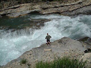
Watkins Glen State Park is located in the village of Watkins Glen, south of Seneca Lake in Schuyler County in New York's Finger Lakes region. The park's lower part is near the village, while the upper part is open woodland. It was opened to the public in 1863 and was privately run as a tourist resort until 1906, when it was purchased by New York State. Initially known as Watkins Glen State Reservation, the park was first managed by the American Scenic and Historic Preservation Society before being turned over to full state control in 1911. Since 1924, it has been managed by the Finger Lakes Region of the New York State Office of Parks, Recreation and Historic Preservation.

Nolichucky River watercourse in the United States of America

The Nolichucky River is a 115-mile (185 km) river that flows through Western North Carolina and East Tennessee, in the southeastern United States. Traversing the Pisgah National Forest and the Cherokee National Forest in the Blue Ridge Mountains, the river's watershed is home to some of the highest mountains in the Appalachians, including Mount Mitchell, the highest point in the eastern United States. The river is a tributary of the French Broad River, and is impounded by Nolichucky Dam near Greeneville, Tennessee.

Sacandaga River river in the United States of America

The Sacandaga River is a 64-mile-long (103 km) river in the northern part of New York in the United States. Its name comes from the Native American Sa-chen-da'-ga, meaning "overflowed lands".

Pleasant Dale, West Virginia Unincorporated community in West Virginia, United States

Pleasant Dale is an unincorporated community in Hampshire County in the U.S. state of West Virginia. Pleasant Dale is located between Capon Bridge and Augusta on the Northwestern Turnpike. Tearcoat Creek flows through Pleasant Dale and offers whitewater rafting in the Spring from the U.S. Route 50 bridge to its confluence with the North River.

Wills Creek (North Branch Potomac River tributary)

Wills Creek is a 38.6-mile-long (62.1 km) tributary of the North Branch Potomac River in Pennsylvania and Maryland in the United States.

Cherry Run river in the United States of America

Cherry Run is a 7.2-mile-long (11.6 km) meandering stream that forms the northern section of the boundary between Morgan and Berkeley counties in West Virginia's Eastern Panhandle. While it is mostly non-navigable, Cherry Run provides many pools of varying depths for fishing and swimming. As a tributary of the Potomac River, Cherry Run is part of the Potomac and Chesapeake Bay watersheds.

Middle Creek is a 9.7-mile-long (15.6 km) tributary of Opequon Creek, belonging to the Potomac River and Chesapeake Bay watersheds, located in Berkeley County in West Virginia's Eastern Panhandle.

Jarbidge River river in the United States of America

The Jarbidge River is a 51.8-mile-long (83.4 km), high elevation river in northern Nevada and southwest Idaho in the United States. The Jarbidge originates as two main forks in the Jarbidge Mountains of northeastern Nevada and then flows through basalt and rhyolite canyons on the high plateau of the Owyhee Desert before joining the Bruneau River.

Big Wapwallopen Creek creek in Pennsylvania, United States

Big Wapwallopen Creek is a tributary of the Susquehanna River in Luzerne County, Pennsylvania, in the United States. It is approximately 23 miles (37 km) long and flows through Bear Creek Township, Fairview Township, Rice Township, Wright Township, Dorrance Township, Hollenback Township, Nescopeck Township, and Conyngham Township. The watershed of the creek has an area of 53.2 square miles (138 km2). The creek has three named tributaries: Balliet Run, Watering Run, and Bow Creek. The creek is designated as a Coldwater Fishery and a Migratory Fishery and is also Class A Wild Trout Waters for part of its length. However, a portion is considered to be impaired by organic enrichment and/or low levels of dissolved oxygen and its pH ranges from moderately acidic to slightly alkaline.

Abrams Creek is an 11.2-mile-long (18.0 km) tributary stream of Opequon Creek in Frederick County and the independent city of Winchester in Virginia. Abrams Creek rises north of Round Hill and flows in a southeasterly direction through Winchester. From Winchester, Abrams Creek flows east into Opequon Creek. The stream was originally known as Abraham's Creek.

Conewago Creek (west) west tributary of the Susquehanna River in Pennsylvania, United States

Conewago Creek is an 80.2-mile-long (129.1 km) tributary of the Susquehanna River in Adams and York counties in Pennsylvania in the United States, with its watershed also draining a small portion of Carroll County, Maryland. The source is at an elevation of 1,440 feet (440 m), east of Caledonia State Park, in Franklin Township in Adams County. The mouth is the confluence with the Susquehanna River at York Haven in York County at an elevation of 259 feet (79 m).

Lochsa River river in the United States of America

The Lochsa River is in the northwestern United States, in the mountains of north central Idaho. It is one of two primary tributaries of the Middle Fork of the Clearwater River in the Clearwater National Forest. Lochsa is a Nez Perce word meaning rough water. The Salish name is Ep Smɫí, "It Has Salmon."

Buffalo Creek is a 4.1-mile-long (6.6 km) free-flowing tributary stream of the South Branch Potomac River, itself a tributary of the Potomac River, making it a part of the Chesapeake Bay watershed. Buffalo Creek is located in west-central Hampshire County in the U.S. state of West Virginia. Because the stream flows through several small farms, Buffalo Creek primarily serves agriculture purposes with segments used for livestock watering.

Latah Creek river in the United States of America

Latah Creek, officially known as Hangman Creek, is a large stream in eastern Washington and north central Idaho in the United States. The creek flows northwest from the Rocky Mountains to Spokane, where it empties into the Spokane River. It drains 673 square miles (1,740 km2) in parts of Benewah and Kootenai counties in Idaho, Spokane County and a small portion of Whitman County in Washington, where over 64 percent of its watershed resides. Some major tributaries of the approximately 60-mile (97 km) creek include Little Latah Creek and Rock Creek. The average flow of the creek can range from 20 cubic feet per second (0.57 m3/s) to 20,000 cubic feet per second (570 m3/s). Latah Creek receives its name from a Nez Perce word likely meaning "fish". In 1854, the creek received another name, Hangman Creek, from a war between the Palouse Indians and white soldiers, which resulted in several Palouse being hanged alongside the creek.

The Klamath River is a river in southern Oregon and northern California in the United States. This article describes its course.

North River (Cacapon River) river in the United States of America

The North River is a tributary of the Cacapon River, belonging to the Potomac River and Chesapeake Bay watersheds. The river is located in Hampshire and Hardy counties in the U.S. state of West Virginia's Eastern Panhandle. The mouth of the North River into the Cacapon is located at Forks of Cacapon. From its headwaters to its mouth, the North River spans 52.4 miles (84.3 km) in length.

Shingle Mill Run is a tributary of West Branch Fishing Creek in Sullivan County, Pennsylvania, in the United States. It is approximately 2.4 miles (3.9 km) long and flows through Davidson Township. The watershed of the stream has an area of 2.60 square miles (6.7 km2). The stream has one named tributary, Bearwallow Run. Shingle Mill Run is designated as an Exceptional Value stream and has a population of native trout. The stream has high water quality and is slightly acidic. Boulder Colluvium and bedrock consisting of sandstone and shale can be found near the stream.

References

  1. U.S. Geological Survey Geographic Names Information System: Tear Coat Creek
  2. U.S. Geological Survey. National Hydrography Dataset high-resolution flowline data. The National Map, accessed August 15, 2011

Coordinates: 39°17′56″N78°33′08″W / 39.29899°N 78.55223°W / 39.29899; -78.55223

Geographic coordinate system Coordinate system

A geographic coordinate system is a coordinate system that enables every location on Earth to be specified by a set of numbers, letters or symbols. The coordinates are often chosen such that one of the numbers represents a vertical position and two or three of the numbers represent a horizontal position; alternatively, a geographic position may be expressed in a combined three-dimensional Cartesian vector. A common choice of coordinates is latitude, longitude and elevation. To specify a location on a plane requires a map projection.