
Springfield is a census-designated place (CDP) in northwestern Hampshire County in the U.S. state of West Virginia. As of the 2010 census, Springfield had a population of 477. Springfield is located north of Romney along West Virginia Route 28 at its junction with Green Spring Road and Springfield Pike. It is currently considering incorporation.
Forks of Cacapon, formerly Forks of Capon, is an unincorporated community in Hampshire County in the U.S. state of West Virginia. The community is named for its location at the confluence of the North River and Cacapon River. Forks of Cacapon is also located at another fork: the crossroads of West Virginia Route 29, West Virginia Route 127, and Frank Haines Road.

Three Churches is an unincorporated community in Hampshire County in the U.S. state of West Virginia. The town is located north of Romney along Jersey Mountain Road at a crossroads with Three Churches Hollow Road. Originally known as Jersey Mountain, Three Churches was renamed for the three historic white wooden churches located there: Mount Bethel Church, Mount Bethel Primitive Baptist Church, and Branch Mountain United Methodist Church. The Three Churches Post Office is no longer in service.

Kirby is an unincorporated community in Hampshire County in the U.S. state of West Virginia situated along Grassy Lick Run, a tributary of North River. Kirby is located south of Romney at the crossroads of Grassy Lick Road and Rock Oak Road.
Yellow Spring is an unincorporated community in Hampshire County in the U.S. state of West Virginia. According to the 2000 census, the Yellow Spring community has a population of 296. Yellow Spring is named after the "Yellow Spring" located there on the Cacapon River. The community lies at the junction of West Virginia Route 259 and Cacapon River Road. Yellow Spring is sometimes incorrectly listed or referred to as Yellowspring or Yellow Springs.
Slanesville is an unincorporated community in northeastern Hampshire County in the U.S. state of West Virginia. Slanesville is located at the crossroads of Bloomery Pike with Slanesville Pike and Cold Stream Road. Slanesville Pike and Cold Stream Road formerly made up the Springfield Grade Road that ran from Capon Bridge to Springfield. According to the 2000 census, the Slanesville community has a population of 691.
Purgitsville is an unincorporated community in Hampshire County in the U.S. state of West Virginia. According to the 2000 census, the ZCTA for Purgitsville had a population of 813. Purgitsville is located on U.S. Highway 220/West Virginia Route 28 at its intersection with Huffman Road south of Junction. An elementary school, Mill Creek Elementary, was open here until 1993 when it was consolidated with Romney Elementary.

Rio is an unincorporated community in southern Hampshire County in the U.S. state of West Virginia. Rio is located just north of the Hardy County line at the crossroads of Augusta-Ford Hill Road and Delray Road in the North River Valley. According to the 2000 census, the Rio community has a population of 154.

Points is an unincorporated community in Hampshire County in the U.S. state of West Virginia. According to the 2000 census, the Points community has a population of 478.

Pin Oak is an unincorporated community in Hampshire County in the U.S. state of West Virginia. Pin Oak is located along West Virginia Route 29 between Paw Paw and Forks of Cacapon. Pin Oak is roughly centered at the intersection of Pin Oak Road and Cabin Run Road with West Virginia Route 29. The old Pinoak School lies north of this intersection.

Wappocomo is an unincorporated community in Hampshire County in the U.S. state of West Virginia. The community is located south of Springfield on West Virginia Route 28 at Hanging Rocks along the South Branch Potomac River. Wappocomo has also historically been referred to as The Rocks, Wapocoma, and Wapocomo.

West Virginia Route 127 is an east–west state highway located in northeast West Virginia. The western terminus is at West Virginia Route 29 near Forks of Cacapon in Hampshire County. The eastern terminus is at the Virginia state line west of U.S. Route 522 and east of Good, where WV 127 continues eastward as State Route 127.
Good is an unincorporated community in northeastern Hampshire County, West Virginia, United States atop Bear Garden Mountain. Good is located on the Bloomery Pike at I.L. Pugh Road east of Bloomery and northwest of Winchester on the West Virginia/Virginia border. Good partly lies in Frederick County, Virginia.

Neals Run is an unincorporated community in Hampshire County in the U.S. state of West Virginia. Neals Run is located south of Little Cacapon near the confluence of the Little Cacapon River and Neals Run on Spring Gap-Neals Run Road. The community derives its name from the stream.
Rada is an unincorporated community in Hampshire County in the U.S. state of West Virginia. Rada is located on U.S. Highway 220/West Virginia Route 28 between Junction and Purgitsville in southwest Hampshire County along Mill Creek. It lies at an intersection of US 220/WV 28 with Rada Road.

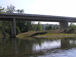
Blues Beach is an unincorporated community in Hampshire County in the U.S. state of West Virginia. Blues Beach is a predominantly river camp community located south of Springfield and north of Wappocomo on West Virginia Route 28 along the South Branch Potomac River. Blues Beach is also the location of the John Blue Bridge, commonly referred to as "Blue Beach Bridge." Long Road intersects with WV 28 here.
Cold Stream is an unincorporated community in Hampshire County in the U.S. state of West Virginia. Cold Stream is located north of Capon Bridge on Cold Stream Road. Referred to as Edwards Run in its past, the community of Cold Stream is in proximity to where Edwards Run empties into the Cacapon River. The community most likely took its name from a nearby stream of the same name noted for the cold water it contains. Their post office has been closed.

Shanghai is an unincorporated community in Berkeley County, West Virginia, United States. The town is nestled in Back Creek Valley between Leading Ridge and North Mountain. Shanghai lies at the junction of West Virginia Secondary Route 7 and Secondary Route 18.
The roads of Charleston, West Virginia, include three major interstate highways, several U.S. highways and state routes, and numerous major thoroughfares.

U.S. Route 11 (US 11) in the U.S. state of West Virginia spans 26.2 miles (42.2 km) across the Eastern Panhandle region. US 11 enters the state near Ridgeway and crosses into Maryland just south of Williamsport. The highway closely parallels Interstate 81 (I-81) for its entire length.


