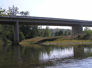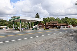
Interstate 68 (I-68) is a 112.9-mile (181.7 km) Interstate Highway in the US states of West Virginia and Maryland, connecting I-79 in Morgantown, West Virginia, east to I-70 in Hancock, Maryland. I-68 is also Corridor E of the Appalachian Development Highway System. From 1965 until the freeway's construction was completed in 1991, it was designated as U.S. Route 48 (US 48). In Maryland, the highway is known as the National Freeway, an homage to the historic National Road, which I-68 parallels between Keysers Ridge and Hancock. The freeway mainly spans rural areas and crosses numerous mountain ridges along its route. A road cut at Sideling Hill exposed geological features of the mountain and has become a tourist attraction.

The Cacapon River, located in the Appalachian Mountains of West Virginia's Eastern Panhandle region, is an 81.0-mile-long (130.4 km) shallow river known for its fishing, boating, wildlife, hunting, and wilderness scenery. As part of the Potomac River watershed, it is an American Heritage River.

Springfield is a census-designated place (CDP) in northwestern Hampshire County in the U.S. state of West Virginia. As of the 2010 census, Springfield had a population of 477. Springfield is located north of Romney along West Virginia Route 28 at its junction with Green Spring Road and Springfield Pike. It is currently considering incorporation.

Yellow Spring is an unincorporated community in Hampshire County in the U.S. state of West Virginia. According to the 2000 census, the Yellow Spring community has a population of 296. Yellow Spring is named after the "Yellow Spring" located there on the Cacapon River. The community lies at the junction of West Virginia Route 259 and Cacapon River Road. Yellow Spring is sometimes incorrectly listed or referred to as Yellowspring or Yellow Springs.

High View is an unincorporated community in Hampshire County, West Virginia, United States. It is located south of Capon Bridge along West Virginia Route 259 on the Virginia line. High View is home to the Bhavana Society Forest Monastery and Retreat Center. According to the 2000 census, the High View community has a population of 791.

Capon Lake is an unincorporated community in Hampshire County of West Virginia's Eastern Panhandle region. Capon Lake is situated between Yellow Spring and Intermont at the junction of West Virginia Route 259 and Capon Springs Road along the Cacapon River. Capon Springs Run empties into the Cacapon here across from the old Capon Lake Whipple Truss Bridge. Capon Lake takes its name from the Cacapon River's lake-like characteristics there. It was a popular picnic spot for tourists and travelers on the Winchester and Western Railroad.

West Virginia Route 259 is a state highway in the U.S. state of West Virginia. The state highway runs 45.6 miles (73.4 km) from the Virginia state line near Mathias north to the Virginia state line at High View. At both termini, the road continues as Virginia State Route 259. WV 259 passes through Hardy and Hampshire counties and runs concurrently with WV 55 on Corridor H between Baker and Wardensville.

West Virginia Route 29 is a north–south state highway located in the Eastern Panhandle of West Virginia. The southern terminus of the route is at West Virginia Route 55 and West Virginia Route 259 in Baker, Hardy County. The northern terminus is at West Virginia Route 9 three miles (5 km) south of Paw Paw in Hampshire County.
Loom is an unincorporated community in Hampshire County, West Virginia, United States. Loom is located between Capon Bridge and Hanging Rock along the Northwestern Turnpike on the western flanks of Cooper Mountain. Timber Mountain Road and Beck's Gap Road converge at Loom on U.S. Route 50.
Nero was an unincorporated community in Hampshire County, West Virginia, United States. It is located on Back Creek Road south of Lehew. Nero lies along Loman Branch, a tributary stream of the Cacapon River. Nero no longer has its own post office in operation.
Jericho is an unincorporated community in Hampshire County in the U.S. state of West Virginia on the Virginia line. It is located on West Virginia Route 259 between High View and Lehew atop Timber Ridge.
Ganotown is an unincorporated community on Back Creek in Berkeley County, West Virginia, United States. It is located at the crossroads of County Routes 7 and 7/19.

Shanghai is an unincorporated community in Berkeley County, West Virginia, United States. The town is nestled in Back Creek Valley between Leading Ridge and North Mountain. Shanghai lies at the junction of West Virginia Secondary Route 7 and Secondary Route 18.

Baker is an unincorporated community on the Lost River in Hardy County, West Virginia, United States. Baker is located at the intersection of U.S. Route 48, West Virginia Route 55, West Virginia Route 29 and West Virginia Route 259. The ZCTA population for Baker's ZIP Code was 1,262 at the 2000 census, though the zip code covers a much larger area than the actual community itself.
Timber Ridge is a mountain ridge of the Ridge-and-valley Appalachians straddling the U.S. states of Virginia and West Virginia. Timber Ridge extends from the forks of Sleepy Creek at Stotlers Crossroads in Morgan County, West Virginia, to Lehew in Hampshire County, West Virginia. The ridge is predominantly forested, as its name suggests, with the exception of a number of orchards and open fields. From WV 127/VA 127 at Good to Lehew, Timber Ridge serves as the boundary line between Hampshire County, West Virginia, and Frederick County, Virginia.
Sand Ridge is an unincorporated community in Calhoun County, West Virginia, United States. It lies along U.S. Route 33 to the south of the town of Grantsville, the county seat of Calhoun County. Its elevation is 1,168 feet.
Tioga is a census-designated place (CDP) in northeastern Nicholas County, West Virginia, United States. As of the 2010 census, its population was 98. The town is located along a road alternatively called Tioga Road in Nicholas County and Strouds Creek Road in Webster County. The road can be accessed from West Virginia Route 20 in Allingdale and West Virginia Route 55 near Craigsville.
Beards Fork is a census-designated place (CDP) and coal town in Fayette County, West Virginia, United States that was founded as a coal town. As of the 2010 census, its population was 199.
Lowell is an unincorporated community in Summers County, West Virginia, United States. Lowell is located on the Greenbrier River, east of Hinton and southwest of Alderson. The community was first settled in 1770 and is the oldest community in Summers County.
Concord is an unincorporated community and former post office in southeastern Hampshire County in the U.S. state of West Virginia. It is located along Eldridge Road between the unincorporated communities of Lehew and Yellow Spring.


