The Potomac Heritage Trail, also known as the Potomac Heritage National Scenic Trail or the PHT, is a designated National Scenic Trail corridor spanning parts of the mid-Atlantic and upper southeastern regions of the United States that will connect various trails and historic sites in the states of Virginia, Maryland, and Pennsylvania and the District of Columbia. The trail network includes 710 miles (1,140 km) of existing and planned sections, tracing the outstanding natural, historical, and cultural features of the Potomac River corridor, the upper Ohio River watershed in Pennsylvania and western Maryland, and a portion of the Rappahannock River watershed in Virginia. The trail is managed by the National Park Service.

Rock Creek is a free-flowing tributary of the Potomac River that empties into the Atlantic Ocean via the Chesapeake Bay. The 32.6-mile (52.5 km) creek drains about 76.5 square miles (198 km2). Its final quarter-mile is affected by tides.

The South Branch Potomac River has its headwaters in northwestern Highland County, Virginia near Hightown along the eastern edge of the Allegheny Front. After a river distance of 139 miles (224 km), the mouth of the South Branch lies east of Green Spring in Hampshire County, West Virginia where it meets the North Branch Potomac River to form the Potomac.

Sleepy Creek is a 44.0-mile-long (70.8 km) tributary of the Potomac River in the United States, belonging to the Chesapeake Bay's watershed. The stream rises in Frederick County, Virginia, and flows through Morgan County, West Virginia before joining the Potomac near the community of Sleepy Creek.

Bull Run is a 32.8-mile-long (52.8 km) tributary of the Occoquan River that originates from a spring in the Bull Run Mountains in Loudoun County, Virginia, and flows south to the Occoquan River. Bull Run serves as the boundary between Loudoun County and Prince William County, and between Fairfax County and Prince William County.

Four Mile Run is a 9.4-mile-long (15.1 km) stream in Northern Virginia that starts near Interstate 66, at Gordon Avenue in Fairfax County and proceeds southeast through Falls Church to Arlington County in the U.S. state of Virginia. Most of the stretch is parkland and is paralleled by two paved non-motorized transport and recreational trails, the Washington & Old Dominion Railroad Trail and the Four Mile Run Trail.

Pimmit Run is a 7.8-mile-long (12.6 km) stream in northern Virginia that runs from Fairfax County to the Potomac River at Chain Bridge in the Arlingwood neighborhood of Arlington.

Accotink Creek is a 25.0-mile-long (40.2 km) tributary stream of the Potomac River in Fairfax County, Virginia, in the United States. At Springfield, Virginia, Accotink Creek is dammed to create Lake Accotink. The stream empties into the Potomac at Gunston Cove's Accotink Bay, to the west of Fort Belvoir.

Goose Creek is a 53.9-mile-long (86.7 km) tributary of the Potomac River in Fauquier and Loudoun counties in northern Virginia. It comprises the principal drainage system for the Loudoun Valley.
Cabin John Creek is a tributary stream of the Potomac River in Montgomery County, Maryland. The watershed covers an area of 26 square miles (67 km2). The headwaters of the creek originate in the city of Rockville, and the creek flows southward for 10.9 miles (17.5 km) to the Potomac River.

Pohick Creek is a 14.0-mile-long (22.5 km) tributary stream of the Potomac River in Fairfax County in the U.S. state of Virginia. It takes its name from the Pohick Native American tribe once prevalent in the area.

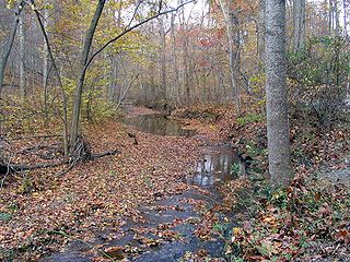
Difficult Run is a 15.9-mile-long (25.6 km) tributary stream of the Potomac River in Northern Virginia in the United States. The area has had many historical uses dating back to the early 1800s. Today, the area is used recreationally by visitors interested in the watershed's variety of options including hiking, biking, fishing, boating, climbing, and bird watching. The wildlife at Difficult Run is vast as 163 different species can be seen depending on the season. There are 41 different soil types found on the trail and alongside the stream. The stream is part of the greater 57.7- square-mile Drainage basin, or watershed, located in the north-central portion of Fairfax County and drains directly to the Potomac River.
Broad Run is a tributary stream of the Potomac River in Montgomery County, Maryland. The headwaters of the stream originate west of the town of Poolesville, and the creek flows southward for 8.9 miles (14.3 km) to the Potomac River. The Broad Run and its watershed are almost entirely within the Montgomery County Agricultural Reserve.

Cameron Run is a 3.0-mile-long (4.8 km) tributary stream of the Potomac River, located in the U.S. state of Virginia. A third-order stream, it is formed by the confluence of Backlick Run and Holmes Run. It flows eastward from Alexandria and forms the border between Fairfax County and Alexandria before opening into Hunting Creek and then into the Potomac River. The lower course near Eisenhower Avenue is largely channelized and flows just north of the Capital Beltway until it crosses under it near Telegraph Road The lower 1 mile (1.6 km) or so is tidal and was navigable in colonial times. Cameron Run Regional Park, a water park, lies along a portion of the stream. Cameron Run is part of the Cameron Run Watershed, which encompasses a total of 44 square miles (110 km2) in Northern Virginia. The Watershed is made up of eight subwatersheds: Tripps Run, Upper Holmes Run, Lower Holmes Run, Turkeycock Run, Backlick Run, Indian Run, Pike Branch, and Cameron Run and its tributaries.

The Occoquan River is a tributary of the Potomac River in Northern Virginia, where it serves as part of the boundary between Fairfax and Prince William counties. The river is a scenic area, and several local high schools and colleges use the river for the sport of rowing.
Broad Run is a 38.0-mile-long (61.2 km) tributary of the Occoquan River in the U.S. state of Virginia. It rises in Fauquier County and passes through Thoroughfare Gap. A gazetteer from the mid-nineteenth century described it as a small stream, a valuable mill stream.
Broad Run may refer to a place in the United States:
The Cameron Run Watershed (CRW) is a highly urbanized, 44 square-mile watershed located in Northern Virginia. "The region is completely urbanized with nearly 95 percent of the watershed developed with mixed residential and commercial use". Seventy-five percent of the watershed lies in Fairfax County, and the rest lies in Arlington County and the cities of Falls Church and Alexandria. In addition to several streams, there are two lakes—Lake Barcroft and Fairview Lake —and four ponds. There are eight sub-watersheds within the CRW. The western part of the CRW lies within the Piedmont; the southeastern part in the Coastal Plain.

Holmes Run is a stream in the Cameron Run Watershed in Northern Virginia. It runs through Fairfax County and the City of Alexandria. It is a first-order tributary of the Potomac River.
Smith Cabin Run is a tributary of North Branch Mehoopany Creek in Sullivan County, Pennsylvania, in the United States. It is approximately 1.6 miles (2.6 km) long and flows through Colley Township. The watershed of the stream has an area of 1.45 square miles (3.8 km2). The stream has a high gradient and flows primarily through forested land. It has an unnamed pond at its headwaters and a 20-foot (6.1 m) waterfall on an unnamed tributary.
