Oxon Creek

Last updated
Oxon Creek
Capital Beltway Anacostia Freeway junction.jpg
Anacostia Freeway Crossing Oxon Creek to join the Beltway (2007) - Wilson Bridge is to the left
Location
Country United States
Location Prince George's County, Maryland and Washington, D.C.
Physical characteristics
Source 
  coordinates 38°49′00″N77°00′23″W / 38.8166667°N 77.0063889°W / 38.8166667; -77.0063889
Mouth  
  location
Potomac River
  coordinates
38°48′26″N77°1′29″W / 38.80722°N 77.02472°W / 38.80722; -77.02472
  elevation
−3 feet (−0.91 m) [1]
Length1.5 miles (2.4 km)
Basin features
River system Potomac River
Tributaries 
  leftBarnaby Run (Winkle Doodle Run), Forest Heights Tributary, Oxon Hill Tributary
  right Oxon Run

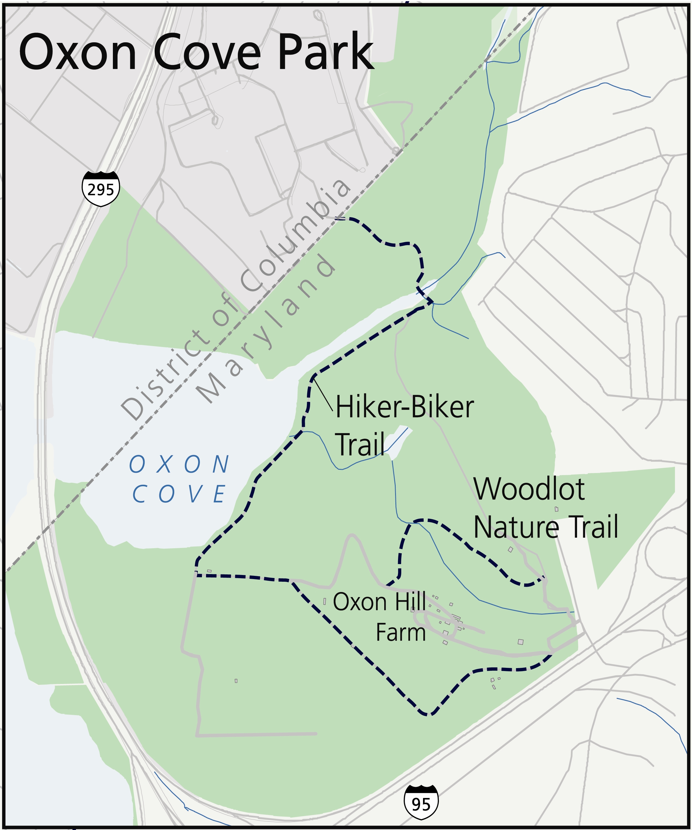
Oxon Creek is a stream on the Potomac River which feeds a cove that straddles the border between Washington, D.C., and Prince George's County, Maryland just north of Interstate 495 (Capital Beltway) at Woodrow Wilson Bridge. [2] [3] Oxon Creek heads at the confluence of Oxon Run and Barnaby Run, sometimes referred to as Winkle Doodle Run. [4] It starts just inside the boundary of D.C. and then runs 1.5 miles (2.4 km) to the south and west into Maryland to empty into the Potomac at Goose Island (a sand bar often under water) across from the city of Alexandria, Virginia. Before reaching the Potomac, the creek widens to form Oxon Cove which is partially in Maryland and partially in Washington, D.C. The creek is almost entirely within Oxon Cove National Park, except for the first few feet in D.C. and a portion of the cove on the southside of the Blue Plains Advanced Wastewater Treatment Plant. [5]

Contents

Two bridges cross the creek. The Anacostia Freeway crosses it on a bridge where it becomes a tidal stream and the Oxon Hill Farm Trail crosses it where it is still narrow.

The unusual spelling is either historical or a reference to Oxfordshire, England, though it was usually labelled as Oxen Creek on maps prior to 1898. The distinction between Oxon Creek and Oxon Run is often not recognized and so both are frequently referred to as Oxon Run. [6] USGS first started labeling it as Oxon Creek in 1892. [7]

Variant names

According to the Geographic Names Information System, Oxon Creek has been known by the following names throughout its history: [1]

History

The area around Oxon Creek was largely undeveloped until the World War II era, when the Town of Forest Heights was built up along the south east side of the creek. Following Hurricane Connie in 1955, the U.S. Army Corps of Engineers began planning a flood control project along Oxon Creek that realigned the channel, dredged the creek to 100 feet wide, and constructed a 3-foot concrete drop structure just upstream from the Forest Heights Tributary. A smaller drop structure was built on the Forest Heights Tributary. [8] Work began on the project in 1961. [9]

The first bridge across the Creek, the Anacostia Freeway bridge, was opened in 1961 and then rebuilt around 2000. [10] The trail bridge was constructed in the 1970s. [11]

Oxon Creek is entirely contained within Oxon Cove Park and Oxon Hill Farm, which is part of the National Park Service. Planning for the park began in 1969. [12]

Oxon Creek Trails

Oxon Creek and the Oxon Creek Trail Oxon Run trail (8733086554).jpg
Oxon Creek and the Oxon Creek Trail

A set of trails run parallel to Oxon Creek and cross it on a bridge. The Oxon Creek Trail starts at the intersection of Oxon Run Drive and Audrey Lane in Forest Heights, Maryland. It crosses over the unnamed Forest Heights tributary and then follows the creek for about half a mile till it meets up with the Oxon Hill Hiker-Biker Trail just past another unnamed tributary within Oxon Cove National Park.

The 2 mile long Oxon Hill Hiker-Biker Trail starts at the Oxon Hill Farm Parking lot and then goes down the hill to the southeast corner of Oxon Cove. From there it follows along the south and east side of Oxon Creek to the Oxon Creek Trail. There it crosses Oxon Creek on one of only two bridges over the creek and passes through parkland, into Washington, D.C., and ends at DC Village Lane, SW. [13]

The Oxon Cove Trails trace their origins to the 1970s when bike commuters used access roads and a causeway built for landfill operations. When the landfill closed, cyclists asked for a trail and one was built in 1978. [11] Prior to 2010, the bridge over the Forest Heights tributary was washed out by high water, leaving only a low water crossing. [14] In 2011, the section within the District was rebuilt as part of the project to create a new police evidence warehouse and, in the same year, the bridge connecting the Oxon Creek Trail and the Hiker-Biker path was constructed. [15] [16] [17]

See also

Related Research Articles

<span class="mw-page-title-main">Rock Creek Park</span> Urban park in Washington, D.C., U.S.

Rock Creek Park is a large urban park that bisects the Northwest quadrant of Washington, D.C. The park was created by an Act of Congress in 1890 and today is administered by the National Park Service. In addition to the park proper, the Rock Creek administrative unit of the National Park Service administers various other federally owned properties in the District of Columbia located to the north and west of the National Mall, including Meridian Hill Park on 16th Street, N.W., the Old Stone House in Georgetown, and certain of the Fort Circle Parks, a series of batteries and forts encircling the District of Columbia for its defense during the U.S. Civil War.

<span class="mw-page-title-main">Potomac River</span> River in the Mid-Atlantic United States

The Potomac River is a major river in the Mid-Atlantic region of the United States that flows from the Potomac Highlands in West Virginia to the Chesapeake Bay in Maryland. It is 405 miles (652 km) long, with a drainage area of 14,700 square miles (38,000 km2), and is the fourth-largest river along the East Coast of the United States and the 21st-largest in the United States. Over 5 million people live within its watershed.

<span class="mw-page-title-main">Oxon Hill, Maryland</span> Census-designated place in Maryland

Oxon Hill is an unincorporated area and census-designated place (CDP) in southern Prince George's County, Maryland, United States. Oxon Hill is a suburb of Washington, located southeast of the downtown district and east of Alexandria, Virginia. It contains the new 300-acre (120 ha) National Harbor development on the shore of the Potomac River.

<span class="mw-page-title-main">Sligo Creek</span> Stream in Maryland, United States of America

Sligo Creek is a free-flowing tributary of the Northwest Branch of the Anacostia River in Maryland. The creek is approximately 9.1 miles (14.6 km) long, with a drainage area of about 11.6 square miles (30 km2).

The Potomac Heritage Trail, also known as the Potomac Heritage National Scenic Trail or the PHT, is a designated National Scenic Trail corridor spanning parts of the mid-Atlantic region of the United States that will connect various trails and historic sites in Virginia, Maryland, Pennsylvania, and the District of Columbia. The trail network includes 710 miles (1,140 km) of existing and planned sections, tracing the natural, historical, and cultural features of the Potomac River corridor, the upper Ohio River watershed in Pennsylvania and western Maryland, and a portion of the Rappahannock River watershed in Virginia. The trail is managed by the National Park Service and is one of three National Trails that are official NPS units.

<span class="mw-page-title-main">Rock Creek (Potomac River tributary)</span> Tributary of the Potomac River in Maryland and Washington, D.C., United States

Rock Creek is a free-flowing tributary of the Potomac River that empties into the Atlantic Ocean via the Chesapeake Bay. The 32.6-mile (52.5 km) creek drains about 76.5 square miles (198 km2). Its final quarter-mile is affected by tides.

<span class="mw-page-title-main">Rock Creek and Potomac Parkway</span> Parkway in Washington D.C.

The Rock Creek and Potomac Parkway, informally called the Rock Creek Parkway, is a parkway maintained by the National Park Service as part of Rock Creek Park in Washington, D.C. It runs next to the Potomac River and Rock Creek in a generally north–south direction, carrying four lanes of traffic from the Lincoln Memorial and Arlington Memorial Bridge north to a junction with Beach Drive near Connecticut Avenue at Calvert Street, N.W., just south of the National Zoological Park.

<span class="mw-page-title-main">Catoctin Mountain</span> Mountain ridge in the United States

Catoctin Mountain, along with the geologically associated Bull Run Mountains, forms the easternmost mountain ridge of the Blue Ridge Mountains, which are in turn a part of the Appalachian Mountains range. The ridge runs northeast–southwest for about 50 miles (80 km) departing from South Mountain near Emmitsburg, Maryland, and running south past Leesburg, Virginia, where it disappears into the Piedmont in a series of low-lying hills near New Baltimore, Virginia. The ridge forms the eastern rampart of the Loudoun and Middletown valleys.

<span class="mw-page-title-main">Seneca Creek (Potomac River tributary)</span> Tributary of the Potomac River in Maryland, United States

Seneca Creek is a 5.8-mile-long (9.3 km) stream in Montgomery County, Maryland, USA, roughly 16 miles (26 km) northwest of Washington, D.C. It drains into the Potomac River.

<span class="mw-page-title-main">Mattawoman Creek</span> Coastal plain tributary in Maryland, United States

Mattawoman Creek is a 30.0-mile-long (48.3 km) coastal-plain tributary to the tidal Potomac River with a mouth at Indian Head, Maryland, 20 miles (32 km) downstream of Washington, D.C. It comprises a 23-mile (37 km) river flowing through Prince George's and Charles counties and a 7-mile (11 km) tidal-freshwater estuary in Charles County. About three-fourths of its 94-square-mile (240 km2) watershed lies in Charles County, with the remainder in Prince George's County immediately to the north.

<span class="mw-page-title-main">Cabin John Creek</span> Tributary stream of the Potomac River in Montgomery County, Maryland, United States

Cabin John Creek is a tributary stream of the Potomac River in Montgomery County, Maryland. The watershed covers an area of 26 square miles (67 km2). The headwaters of the creek originate in the city of Rockville, and the creek flows southward for 10.9 miles (17.5 km) to the Potomac River.

<span class="mw-page-title-main">Pohick Creek</span> Stream in Virginia, USA

Pohick Creek is a 14.0-mile-long (22.5 km) tributary stream of the Potomac River in Fairfax County in the U.S. state of Virginia. It takes its name from the Pohick Native American tribe once prevalent in the area.

<span class="mw-page-title-main">Difficult Run</span> River in Northern Virginia, United States

Difficult Run is a 15.9-mile-long (25.6 km) tributary stream of the Potomac River in Northern Virginia in the United States. The area has had many historical uses dating back to the early 1800s. Today, the area is used recreationally by visitors interested in the watershed's variety of options including hiking, biking, fishing, boating, climbing, and bird watching. The wildlife at Difficult Run is vast as 163 different species can be seen depending on the season. There are 41 different soil types found on the trail and alongside the stream. The stream is part of the greater 57.7- square-mile Drainage basin, or watershed, located in the north-central portion of Fairfax County and drains directly to the Potomac River.

<span class="mw-page-title-main">Little Falls Branch (Potomac River tributary)</span> Stream in Maryland, United States of America

Little Falls Branch, a 3.8-mile-long (6.1 km) tributary stream of the Potomac River, is located in Montgomery County, Maryland. In the 19th century, the stream was also called Powder Mill Branch. It drains portions of Bethesda, Somerset, Friendship Heights, and Washington, D.C., flows under the Chesapeake and Ohio Canal (C&O), and empties into the Potomac at Little Falls rapids, which marks the upper end of the tidal Potomac.

<span class="mw-page-title-main">Oxon Cove Park and Oxon Hill Farm</span> Historic district in Maryland, United States

Oxon Cove Park and Oxon Cove Farm is a national historic district that includes a living farm museum operated by the National Park Service, and located at Oxon Hill, Prince George's County, Maryland. It is part of National Capital Parks-East. It was listed on the National Register of Historic Places in 2003.

<span class="mw-page-title-main">Anacostia Tributary Trail System</span> Hiking trail in Maryland

The Anacostia Tributary Trail System (ATTS) is a unified and signed system of stream valley trails joining trails along the Anacostia tributaries of Northwest Branch, Northeast Branch, Indian Creek and Paint Branch with a trail along the Anacostia River, set aside and maintained by the Maryland-National Capital Park and Planning Commission (M-NCPPC) in the Maryland suburbs of Washington, D.C.

<span class="mw-page-title-main">Oxon Run</span> Stream in Maryland, USA

Oxon Run is a tributary stream of Oxon Creek and the Potomac River in Prince George's County, Maryland, and Washington, D.C.

References

  1. 1 2 U.S. Geological Survey Geographic Names Information System: Oxen Creek
  2. "Feature Detail Report for: Oxon Creek Stream". usgs. Retrieved 29 January 2019.
  3. "Feature Detail Report for: Oxon Creek Bay". USGS. Retrieved 29 January 2019.
  4. Barnaby Run and Winkle Doodle Run meet just north of Galveston Street at Southern Avenue. Sometimes the combined stream south of that is referred to as Barnaby Run and at others as Winkle Doodle Run, Winkle Doodle is the older, more frequently used name, but Barnaby Run is used by USGS. Barnaby Run used to be called Barnabas Creek, getting its name from St. Barnabas Church which was founded in 1789 near the source of the stream. "Board of Public Works". The Evening Star. 14 September 1871.
  5. "Oxon Cove Park and Oxon Hill Farm Map". NPS. Retrieved 29 January 2019.
  6. "Oxon Run Watershed Implementation Plan (WIP)" (PDF). Retrieved 5 February 2019.
  7. "Oxon Run Decision Card" . Retrieved 29 January 2019.
  8. "Oxon Run, Washington, D.C. Watershed and Stream Assessment" (PDF). U.S. Fish and Wildlife Service. Retrieved 21 February 2019.
  9. "Army Approves Plan To Control Oxon Run". The Washing Times Herald. 11 July 1961.
  10. Douglas, Walter B. (25 December 1961). "Wilson Span Dedication Set Today". The Washington Post.
  11. 1 2 Paved recreation trails of the National Capital Region. Washington, D.C.: National Park Service, U.S. Dept. of the Interior. 1990. p. 13. Retrieved 18 February 2019.
  12. Meyer, Lawrence (17 April 1969). "Oxon Run Park Is Proposed". The Washington Post.
  13. "Oxon Cove Park Trail Map" . Retrieved 18 February 2019.
  14. "Oxon Run Trail Rehabilitation Project" . Retrieved 8 April 2019.
  15. Billing, Greg. "OXON COVE FARM TRAIL CONNECTION FIXED". WABA. Retrieved 18 February 2019.
  16. Cranor, David. "New Bridge along Oxon Run". TheWashCycle.com. Retrieved 18 February 2019.
  17. Waite, Andrew (17 February 2011). "Summer jobs will help bridge a gap in the Oxon Hill project". The Washington Post. Retrieved 29 March 2019.