Herring Bay

Last updated
Herring Bay
2016-08-19 10 59 06 View southeast across Herring Bay from Maryland State Route 423 (Fairhaven Road) in Fairhaven-on-the-Bay, Anne Arundel County, Maryland.jpg
View southeast across Herring Bay from MD 423 in Fairhaven-on-the-Bay
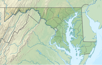
USA Maryland relief location map.svg
Red pog.svg
Herring Bay
Usa edcp relief location map.png
Red pog.svg
Herring Bay
Location Anne Arundel County [1]
Coordinates 38°45′10″N76°32′36″W / 38.75278°N 76.54333°W / 38.75278; -76.54333
Type Bay [1]
Part of Chesapeake Bay
Surface elevation0 feet (0 m) [1]

Herring Bay is a bay in Anne Arundel County in the U.S. state of Maryland. It lies in the mid-Chesapeake Bay along the western shore.
Related Research Articles

<span class="mw-page-title-main">Herring</span> Forage fish, mostly belonging to the family Clupeidae

Herring are forage fish, mostly belonging to the family of Clupeidae.

<span class="mw-page-title-main">Atlantic herring</span> Species of fish

Atlantic herring is a herring in the family Clupeidae. It is one of the most abundant fish species in the world. Atlantic herrings can be found on both sides of the Atlantic Ocean, congregating in large schools. They can grow up to 45 centimetres (18 in) in length and weigh up to 1.1 kilograms (2.4 lb). They feed on copepods, krill and small fish, while their natural predators are seals, whales, cod and other larger fish.

<span class="mw-page-title-main">Felucca</span> Type of boat

A felucca is a traditional wooden sailing boat with a single sail used in the Mediterranean, including around Malta and Tunisia. However, in Egypt, Iraq and Sudan, its rig can consist of two lateen sails as well as just one.

<span class="mw-page-title-main">Pickled herring</span> Traditional way of preserving herring

Pickled herring is a traditional way of preserving herring as food by pickling or curing.

<span class="mw-page-title-main">Apostle Islands</span> Lake Superior archipelago in northern Wisconsin

The Apostle Islands are a group of 22 islands in Lake Superior, off the Bayfield Peninsula in northern Wisconsin. The majority of the islands are located in Ashland County—only Sand, York, Eagle, and Raspberry Islands are located in Bayfield County. All the islands except for Madeline Island are part of the Apostle Islands National Lakeshore. The islands in Ashland County are all in the Town of La Pointe, except for Long Island, which is in the Town of Sanborn, while those in Bayfield County are in the Towns of Russell and Bayfield.

<span class="mw-page-title-main">Richardson Bay</span> Arm of San Francisco Bay

Richardson Bay is a shallow, ecologically rich arm of San Francisco Bay, managed under a Joint Powers Agency of four northern California cities. The 911-acre (369 ha) Richardson Bay Sanctuary was acquired in the early 1960s by the National Audubon Society. The bay was named for William A. Richardson, early 19th century sea captain and builder in San Francisco. It contains both Strawberry Spit and Aramburu Island.

<span class="mw-page-title-main">Pacific herring</span> Species of fish

The Pacific herring is a species of the herring family associated with the Pacific Ocean environment of North America and northeast Asia. It is a silvery fish with unspined fins and a deeply forked caudal fin. The distribution is widely along the California coast from Baja California north to Alaska and the Bering Sea; in Asia the distribution is south to Japan, Korea, and China. Clupea pallasii is considered a keystone species because of its very high productivity and interactions with many predators and prey. Pacific herring spawn in variable seasons, but often in the early part of the year in intertidal and sub-tidal environments, commonly on eelgrass, seaweed or other submerged vegetation; however, they do not die after spawning, but can breed in successive years. According to government sources, the Pacific herring fishery collapsed in the year 1993, and is slowly recovering to commercial viability in several North American stock areas. The species is named for Peter Simon Pallas, a noted German naturalist and explorer.

<span class="mw-page-title-main">Quashnet River</span> Estuary in Massachusetts, United States

The Quashnet River, also known as Quoshnet River or Moonakis River, is a 5.1-mile-long (8.2 km) estuary in Falmouth, Massachusetts on Cape Cod. Its area is about 1-square-mile (2.6 km2).

<span class="mw-page-title-main">Santuit River</span>

The Santuit River, also known as the Cotuit River, is a 2.3-mile-long (3.7 km) river on the border between Mashpee and Cotuit, Massachusetts on Cape Cod.

<span class="mw-page-title-main">Agawam River</span> River in Massachusetts, United States

The Agawam River is a 10.7-mile-long (17.2 km) stream in southeastern Massachusetts, USA, that is part of the Wareham River estuary watershed. The Agawam River is named in honor of the peaceful Native Americans that helped the Massachusetts Bay Colony establish its first Connecticut River Valley settlement at Springfield, Massachusetts in 1636, and helped it to flourish while many of the Connecticut Colony settlements south of Springfield were attacked or destroyed by more war-like Native American tribes.

<span class="mw-page-title-main">Mattapoisett River</span> River in Massachusetts, United States

The Mattapoisett River is an 11.6-mile-long (18.7 km) river in southeastern Massachusetts, in the United States.

<span class="mw-page-title-main">Weweantic River</span>

The Weweantic River is a 17.0-mile-long (27.4 km) river in southeastern Massachusetts. Its name means "crooked" or "wandering stream" in the Wampanoag language.

Isle of Wight Bay is a lagoon that separates part of mainland Worcester County, Maryland from the midtown part of Ocean City, also in Worcester County. To the north, it connects to the Assawoman Bay just south of the Assawoman Bay Bridge, and to the south it connects to the Sinepuxent Bay at the north end of West Ocean City where the bay narrows between the Thoroughfare channel and Mallard Island. The major tributary of Isle of Wight Bay is the St. Martin's River; other tributaries include Turville Creek, Manklin Creek, and Herring Creek.

Back River is a tidal estuary in Baltimore County, Maryland, located about 2 miles (3 km) east of the city of Baltimore. The estuary extends from Essex, Maryland, southeast for about 8.8 miles (14.2 km) to the Chesapeake Bay. The watershed area is 39,075 acres (15,813 ha) and includes Essex Skypark Airport and the Back River Wastewater Treatment Plant. The river is shared between Essex, MD, Dundalk, MD, and Edgemere, MD

The Herring Run is an 11.1-mile-long (17.9 km) tributary of the Back River located in Baltimore, Maryland.

Green Bay National Wildlife Refuge is a National Wildlife Refuge of the United States located in the state of Wisconsin. It includes five all or part of six islands in Lake Michigan: Hog Island, Plum Island, Pilot Island, part of St. Martin Island and Rocky Island. Additionally it includes part of Detroit Island. The islands are near Washington Island off the tip of the Door Peninsula of Wisconsin and the Garden Peninsula of Michigan.

<span class="mw-page-title-main">Herring as food</span> Type of fish used as food for humans

Herring are forage fish in the wild, mostly belonging to the family Clupeidae. They are an important food for humans. Herring often move in large schools around fishing banks and near the coast. The most abundant and commercially important species belong to the genus Clupea, found particularly in shallow, temperate waters of the North Pacific and North Atlantic Oceans, including the Baltic Sea, as well as off the west coast of South America. Three species of Clupea are recognized; the main taxon, the Atlantic herring, accounts for over half the world's commercial capture of herrings.

<span class="mw-page-title-main">Yupʼik cuisine</span> Culinary traditions of Yupik people

Yup'ik cuisine refers to the Inuit and Yup'ik style traditional subsistence food and cuisine of the Yup'ik people from the western and southwestern Alaska. Also known as Cup'ik cuisine for the Chevak Cup'ik dialect speaking Eskimos of Chevak and Cup'ig cuisine for the Nunivak Cup'ig dialect speaking Eskimos of Nunivak Island. This cuisine is traditionally based on meat from fish, birds, sea and land mammals, and normally contains high levels of protein. Subsistence foods are generally considered by many to be nutritionally superior superfoods. Yup’ik diet is different from Alaskan Inupiat, Canadian Inuit, and Greenlandic diets. Fish as food are primary food for Yup'ik Eskimos. Both food and fish called neqa in Yup'ik. Food preparation techniques are fermentation and cooking, also uncooked raw. Cooking methods are baking, roasting, barbecuing, frying, smoking, boiling, and steaming. Food preservation methods are mostly drying and less often frozen. Dried fish is usually eaten with seal oil. The ulu or fan-shaped knife is used for cutting up fish, meat, food, and such.

Bellow Island, also known as Gull Island, is an island in the Grand Traverse Bay, a bay of Lake Michigan, located in Leelanau Township, Leelanau County, Michigan.

<span class="mw-page-title-main">Boundary Bay Wildlife Management Area</span> Wildlife Management Area in British Columbia, Canada

Boundary Bay Wildlife Management Area is a wildlife management area encompassing the entire Canadian portion of Boundary Bay in the Lower Mainland of British Columbia. It was established by the British Columbia Ministry of Forests, Lands, Natural Resource Operations and Rural Development (FLNRORD) on 21 June 1995 to conserve critical habitat for migratory bird species and resident fish and marine mammal species. It is part of the larger Fraser River Delta Ramsar Site.

References