Isle of Wight Bay

Last updated
Isle of Wight Bay
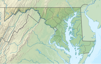
USA Maryland relief location map.svg
Red pog.svg
Isle of Wight Bay
Location Worcester County, Maryland [1]
Coordinates 38°22′18″N75°05′51″W / 38.37167°N 75.09750°W / 38.37167; -75.09750 Coordinates: 38°22′18″N75°05′51″W / 38.37167°N 75.09750°W / 38.37167; -75.09750
Type Bay [1]

Isle of Wight Bay is a lagoon that separates part of mainland Worcester County, Maryland from the midtown part of Ocean City, also in Worcester County. To the north, it connects to the Assawoman Bay just south of the Assawoman Bay Bridge, and to the south it connects to the Sinepuxent Bay at the north end of West Ocean City where the bay narrows between the Thoroughfare channel and Mallard Island. The major tributary of Isle of Wight Bay is the St. Martin's River; other tributaries include Turville Creek, Manklin Creek, and Herring Creek.
Related Research Articles

Worcester County, Maryland County in Maryland, US

Worcester County is the easternmost county of the U.S. state of Maryland. As of the 2010 census, the population was 51,454. Its county seat is Snow Hill. It is the only county of Maryland that borders the Atlantic Ocean, and the only county bordering both Delaware and Virginia. The county was named for Mary Arundell, the wife of Sir John Somerset, a son of Henry Somerset, 1st Marquess of Worcester. She was sister to Anne Arundell, wife of Cecil Calvert, 2nd Baron Baltimore, the first Proprietor and Proprietary Governor of the Province of Maryland.

Sandown Human settlement in England

Sandown is a seaside resort and civil parish on the south-east coast of the Isle of Wight, United Kingdom with the resort of Shanklin to the south and the settlement of Lake in between. Together with Shanklin, Sandown forms a built-up area of 21,374 inhabitants.

Biscayne Bay Florida lagoon

Biscayne Bay is a lagoon, with characteristics of an estuary, located on the Atlantic coast of South Florida, United States. The northern end of the lagoon is surrounded by the densely developed heart of the Miami metropolitan area, while the southern end is largely undeveloped, with a large portion of the lagoon included in Biscayne National Park. Sources differ on the extent of the lagoon. The part of the lagoon that is traditionally called "Biscayne Bay" is approximately 35 miles (56 km) long and up to 8 miles (13 km) wide, with a surface area of 573 square kilometres (221 sq mi). Various definitions may include Dumfoundling Bay, Card Sound, and Barnes Sound in a larger "Biscayne Bay", which is 60 miles (97 km) long, with a surface area of about 703 square kilometres (271 sq mi).

South Hampton Roads

South Hampton Roads is a region located in the extreme southeastern portion of Virginia's Tidewater region in the United States with a total population of 1,191,937. It is part of the Virginia Beach-Norfolk-Newport News, VA-NC MSA, which itself has a population of 1,724,876.

Eastern Shore of Maryland Part of the U.S. state of Maryland

The Eastern Shore of Maryland is a part of the U.S. state of Maryland that lies mostly on the east side of the Chesapeake Bay and consists of nine counties, seven of which have Chesapeake Bay coastlines. The region also contains Maryland's only coast along the Atlantic Ocean.

Maryland Route 90 is a state highway in the U.S. state of Maryland. Known as the Ocean City Expressway, the state highway runs 11.83 miles (19.04 km) from U.S. Route 50 near Whaleyville to MD 528 in Ocean City. MD 90 is a two-lane expressway that provides one of the main access routes to Ocean City, especially the northern part of the resort town, and thus sees heavy seasonal traffic. The highway was constructed from Ocean City starting in 1970. The state highway was opened west to MD 589 in 1972 and to US 113 in 1975. MD 90 was completed west to US 50 in 1976.

Rehoboth Bay is a body of water in Sussex County, Delaware. It is connected to the Broadkill River by the Lewes and Rehoboth Canal.

Sinepuxent Bay

Sinepuxent Bay is an inland waterway which connects Chincoteague Bay to Isle of Wight Bay, and is connected to the Atlantic Ocean via the Ocean City Inlet. It separates Sinepuxent Neck, in Worcester County, Maryland from Assateague Island, and West Ocean City, Maryland from downtown Ocean City. Islands in the Sinepuxent Bay include Horn Island and Skimmer Island. It is crossed by the Harry W. Kelley Memorial Bridge on U.S. Route 50 and the Verrazano Bridge on Maryland Route 611. The bay is the location of the islands that compose the Sinepuxent Bay Wildlife Management Area. Historically the area was referred to by various names including Sinepuxent, Sene Puxon, Synepuxent, Cinnepuxon, et al.

Assawoman Bay

Assawoman Bay, once called Assawoman Sound, is a lagoon that is located between Ocean City, Maryland and mainland Delmarva. The bay is located on the northern end of the city, the bay on the southern end is called the Isle of Wight Bay. Another bay called Little Assawoman Bay extends into southern Delaware, and is geologically separated from the main estuaries, by a narrow strait locally referred to as "The Ditch" which crosses the Transpeninsular Line. The larger bay is sometimes called "Big Assawoman Bay", to distinguish it from the smaller bay, though this is often meant to be a tongue-in-cheek rendering of the name.

Blackwater River (Virginia)

The Blackwater River of southeastern Virginia flows from its source near the city of Petersburg, Virginia for about 105 miles (170 km) through the Inner Coastal Plain region of Virginia. The Blackwater joins the Nottoway River to form the Chowan River, which empties into Albemarle Sound. The Blackwater-Nottoway confluence forms the boundary between Virginia and North Carolina.

Chuckatuck Creek is a 13.3-mile-long (21.4 km) tributary of the James River in the U.S. state of Virginia. The creek rises in Isle of Wight County and flows southeast to Chuckatuck in the city of Suffolk, where it turns northeast as it passes under State Route 10/State Route 32. Becoming tidal, the creek continues northeast to the mouth of Brewers Creek, where it broadens considerably and becomes the boundary between Isle of Wight County and the city of Suffolk. If proceeds under the Crittenden Bridge at Crittenden and reaches the James River at Batten Bay.

Fenwick Island State Park

Fenwick Island State Park is a 344-acre (139 ha) Delaware state park between Ocean City, Maryland and South Bethany, Delaware in Sussex County, Delaware, US. Fenwick Island State Park is open for year-round recreation from 8:00 am until sunset. Originally part of Delaware Seashore State Park, it was established in 1966 and renamed in 1981. The park is located on Fenwick Island, a narrow strip of land between the Atlantic Ocean and Little Assawoman Bay. It is largely undeveloped in comparison to the beach communities that surround it.

Chincoteague Bay

Chincoteague Bay is a lagoon between the Atlantic barrier islands of Assateague and Chincoteague and the mainland of Worcester County, Maryland and northern Accomack County, Virginia. At the bay's northern end, where it narrows between Assateague and Sinepuxent Neck, it becomes Sinepuxent Bay; Chincoteague Bay's southern end drains into the Atlantic Ocean via Queen Sound and Chincoteague Inlet. No major river flows into Chincoteague Bay—its largest tributaries are Newport Creek in Worcester County and Swans Gut Creek in Accomack County.

Isle of Wight Wildlife Management Area is a state wildlife management area (WMA) of Maryland located on the Isle of Wight, a small peninsula between the St. Martin's River and Isle of Wight Bay in Worcester County. Although called Isle of Wight, a small strip of marsh and road connects it with the mainland.

The St. Martin River is a tributary of Isle of Wight Bay in Worcester County, Maryland. Approximately 4.4 miles (7.1 km) long, it drains the northernmost part of Worcester County.

Isle of Wight is an island in Worcester County, Maryland. The island is in Isle of Wight Bay at the mouth of St. Martin River just west of Ocean City on Fenwick Island in eastern Maryland. The Ocean City Expressway crosses the island between the mainland and Fenwick Island.

Assawoman Bay Bridge

The Assawoman Bay Bridge crosses the Assawoman Bay in Ocean City, Maryland. The bridge carries Maryland Route 90, a freeway into northern Ocean City. The bridge consists of two lanes and is undivided, but is heavily travelled; as such, in the summertime, it is usually congested with traffic heading into and out of Ocean City, especially on Fridays and Sundays. It ends in North Ocean City at Maryland Route 528 and 62nd Street.

Dog and Bitch Island is depending on the sources one or two islands in Worcester County, Maryland, in the United States. It is located within the Isle of Wight Bay. The island is small in size and marshy. In 2014 the federal Army Corps of Engineers pumped 18,000 cubic yards of material from navigation channel dredging operations onto the island to improve migratory bird habitat.

The Cape May Peninsula AVA is an American Viticultural Area located in extreme southern New Jersey. The 126,635 acres (51,000 ha) wine appellation includes most of Cape May county and a small portion of Cumberland county. The region is characterized by well-drained sandy or sandy loam soils of low to moderate fertility, and a relatively long growing season. The climate is strongly moderated by the influence of the Atlantic Ocean and Delaware Bay. The region is in hardiness zones 6b, 7a, and 7b. The AVA is entirely contained within the larger Outer Coastal Plain AVA, but is distinguished from it primarily by a more moderate temperature, providing for a longer growing season.

Roy Creek (Assawoman Bay tributary)

Roy Creek is a 2.65 mi (4.26 km) long 1st order tributary to Assawoman Bay, in Sussex County, Delaware.

References