Tangier Sound | |
---|---|
Coordinates | 38°03′45″N75°59′44″W / 38.0626234°N 75.9954899°W |
Type | Bay [1] |
Part of | Chesapeake Bay [1] |
Surface elevation | 0 feet (0 m) [1] |
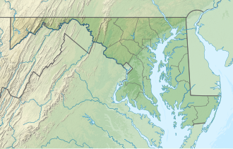
Tangier Sound is a sound of the Chesapeake Bay bounded on the west by Tangier Island in Virginia, and Smith Island and South Marsh Island in Maryland, by Deal Island in Maryland on the north, and the mainland of the Eastern Shore of Maryland and Pocomoke Sound on the east. It stretches into Virginia as far south as Watts Island.
The Manokin, Big Annemessex, and Little Annemessex Rivers all flow into Tangier Sound from Somerset County, Maryland.
Crisfield, Maryland, located on Tangier Sound, is a center of the shellfish industry. Smith Island, Tangier Island and Deal Island also remain centers of the Chesapeake Bay seafood industry and outposts of Chesapeake culture and history. As in other parts of Chesapeake Bay, the seafood industry on Tangier Sound has declined markedly due to pollution, mismanagement and the growth of recreational fishing. However, the wild oyster industry has seen a strong reemergence in recent years due to shell planting and caretaking methods performed by Chesapeake watermen. Tangier Sound is considered by many to possess the best oysters and soft crabs in the world. The Tangier Sound wild fishery is an artisanal fishery and source of iconic seafood.
Several Maryland wildlife management areas border Tangier Sound: South Marsh Island, Deal Island, Fairmount, and Cedar Island areas.
The Chesapeake Bay is the largest estuary in the United States. The bay is located in the Mid-Atlantic region and is primarily separated from the Atlantic Ocean by the Delmarva Peninsula, including parts of the Eastern Shore of Maryland, the Eastern Shore of Virginia, and the state of Delaware. The mouth of the bay at its southern point is located between Cape Henry and Cape Charles. With its northern portion in Maryland and the southern part in Virginia, the Chesapeake Bay is a very important feature for the ecology and economy of those two states, as well as others surrounding within its watershed. More than 150 major rivers and streams flow into the bay's 64,299-square-mile (166,534 km2) drainage basin, which covers parts of six states and all of Washington, D.C.
Crisfield is a city in Somerset County, Maryland, United States, located on the Tangier Sound, an arm of the Chesapeake Bay. The population was 2,515 at the 2020 census. It is included in the Salisbury, Maryland-Delaware Metropolitan Statistical Area. Crisfield has the distinction of being the southernmost incorporated city in Maryland.
Smith Island is a collection of three distinct island communities – Tylerton, Rhodes Point, and Ewell, Maryland – on the Chesapeake Bay, on the border of Maryland and Virginia territorial waters in the United States. The island is the last inhabited island in Maryland that is not accessible by vehicle. Most of the islands are eroding due to tidal currents and sea level rise; a study conducted in 2008 by the DNR reported that Smith Island is expected to completely erode by 2100 if no action is taken.
Saxis is a town in Accomack County, Virginia, United States. The population was 241 at the 2010 census.
Tangier is a town in Accomack County, Virginia, United States, on Tangier Island in the Chesapeake Bay. The population was 436 at the 2020 census. Since 1850, the island's landmass has been reduced by 67%. Under the mid-range sea level rise scenario, much of the remaining landmass is expected to be lost in the next 50 years and the town will likely need to be abandoned.
The eastern oyster —also called the Atlantic oyster, American oyster, or East Coast oyster—is a species of true oyster native to eastern North and South America. Other names in local or culinary use include the Wellfleet oyster, Virginia oyster, Malpeque oyster, Blue Pointoyster, Chesapeake Bay oyster, and Apalachicola oyster. C. virginica ranges from northern New Brunswick south through parts of the West Indies to Venezuela. It is farmed in all of the Maritime provinces of Canada and all Eastern Seaboard and Gulf states of the United States, as well as Puget Sound, Washington, where it is known as the Totten Inlet Virginica. It was introduced to the Hawaiian Islands in the 19th century and is common in Pearl Harbor.
Callinectes sapidus, the blue crab, Atlantic blue crab, or, regionally, the Maryland blue crab, is a species of crab native to the waters of the western Atlantic Ocean and the Gulf of Mexico, and introduced internationally.
The Eastern Shore of Virginia is the easternmost region of the Commonwealth of Virginia in the United States. It consists of two counties on the Atlantic coast. It is detached from the mainland of Virginia by the Chesapeake Bay. The 70-mile-long (110 km) region is part of the Delmarva Peninsula. Its population was 45,695 as of 2020.
The skipjack is a traditional fishing boat used on the Chesapeake Bay for oyster dredging. It is a sailboat which succeeded the bugeye as the chief oystering boat on the bay, and it remains in service due to laws restricting the use of powerboats in the Maryland state oyster fishery.
An oyster bar, also known as an oyster saloon, oyster house or a raw bar service, is a restaurant specializing in serving oysters, or a section of a restaurant which serves oysters buffet-style. Oysters have been consumed since ancient times and were common tavern food in Europe, but the oyster bar as a distinct restaurant began making an appearance in the 18th century.
The Virginia Marine Police is the law enforcement division of the Virginia Marine Resources Commission, an agency of the Commonwealth of Virginia, United States.
Hoopers Island is a chain of islands in Dorchester County, Maryland, United States. Upper Hoopers Island and Lower Hoopers Island are surrounded by water with the Chesapeake Bay on the left side and the Honga River on the right side. The remote set of islands has much wildlife and is well known for sport fishing and crabbing industries. Hoopers Island was issued one of the earliest land grants in Dorchester County, Maryland.
Janes Island State Park is a public recreation area on Chesapeake Bay lying adjacent to the city of Crisfield in Somerset County, Maryland. The state park features some 30 miles (48 km) of marked water trails through the island's salt marsh leading to isolated pristine beaches. The park is managed by the Maryland Department of Natural Resources.
Glenn Martin National Wildlife Refuge includes the northern half of Smith Island, which lies 11 miles (18 km) west of Crisfield, Maryland, and Watts Island, which is located between the eastern shore of Virginia and Tangier Island. Both islands are situated in the lower Chesapeake Bay.
Pocomoke Sound is a bay of the Chesapeake Bay that forms part of the boundary between the Eastern Shores of Maryland and Virginia. The Pocomoke River is the largest stream feeding into the Sound, which is bounded by Somerset County, Maryland on the north, Worcester County, Maryland, Accomack County, Virginia, and Beasley Bay on the east, the Chesapeake Bay on the south, and Tangier Sound on the west. Its southwesternmost point may be considered to be Watts Island, Virginia.
The Oyster Wars were a series of sometimes violent disputes between oyster pirates and authorities and legal watermen from Maryland and Virginia in the waters of the Chesapeake Bay and the Potomac River from 1865 until about 1959.
An oyster buy-boat, also known as deck boat, is an approximately 40–90 foot long wooden boat with a large open deck which serviced oyster tongers and dredgers. Similar in function to sardine carriers, buy boats circulated among the harvesters collecting their catches, then delivered their loads to a wholesaler or oyster processing house. This spared the fishermen the task and its downtime, allowing them to catch more oysters. Buy-boats also bought seed oysters, or spat, for planting in oyster beds.
The Tilghman Watermen's Museum records the maritime traditions of the people of Tilghman Island and the unique way of life of the watermen who lived on the island. It is located on Tilghman Island, Talbot County, Maryland, United States.
The Suminoe oyster, is a species of true oyster which inhabits intertidal hard grounds and substrate, as well as muddy creeks of warm estuaries throughout the western Pacific. It is large and flat in appearance and almost identical in gross morphology to Crassostrea virginica.
The Battle of Kedges Strait took place on November 30, 1782 near Tangier Sound in Chesapeake Bay near the town of Onancock, Virginia, between naval militia forces of the rebellious British colony of Maryland and the Royal Navy of Great Britain.