Newport Bay (Maryland)

Last updated
Newport Bay
USA Maryland location map.svg
Red pog.svg
Newport Bay
Usa edcp relief location map.png
Red pog.svg
Newport Bay
Location Worcester County, Maryland [1]
Coordinates 38°13′56″N75°13′5″W / 38.23222°N 75.21806°W / 38.23222; -75.21806 Coordinates: 38°13′56″N75°13′5″W / 38.23222°N 75.21806°W / 38.23222; -75.21806
Type Bay [1]
Surface elevation0 feet (0 m) [1]

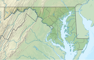
Newport Bay is an arm of Chincoteague Bay between the mainland of Worcester County, Maryland and Sinepuxent Neck; its principal tributaries are Newport Creek and Trappe Creek.

The names Newport Bay and Newport Creek refer to a tract of land on the creek, "Newport Pagnell", patented in the late 17th century, which in turn commemorated the town of the same name in Buckinghamshire. Newport Bay has also been known as Mobjack Bay. [1]
Related Research Articles

Christina River river in Delaware, United States

The Christina River is a tributary of the Delaware River, approximately 35 miles (56 km) long, in northern Delaware in the United States, also flowing through small areas of southeastern Pennsylvania and northeastern Maryland. Near its mouth the river flows past downtown Wilmington, Delaware, forming the city's harbor for traffic on the Delaware River. The Port of Wilmington, opened in 1923 at the river's mouth, handles international cargo and trade.

Yaquina River river in Oregon, United States of America

The Yaquina River is a stream, 59 miles (95 km) long, on the Pacific coast of the U.S. state of Oregon. It drains an area of the Central Oregon Coast Range west of the Willamette Valley near Newport.

Severn River (Maryland) River in Maryland, United States

The Severn River is a tidal estuary 14 miles (23 km) long, located in Anne Arundel County in the U.S. state of Maryland, south of the Magothy River and north of the South River.

Chester River river in Maryland and Delaware, United States

The Chester River is a major tributary of the Chesapeake Bay on the Delmarva Peninsula. It is about 43 miles (69 km) long, and its watershed encompasses 368 sq mi (950 km2), which includes 295 sq mi (760 km2) of land. Thus the total watershed area is 20% water. It forms the border between Kent County and Queen Anne's County, Maryland, with its headwaters extending into New Castle County and Kent County, Delaware. Chestertown, the seat of Maryland's Kent County, is located on its north shore. It is located south of the Sassafras River and north of Eastern Bay, and is connected with Eastern Bay through Kent Narrows.

Christiana Hundred is an unincorporated subdivision of New Castle County, Delaware. Hundreds were once used as a basis for representation in the Delaware General Assembly, and while their names still appear on all real estate transactions, they presently have no meaningful use or purpose except as a geographical point of reference.

Wicomico River (Potomac River tributary) river in the United States of America, tributary of the Potomac River

The Wicomico River is a 13.0-mile-long (20.9 km) tributary of the lower tidal portion of the Potomac River located in the U.S. state of Maryland south of Washington, DC. The river empties into the Potomac at Cobb Island and St. Margaret's Island. Its watershed area is 77 square miles (200 km2), with 2% impervious surface in 1994. in Charles, St. Mary's, and southern Prince George's counties. The lower section of the river forms part of the boundary between Charles and St. Mary's counties. The Wicomico River was designated a Scenic River under the Maryland Scenic River Act in 1968, and there are Scenic River Commissions for it in both Charles and St. Mary's counties.

Curtis Bay, Baltimore Neighborhood of Baltimore in Maryland, United States

Curtis Bay is a residential / commercial / industrial neighborhood in the southern portion of the City of Baltimore, Maryland, United States.

Mattawoman Creek coastal plain tributary in Maryland, United States

Mattawoman Creek is a 30.0-mile-long (48.3 km) coastal-plain tributary to the tidal Potomac River with a mouth at Indian Head, Maryland, 20 miles (32 km) downstream of Washington, D.C. It comprises a 23-mile (37 km) river flowing through Prince George's and Charles counties and a 7-mile (11 km) tidal-freshwater estuary in Charles County. About three-fourths of its 94-square-mile (240 km2) watershed lies in Charles County, with the remainder in Prince George's County immediately to the north.

Nanticoke River river in Maryland and Delaware, United States

The Nanticoke River is a tributary of the Chesapeake Bay on the Delmarva Peninsula. It rises in southern Kent County, Delaware, flows through Sussex County, Delaware, and forms the boundary between Dorchester County, Maryland and Wicomico County, Maryland. The tidal river course proceeds southwest into the Tangier Sound, Chesapeake Bay. The river is 64.3 miles (103.5 km) long. A 26-mile ecotourism water trail running along the River was set aside in July 2011 by Delaware state and federal officials, contiguous with a 37-mile water-trail extending through Maryland to the Chesapeake Bay.

Elk River (Maryland) tidal tributary of the Chesapeake Bay on the Eastern Shore of Maryland and on the northern edge of the Delmarva Peninsula

The Elk River is a tidal tributary of the Chesapeake Bay on the Eastern Shore of Maryland and on the northern edge of the Delmarva Peninsula. It is about 15 miles (24 km) long. As the most northeastern extension of the Chesapeake Bay estuary, it has served as one entrance to the Chesapeake & Delaware Canal since the 19th century. The canal and river now serve as one boundary of the Elk Neck Peninsula. The river flows through Cecil County, Maryland, with its watershed extending into New Castle County, Delaware and Chester County, Pennsylvania. Elkton, the county seat of Cecil County, is located at its head. Its total watershed area is 143 square miles (370 km2), with 21 square miles (54 km2) of open water, so its watershed is 15% open water. It is south and east of the North East River, and north of the Sassafras River.

Upper Newport Bay Coastal wetland in Newport Beach, Southern California

The Upper Newport Bay is a large coastal wetland in Newport Beach, Southern California and a major stopover for birds on the Pacific Flyway. Dozens of species, including endangered ones, can be observed here. Upper Newport Bay Nature Preserve and Ecological Reserve represent approximately 1,000 acres (4 km2) of open space. The Upper Newport Bay was purchased by the state in 1975 for its Fish and Wildlife Department's Ecological Reserve System. In 1985 the upper west bluffs and lands surrounding the bay became part of an Orange County regional park, which offers outdoor activities such as bird-watching, jogging, bicycling, hiking, and kayaking. The Peter and Mary Muth Interpretive Center, located at 2301 University Drive, is open to the public Tuesday through Sunday from 10:00 AM to 4:00 PM. An organization known as the Newport Bay Conservancy (NBC) provides volunteers to answer visitors' questions and guide them through the various activities.

Curtis Creek tidal creek in Maryland

Curtis Creek is a tidal creek located in Baltimore City and Anne Arundel County, Maryland. It is a tributary of the cove Curtis Bay and is adjacent to the west of the South Baltimore community of Curtis Bay. The creek begins at the confluence of Furnace Creek and Marley Creek in northern Anne Arundel County, Maryland and flows north about 2.5 miles (4.0 km) into Curtis Bay which opens to the east into the main branch and stem of the Patapsco River and Chesapeake Bay.

Chincoteague Bay bay between Assateague and Chincoteague Maryland, USA

Chincoteague Bay is a lagoon between the Atlantic barrier islands of Assateague and Chincoteague and the mainland of Worcester County, Maryland and northern Accomack County, Virginia. At the bay's northern end, where it narrows between Assateague and Sinepuxent Neck, it becomes Sinepuxent Bay; Chincoteague Bay's southern end drains into the Atlantic Ocean via Queen Sound and Chincoteague Inlet. No major river flows into Chincoteague Bay—its largest tributaries are Newport Creek in Worcester County and Swans Gut Creek in Accomack County.

Maryland Route 234 highway in Maryland

Maryland Route 234 (MD 234) is a state highway in the U.S. state of Maryland. Known as Budds Creek Road, the state highway runs 19.02 miles (30.61 km) from U.S. Route 301 (US 301) in Allens Fresh east to MD 5 in Leonardtown. MD 234 is the primary east–west highway of southern Charles County and western St. Mary's County, connecting the St. Mary's County seat of Leonardtown and the communities of Clements, Chaptico, Budds Creek, Wicomico, and Newport with US 301, which heads north to La Plata, the county seat of Charles County, and south to the Governor Harry W. Nice Memorial Bridge over the Potomac River.

Tred Avon River river in the United States of America

The Tred Avon River is a main tributary of the Choptank River in Talbot County on Maryland's Eastern Shore. The river is 17 miles (27 km) long.

USS <i>Beacon</i> (PG-99)

USS Beacon (PGM-99/PG-99) was a Asheville-class gunboat in the United States Navy during the Vietnam War. She was transferred to the Hellenic Navy where she serves as PG Hormi.

The West River is a 6-mile-long (9.7 km) tidal tributary of Chesapeake Bay in southern Anne Arundel County, Maryland. It is south of the Rhode River, which is one of its tributaries, and north of Herring Bay.

Town Creek is a tributary of the Patuxent River in Saint Mary's County, Maryland.

Pocomoke Sound is a bay of the Chesapeake Bay that forms part of the boundary between the Eastern Shores of Maryland and Virginia. The Pocomoke River is the largest stream feeding into the Sound, which is bounded by Somerset County, Maryland on the north, Worcester County, Maryland, Accomack County, Virginia, and Beasley Bay on the east, the Chesapeake Bay on the south, and Tangier Sound on the west. Its southwesternmost point may be considered to be Watts Island, Virginia.

Harris Creek (Maryland) is a tidal creek on the eastern shore of Maryland. It is a location for oyster restoration.

References