Triadelphia Reservoir | |
---|---|
Location | Howard / Montgomery counties, near Brookeville, Maryland |
Coordinates | 39°12′27″N77°00′48″W / 39.207517°N 77.013302°W |
Type | reservoir |
Primary inflows | Patuxent River |
Primary outflows | Patuxent River |
Catchment area | 77.3 sq mi (200 km2) |
Basin countries | United States |
Surface area | 800 acres (3.2 km2) |
Average depth | 52 ft (16 m) |
Water volume | 6,200,000,000 US gal (0.023 km3) |
Surface elevation | 351 ft (107 m) |
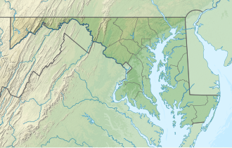
Triadelphia Reservoir is located on the Patuxent River, in Howard County and Montgomery County, Maryland near the town of Brookeville.
The reservoir was created in 1943 by the construction of the Brighton Dam on the Patuxent. [1]
The river valley was once occupied by prehistoric Native American settlements surveyed in the 1980s when the modern dam was drained for maintenance. [2]
The reservoir is located on a land grant surveyed by Benjamin Gaither in 1725. It was named after the town of Triadelphia which was founded in 1809 by three Quaker brothers-in-law. Isaac Briggs, Thomas Moore, and Revolutionary veteran and silversmith Caleb Bentley built a small town on 276 acres of land with nine houses, sawmill, general store, grist mill, and a mill race. The property was expanded to 515 acres containing the land grant "Benjamin's Lot" and "What's Left". [3] The Triadelphia Cotton Factory (Montgomery Manufacturing Company) managed by Allen Bowie Davis operated 196 spindles from its waterwheel and grew to several dozen buildings by 1850 including Mt. Carmel Methodist Church and a schoolhouse. [4] In 1868 a flood washed away a portion of the city and a second flood destroyed most of the remainder. The Triadelphia Turnpike company operated a toll road from Triadelphia to Glenelg to the Baltimore-Frederick Turnpike, now labeled Triadelphia road. [5] By 1905 the town was mostly abandoned. The Ligon family purchased the land, using it for storage and tenants until it went underwater with the construction of the reservoir. [6]
It has a surface area of 800 acres (3.2 km2). [7] The reservoir holds approximately 6,300,000,000 US gallons (19,000 acre⋅ft) of drinking water source and is managed by the Washington Suburban Sanitary Commission (WSSC). [8]
The dam was put into operation in 1944. In 2017, the WSSC began a renovation project in order to rehabilitate the 13 tainter gates and the dam's concrete spillway surface, and the original intake gates and bar screen. The project began in June 2017, and was completed in December 2019. [9]
WSSC provides recreational facilities to the public on portions of the Triadelphia property, including hiking, picnicking, fishing, boating, horseback riding, and hunting. Permits are required for any boating, and only self-powered or battery powered vessels are allowed. This is enforced by law enforcement who actively patrol the area. [10]
Brookeville is a town in Montgomery County, Maryland, located 20 km (12 mi) north of Washington, D.C., and 2 km (1.2 mi) north of Olney. Brookeville was settled by Quakers late in the 18th century and was incorporated as a town in 1808. Historically a farming town, Brookeville is now at the northern edge of the densely developed Washington suburbs. The population was 166 at the 2020 census.
Laurel is a city in Maryland, United States, located midway between Washington, D.C. and Baltimore on the banks of the Patuxent River. While the city limits are entirely in northern Prince George's County, outlying developments extend into Anne Arundel, Montgomery and Howard counties. Founded as a mill town in the early 19th century, Laurel expanded local industry and was later able to become an early commuter town for Washington and Baltimore workers following the arrival of the Baltimore and Ohio Railroad in 1835. Largely residential today, the city maintains a historic district centered on its Main Street, highlighting its industrial past.
The Patuxent River is a tributary of the Chesapeake Bay in the state of Maryland. There are three main river drainages for central Maryland: the Potomac River to the west passing through Washington, D.C., the Patapsco River to the northeast passing through Baltimore, and the Patuxent River between the two. The 908-square-mile (2,352 km2) Patuxent watershed had a rapidly growing population of 590,769 in 2000. It is the largest and longest river entirely within Maryland, and its watershed is the largest completely within the state.
The Patapsco River mainstem is a 39-mile (63 km) river in central Maryland that flows into the Chesapeake Bay. The river's tidal portion forms the harbor for the city of Baltimore. With its South Branch, the Patapsco forms the northern border of Howard County, Maryland. The name "Patapsco" is derived from the Algonquian pota-psk-ut, which translates to "backwater" or "tide covered with froth".
River Hill is the last and westernmost village to be developed in the town of Columbia, Maryland, United States, though some residents maintain addresses in Clarksville. The village is home to 6,520 residents in 2,096 housing units in 2014. The area was used as a game preserve by James Rouse to entertain clients and personal hunting during the buildout of the Columbia project. In 1976, County Executive Edward L. Cochran selected the 784-acre parcel owned by Howard Research and Development for an alternate location for a county landfill; a task force selected Alpha Ridge Landfill instead. Residential construction started in 1990. It is bounded by Maryland Route 108 and Maryland Route 32, and is centered on Trotter Road. The village is divided into two neighborhoods: Pheasant Ridge and Pointers Run, with about 6,500 residents.
The Washington Suburban Sanitary Commission is a bi-county political subdivision of the State of Maryland that provides safe drinking water and wastewater treatment for Montgomery and Prince George's Counties in Maryland except for a few cities in both counties that continue to operate their own water facilities.
Lake Needwood is a 75-acre (300,000 m2) reservoir in Derwood, Maryland, United States. Located east of Rockville, in the eastern part of Montgomery County, it is situated on Rock Creek. The lake was created by damming Rock Creek in 1965 with the goal of providing flood control and reducing soil erosion. Lake Needwood also protects the water quality of the creek by functioning as a retention basin to trap sediment from storm-water runoff.
U.S. Route 29 (US 29) is a north–south United States Numbered Highway that runs for 1,043.3 miles (1,679.0 km) from Pensacola, Florida, to the western suburbs of Baltimore, Maryland. In the U.S. state of Maryland, US 29 is a major highway that emerges from Washington DC and runs north into eastern Montgomery County, stretching over 25.86 miles (41.62 km) through the state and terminating at Maryland Route 99 (MD 99) outside of Ellicott City. It serves the cities of Columbia and Ellicott City and provides the westernmost north–south route between Washington DC and Baltimore.
Scaggsville is an unincorporated community and census-designated place in Howard County, Maryland, United States. It is situated near the southeastern tip of Howard County, between Laurel and Fulton. As of the 2010 census it had a population of 24,333. The town mainly consists of residences, with some commercial establishments. Scaggsville generally falls within ZIP code 20723, assigned to Laurel, though the town formerly had its own post office.
Little Falls Branch, a 3.8-mile-long (6.1 km) tributary stream of the Potomac River, is located in Montgomery County, Maryland. In the 19th century, the stream was also called Powder Mill Branch. It drains portions of Bethesda, Somerset, Friendship Heights, and Washington, D.C., flows under the Chesapeake and Ohio Canal (C&O), and empties into the Potomac at Little Falls rapids, which marks the upper end of the tidal Potomac.
Hawlings River is a 12.9-mile-long (20.8 km) tributary of the Patuxent River in Montgomery County, Maryland. The watershed covers an area of about 28 square miles (73 km2). The waterway was originally called Holland's River. The headwaters of the river originate in the area north of Laytonsville, and the river flows southeast, entering the Patuxent about 1.5 miles (2.4 km) below the Triadelphia Reservoir. Portions of Hawlings River flow through Rachel Carson Conservation Park and Hawlings River Stream Valley Park. Tributaries of the Hawlings River include Mount Zion Tributary, Reddy Branch, Olney Mill Tributary, Gregg Tributary, and James Creek. The river and its tributaries total about 98 miles (158 km) of streams.
Little Seneca Lake is a reservoir located near the Boyds community in Montgomery County, Maryland.
Rocky Gorge Reservoir is located on the Patuxent River in Howard, Montgomery, and Prince George's counties in Maryland, between Laurel and Burtonsville. The reservoir was created in 1952 by the construction of the T. Howard Duckett Dam on the Patuxent. The dam is visible from Interstate 95 near milemarker 34. Because of its close association with a dam by the name, the reservoir is sometimes called the T. Howard Duckett Reservoir. It has a surface area of 773 acres (313 ha). The reservoir is maintained as a drinking water source by the Washington Suburban Sanitary Commission (WSSC).
Lake Elkhorn is a 37-acre (150,000 m2) reservoir located in the Owen Brown area of Columbia, Maryland. It is Columbia's third and largest lake. Its main features are a small dam and a park with a picnic pavilion and a two-mile (3 km) walking path around the lake. The path was built in 1982 and is surrounded by a park and townhouses. The lake, which was built in 1974, is named for the Elkhorn branch of the Little Patuxent River. In 1969, Spiro Agnew proclaimed the arrival of the first Columbia based scientific firm, Hittman Associates that relocated for favorable lease rates from Howard Research and Development. Hittman in turn was contracted by the EPA using Wilde Lake as an example to recommend reuse of storm water runoff from all of Columbia's reservoir systems for residential drinking water to save on development costs. The lake is overseen by the Columbia Association. The lake's location behind many townhouses, though considered an attractive feature to homeowners, has raised concern following the drowning of a small child on September 2, 2005. A drowning also occurred in 1980, and a maintenance worker drowned in March 1991. A movement was started soon after to erect a fence around playground next to the lake, but the community was split over this need, and a consultant concluded a fence was not necessary. The lake remained free of fatal incidents until October 8, 2013, when a body of a 32-year-old was found dead in the lake.
Centennial Lake is a man-made 54-acre (220,000 m2) reservoir, in a 325-acre (1.32 km2) park in Howard County, Maryland, near Columbia, Maryland and Clarksville, known as Centennial Park. It was created by damming the Centennial Branch of the Little Patuxent River. The lake and the park feature a dam, a wildlife area, a walking trail, boating, fishing, and other recreational activities. The park is owned by the Howard County Department of Recreation and Parks.
Lake Kittamaqundi is a man made 27-acre (110,000 m2) reservoir located in Columbia, Maryland in the vicinity of the Mall in Columbia as well as Merriweather Post Pavilion. It is also adjacent to offices and visible from US-29.
Blue Plains Advanced Wastewater Treatment Plant in Washington, D.C., is the largest advanced wastewater treatment plant in the world. The facility is operated by the District of Columbia Water and Sewer Authority. The plant opened in 1937 as a primary treatment facility, and advanced treatment capacity was added in the 1970s and 1980s. The effluent that leaves Blue Plains is discharged to the Potomac River and meets some of the most stringent permit limits in the United States.
Burnt Mills is an census designated place in Montgomery County, Maryland, United States. Per the 2020 Census, the population was 3,592.
The Washington Suburban Sanitary Commission Police Department is a small full service police department located in the U.S. state of Maryland. Its main purpose is to protect water that runs through and around the water treatment plants operated by the Washington Suburban Sanitary Commission (WSSC). They also help the WSSC in traffic control, patrol parks, and assist other local agencies in calls for service as necessary. The WSSC is a bi-county government agency that serves Montgomery County and Prince George's County, both bordering the US federal district of Washington, D.C.. The police have full jurisdiction within those counties as well as the watershed area of Howard County.
{{cite journal}}
: Missing or empty |title=
(help)