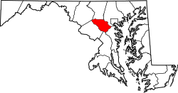
Glenelg, Maryland

Last updated
Glenelg, Maryland
USA Maryland location map.svg
Red pog.svg
Glenelg
Usa edcp location map.svg
Red pog.svg
Glenelg
Coordinates: 39°15′51″N76°59′33″W / 39.26417°N 76.99250°W / 39.26417; -76.99250 Coordinates: 39°15′51″N76°59′33″W / 39.26417°N 76.99250°W / 39.26417; -76.99250
Country United States
State Maryland
County Howard County
Population
  Total1,724
Time zone UTC-5 (Eastern (EST))
  Summer (DST) UTC-4 (EDT)
Zip Code
21737
Area code(s) 410

Glenelg is an unincorporated community in Howard County, Maryland, United States. It is located in the 21737 ZIP Code, and is part of the 410 area code. [1] It is the home town of Glenelg High School.

Contents

History

John Dorsey, who was one of the first settlers in what is now Howard County and a prominent man, gave land to his daughter Sarah Dorsey Howard and her husband Henry Howard out in the western part of the county (which is now Glenelg) in 1735. The property was called Howard's Resolution. Ephraim Howard, son of Sara and Henry, built a house on the property in the middle or late 18th century. Dr. Ephraim Howard (3.XII.1745-6.XII.1788) matriculated at the University of Edinburgh in 1766 [2] and at the University of Leiden in the Netherlands 7 May 1767 [3] . [4] [5] He received his Medical Doctor degree from the University of Leiden on 18 May 1767. [6] The title description of his thesis is: Dissertatio medica inauguralis de variolarum insitione. - Lugduni Batavorum  : apud Theodorum Haak, 1767. [7] [8]

In 1884, an additional section was added on to the front of the house. The newer front section was built by General Joseph Tyson, Assistant Postmaster General under President John Tyler. General and Mrs. Tyson called their home "Glenelg" after an old estate in Scotland and "because it spelled the same from either end" — in other words, a palindrome. Although historically not a true manor house, what is today known as "Glenelg Manor" forms the nucleus of a sprawling structure, which houses the Glenelg Country School lower school division. Glenelg Country School is in neighboring Ellicott City.

Discovery Farm was built land patented as "Second Discovery" in 1729. A house was built starting with a kitchen in 1760 with nearby slave quarters. [9] [10] Folly Quarter road was once one of the "Rolling roads" that slaves would roll hogsheads of tobacco toward Elkridge Landing for sale.

A postal village named Glenelg was put in operation on February 6, 1856. The post office served the community out of Browns General store for 133 years until moved into the Ten Oaks shopping center in 1983. [11] [12] By 1878 population increased to 75, with land values ranging from $10 to $30 an acre. [13] In 1915, a Typhoid fever epidemic struck 20 residents, with four deaths. [14]

The Howard Hunt Club ranged throughout the Glenelg area. Future General George S. Patton would travel from Ft. Myer, Va. to hunt along Homewood Road. [15]

Economy

The economy of Glenelg is primarily driven by commuting professionals working in Baltimore and Washington, DC metro areas, along with a few local restaurants and storefronts.

The median household income in Glenelg is $195,104.00, making it one of the wealthier communities in the United States. [16]

Community statistics

See also

Related Research Articles

Baltimore County, Maryland County in Maryland, United States

Baltimore County is the third-most populous county in the U.S. state of Maryland and is part of the Baltimore metropolitan area. Baltimore County is part of the Northeast megalopolis, which stretches from Northern Virginia northward to Boston. Baltimore County hosts a diversified economy, with particular emphasis on education, government, and health care. As of the 2020 census, the population was 854,535.

Howard County, Maryland County in Maryland, United States

Howard County is located in the U.S. state of Maryland. As of the 2010 census, the population was 287,085. As of the 2020 census its population rose to 328,200. Its county seat is Ellicott City. Howard County is included in the Baltimore-Columbia-Towson, MD Metropolitan Statistical Area, which is also part of the larger Washington-Baltimore-Arlington, DC-MD-VA-WV-PA Combined Statistical Area.

Linthicum, Maryland Census-designated place in Maryland, United States

Linthicum is a census-designated place (CDP) and unincorporated community in Anne Arundel County, Maryland, United States. The population was 10,324 at the 2010 census. It is located directly north of Baltimore–Washington International Thurgood Marshall Airport (BWI).

Mayo, Maryland Census-designated place in Maryland, United States

Mayo is a census-designated place (CDP) in Anne Arundel County, Maryland, United States. The population was 8,298 at the 2010 census. The Mayo CDP of 2010 includes all of the area that used to be counted as the Selby-on-the-Bay CDP. The beach in Mayo used to be a popular weekend resort.

Parkville, Maryland Census-designated place in Maryland, United States

Parkville is an unincorporated community and census-designated place in Baltimore County, Maryland, United States. As of the 2010 census, the population was 30,734.

Pikesville, Maryland Census-designated place in Maryland, United States

Pikesville is a census-designated place (CDP) in Baltimore County, Maryland, United States. Pikesville is just northwest of the Baltimore city limits. It is the northwestern suburb closest to Baltimore.

Woodlawn, Baltimore County, Maryland Place in Maryland, United States

Woodlawn is an unincorporated community and census-designated place in Baltimore County, Maryland. Per the 2020 census, the population was 39,986. It is home to the headquarters of the Social Security Administration (SSA) and the Centers for Medicare and Medicaid Services (CMS). It is bordered by Catonsville on the south, by the Patapsco River and Howard County on the west, by Randallstown and Lochearn to the north, and by the City of Baltimore to the east. Parts of Woodlawn are sometimes informally referred to as Security, Maryland, due to the importance of the SSA's headquarters as well as nearby Security Boulevard and Security Square Mall.

Sykesville, Maryland Town in Maryland, United States

Sykesville is a small town in Carroll County, Maryland, United States. The town lies 20 miles (32 km) west of Baltimore and 40 miles (64 km) north of Washington D.C. The population was 4,436 at the 2010 census. BudgetTravel.com named Sykesville 'Coolest Small Town in America' in June 2016.

Elkridge, Maryland Census-designated place in Maryland, United States of America

Elkridge is an unincorporated community and census-designated place (CDP) in Howard County, Maryland, United States. The population was 15,593 at the 2010 census. Founded early in the 18th century, Elkridge is adjacent to two other counties, Anne Arundel and Baltimore.

Ellicott City, Maryland Census-designated place in Maryland, United States

Ellicott City is an unincorporated community and census-designated place in, and the county seat of, Howard County, Maryland, United States. Part of the Baltimore metropolitan area, its population was 65,834 at the 2010 census, making it the most populous unincorporated county seat in the country.

North Laurel, Maryland Census-designated place in Maryland

North Laurel is a census-designated place (CDP) in Howard County, Maryland, United States. The published population was 4,474 at the 2010 census. This population was substantially less than the CDP's population in 2000, and was the result of an error in defining the boundary prior to tabulation and publication of 2010 Census results. The corrected 2010 Census population is 20,259. North Laurel is adjacent to the City of Laurel, which is located across the Patuxent River in Prince George's County.

Jessup, Maryland Census-designated place in Maryland

Jessup is an unincorporated community and census-designated place in Howard and Anne Arundel counties, about 15 miles (24 km) southwest of Baltimore, Maryland, United States. Per the 2020 census, the population was 10,535.

Washington metropolitan area Metropolitan area in the United States

The Washington metropolitan area, also commonly referred to as the National Capital Region, is the metropolitan area centered on Washington, D.C., the capital of the United States. The area includes all of the District of Columbia and parts of the states of Maryland, Virginia and West Virginia. It is part of the larger Baltimore–Washington metropolitan area.

Maryland Route 32 State highway in Maryland, US

Maryland Route 32 (MD 32) is a state highway in the U.S. state of Maryland. The road runs 51.79 miles (83.35 km) from Interstate 97 (I-97) and MD 3 in Millersville west and north to Washington Road in Westminster. The east–west portion of MD 32 is the Patuxent Freeway, a four- to six-lane freeway between I-97 and MD 108 in Clarksville. The freeway passes through Odenton and Fort Meade, the site of Fort George G. Meade and the National Security Agency (NSA), in western Anne Arundel County and along the southern part of Columbia in Howard County. Via I-97, MD 32 connects those communities with U.S. Route 50 (US 50)/US 301 in Annapolis. The state highway also intersects the four primary highways connecting Baltimore and Washington: the Baltimore–Washington Parkway, US 1, I-95, and US 29. MD 32's north–south section, Sykesville Road, connects Clarksville and Westminster by way of Sykesville and Eldersburg in southern Carroll County.

Glenelg Country School Private school in the United States

Glenelg Country School is a nonsectarian, co-educational independent day school in Howard County, Maryland, adjacent to Columbia, Maryland and between Baltimore and Washington, D.C. The School offers a continuous college-preparatory program from age 2 through grade 12. GCS was founded in 1954, enrolling 35 students in grades one through seven. In the fall of 1985, the new Upper School division opened with 10 students. The first class graduated in June 1989. Today, Glenelg Country School enrolls over 750 students.

West Friendship is a semi-rural unincorporated community in western Howard County, Maryland, United States. West Friendship is located at the junction of Interstate 70 and Maryland Route 32. Frederick Road is a main thoroughfare.

Dayton is an unincorporated community located in Howard County, Maryland, United States.

Fulton, Maryland Census-designated place in Maryland

Fulton is a census-designated place located in southern Howard County, Maryland, United States. As of the 2010 census it had a population of 2,049.

Glenwood, Howard County, Maryland

Glenwood is an unincorporated community in Howard County, Maryland, United States. It is located between Baltimore and Washington, D.C., therefore attracting commuters to those employment centers. The community features acres of open space and is districted to Bushy Park Elementary, Glenwood and Folly Quarter Middle, and Glenelg High schools. Union Chapel was listed on the National Register of Historic Places in 1975 and Round About Hills was added in 2008. The population in 2020 was approximately 3,416.

Edward Gantt was an Episcopal clergyman who served as Chaplain of the Senate of the United States (1801–1804).

References

  1. A Gazetteer of Maryland: 36. 1901.{{cite journal}}: Missing or empty |title= (help)
  2. The University of Edinburgh Historical Alumni.
  3. English-speaking students of medicine at the University of Leyden / R.W. Innes Smith. - Edinburgh/London : Oliver and Boyd, 1932, p. 122.
  4. Album Studiosorum Academiae Lugduno Batavae MDLXXV-MDCCCLXXV, kol. 1091.
  5. Index to English speaking students who have graduated at Leyden university / by Edward Peacock, F.S.A. - London : For the Index society, by Longmans, Green & co. 1883, p. 51, 1091.
  6. Bronnen tot de geschiedenis der Leidsche Universiteit, zesde deel, 10 Febr. 1765-21 Febr. 1795 : Catalogus promotorum ex die 14. Februarii anni 1765 / P.C. Molhuysen. - 's-Gravenhage : Martinus Nijhoff, 1923, p. 77.
  7. Contributions to a census of American Latin Prose, 1634-1800 / Leon M. Kaiser. - In: Humanistica Lovaniesia : Journal of Neo-Latin Studies, Vol. 31, 1982, p. 179.
  8. National Union Catalogue: NH 0553744; NNNAM
  9. Howard County Historical Society. Images of America Howard County. p. 83.
  10. "Decorators' Show House set for Discovery Farm". The Baltimore Sun. 23 August 1993.
  11. "Checklist of Maryland Post Offices" (PDF). Smithsonian National Postal Museum. 12 July 2007. Archived from the original (PDF) on August 15, 2013. Retrieved 17 May 2014.
  12. Henry Gannett (1906). A Gazetteer of Maryland and Delaware, Volume 2. p. 36.
  13. Howard's Roads to the Past. Howard County Sesquicentennial Celebration Committee, 2001. 2001. p. 11.
  14. Louise Vest (4 August 2015). "Steppenwolf causes Merriweather to reconsider rock concerts - History Matters". The Baltimore Sun.
  15. Jams A Clark Jr. Jim Clark Soldier Farmer Legislator. p. 7.
  16. "Glenelg Population & Demographics, Median Income - Point2". www.point2homes.com. Retrieved 2020-10-12.