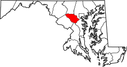
Poplar Springs, Maryland | |
---|---|
Coordinates: 39°20′36″N77°05′47″W / 39.34333°N 77.09639°W | |
Country | United States of America |
State | Maryland |
County | Howard |
Population (1888) | |
• Total | 48 |
Time zone | UTC-5 (Eastern (EST)) |
• Summer (DST) | UTC-4 (EDT) |
Poplar Springs is a town located in western Howard County in the state of Maryland, United States.
The town is named for the "Poplar Spring Branch", where Levin Lawrance settled in 1741 and Captain Philimon Dorsey settled in 1750 on a land patent named "Dorseys Grove". [1]
Old Frederick Road was built through the town, following a Native American foot trail. By 1783, two weekly stagecoaches traveled the road. As of 1835, eight daily coaches traveled through town. In the summer of 1843 and 1844, Samuel Morse used Poplar Springs as a vacation spot while experimenting with the single wire telegraph.
After the Civil War, members of the 1st Maryland Infantry, CSA would hold regular reunions at the hotel in town. [2] By 1888, the town population was 48. [3] [4]
Elkridge is an unincorporated community and census-designated place (CDP) in Howard County, Maryland, United States. The population was 15,593 at the 2010 census. Founded early in the 18th century, Elkridge is adjacent to two other counties, Anne Arundel and Baltimore.
North Laurel is a census-designated place (CDP) in Howard County, Maryland, United States. The published population was 4,474 at the 2010 census. This population was substantially less than the CDP's population in 2000, and was the result of an error in defining the boundary prior to tabulation and publication of 2010 Census results. The corrected 2010 Census population is 20,259. North Laurel is adjacent to the City of Laurel, which is located across the Patuxent River in Prince George's County.
Clarksville is an unincorporated community in Howard County, Maryland; the second highest-earning county in the United States according to the U.S. Census Bureau. The community is named for William Clark, a farmer who owned much of the land on which the community now lies and served as a postal stop that opened on the 4th of July 1851.
Guilford is an unincorporated community located in Howard County in the state of Maryland. The location is named after the Guilford Mill. Guilford is near Kings Contrivance, one of the nine "villages" of Columbia.
Savage is an unincorporated community and census-designated place located in Howard County, Maryland, United States, approximately 18 miles (29 km) south of Baltimore and 21 miles (34 km) north of Washington, D.C. It is situated close to the city of Laurel and to the planned community of Columbia. As of the 2020 census, it had a population of 7,542. The former mill town is a registered historic place, and has several original buildings preserved within and around the Savage Mill Historic District.
Oakland Mills is one of the 10 villages in Columbia, Maryland, United States. It is located immediately east of Town Center, across U.S. Route 29.
Long Reach, one of ten villages composing Columbia, Maryland, United States, is found in the northeast part of Columbia along Maryland Route 108. Started in 1971, it is one of the oldest villages, and comprises four neighborhoods: Jeffers Hill, Kendall Ridge, Locust Park, and Phelps Luck. The village, with an approximate population of 15,600, is governed by five elected village board members through "Long Reach Community Association, Inc." The Village Office is located in Stonehouse, the community center, which opened in 1974.
Lisbon is a census-designated place located in western Howard County in the state of Maryland, United States, located roughly between Baltimore and Frederick and north of Washington, D.C. It is contained in an area of roughly one square mile. Lisbon is located along Interstate 70 and Maryland Route 144 and is home to the first roundabout in Maryland. It first appeared as a CDP in the 2020 Census with a population of 282.
The Howard County Public School System (HCPSS) is the school district that manages and runs the public schools of Howard County, Maryland. It operates under the supervision of an elected, eight-member Board of Education. Jennifer Mallo is the chair of the board. William J. Barnes has been the acting superintendent since January 2024.
Glenelg is an unincorporated community in Howard County, Maryland, United States. It is located in the 21737 ZIP Code, and is part of the 410 area code. It is the home town of Glenelg High School.
Highland is an unincorporated community and census-designated place in Howard County, Maryland, United States. As of the 2020 census it had a population of 1,133. It uses the 20777 zip code.
U.S. Route 1 (US 1) is the easternmost and longest of the major north–south routes of the older 1920s era United States Numbered Highway System, running from Key West, Florida, to Fort Kent, Maine. In the U.S. state of Maryland, it runs 81 miles (130 km) from the Washington, D.C. line to the Pennsylvania state line near the town of Rising Sun.
Marriottsville is an unincorporated community in Howard, Carroll and Baltimore counties, Maryland, United States. Marriottsville is located along Marriottsville Road near the Carroll County line, 10.3 miles (16.6 km) north-northwest of Columbia.
Scaggsville is an unincorporated community and census-designated place in Howard County, Maryland, United States. It is situated near the southeastern tip of Howard County, between Laurel and Fulton. As of the 2010 census it had a population of 24,333. The town mainly consists of residences, with some commercial establishments. Scaggsville generally falls within ZIP code 20723, assigned to Laurel, though the town formerly had its own post office.
Dorsey's Search is a parcel of land patented by John Dorsey of Hockley-in-the-hole (1645–1714) in Baltimore County. The 479-acre (194 ha) property adjacent to the north branch of the Patuxent river was surveyed by Richard Beard in December 1684, and granted to Dorsey in March 1696. The property lying between "Long Reach" and "Elk Ridge" was resurveyed in March 1723 to include 750 acres (300 ha). After several generations of inheritance, a series of legal disputes were held over the land by Rezin Hammond and Richard Ridgley in 1820. In 1827 the property exchanged hands to Robert Oliver, builder of Oakland Mill, who combined it with multiple properties totaling 2,300 acres (930 ha). George Gaither acquired the property in 1838. John Dorsey's grandson, "Patuxent" John Dorsey of "Dorsey's Search" built Dorsey Hall at the site.
Troy, also known as Troy Hill Farm, is a historic slave plantation home located at Elkridge, Howard County, Maryland, United States. It is associated with the prominent Dorsey family of Howard County, who also built Dorsey Hall.
Elkridge Landing was a Patapsco River seaport in Maryland, and is now part of Elkridge, Maryland. The historic Elkridge Furnace Inn site is in Patapsco Valley State Park.
Arlington is a historic slave plantation located in Columbia, Howard County, Maryland, now part of the Fairway Hills Golf Course.
Bushy Park is a historic slave plantation located at Glenwood, Howard County, Maryland, United States. It is located on a 3,940 acre land patent named "Ridgley's Great Park".
Guilford Road is a historic road north of Savage, Maryland that traverses Anne Arundel and Howard Counties in an area that was first settled by English colonists in the mid-1600s. Today's Guilford road is a series of disconnected segments bisected multiple times by the construction of Maryland Route 32.