Clarksville is an unincorporated community in Howard County; the second wealthiest county in the United States according to the U.S. Census Bureau. The community is named for William Clark, a farmer who owned much of the land on which the community now lies and served as a postal stop that opened on the 4th of July 1851.

Long Reach, one of ten villages composing Columbia, Maryland, is found in the northeast part of Columbia along Maryland Route 108. Started in 1971, it is one of the oldest villages, and comprises four neighborhoods: Jeffers Hill, Kendall Ridge, Locust Park, and Phelps Luck. The village, with an approximate population of 17,000, is governed by five elected village board members through "Long Reach Community Association, Inc." The Village Office is located in Stonehouse, the community center, which opened in 1974.

Long Reach High School is a public high school located in Columbia, Maryland. It is part of the Howard County Public School System. In 2013, Newsweek ranked Long Reach as one of the top 2,000 high schools in the country.

Glenelg is an unincorporated community in Howard County, Maryland, United States. It is in the 21737 zip code, and the 410 area code. It is the home town of Glenelg High School and Glenelg Country School. Although quite rural, it is a high-income area.

Dayton is an unincorporated community located in Howard County, Maryland, United States.
Cooksville is an unincorporated community in Howard County, Maryland, United States. In 2016, the population was 631. The town was founded by Thomas Cook in 1802. The crossroads town was anchored by the Joshua Roberts Tavern, where General Lafayette visited in 1824. The inn was destroyed by fire, rebuilt, and demolished a second time. Thomas Cook exchanged his stake in Cooksville with Thomas Beale Dorsey for the 231 acre Round About Hills slave plantation. A Post Office opened on the 4th of July 1851, the same year Howard County was formed from Anne Arundel County. Roberts Inn was listed on the National Register of Historic Places in 1973.
Simpsonville is an unincorporated community in Howard County, Maryland, United States.
Lake Linganore is a community in Frederick County, in the U.S. state of Maryland, located just outside New Market, Maryland.
Parr's Ridge is a ridge which forms the summit of the Piedmont Plateau region in the U.S. state of Maryland.
Elkridge Landing was a Patapsco River seaport in Maryland, and is now part of Elkridge, Maryland. The historic Elkridge Furnace Inn site resides within the Patapsco Valley State Park.
Atholton is an unincorporated community in Howard County, Maryland, United States. A postal office operated from May 26, 1897 to November 1900 and again from 1903 to July 1917.
Florence is an unincorporated community in Howard County, Maryland, United States. A postal stop operated in Florence between June 17, 1868 and March 31, 1906. Governor Edwin Warfield taught in the neighborhood one room schoolhouse.
Gary is an unincorporated community in Howard County, Maryland, United States. A postal stop operated between February 2, 1892 and June 13, 1918. The town is located at the crossroads of Sharp and Tridelphia Road near modern Woodbine, Maryland.

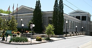
Howard County Library System (HCLS), established in 1940, is a award-winning public library system located in central Maryland. HCLS delivers equal opportunity in education to students of all ages in Howard County, Maryland.
Located Glenwood in Howard County, Maryland, United States, Ellerslie Plantation.
Oakdale is a historic plantation located in Daisy, (Woodbine) Howard County, Maryland, former home of Maryland Governor Edwin Warfield.
Dorseyville is an unincorporated community in Howard County, Maryland, United States. It is considered part of the modern Glenwood area. The village was situating along a fork in the rolling road that would service Annapolis, Maryland or Tridelphia, Maryland. A stone dam, named Dorsey's Mill Dam was situated on the Cattail Creek here before being washed out.
Ivory is an unincorporated community located at the Northwest tip of Howard County, Maryland. It is located between modern Glenelg, Maryland and West Friendship, Maryland.

Athol is a historic slave manor and rectory located in Columbia (Simpsonville), Howard County, Maryland, U.S.