
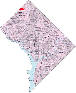
Wheaton is a census-designated place in Montgomery County, Maryland, United States, situated north of Washington, D.C. and northwest of Silver Spring. Wheaton takes its name from Frank Wheaton (1833–1903), a career officer in the United States Army and volunteer from Rhode Island in the Union Army who rose to the rank of major-general while serving before, during and after the Civil War.

Elkridge is an unincorporated community and census-designated place (CDP) in Howard County, Maryland, United States. The population was 15,593 at the 2010 census. Founded early in the 18th century, Elkridge is located at the confluence of three counties, the other two being Anne Arundel and Baltimore counties.

Beltsville is a census-designated place (CDP) in northern Prince George's County, Maryland, United States. The community was named for Truman Belt, a local landowner. The population was 16,772 at the 2010 census. Beltsville includes the unincorporated community of Vansville.

Hyattsville is a city in Prince George's County, Maryland, United States, and also a close, urban suburb of Washington. The population was 17,557 at the 2010 United States Census.

Woodmore is an unincorporated area and census-designated place in Prince George's County, Maryland, United States, located within the boundaries of Route 193 to the west, Church Road to the east, Route 214 to the south and Route 50 to the north. Woodmore Road runs east and west through the center. The population of Woodmore was 3,936 at the 2010 census. It contains a large gated community and country club on the north side of Woodmore Road, and the developments of Woodmore Meadows and Woodmore South on the south side, as well as various other custom built homes and farmland. Off Enterprise Road sits the development of Kingsford. It is contiguous with the year 2010 Mitchellville, Maryland CDP, and historically had a Mitchellville mailing address, for many years served by the South Bowie/Mitchellville Post Office with zip code 20721 and has been considered part of Mitchellville. The Woodmore and Mitchellville community is notable as one of the most affluent predominantly African-American communities in the United States.

Jessup is an unincorporated community and census-designated place in Howard and Anne Arundel counties, Maryland, United States. The population was 7,137 at the 2010 census.

Georgetown is a historic neighborhood and a commercial and entertainment district located in northwest Washington, D.C., situated along the Potomac River. Founded in 1751 in the Province of Maryland, the port of Georgetown predated the establishment of the federal district and the City of Washington by 40 years. Georgetown remained a separate municipality until 1871 when the United States Congress created a new consolidated government for the whole District of Columbia. A separate act passed in 1895 specifically repealed Georgetown's remaining local ordinances and renamed Georgetown's streets to conform with those in the City of Washington.

Guilford is an unincorporated community located in Howard County in the state of Maryland. The location is named after the Guilford Mill. Guilford is near Kings Contrivance, one of the nine "villages" of Columbia.

Maryland Route 175 is a state highway in the U.S. state of Maryland. The highway runs 17.01 miles (27.37 km) from Little Patuxent Parkway in Columbia east to MD 3 in Millersville. MD 175 is a major highway through the large unincorporated community of Columbia; the highway connects U.S. Route 29 next to Columbia Town Center with Interstate 95 (I-95) and an industrial area on the eastern side of Howard County. MD 175 also connects Fort Meade with Jessup and Odenton in western Anne Arundel County, where it links MD 295 and MD 32 with the eastern part of the U.S. Army base.

Fairlawn is a working class and middle class residential neighborhood located in southeast Washington, D.C., United States. It is bounded by Interstate 295, Pennsylvania Avenue SE, Minnesota Avenue SE, Naylor Road SE, and Good Hope Road SE.
Barnaby Woods is a neighborhood in the Northwest quadrant of Washington, D.C., wedged between Rock Creek Park and Montgomery County, Maryland. It is bounded on the north by Aberfoyle Place, on the west by Western Avenue, on the south by Tennyson Street, and on the east by Oregon Avenue. Barnaby Woods is entirely residential, with no commercial zoning whatsoever, and the housing consists primarily of 1930s colonial homes on large parcels of land although on Unicorn Lane NW there are only townhouses.

Spurrier's Tavern was a well-known tavern and horse-changing depot which stood by the main road between Baltimore and Washington, D.C. from 1771 to 1835 near what is now Jessup, Maryland. George Washington visited the tavern several times during his presidency. After an 1835 fire, the building was repaired for residence by the family of its owner, who died there in 1852. It was demolished sometime thereafter.

The Maryland House of Correction, nicknamed "The Cut" or "The House", was a Maryland Department of Corrections state maximum security prison in an unincorporated area in Maryland. The prison opened in 1879 and became infamous for the high levels of violence that took place inside its walls. The state, under Governor Martin O'Malley, closed the prison in March 2007.
The Howard County Police Department (HCPD) is the primary law enforcement agency servicing 304,580 (2013) persons within the 254 square miles (660 km2) of Howard County, Maryland.
Aquasco is an unincorporated area and census-designated place in southeastern Prince George's County, Maryland, United States, surrounding the town of Eagle Harbor and bordering Charles County. As of the 2010 census, the CDP had a population of 981. Aquasco was home to the Aquasco Speedway.

Trinity Church is a historic Episcopal church located at Elkridge, Howard County, Maryland. The post road site was also known as Waterloo, Pierceland, Jessop and Jessup throughout the years.
Calvin B. Ball III is an American Democratic politician who serves as the county executive of Howard County, Maryland. He is the first African-American to hold this office. On Thursday, November 9, 2017, Ball announced his candidacy for County Executive for the 2018 Election. On November 7, 2018 Ball won against incumbent Republican Allan Kittleman. He was sworn in as the new County Executive on December 3, 2018.

Sabina Mattfeldt is a neighborhood in the North District of Baltimore, located beside the Jones Falls, between the neighborhoods of Mount Washington (west) and Poplar Hill (east). Its name comes from the two streets, Sabina Avenue and Mattfeldt Avenue, where most of the neighborhood's homes are located.

Mt. Moriah Lodge No. 7, is a historic building located in Jessup, Maryland. It is a two-story lodge constructed in the late 19th century.


