Dorseyville, Maryland

Last updated
Dorseyville, Maryland
USA Maryland location map.svg
Red pog.svg
Dorseyville
Coordinates: 39°15′40″N77°02′13″W / 39.26111°N 77.03694°W / 39.26111; -77.03694 Coordinates: 39°15′40″N77°02′13″W / 39.26111°N 77.03694°W / 39.26111; -77.03694
Country Flag of the United States.svg  United States of America
State Flag of Maryland.svg  Maryland
County Flag of Howard County, Maryland.svg Howard
Time zone UTC-5 (Eastern (EST))
  Summer (DST) UTC-4 (EDT)

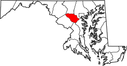
Dorseyville is an unincorporated community in Howard County, Maryland, United States. It is considered part of the modern Glenwood area. The village was situated along a fork in the rolling road that would service Annapolis or Tridelphia, Maryland. A stone dam, named Dorsey's Mill Dam, was situated on the Cattail Creek here before being washed out. [1]

Unincorporated area Region of land not governed by own local government

In law, an unincorporated area is a region of land that is not governed by a local municipal corporation; similarly an unincorporated community is a settlement that is not governed by its own local municipal corporation, but rather is administered as part of larger administrative divisions, such as a township, parish, borough, county, city, canton, state, province or country. Occasionally, municipalities dissolve or disincorporate, which may happen if they become fiscally insolvent, and services become the responsibility of a higher administration. Widespread unincorporated communities and areas are a distinguishing feature of the United States and Canada. In most other countries of the world, there are either no unincorporated areas at all, or these are very rare; typically remote, outlying, sparsely populated or uninhabited areas.

Howard County, Maryland County in Maryland

Howard County is a county in the central part of the U.S. state of Maryland. As of the 2010 census, the population was 287,085. Its county seat is Ellicott City.

Maryland State in the United States

Maryland is a state in the Mid-Atlantic region of the United States, bordering Virginia, West Virginia, and the District of Columbia to its south and west; Pennsylvania to its north; and Delaware to its east. The state's largest city is Baltimore, and its capital is Annapolis. Among its occasional nicknames are Old Line State, the Free State, and the Chesapeake Bay State. It is named after the English queen Henrietta Maria, known in England as Queen Mary, who was the wife of King Charles I.

See also

Related Research Articles

Ellicott City, Maryland Census-designated place in Maryland, United States

Ellicott City is an unincorporated community and census-designated place in, and the county seat of, Howard County, Maryland, United States. Part of the Baltimore metropolitan area, its population was 65,834 at the 2010 census, qualifying it as the largest unincorporated county seat in the country.

Guilford, Maryland Unincorporated community in Maryland, United States

Guilford is an unincorporated community located in Howard County in the state of Maryland. The location is named after the Guilford Mill. Guilford is near Kings Contrivance, one of the nine "villages" of Columbia.

Patapsco River river in Maryland, United States

The Patapsco River mainstem is a 39-mile-long (63 km) river in central Maryland which flows into the Chesapeake Bay. The river's tidal portion forms the harbor for the city of Baltimore. With its South Branch, the Patapsco forms the northern border of Howard County, Maryland. The name "Patapsco" is derived from the Algonquian pota-psk-ut, which translates to "backwater" or "tide covered with froth."

Savage, Maryland Census-designated place in Maryland, United States

Savage is an unincorporated community and census-designated place located in Howard County, Maryland, about 18 miles (29 km) south of Baltimore and 21 miles (34 km) north of Washington, D.C. It is situated close to the city of Laurel and to the planned community of Columbia. As of the 2010 census it had a population of 7,054. The former mill town is a registered historic place, and has many original buildings preserved within and around the Savage Mill Historic District.

Lisbon, Maryland Unincorporated community in Maryland

Lisbon is an unincorporated community located in western Howard County in the state of Maryland, United States, located roughly between Baltimore and Frederick and north of Washington, D.C.. It is contained in an area of roughly one square mile. Lisbon is located along Interstate 70 and Maryland Route 144 and is home to the first roundabout in Maryland.

Woodbine, Maryland Unincorporated community in Maryland

Woodbine is an unincorporated rural community in Howard and Carroll counties, Maryland, United States. It is part of the Baltimore metropolitan area. It is located southeast of Frederick, west of Baltimore, north of Washington, D.C., and east of Mount Airy. The community was named for the woodbine plant, which grew in the community in fields and along riverbanks.

Ilchester, Maryland Census-designated place in Maryland

Ilchester is an unincorporated community and census-designated place in Howard County, Maryland, United States. The population was 23,476 at the 2010 census. It was named after the village of Ilchester in the English county of Somerset.

Triadelphia Reservoir reservoir located on the Patuxent River in Maryland, United States

Triadelphia Reservoir is located on the Patuxent River, in Howard County and Montgomery County, Maryland near the town of Brookeville.

Union Chapel (Glenwood, Maryland) United States historic place

The Union Chapel, now known as St. Andrew's Episcopal Church, is a historic church located near Glenwood, Howard County, Maryland, United States. It is a rectangular two-story building of stuccoed stone construction painted pastel yellow completed in 1833 for $1,459. To the rear of the chapel is the attractively landscaped non-sectarian Oak Grove Cemetery. Charles Dorsey Warfield, a member of the prominent Warfield family that settled this region, deeded the property to the residents of the area for non-denominational church and community use. The building was constructed for $5,040 In 1886, it became part of the Methodist church circuit.

Glenwood, Howard County, Maryland unincorporated community in Howard County, Maryland, United States

Glenwood is an unincorporated community in Howard County, Maryland, United States. It is located between Baltimore and Washington, D.C., therefore attracting commuters to those employment centers. The community features acres of open space and is districted to Bushy Park Elementary, Glenwood and Folly Quarter Middle, and Glenelg High schools. Union Chapel was listed on the National Register of Historic Places in 1975 and Round About Hills was added in 2008.

Simpsonville, Maryland Place in Maryland

Simpsonville is an unincorporated community in Howard County, Maryland, United States.

Round About Hills United States historic place

Round About Hills or Peacefields is a historic slave plantation home located at Glenwood, Howard County, Maryland. An alternate address for this house is 14581 McClintock Drive, Glenwood, Maryland. It was built about 1773 on a 266-acre land patent and consists of a ​1 12-story frame house with a stone end. Thomas Beale Dorsey inherited the property in 1794 then exchanged his interest in the plantation with Thomas Cook's stagecoach wayside town Cooksville.

The Carr's Mill Landfill is a controversial landfill in Howard County, Maryland in the United States. Its official address is 15900 Carrs Mill Road in Lisbon, Maryland.

Gary is an unincorporated community in Howard County, Maryland, United States. A postal stop operated between February 2, 1892 and June 13, 1918. The town is located at the crossroads of Sharp and Tridelphia Road near modern Woodbine, Maryland.

Ellerslie (Glenwood, Maryland)

Located Glenwood in Howard County, Maryland, United States, Ellerslie Plantation.

Longwood (Glenwood, Maryland)

Located Glenwood in Howard County, Maryland, United States, Longwood Plantation.

Roxbury Mill

Roxbury Mill is a historic flour and grist mill located in Glenwood, Howard County, Maryland, now part of the Howard County Farm Museum.

Inwood is an unincorporated community in Howard County, Maryland, United States. The crossroads settlement was settled around Woodlawn, home of Dr. Edwin Warfield, which has been removed for the Gary J. Arthur Community Center and Cooksville Library. The town once featured a general store, blacksmith shop and residential homes. The neighborhood postal service is now consolidated around Cooksville. Inwood is a very small historic town located between Cooksville and Glenwood.

Bushy Park (Glenwood, Maryland)

Bushy Park is a historic slave plantation located at Glenwood, Howard County, Maryland, United States. It is located on a 3,940 acre land patent named "Ridgley's Great Park".

References

  1. Howard's Roads to the Past. Howard County Sesquicentennial Celebration Committee, 2001. 2001. p. 91.