Woodbine, Maryland

Last updated

Woodbine, Maryland
Salt Box Ball Field 07.JPG
3427 Eleanors Garden Way, Woodbine, Maryland (21 May 2022).jpg
Woodbine's Salt Box Ball Field and a typical residential neighborhood in Woodbine
USA Maryland location map.svg
Red pog.svg
Woodbine
Usa edcp location map.svg
Red pog.svg
Woodbine
Coordinates: 39°21′39″N77°3′43″W / 39.36083°N 77.06194°W / 39.36083; -77.06194
Country Flag of the United States.svg United States
State Flag of Maryland.svg  Maryland
Counties Flag of Howard County, Maryland.svg Howard
Flag of Carroll County, Maryland.png Carroll
Named for Woodbine Plant
Population
 (2014) [1]
  Total8,124
Time zone UTC-5 (Eastern)
  Summer (DST) UTC-4 (EDT)
ZIP code
21797
Area code 410, 443, 667

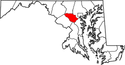
Woodbine is an unincorporated rural community in Howard and Carroll counties, Maryland, United States. It is part of the Baltimore metropolitan area. It is located southeast of Frederick, west of Baltimore, north of Washington, D.C., and east of Mount Airy. The community was named for the woodbine plant, which grew in the community in fields and along riverbanks.

Contents

Background

Woodbine is located at the juncture of the Patapsco River, the B&O Railroad, and the road that runs north from Lisbon to Winfield on Liberty Road (Maryland Route 26) and through to Westminster, Maryland. The original road from Baltimore to Frederick runs just north of Lisbon, following a slight ridge line westward half way to Woodbine (the road was finally paved in the 1960s). This was the original trail that existed before the National Road was built (the road that runs through Lisbon).

History

During the Civil War, Confederate cavalry crossed the Patapsco River at Woodbine and at Hoods Mill, just a few miles east on the river and the B&O Railroad, scouting a U.S. army that was on its way to the Battle of Gettysburg. The main road at that time ran just west of the existing road and up the west side of a creek that runs south and that joins with the Patapsco River just 50 yards west of the existing road. That original road, now partly unused, runs north 100 yards from the river and then Eastward (Gum Road) to join up with the existing road today. There was no bridge across the Patapsco River at that time, just a ford in the river.

The town straddles the Patapsco River to the north (into Carroll County) and south (into Howard County). A new concrete bridge was constructed between 1916 and 1917. [2] In the 1920s and 1930s the town had a large canning factory on the Carroll County side of the river. There was another small canning factory, from the turn of the century, run by water power west of Woodbine at the foot of New Port Hill. Remains of the factory still exist, and the sluice where water (from Gillis Falls Run) came to run the machinery is still visible in the wooded area below New Port Hill leading north to the dam, no longer existing.

Just north, 300 yards up the hill and west of the existing road (SR 94) on John Pickett Road, was a wormseed distillery, where wormseed oil was steam-distilled. This small factory was later converted into the Woodbine Canning Factory, canning tomatoes, corn, and peas. The factory burned in June 1933 and was converted to a paper mill in the 1950s. [3]

Notable people

See also

Related Research Articles

<span class="mw-page-title-main">Elkridge, Maryland</span> Census-designated place in Maryland, United States of America

Elkridge is an unincorporated community and census-designated place (CDP) in Howard County, Maryland, United States. The population was 15,593 at the 2010 census. Founded early in the 18th century, Elkridge is adjacent to two other counties, Anne Arundel and Baltimore.

<span class="mw-page-title-main">Ellicott City, Maryland</span> Census-designated place in Maryland, United States

Ellicott City is an unincorporated community and census-designated place in, and the county seat of, Howard County, Maryland, United States. Part of the Baltimore metropolitan area, its population was 75,947 at the 2020 census, making it the most populous unincorporated county seat in the country.

<span class="mw-page-title-main">Patapsco River</span> River in Maryland, United States

The Patapsco River mainstem is a 39-mile (63 km) river in central Maryland that flows into the Chesapeake Bay. The river's tidal portion forms the harbor for the city of Baltimore. With its South Branch, the Patapsco forms the northern border of Howard County, Maryland. The name "Patapsco" is derived from the Algonquian pota-psk-ut, which translates to "backwater" or "tide covered with froth".

<span class="mw-page-title-main">Lisbon, Maryland</span> Census-designated place in Maryland

Lisbon is a census-designated place located in western Howard County in the state of Maryland, United States, located roughly between Baltimore and Frederick and north of Washington, D.C. It is contained in an area of roughly one square mile. Lisbon is located along Interstate 70 and Maryland Route 144 and is home to the first roundabout in Maryland. It first appeared as a CDP in the 2020 Census with a population of 282.

<span class="mw-page-title-main">Baltimore Light RailLink</span> Light rail system in Baltimore

The Baltimore Light RailLink is a light rail system serving Baltimore, Maryland, United States, and its northern and southern suburbs. It is operated by the Maryland Transit Administration. In downtown Baltimore, it uses city streets. Outside the central portions of the city, the line is built on private rights-of-way, mostly from the defunct Northern Central Railway, Baltimore and Annapolis Railroad and Washington, Baltimore and Annapolis Electric Railway. The system had a ridership of 3,546,300, or about 12,500 per weekday, as of the fourth quarter of 2023.

<span class="mw-page-title-main">Maryland Route 32</span> State highway in Maryland, US

Maryland Route 32 (MD 32) is a state highway in the U.S. state of Maryland. The road runs 51.79 miles (83.35 km) from Interstate 97 (I-97) and MD 3 in Millersville west and north to Washington Road in Westminster. The 30 mile four- to six-lane freeway portion of MD 32 is the Patuxent Freeway between I-97 and I-70 in West Friendship. The freeway passes through Odenton and Fort Meade, the site of Fort George G. Meade and the National Security Agency (NSA), in western Anne Arundel County and along the southern part of Columbia in Howard County. Via I-97, MD 32 connects those communities with U.S. Route 50 (US 50)/US 301 in Annapolis. MD 32 also intersects the four primary highways connecting Baltimore and Washington: the Baltimore–Washington Parkway, US 1, I-95, and US 29. MD 32's north–south section, Sykesville Road, connects West Friendship and Westminster by way of Sykesville and Eldersburg in southern Carroll County.

<span class="mw-page-title-main">Maryland Route 144</span> State highway in Maryland, US

Maryland Route 144 is a collection of state highways in the U.S. state of Maryland. These highways are sections of old alignment of U.S. Route 40 between Cumberland and Baltimore. Along with US 40 Scenic, US 40 Alternate, and a few sections of county-maintained highway, MD 144 is assigned to what was once the main highway between the two cities, connecting those endpoints with Hancock, Hagerstown, Frederick, New Market, Mount Airy, Ellicott City, and Catonsville. MD 144 has seven disjoint sections of mainline highway that pass through the Appalachian Mountains in Allegany and Washington counties and the rolling Piedmont of Frederick, Carroll, Howard, and Baltimore counties.

<span class="mw-page-title-main">Westport, Baltimore</span> Neighborhood of Baltimore in Maryland, United States

Westport is a neighborhood in south Baltimore, Maryland. Westport is a majority African-American neighborhood that has struggled with crime, housing abandonment, and unemployment in the past decade. The neighborhood is bordered by the Middle Branch of the Patapsco River on the east, the city neighborhoods of Cherry Hill, Brooklyn and the southwestern Baltimore County community of Lansdowne to the southwest, Hollins Ferry Road and the Mount Winans and Lakeland neighborhoods to the west, and Interstate 95 to the north, along with the South Baltimore communities of Federal Hill and Otterbein. The Baltimore–Washington Parkway runs through the middle of Westport and intersects with Interstate 95, the main East Coast super-highway, north to south, Maine to Florida.

<span class="mw-page-title-main">Maryland Route 26</span> State highway in Maryland, US

Maryland Route 26 is a state highway in the U.S. state of Maryland. Known for most of its length as Liberty Road, the state highway runs 44.10 miles (70.97 km) from U.S. Route 15 in Frederick east to MD 140 in Baltimore. MD 26 connects Frederick and Baltimore with the highway's namesake of Libertytown in eastern Frederick County, the suburban area of Eldersburg in southern Carroll County, and the western Baltimore County suburbs of Randallstown, Milford Mill, and Lochearn. The highway also serves as a major thoroughfare in the western part of Baltimore, where the street is named Liberty Heights Avenue. MD 26 is maintained by the Maryland State Highway Administration outside of Baltimore and by the Baltimore City Department of Transportation within the city.

<span class="mw-page-title-main">Maryland Route 851</span> State highway in Maryland, United States

Maryland Route 851 is a state highway in the U.S. state of Maryland. The state highway runs 1.46 miles (2.35 km) as a north–south highway between junctions with MD 32 in Sykesville. MD 851 is the old alignment of MD 32 through Sykesville, which was paved by 1910. The state highway was designated when the MD 32 bypass of Sykesville opened in 1963. MD 851 was relocated at its northern end in 2006.

<span class="mw-page-title-main">Maryland Route 27</span> State highway in Maryland, United States

Maryland Route 27 is a state highway in the U.S. state of Maryland. Known for most of its length as Ridge Road, the highway runs 39.17 miles (63.04 km) from MD 355 in Germantown north to MD 30 in Manchester. MD 27 follows a ridge that separates several watersheds in northern Montgomery County and Carroll County. The highway connects Germantown and Manchester with Damascus in far northern Montgomery County; Westminster, the county seat of Carroll County; and Mount Airy, which lies at the junction of Carroll, Frederick, Howard, and Montgomery counties and where MD 27 intersects Interstate 70 (I-70)/U.S. Route 40.

<span class="mw-page-title-main">U.S. Route 40 in Maryland</span> Section of U.S. Highway in Maryland, United States

U.S. Route 40 in the U.S. state of Maryland runs from Garrett County in Western Maryland to Cecil County in the state's northeastern corner. With a total length of 221 miles (356 km), it is the longest numbered highway in Maryland. Almost half of the road overlaps or parallels with Interstate 68 (I-68) or I-70, while the old alignment is generally known as US 40 Alternate, US 40 Scenic, or Maryland Route 144. West of Baltimore, in the Piedmont and Appalachian Mountains / Blue Ridge region of the Western Maryland panhandle of the small state, the portions where it does not overlap an Interstate highway are mostly two-lane roads. The portion northeast of Baltimore going toward Wilmington in northern Delaware and Philadelphia in southeastern Pennsylvania is a four-lane divided highway, known as the Pulaski Highway. This section crosses the Susquehanna River at the north end of the Chesapeake Bay on the Thomas J. Hatem Memorial Bridge.

<span class="mw-page-title-main">Ilchester, Maryland</span> Census-designated place in Maryland

Ilchester is an unincorporated community and census-designated place in Howard County, Maryland, United States. The population was 23,476 at the 2010 census. It was named after the village of Ilchester in the English county of Somerset.

Old Court Road is a state- and county-maintained highway in the U.S. state of Maryland. Including the adjacent road in Howard County known as Woodstock Road, the highway runs 15.4 miles (24.8 km) from Maryland Route 99 near Woodstock east to Joppa Road near Towson. Old Court Road includes two county-maintained sections and two Maryland state highways, Maryland Route 125 and Maryland Route 133. MD 125 has a length of 3.59 miles (5.78 km) between Woodstock and the edge of Randallstown and MD 133 spans 3.31 miles (5.33 km) between MD 129 and MD 25 in Pikesville. Old Court Road connects the western and central Baltimore County communities of Granite, Randallstown, Milford Mill, Pikesville, and Towson. Old Court Road has been a cross-county highway since the colonial era. The highway was fully paved in Baltimore County by the mid-1920s, including the sections of the highway that became MD 125 and MD 133. MD 133 was extended west to MD 140 and MD 125 was extended west to MD 99 in the early 1930s; MD 125's terminus returned to the Patapsco River in the mid-1950s. Old Court Road was relocated at its eastern end in the early 1960s and in Pikesville in the late 1960s, at which time MD 133 assumed its current course.

<span class="mw-page-title-main">Maryland Route 94</span> State highway in Howard County, Maryland, US, known as Woodbine Rd

Maryland Route 94 is a state highway in the U.S. state of Maryland. Known as Woodbine Road, the state highway runs 6.25 miles (10.06 km) from the Montgomery–Howard county line at the Patuxent River north to Old Frederick Road near Lisbon. MD 94 originally extended into southern Carroll County in addition to connecting the western Howard County communities of Lisbon and Florence. The state highway was constructed from Lisbon to Woodbine in the late 1910s. MD 94 was constructed from Lisbon south through Florence and from Woodbine north to the village of Daniel south of MD 26 in the late 1920s and early 1930s. The state highway was extended south and removed from the state highway system north of Lisbon in 1956. MD 94 was relocated when its interchange with Interstate 70 (I-70)/U.S. Route 40 was built in the mid-1970s. The state highway has two roundabouts, one of which was the first modern roundabout in Maryland.

<span class="mw-page-title-main">Baltimore Terminal Subdivision</span> Railroad line owned by CSX in Maryland

The Baltimore Terminal Subdivision is a railroad line owned and operated by CSX Transportation in the U.S. state of Maryland. The line runs from Baltimore to Halethorpe along the original Baltimore and Ohio Railroad (B&O) line, one of the oldest rail lines in the United States and the first passenger railroad line. At its east (north) end, it connects with the Philadelphia Subdivision; its west (south) end has a junction with the Capital Subdivision and the Old Main Line Subdivision.

<span class="mw-page-title-main">Elkridge Landing</span> Historic seaport, now part of Elkridge, MD, US

Elkridge Landing was a Patapsco River seaport in Maryland, and is now part of Elkridge, Maryland. The historic Elkridge Furnace Inn site resides within the Patapsco Valley State Park.

Hood's Mill is an unincorporated community located in Howard County and Carroll County in the state of Maryland in the United States of America.

<span class="mw-page-title-main">Patapsco Valley</span> Valley surrounding the Patapsco River in the U.S. state of Maryland

The Patapsco Valley is a small valley surrounding the Patapsco River in central Maryland. The region is known for its historical significance as a major economic and industrial center in the eighteenth and nineteenth centuries.

References

  1. "Zip Code Overview". Sperling's BestPlaces. Retrieved 2010-09-19.
  2. Maryland State Roads Commission. Report of the State Roads Commission of Maryland for the Years 1920. p. 27.
  3. Howard County Historical Society. Images of America Howard County. p. 75.
  4. Seeking Freedom The History of the Underground Railroad in Howard County. p. 82.