Brooklyn Park, Maryland | |
---|---|
Coordinates: 39°13′29″N76°36′46″W / 39.22472°N 76.61278°W | |
Country | United States |
State | Maryland |
County | Anne Arundel |
Area | |
• Total | 4.27 sq mi (11.06 km2) |
• Land | 4.21 sq mi (10.91 km2) |
• Water | 0.06 sq mi (0.15 km2) |
Elevation | 112 ft (34 m) |
Population (2020) | |
• Total | 16,112 |
• Density | 3,826.17/sq mi (1,477.44/km2) |
Time zone | UTC−5 (Eastern (EST)) |
• Summer (DST) | UTC−4 (EDT) |
FIPS code | 24-10475 |
GNIS feature ID | 0589827 |
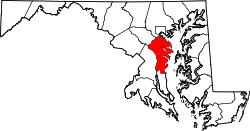
Brooklyn Park is a census-designated place (CDP) in Anne Arundel County, Maryland, United States. The population was 14,373 at the 2010 census [2] , and 16,112 at the 2020 census [3] .
Brooklyn Park is located at 39°13′29″N76°36′46″W / 39.22472°N 76.61278°W (39.224857, −76.612655) [4] on the northern edge of Anne Arundel County and borders the city of Baltimore along its southern boundary of 1919. The CDP is bordered as well by Interstate 695 (the Baltimore Beltway) to the south, by Maryland Route 648 (Baltimore Annapolis Boulevard) to the west, and by the Patapsco River, which forms the Anne Arundel County/Baltimore County boundary, to the northwest.
According to the United States Census Bureau, the CDP has a total area of 4.3 square miles (11.1 km2), of which 4.2 square miles (10.9 km2) is land and 0.077 square miles (0.2 km2), or 1.65%, is water, [2] consisting largely of the Patapsco River and associated wetlands.
To the north of the CDP, are the older Baltimore city neighborhoods of Brooklyn (founded 1853), Curtis Bay (development proposed in 1874, buildings began in 1889), and several smaller communities that are now defunct: Fairfield, Masonville, Wagner's Point (also known as East Brooklyn), Arundel Cove, and Hawkins Point. To the northeast is the Baltimore County community of Baltimore Highlands, to the west is Linthicum, and to the south are Ferndale and Glen Burnie.
The Brooklyn Park CDP in Anne Arundel County is composed of several smaller neighborhoods: old Brooklyn Park (west of Gov. Ritchie Highway - Maryland Route 2), Brooklyn Heights (east of Gov. Ritchie Highway), Arundel Village (along and north of Church Street), Roland Terrace (along and south of Church Street), Arundel Gardens (southwest of Gov. Ritchie Highway and south of Hammonds Lane), and Pumphrey, which lies along Belle Grove Road, south of the Patapsco River.
A History of Brooklyn-Curtis Bay, of approximately 200 pages, was published in September 1976, in celebration of the American Bicentennial by the members of the Brooklyn-Curtis Bay Historical Committee. [5] Brooklyn Park has many different types of buildings such as schools and senior centers.
Census | Pop. | Note | %± |
---|---|---|---|
1970 | 13,896 | — | |
1980 | 11,508 | −17.2% | |
1990 | 10,987 | −4.5% | |
2000 | 10,938 | −0.4% | |
2010 | 14,373 | 31.4% | |
2020 | 16,112 | 12.1% | |
source: [6] [7] |
Race / Ethnicity (NH = Non-Hispanic) | Pop 2000 [8] | Pop 2010 [9] | Pop 2020 [3] | % 2000 | % 2010 | % 2020 |
---|---|---|---|---|---|---|
White alone (NH) | 9,969 | 10,282 | 8,799 | 91.14% | 71.54% | 54.61% |
Black or African American alone (NH) | 458 | 2,362 | 3,332 | 4.19% | 16.43% | 20.68% |
Native American or Alaska Native alone (NH) | 51 | 50 | 62 | 0.47% | 0.35% | 0.38% |
Asian alone (NH) | 164 | 400 | 591 | 1.50% | 2.78% | 3.67% |
Pacific Islander alone (NH) | 4 | 5 | 10 | 0.04% | 0.03% | 0.06% |
Other race alone (NH) | 19 | 18 | 72 | 0.17% | 0.13% | 0.45% |
Mixed race or Multiracial (NH) | 99 | 398 | 953 | 0.91% | 2.77% | 5.91% |
Hispanic or Latino (any race) | 174 | 858 | 2,293 | 1.59% | 5.97% | 14.23% |
Total | 10,938 | 14,373 | 16,112 | 100.00% | 100.00% | 100.00% |
As of the census [10] of 2000, there were 10,938 people, 4,093 households, and 2,910 families residing in the CDP. The population density was 3,701.0 inhabitants per square mile (1,429.0/km2). There were 4,311 housing units at an average density of 1,458.7 per square mile (563.2/km2). The racial makeup of the CDP was 92.15% White, 4.21% African American, 0.48% Native American, 1.50% Asian, 0.04% Pacific Islander, 0.58% from other races, and 1.05% from two or more races. Hispanic or Latino of any race were 1.59% of the population.
There were 4,093 households, out of which 30.6% had children under the age of 18 living with them, 50.2% were married couples living together, 15.1% had a female householder with no husband present, and 28.9% were non-families. 22.8% of all households were made up of individuals, and 11.2% had someone living alone who was 65 years of age or older. The average household size was 2.67 and the average family size was 3.10.
In the CDP, the population was spread out, with 24.9% under the age of 18, 8.0% from 18 to 24, 28.9% from 25 to 44, 22.2% from 45 to 64, and 16.0% who were 65 years of age or older. The median age was 38 years. For every 100 females, there were 94.8 males. For every 100 females age 18 and over, there were 90.5 males.
The median income for a household in the CDP was $42,207, and the median income for a family was $50,496. Males had a median income of $33,476 versus $26,316 for females. The per capita income for the CDP was $18,582. About 6.6% of families and 8.0% of the population were below the poverty line, including 13.5% of those under age 18 and 6.3% of those age 65 or over.
By the 2010 census, [11] the local population had grown and changed substantially. In 2010 Brooklyn Park had 14,373 people, 5,158 households and 3,634 families. The racial makeup of the CDP was 76.8% White, 18.6% African American, 6% Latino, and 3.4% Asian (NB: some Latinos had responded as both Latino and white).
Anne Arundel County, also notated as AA or A.A. County, is a county located in the U.S. state of Maryland. As of the 2020 United States census, its population was 588,261, an increase of just under 10% since 2010. Its county seat is Annapolis, which is also the capital of the state. The county is named for Anne Arundell, Lady Baltimore, a member of the ancient family of Arundells in Cornwall, England, and the wife of Cecilius Calvert, 2nd Baron Baltimore (1605–1675), founder and first lord proprietor of the colony Province of Maryland. The county is part of the Central Maryland region of the state.
Arnold, a census-designated place (CDP) in Anne Arundel County, Maryland, United States, located just outside of the state's capital, Annapolis. It is located 18.78 miles south of Baltimore, and 29.97 miles east of Washington, D.C. The population was 23,106 at the 2010 census. Neighborhoods straddle College Parkway and Maryland Route 2. Arnold is located on the scenic Broadneck Peninsula. The ZIP code is 21012. It is bordered by Severna Park to the northwest, Cape Saint Claire to the southeast, Annapolis to the southwest, and Lake Shore to the northeast.
Ferndale is a census-designated place (CDP) in Anne Arundel County, Maryland, United States. At the 2010 census, the population was 16,746.
Lake Shore is a census-designated place and unincorporated community in Anne Arundel County, Maryland, United States, located east of Pasadena. The population of Lake Shore was 19,477 at the 2010 census.
Linthicum is a census-designated place (CDP) and unincorporated community in Anne Arundel County, Maryland, United States. The population was 10,324 at the 2010 census. It is located directly north of Baltimore–Washington International Thurgood Marshall Airport (BWI).
Mayo is a census-designated place (CDP) in Anne Arundel County, Maryland, United States. The population was 8,298 in the 2010 census. The Mayo CDP of 2010 includes all of the area that used to be counted as the Selby-on-the-Bay CDP. The beach in Mayo used to be a popular weekend resort.
Pasadena is a census-designated place (CDP) in Anne Arundel County, Maryland, United States. The population was 24,287 at the 2010 census.
Pumphrey is an unincorporated community and former census-designated place (CDP) in Anne Arundel County, Maryland, United States. At the 2000 census, the population was 5,317. It was split between the Linthicum and Brooklyn Park CDPs for the 2010 census.
Riviera Beach is a census-designated place in Anne Arundel County, Maryland, United States. The population was 12,677 at the 2010 U.S. census.
Selby-on-the-Bay is a census-designated place (CDP) in Anne Arundel County, Maryland, United States, for the 2000 census, at which time its population was 3,674. It was added to the Mayo CDP for the 2010 census.
Shady Side is a census-designated place (CDP) in Anne Arundel County, Maryland, United States. The population was 5,803 at the 2010 census.
Arbutus is an unincorporated community and a census-designated place in Baltimore County, Maryland, United States. The population was 20,483 at the 2010 census. The census area also contains the communities of Halethorpe and Relay, in which all three names were used during the 1960 census when the area had a population of 22,402.
Lochearn is an unincorporated community and census-designated place in Baltimore County, Maryland, United States, located immediately to the west of the City of Baltimore. Per the 2020 census, the population was 25,511.
Milford Mill is an unincorporated community and census-designated place in Baltimore County, Maryland, United States. Per the 2020 census, the population was 30,622.
Randallstown is an unincorporated community and census-designated place in Baltimore County, Maryland, United States. It is named after Christopher and Thomas Randall, two 18th-century tavern-keepers. At that time, Randallstown was a tollgate crossroads on the Liberty Turnpike, a major east–west thoroughfare. It is a suburb of Baltimore, with a population of 33,655 as of the 2020 census. As of 2020 it was 72 percent African American. In the 1990s, Randallstown transitioned to a majority African American community.
Woodlawn is an unincorporated community and census-designated place in Baltimore County, Maryland. Per the 2020 census, the population was 39,986. It is home to the headquarters of the Social Security Administration (SSA) and the Centers for Medicare and Medicaid Services (CMS). It is bordered by Catonsville on the south, by the Patapsco River and Howard County on the west, by Randallstown and Lochearn to the north, and by the City of Baltimore to the east. Parts of Woodlawn are sometimes informally referred to as Security, Maryland, due to the importance of the SSA's headquarters as well as nearby Security Boulevard and Security Square Mall.
Eldersburg is an unincorporated community and census-designated place (CDP) in Carroll County, Maryland, United States. The population was 30,531 at the 2010 census.
Jessup is an unincorporated community and census-designated place in Howard and Anne Arundel counties, about 15 miles (24 km) southwest of Baltimore, Maryland, United States. Per the 2020 census, the population was 10,535.
Lansdowne is a census-designated place in southern Baltimore County, Maryland, United States, located just south of Baltimore. As of the 2010 census, it had a population of 8,409. At the 2000 census and earlier, the area was delineated as part of the Lansdowne-Baltimore Highlands CDP.
Baltimore Highlands is a census-designated place (CDP) in Baltimore County, Maryland, United States, directly south of the city of Baltimore. The population was 7,019 at the 2010 census. At the 2000 census and earlier, the area was delineated as part of the Lansdowne-Baltimore Highlands CDP.