Millersville, Maryland

Last updated
Millersville, Maryland
2007 11 24 - 229 - Millersville - Old Mill Blvd (3109099425).jpg
Old Mill Blvd. and subdivisions seen from the air, 2007
USA Maryland location map.svg
Red pog.svg
Millersville
Location within the state of Maryland
Usa edcp location map.svg
Red pog.svg
Millersville
Millersville (the United States)
Coordinates: 39°03′34″N076°38′53″W / 39.05944°N 76.64806°W / 39.05944; -76.64806 Coordinates: 39°03′34″N076°38′53″W / 39.05944°N 76.64806°W / 39.05944; -76.64806
Country Flag of the United States.svg United States
State Flag of Maryland.svg  Maryland
County Flag of Anne Arundel County, Maryland.png Anne Arundel
Elevation
100 ft (30 m)
Population
 (2015)
  Total20,965
Time zone UTC-5 (Eastern (EST))
  Summer (DST) UTC-4 (EDT)
ZIP code
21108 [1]
Area code(s) 410, 443 and 667
GNIS feature ID590805

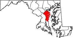
Millersville is an unincorporated community in Anne Arundel County, Maryland, United States. Population was 20,965 in 2015 based on American Community Survey (U.S. Census Bureau) data.

Contents

Geography

Millersville is located at 39°03′34″N076°38′53″W / 39.05944°N 76.64806°W / 39.05944; -76.64806 (39.0596, -76.6480). [2]

History

Millersville, named for the first Postmaster, George Miller, was the first Post Office to be established, on July 24, 1841, along the Annapolis & Elkridge Railroad (the A & E). [3] Completed in 1840, the A & E was one of the earliest rail lines in the U.S., connecting Annapolis with the Washington Branch of the Baltimore and Ohio Railroad. Today, Millersville is largely suburban, but the core of the historic village remains. The Childs Residence, listed on the National Register of Historic Places in 1986, is a focal point of the new bike trail that passes through the historic core. [4]

Education

Secondary schools

Colleges and universities

288-acre park

Parks and recreation

Related Research Articles

<span class="mw-page-title-main">Anne Arundel County, Maryland</span> County in Maryland, United States

Anne Arundel County, also notated as AA or A.A. County, is located in the U.S. state of Maryland. As of the 2020 United States census, its population was 588,261, an increase of just under 10% since 2010. Its county seat is Annapolis, which is also the capital of the state. The county is named for Lady Anne Arundell, a member of the ancient family of Arundells in Cornwall, England, and the wife of Cecilius Calvert, 2nd Baron Baltimore (1605–1675), founder and first lord proprietor of the colony Province of Maryland.

<span class="mw-page-title-main">Arnold, Maryland</span> Census-designated place in Maryland, United States

Arnold, a census-designated place (CDP) in Anne Arundel County, Maryland, United States, located just outside of the state's capital, Annapolis. It is located 18.78 miles south of Baltimore, and 29.97 miles east of Washington, D.C. The population was 23,106 at the 2010 census. Neighborhoods straddle College Parkway and Maryland Route 2. Arnold is located on the scenic Broadneck Peninsula. The ZIP code is 21012. It is bordered by Severna Park to the northwest, Cape Saint Claire to the southeast, Annapolis to the southwest, and Lake Shore to the northeast.

<span class="mw-page-title-main">Crownsville, Maryland</span> Census-designated place in Maryland, United States

Crownsville is a census-designated place (CDP) in Anne Arundel County, Maryland, United States. The population was 1,757 at the 2010 census. It hosts the Anne Arundel County Fair each September, as well as the annual Maryland Renaissance Festival for several summer weekends. A state psychiatric hospital was formerly in Crownsville. The area offers waterfront scenery and easy access to urban metropolitan areas and culture.

<span class="mw-page-title-main">Glen Burnie, Maryland</span> Census-designated place in Maryland, United States

Glen Burnie is an unincorporated town and census-designated place (CDP) in Anne Arundel County, Maryland, United States. It is a suburb of Baltimore. The population of Glen Burnie was 67,639 at the 2010 census.

<span class="mw-page-title-main">Linthicum, Maryland</span> Census-designated place in Maryland, United States

Linthicum is a census-designated place (CDP) and unincorporated community in Anne Arundel County, Maryland, United States. The population was 10,324 at the 2010 census. It is located directly north of Baltimore–Washington International Thurgood Marshall Airport (BWI).

<span class="mw-page-title-main">Odenton, Maryland</span> Census-designated place in Maryland, U.S.

Odenton is a census-designated place (CDP) in Anne Arundel County, Maryland, United States, located approximately 10–20 minutes from the state capital, Annapolis. The population was 37,132 at the 2010 census, up from 20,534 at the 2000 census. The town's population growth rate of 80.8% between 2000 and 2010 was the greatest of any town in western Anne Arundel County. Odenton is located west of Annapolis, south of Baltimore, and northeast of Washington.

<span class="mw-page-title-main">Severna Park, Maryland</span> Census-designated place in Maryland, United States

Severna Park is a census-designated place (CDP) in Anne Arundel County, Maryland, United States. Severna Park is part of the Baltimore-Washington Metropolitan Area, and is located approximately 8 miles (13 km) north of Annapolis, 17 miles (27 km) south of Baltimore and 39 miles (63 km) east of Washington. Severna Park's population was 37,634 at the 2010 census.

<span class="mw-page-title-main">Maryland Route 648</span> Highway in Maryland

Maryland Route 648 is a collection of state highways in the U.S. state of Maryland. These nine highways are current or former sections of the Baltimore–Annapolis Boulevard between Annapolis and Baltimore via Glen Burnie. There are five signed mainline segments of MD 648 through Arnold, Severna Park, Pasadena, Glen Burnie, Ferndale, and Pumphrey in northern Anne Arundel County; Baltimore Highlands in southern Baltimore County; and the independent city of Baltimore. MD 648 mainly serves local traffic along its meandering route, with long-distance traffic intended to use the parallel and straighter MD 2 south of Glen Burnie and freeway-grade Interstate 97 (I-97), I-695, and MD 295 between Glen Burnie and Baltimore.

<span class="mw-page-title-main">Hanover, Maryland</span> Unincorporated community in Maryland, United States

Hanover is an unincorporated community in the Baltimore/Annapolis area in northwestern Anne Arundel County and eastern Howard County in the U.S. state of Maryland, located south of Baltimore.

Old Mill High School is an American public high school in Millersville, Maryland, United States serving students in grades 9 through 12. It was occupied in 1975 and is administered by Anne Arundel County Public Schools (AACPS). The school was built to alleviate over-crowding at Arundel and Severna Park High Schools. The school has no walls and no ceilings in some classrooms, only partitions to separate their classrooms. Along with Annapolis High School and Meade Senior High School, Old Mill Senior High is one of the three IB World Schools in Anne Arundel County. The school building also houses the high school's two feeder schools, Old Mill Middle School North and Old Mill Middle School South. The school mascot is the patriot.

The Baltimore & Annapolis Trail is a 13.3-mile (21.4 km) rail trail in Anne Arundel County, Maryland. The trail starts at Boulter's Way in Arnold and ends near Baltimore Light Rail's Cromwell Station in Glen Burnie. Starting near Annapolis at Jonas Green Park, the trail passes (northward) through Arnold, Severna Park, Millersville, Pasadena, and Glen Burnie. The Baltimore & Annapolis Trail follows the route of the Baltimore & Annapolis Railroad from which it derives its name. Proposed in 1972 by Jim Hague, it opened on Oct 7, 1990 as the second rail trail in Maryland.

<span class="mw-page-title-main">Severna Park High School</span> Public school in Severna Park, Maryland, United States

Severna Park High School is a public high school in the United States located in the suburban CDP of Severna Park, Maryland. It is a part of the Anne Arundel County Public Schools system. SPHS opened its doors to students in 1959 and was the seventh public high school opened in Anne Arundel County.. Its principal is Patrick Bathras. A new school was built on the same grounds, and opened in January 2017. The Falcons are sports rivals with nearby Broadneck High School.

<span class="mw-page-title-main">Anne Arundel County Public Schools</span>

Anne Arundel County Public Schools is the public school district serving Anne Arundel County, Maryland. With over 80,000 students, the AACPS school system is the 5th largest in Maryland and the 46th largest in the United States. The district has over 5,000 teachers supporting a comprehensive curriculum from Pre-K through 12th grade.

<span class="mw-page-title-main">Baltimore and Annapolis Railroad</span> Defunct railway line in Maryland, US

The Baltimore & Annapolis Railroad was an American railroad of central Maryland built in the 19th century. The railroad, the second to serve Annapolis, ran between Annapolis and Clifford along the north shore of the Severn River. From Clifford, just north of the present day Patapsco Light Rail Stop, it connected with the B&O's Curtis Bay branch so that trains could travel to Baltimore. In 1921, when it was called the Annapolis and Baltimore Short Line, it was purchased by the larger Washington, Baltimore and Annapolis Electric Railway (WB&A), and then emerged from the WB&A's 1935 bankruptcy and closure as the Baltimore & Annapolis Railroad. B&A electric passenger operation between the two cities continued until 1950, at which time the rail line became solely a freight carrier, operating buses for passenger service. Freight service to Annapolis continued until June 1968 when the Severn River Trestle was declared unsafe. In the 1980s, the line was completely shut down. The right-of-way now serves as part of Baltimore's light rail system and as the Baltimore & Annapolis Trail.

<span class="mw-page-title-main">Childs Residence</span> Historic house in Maryland, United States

Childs Residence, also known as the George Miller Residence and Millersville Store and Post Office, is a historic home and associated buildings at Millersville, Anne Arundel County, Maryland. The home is a c. 1840 1+12-story frame dwelling with a large 2-story frame addition built about 1852. Also on the property are a frame smokehouse/dairy built about 1840, and a c. 1920 frame store. It served as the dwelling of the first Postmaster in Millersville, and is noteworthy for having continuously served as the Post Office and community store for 130 years. It is now home to the Anne Arundel County Trails program.

The Broadneck Peninsula is an area in Anne Arundel County, Maryland. The area is north of the Severn River, south of the Magothy River and west of the Chesapeake Bay. At the lower end of the Broadneck Peninsula is the 4.3 mile Chesapeake Bay Bridge.

St. Margaret's is a suburb of Annapolis in Anne Arundel County, Maryland, United States on the scenic Broadneck Peninsula. The ZIP code is 21409.

The Linstead House is a historic home in the Linstead community of Severna Park, Maryland. The three-story brick house overlooks the Severn River and is believed to have been constructed by the McCubbin or Linstead families between 1772 and 1780.

<span class="mw-page-title-main">South Shore Trail</span>

The South Shore Trail is a 11.2-mile (18.0 km) long, planned shared-use rail trail that will run from Annapolis to Odenton in Maryland, United States. Two segments, totaling 2.96-mile (4.76 km) have been built. The Trail primarily utilizes the abandoned road bed of the Annapolis and Elk Ridge Railroad. The trail will connect with the Colonial Annapolis Maritime Trail on the east and the Washington, Baltimore and Annapolis Trail, via the Odenton Bike Path, on the west. When complete, it will be a component of the American Discovery Trail, the East Coast Greenway and the September 11th National Memorial Trail. The trail name is a reference to the railroad it replaces which during its last 10 years in operation was known as the South Shore Division because it ran along the south shore of the Severn River.

Anne Arundel County Public Library (AACPL) is a public library system located in central Maryland. Established in 1921 as the Annapolis and Anne Arundel County Public Library, Inc, the system now includes 16 locations throughout Anne Arundel County, Maryland.

References

  1. "Millersville ZIP Code". zipdatamaps.com. 2022. Retrieved November 18, 2022.
  2. "Millersville". Geographic Names Information System . United States Geological Survey, United States Department of the Interior . Retrieved 2009-05-03.
  3. Smith, Chester M., Jr., and Kay, John L. (1984). The Postal History of Maryland, The Delmarva Peninsula, And The District of Columbia: The Post Offices and First Postmasters from 1775 to 1984, p. 71. Burtonsville, Md: The Depot. Library of Congress Card No. 84-72653.
  4. "Maryland Historical Trust". Childs Residence, Anne Arundel County. Maryland Historical Trust. 2008-11-21.