Gibson Island (Maryland)

Last updated

Gibson Island, Maryland
Gibson Island.JPG
Gibson Island in late winter, as seen from the mainland
USA Maryland location map.svg
Red pog.svg
Gibson Island
Location within the state of Maryland
Usa edcp location map.svg
Red pog.svg
Gibson Island
Gibson Island (the United States)
Coordinates: 39°04′27″N76°25′26″W / 39.07417°N 76.42389°W / 39.07417; -76.42389
Country Flag of the United States.svg United States
State Flag of Maryland.svg  Maryland
County Flag of Anne Arundel County, Maryland.png Anne Arundel
Time zone UTC-5 (Eastern (EST))
  Summer (DST) UTC-4 (EDT)
ZIP code
21056
GNIS feature ID590298
Gibson Island's gated causeway. The Chesapeake Bay Bridge is visible in the background. Gibson Island, landscape (21413305460).jpg
Gibson Island's gated causeway. The Chesapeake Bay Bridge is visible in the background.

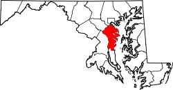
Gibson Island is an island and unincorporated community on the western shore of the Chesapeake Bay. It is part of Anne Arundel County, Maryland, United States and is the eastern terminus of Maryland Route 177. It is connected by a causeway to Pasadena, Maryland. The two locations do not share a ZIP code.

Contents

History

Gibson Island's history [1] includes its use as a summer residence by Native Americans in the 17th century. Captain John Smith sailed past it in his voyage up the Chesapeake Bay in 1608. Land grants began issue around the 1680s. In the early 1900s, W. Stuart Symington Jr. (1871–1926) [2] bought the island's land (including three existing island farms) with his brother Thomas, to develop the island into a residential community. One of the early owners was a man named Gibson, after whom the island is named.

The Symingtons, upon the advice of Edward H. Bouton, the developer of the Roland Park and Guilford neighborhoods in Baltimore, hired landscape architect Frederick Law Olmsted Jr. to create a master plan for the island. The Symington brothers set certain areas aside for community facilities and divided the remaining land into building lots offered for sale through the Gibson Island Company, now known as the Gibson Island Corporation. In 1925, the first deed and agreement was adopted and recorded. From that time to the present, the Corporation has had its own real estate department specifically handling the listing and selling of island properties.

The Great Depression halted rapid development of the island. An 18-hole Charles B. Macdonald designed golf course constructed in the 1920s was forced to downsize to nine holes, where it remains to this day. In 1936, corporation ownership was reorganized, giving greater control to island homeowners. This change led to a greater emphasis on maintaining the island's natural environment, with about two-thirds of its land set aside for recreation, forestry and open space.

Today, home prices on the island start at $US 1 million-plus, with the 2023 median sale price being $2,525,000. This makes Gibson Island the most expensive zip code in Maryland and the 45th most expensive zip code in the country. [3] Today, Gibson Island is a gated community run by the Gibson Island Corporation, along with the Gibson Island Club, limiting access to the island and its facilities to residents or those with a formal reason for visiting. Many residents of the island are seasonal residents who reside primarily in Washington, D.C. or Baltimore. Features of the island include a yacht club, golf, tennis, skeet shooting, a post office, a historical society, and an Episcopal church. [4]

Public safety

The residents of the island employ a Special Police force through the Corporation. The members of the force are sworn law enforcement officers, who have full law enforcement authority while working on the island. There have been reports over the years of sworn officers from the Anne Arundel County Police being stopped and questioned by the guards at the entrance to the island. In 2001, an inquiry by the Maryland State Police was opened into allegations of misconduct by the island's special police force. [5] While the state police investigation found evidence of illegal traffic stops and uniform violations, the investigation was dropped after a new security staff passed a surprise inspection. [6]

Education

Although there are few families with children on Gibson Island [7] and 100% of the children on the island are enrolled in private school, [8] Gibson Island belongs to the Anne Arundel County Public Schools district. Children living on Gibson Island would hypothetically attend Bodkin Elementary School, Chesapeake Bay Middle School, and Chesapeake High School if they attended public schools.

Related Research Articles

<span class="mw-page-title-main">Anne Arundel County, Maryland</span> County in Maryland, United States

Anne Arundel County, also notated as AA or A.A. County, is located in the U.S. state of Maryland. As of the 2020 United States census, its population was 588,261, an increase of just under 10% since 2010. Its county seat is Annapolis, which is also the capital of the state. The county is named for Anne Arundell, Lady Baltimore, a member of the ancient family of Arundells in Cornwall, England, and the wife of Cecilius Calvert, 2nd Baron Baltimore (1605–1675), founder and first lord proprietor of the colony Province of Maryland.

<span class="mw-page-title-main">Annapolis, Maryland</span> Capital city of Maryland, United States

Annapolis is the capital city of the U.S. state of Maryland and the county seat of, and only incorporated city in, Anne Arundel County. Situated on the Chesapeake Bay at the mouth of the Severn River, 25 miles (40 km) south of Baltimore and about 30 miles (50 km) east of Washington, D.C., Annapolis forms part of the Baltimore–Washington metropolitan area. The 2020 census recorded its population as 40,812, an increase of 6.3% since 2010.

<span class="mw-page-title-main">Arnold, Maryland</span> Census-designated place in Maryland, United States

Arnold, a census-designated place (CDP) in Anne Arundel County, Maryland, United States, located just outside of the state's capital, Annapolis. It is located 18.78 miles south of Baltimore, and 29.97 miles east of Washington, D.C. The population was 23,106 at the 2010 census. Neighborhoods straddle College Parkway and Maryland Route 2. Arnold is located on the scenic Broadneck Peninsula. The ZIP code is 21012. It is bordered by Severna Park to the northwest, Cape Saint Claire to the southeast, Annapolis to the southwest, and Lake Shore to the northeast.

<span class="mw-page-title-main">Crofton, Maryland</span> Census-designated place in Maryland, United States

Crofton is a census-designated place and planned community in Anne Arundel County, Maryland, United States, located 9.8 miles (15.8 km) west of the state capital Annapolis, 24 miles (39 km) south of Baltimore, and 24 miles (39 km) east-northeast of Washington, D.C. The community was established in 1964 and as of the 2020 census, it had a population of 29,136.

<span class="mw-page-title-main">Pasadena, Maryland</span> Census-designated place in Maryland, United States

Pasadena is a census-designated place (CDP) in Anne Arundel County, Maryland, United States. The population was 24,287 at the 2010 census.

<span class="mw-page-title-main">Laurel, Maryland</span> City in Maryland, United States

Laurel is a city in Maryland, United States, located midway between Washington, D.C. and Baltimore on the banks of the Patuxent River. While the city limits are entirely in northern Prince George's County, outlying developments extend into Anne Arundel, Montgomery and Howard counties. Founded as a mill town in the early 19th century, Laurel expanded local industry and was later able to become an early commuter town for Washington and Baltimore workers following the arrival of the Baltimore and Ohio Railroad in 1835. Largely residential today, the city maintains a historic district centered on its Main Street, highlighting its industrial past.

<span class="mw-page-title-main">Patuxent River</span> River in Maryland, United States

The Patuxent River is a tributary of the Chesapeake Bay in the state of Maryland. There are three main river drainages for central Maryland: the Potomac River to the west passing through Washington, D.C., the Patapsco River to the northeast passing through Baltimore, and the Patuxent River between the two. The 908-square-mile (2,352 km2) Patuxent watershed had a rapidly growing population of 590,769 in 2000. It is the largest and longest river entirely within Maryland, and its watershed is the largest completely within the state.

<span class="mw-page-title-main">Severn River (Maryland)</span> River in Maryland, United States

The Severn River is a tidal estuary 14 miles (23 km) long, located in Anne Arundel County in the U.S. state of Maryland, south of the Magothy River and north of the South River.

<span class="mw-page-title-main">Kent Island (Maryland)</span> Largest Island and historic place in the Chesapeake Bay, United States

Kent Island is the largest island in the Chesapeake Bay and a historic place in Maryland. To the east, a narrow channel known as the Kent Narrows barely separates the island from the Delmarva Peninsula, and on the other side, the island is separated from Sandy Point, an area near Annapolis, by roughly four miles (6.4 km) of water. At only four miles wide, the main waterway of the bay is at its narrowest at this point and is spanned here by the Chesapeake Bay Bridge. The Chester River runs to the north of the island and empties into the Chesapeake Bay at Kent Island's Love Point. To the south of the island lies Eastern Bay. The United States Census Bureau reports that the island has 31.62 square miles (81.90 km2) of land area.

<span class="mw-page-title-main">Hanover, Maryland</span> Unincorporated community in Maryland, United States

Hanover is an unincorporated community in the Baltimore/Annapolis area in northwestern Anne Arundel County and eastern Howard County in the U.S. state of Maryland, located south of Baltimore.

The Magothy River runs 12.1 miles (19.5 km) through Anne Arundel County in the U.S. state of Maryland. It is located south of the Patapsco River and north of the Severn River. There are two public park paddling access points, Beachwood Park on the north shore a half mile east of the Magothy Bridge Road bridge, and Spriggs Farm Park off Bayberry Drive, on the south shore two miles west of the Magothy's mouth. Both are Anne Arundel County parks.

<span class="mw-page-title-main">Russett, Maryland</span> Unincorporated community in Maryland, United States

Russett is an unincorporated planned community of 613 acres (2.48 km2) within the Maryland City census-designated place in far-western Anne Arundel County, Maryland, United States, near the city of Laurel. It is situated in a park-like setting complemented by 12 miles (19 km) of walking trails and a 70-acre (280,000 m2) lake nature preserve.

<span class="mw-page-title-main">Pamela Beidle</span> American politician

Pamela Graboski Beidle is an American politician who has served as a member of the Maryland Senate from District 32 since 2019. A member of the Democratic Party, she previously represented the district in the Maryland House of Delegates from 2007 to 2019, and was a member of the Anne Arundel County Council from 1998 to 2006.

<span class="mw-page-title-main">Chesapeake High School (Anne Arundel County)</span> Public secondary school in Pasadena, Maryland, United States

Chesapeake Senior High School (CHS) is a public high school in Pasadena, Maryland. It is one of two public high schools in Pasadena, the other being Northeast High School, Chesapeake's rival school. Chesapeake opened in 1976 due to overcrowding at Northeast. It serves students in grades 9–12. The school serves the local feeder system, encompassing Chesapeake Bay Middle School and the respective five elementary schools that feed into it. The school has two floors and includes a football field, several soccer and other athletic fields, and a variety of gymnasiums, including a smaller dance studio.

<span class="mw-page-title-main">Brooklyn, Baltimore</span> Neighborhood of Baltimore in Maryland, United States

Brooklyn is one of the southernmost neighborhoods in Baltimore, Maryland. It is located near Anne Arundel County along Governor Ritchie Highway which is also Maryland Route 2. Its main roads are South Hanover Street,, Potee Street, and East Patapsco Avenue, Sixth Street, Tenth Street, and West Bay Avenue which borders the neighboring Curtis Bay community to the east, running through Bay Brook Park, which separates the two. South Hanover Street also serves as the dividing line between east–west streets in Brooklyn, as Charles Street does not exist here.

The Little Magothy River runs 2.5 miles (4.0 km) through Anne Arundel County in the U.S. state of Maryland. It is located southeast of the Magothy River, just outside its mouth and north of the Severn River.

St. Helena Island is situated between Round Bay and Little Round Bay in the Severn River, 5 miles (8.0 km) upstream from Annapolis, Maryland and 17 miles (27 km) south of Baltimore, Maryland.

<span class="mw-page-title-main">Glenwood, Howard County, Maryland</span>

Glenwood is an unincorporated community in Howard County, Maryland, United States. It is located between Baltimore and Washington, D.C., therefore attracting commuters to those employment centers. The community features acres of open space and is districted to Bushy Park Elementary, Glenwood and Folly Quarter Middle, and Glenelg High schools. Union Chapel was listed on the National Register of Historic Places in 1975 and Round About Hills was added in 2008. The population in 2020 was approximately 3,416.

The Broadneck Peninsula is an area in Anne Arundel County, Maryland. The area is north of the Severn River, south of the Magothy River and west of the Chesapeake Bay. At the lower end of the Broadneck Peninsula is the 4.3 mile Chesapeake Bay Bridge.

References

  1. "AA-936: Gibson Island" (PDF). Retrieved February 8, 2018.
  2. "W. Stuart Symington, MSA SC 3520-14418".
  3. Jozsa, Evelyn (November 2, 2023). "Top 100 Most Expensive U.S. Zip Codes: 2022 Shatters Last Year's Records with 14 Zip Codes Surpassing $4 Million Median". PropertyShark Real Estate Blog. Retrieved November 6, 2023.
  4. Kathy Orton. "On Maryland's Gibson Island, year-round living and year-round play". The Washington Post. Retrieved May 19, 2021.
  5. Laura Barnhardt (June 12, 2001). "A reach too far for security?". The Baltimore Sun. Retrieved May 19, 2021.
  6. Laura Barnhardt (November 21, 2001). "Lawsuit disputes officer's firing". The Baltimore Sun. Retrieved May 20, 2021.
  7. "On Maryland's Gibson Island, year-round living and year-round play - The Washington Post". The Washington Post .
  8. "ZIP Code 21056 Map, Demographics, More for Gibson Island, MD".