Bristol, Maryland

Last updated

Bristol, Maryland
USA Maryland location map.svg
Red pog.svg
Bristol, Maryland
Location within the U.S. state of Maryland
Usa edcp location map.svg
Red pog.svg
Bristol, Maryland
Bristol, Maryland (the United States)
Coordinates: 38°47′30″N76°40′20″W / 38.79167°N 76.67222°W / 38.79167; -76.67222
Country Flag of the United States.svg United States
State Flag of Maryland.svg  Maryland
County Flag of Anne Arundel County, Maryland.png Anne Arundel
Time zone UTC-5 (Eastern (EST))
  Summer (DST) UTC-4 (EDT)

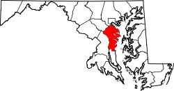
Bristol is an unincorporated community in Anne Arundel County, Maryland, United States. [1] Jug Bay Wetlands Sanctuary (a stop on the Patuxent Water Trail) [2] and the colonial town of Pig Point (alternately referred to as Bristol Landing and Leon at times) are on the Patuxent River waterfront portion of Bristol. Pig Point saw War of 1812 action [3] and was the county's largest steamboat port on the Patuxent in the mid-19th century. [4] Pig Point is a very significant Native American Early Archaic Period archaeological site. [5] [6]

The Chesapeake Beach Railway was completed in 1899 through the southern part of Bristol or "Pindell"; ruins of the Pindell Station and its general store remain. [7] [8] The James Owens Farm, listed on the National Register of Historic Places, [9] and the southern terminus of the Stephanie Roper Highway portion of Maryland Route 4 are also located in Bristol.

In the mid-twentieth century, the segregated Bristol Elementary School was located in the northern part of town, three-quarter mile southeast of Waysons Corner and a half mile south of the crossroad village of Drury. The school in 1953 published a history of Bristol (largely reprinting a 1927 Bristol town history from the Annapolis Capital newspaper). [10] The following year it was enlarged and renovated, growing to 200 students (and four teachers and a heating and rodent problem) by 1969 [11] after the county was ordered to desegregate schools in 1966. [12]

Related Research Articles

<span class="mw-page-title-main">Howard County, Maryland</span> County in Maryland, United States

Howard County is located in the U.S. state of Maryland. As of the 2020 census, the population was 334,529. Since there are no incorporated municipalities, there is no incorporated county seat either. Therefore, its county seat is the unincorporated community of Ellicott City. Howard County is included in the Baltimore-Columbia-Towson, MD Metropolitan Statistical Area, which is part of the larger Washington–Baltimore combined statistical area.

<span class="mw-page-title-main">Calvert County, Maryland</span> County in Maryland, United States

Calvert County is located in the U.S. state of Maryland. As of the 2020 census, the population was 92,783. Its county seat is Prince Frederick. The county's name is derived from the family name of the Barons of Baltimore, the proprietors of the English Colony of Maryland Calvert County is included in the Washington–Arlington–Alexandria, DC–VA–MD–WV Metropolitan Statistical Area. It occupies the Calvert Peninsula, which is bordered on the east by Chesapeake Bay and on the west by the Patuxent River. Calvert County is part of the Southern Maryland region. The county has one of the highest median household incomes in the United States. It is one of the older counties in Maryland, after St. Mary's, Kent County and Anne Arundel counties.

<span class="mw-page-title-main">Anne Arundel County, Maryland</span> County in Maryland, United States

Anne Arundel County, also notated as AA or A.A. County, is located in the U.S. state of Maryland. As of the 2020 United States census, its population was 588,261, an increase of just under 10% since 2010. Its county seat is Annapolis, which is also the capital of the state. The county is named for Anne Arundell, Lady Baltimore, a member of the ancient family of Arundells in Cornwall, England, and the wife of Cecilius Calvert, 2nd Baron Baltimore (1605–1675), founder and first lord proprietor of the colony Province of Maryland.

<span class="mw-page-title-main">Crofton, Maryland</span> Census-designated place in Maryland, United States

Crofton is a census-designated place and planned community in Anne Arundel County, Maryland, United States, located 9.8 miles (15.8 km) west of the state capital Annapolis, 24 miles (39 km) south of Baltimore, and 24 miles (39 km) east-northeast of Washington, D.C. The community was established in 1964 and as of the 2020 census, it had a population of 29,136.

<span class="mw-page-title-main">Fort Meade, Maryland</span> Census-designated place in Maryland, United States

Fort Meade is a census-designated place (CDP) in Anne Arundel County, Maryland, United States. The population was 9,327 at the 2010 census. It is the home to the National Security Agency, Central Security Service, United States Cyber Command and the Defense Information Systems Agency, which are located on the U.S. Army post Fort George G. Meade.

<span class="mw-page-title-main">Odenton, Maryland</span> Census-designated place in Maryland, U.S.

Odenton is a census-designated place (CDP) in Anne Arundel County, Maryland, United States, located approximately 10–20 minutes from the state capital, Annapolis. The population was 37,132 at the 2010 census, up from 20,534 at the 2000 census. The town's population growth rate of 80.8% between 2000 and 2010 was the greatest of any town in western Anne Arundel County. Odenton is located west of Annapolis, south of Baltimore, and northeast of Washington.

<span class="mw-page-title-main">Laurel, Maryland</span> City in Maryland, United States

Laurel is a city in Maryland, United States, located midway between Washington, D.C. and Baltimore on the banks of the Patuxent River. While the city limits are entirely in northern Prince George's County, outlying developments extend into Anne Arundel, Montgomery and Howard counties. Founded as a mill town in the early 19th century, Laurel expanded local industry and was later able to become an early commuter town for Washington and Baltimore workers following the arrival of the Baltimore and Ohio Railroad in 1835. Largely residential today, the city maintains a historic district centered on its Main Street, highlighting its industrial past.

<span class="mw-page-title-main">Patuxent River</span> River in Maryland, United States

The Patuxent River is a tributary of the Chesapeake Bay in the state of Maryland. There are three main river drainages for central Maryland: the Potomac River to the west passing through Washington, D.C., the Patapsco River to the northeast passing through Baltimore, and the Patuxent River between the two. The 908-square-mile (2,352 km2) Patuxent watershed had a rapidly growing population of 590,769 in 2000. It is the largest and longest river entirely within Maryland, and its watershed is the largest completely within the state.

<span class="mw-page-title-main">Guilford, Maryland</span> Unincorporated community in Maryland, United States

Guilford is an unincorporated community located in Howard County in the state of Maryland. The location is named after the Guilford Mill. Guilford is near Kings Contrivance, one of the nine "villages" of Columbia.

<span class="mw-page-title-main">Savage, Maryland</span> Census-designated place in Maryland, United States

Savage is an unincorporated community and census-designated place located in Howard County, Maryland, United States, approximately 18 miles (29 km) south of Baltimore and 21 miles (34 km) north of Washington, D.C. It is situated close to the city of Laurel and to the planned community of Columbia. As of the 2020 census, it had a population of 7,542. The former mill town is a registered historic place, and has several original buildings preserved within and around the Savage Mill Historic District.

<span class="mw-page-title-main">Maryland Route 4</span> State highway in Maryland, US

Maryland Route 4 is a state highway in the U.S. state of Maryland. The highway runs 64.85 miles (104.37 km) from MD 5 in Leonardtown north to Southern Avenue in Suitland at the District of Columbia boundary, beyond which the highway continues into Washington as Pennsylvania Avenue. MD 4 is a four- to six-lane highway that connects Washington and communities around Interstate 95 (I-95)/I-495 with southern Prince George's County with southwestern Anne Arundel County. The highway is the primary highway for the length of Calvert County, during most of which the route runs concurrently with MD 2. MD 4 also connects Calvert and St. Mary's counties via the Governor Thomas Johnson Bridge across the Patuxent River. The highway connects the Southern Maryland county seats of Leonardtown, Prince Frederick, and Upper Marlboro.

The Washington, Baltimore and Annapolis Trail (WB&A) is a 10.25-mile (16.50 km) long discontinuous rail trail from Lanham to Odenton in Maryland. Despite its name, it does not actually connect with Washington, D.C., Annapolis or Baltimore; its name is taken from the Washington, Baltimore and Annapolis Electric Railway, from which the right-of-way comes. The trail exists in two separate pieces, one in Anne Arundel County and the other in Prince George's County, separated by the lack of a bridge over the Patuxent River. The bridge's construction and the trail's alignment was delayed for over a decade due to a property dispute; however, the trail was realigned and plans exist to complete a bridge by 2021. Additional plans exist to extend the trail southward to the Washington, D.C. border.

<span class="mw-page-title-main">Savage Mill</span> United States historic place

The Savage Mill is a historic cotton mill complex in Savage, Maryland, which has been turned into a complex of shops and restaurants. It was placed on the National Register of Historic Places in 1974. It is located in the Savage Mill Historic District. Buildings in the complex date from 1822 to 1916.

<span class="mw-page-title-main">Maryland Route 980</span>

Maryland Route 980 is a designation used for a collection of five service roads in the U.S. state of Maryland along MD 4, four in Bristol and Waysons Corner in southern Anne Arundel County and one near Upper Marlboro in southern Prince George's County. MD 980 was assigned to the service roads constructed during the expansion of MD 4 to a four-lane divided highway in the early to mid-1960s.

<span class="mw-page-title-main">Russett, Maryland</span> Unincorporated community in Maryland, United States

Russett is an unincorporated planned community of 613 acres (2.48 km2) within the Maryland City CDP in far-western Anne Arundel County, Maryland, United States, near the city of Laurel. It is situated in a park-like setting complemented by 12 miles (19 km) of walking trails and a 70-acre (280,000 m2) lake nature preserve.

Queen Anne in Prince George's County, Maryland, United States, is a former port on the Patuxent River. It was delineated as a CDP for the 2010 census, at which time it had a population of 1,280. Per the 2020 census, the population was 1,405.

Woodwardville is an unincorporated community situated in western Anne Arundel County, Maryland, United States, containing 27 structures, 16 of which are historic and included in the Woodwardville Historic District, listed on the National Register of Historic Places in 2003. Most of the structures are located adjacent to Patuxent Road, which runs through the center of the community. On the north end of the district, a small street, 5th Avenue, runs west from Patuxent Road underneath the train tracks. Prior to the establishment of what would be later known as Fort George G. Meade in 1917, the road once continued on to Laurel. Three of the seven buildings along 5th Avenue are historic. Woodwardville's building stock consists principally of late-19th and early-20th century domestic architecture. Good examples of the Bungalow, Foursquare, Tudor Revival, and Queen Anne styles are present, as well as older traditional vernacular classifications such as the I-house. These older forms are supplemented by a handful of post-World War II era structures. Woodwardville also features several public or commercial buildings including a church, a former schoolhouse, the ruins of a store and storage or service buildings associated with the railroad. Many of Woodwardville's older buildings fell into decline following World War II, but in recent years, due to its close proximity to commuter rail service, Woodwardville has evolved into a bedroom community for persons working in Washington and Baltimore. Investment by new residents resulted in the restoration and renovation of many buildings which had formerly been in deteriorating condition. Despite the intense development a mile away in Piney Orchard, this quaint community retains its ability to communicate its historic qualities and distinct sense of place.

<span class="mw-page-title-main">Savage Mill Historic District</span> Historic district in Maryland, United States

The Savage Mill Historic District is a national historic district located at Savage, Howard County, Maryland. The district comprises the industrial complex of Savage Mill and the village of workers' housing to the north of the complex.

<span class="mw-page-title-main">Woodwardville Historic District</span> Historic district in Maryland, United States

Woodwardville Historic District is a national historic district at Woodwardville, Anne Arundel County, Maryland. The district consists of 16 historic structures, most of which are located adjacent to Patuxent Road, which runs through the center of the village of Woodwardville. The district contains good examples of late-19th and early-20th century domestic architecture, including Bungalow, Foursquare, Tudor Revival, and Queen Anne styles. The village's development was directly related to the construction of the Baltimore & Potomac Railroad, initiated in 1867 and completed in 1872.

<span class="mw-page-title-main">Whiskey Bottom Road</span> Historic road north of Laurel, Maryland, U.S.

Whiskey Bottom Road is a historic road north of Laurel, Maryland that traverses Anne Arundel and Howard Counties in an area that was first settled by English colonists in the mid-1600s. The road was named in the 1880s in association with one of its residents delivering whiskey after a prohibition vote. With increased residential development after World War II, it was designated a collector road in the 1960s; a community center and park are among the most recent roadside developments.

References

  1. "Geographic Names Information System". Bristol (Populated Place). U.S. Geological Survey. January 29, 2009.
  2. "Patuxent Water Trail". Patuxent Riverkeeper. Archived from the original on September 23, 2012. Retrieved February 20, 2013.
  3. "Star-Spangled History". National Park Service Star-Spangled Banner National Historic Trail. Archived from the original on June 30, 2013. Retrieved February 20, 2013.
  4. "South County Draft Small Area Plan" (PDF). Anne Arundel County. Archived from the original (PDF) on November 10, 2013. Retrieved February 26, 2015.
  5. Al Luckenbach; et al. "Pig Point". Anne Arundel County. Archived from the original on October 8, 2013. Retrieved February 20, 2013.
  6. Al Luckenbach; et al. (2010). "Archaic Period Triangular Points from Pig Point" (PDF). Journal of Middle Atlantic Archaeology. 26. Retrieved February 20, 2013.[ permanent dead link ]
  7. "Nomination Form for National Register of Historic Places" (PDF). Maryland Historic Trust. Retrieved February 20, 2013.
  8. "Maryland and Delaware (map showing towns of Bristol and Pindell and the rail line)". C.S. Hammond and Co., NY. 1908. Retrieved February 26, 2015.
  9. "National Register Information System". National Register of Historic Places . National Park Service. April 15, 2008.
  10. Fifth Grade class (1953). "Discovering Our School Community" (PDF). Anne Arundel County Board of Education. Retrieved February 26, 2015.
  11. Pat Melville (November 12, 1996). "Grand Jury Inspection of Schools". The Archivist's Bulldog. Maryland Archives. 10 (21). Retrieved February 26, 2015.
  12. Carol L. Bowers (February 12, 1995). "Philip L. Brown has the long view of Anne Arundel's schools and racial integration". The Baltimore Sun . Retrieved February 26, 2015.