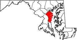
Davidsonville, Maryland

Last updated

Davidsonville, Maryland
Davidsonville Free School.JPG
The Anne Arundel Free School, constructed sometime between 1724 and 1746, is located in Davidsonville in the community of Lavall
USA Maryland location map.svg
Red pog.svg
Davidsonville
Location within the state of Maryland
Usa edcp location map.svg
Red pog.svg
Davidsonville
Davidsonville (the United States)
Coordinates: 38°55′22″N76°37′42″W / 38.92278°N 76.62833°W / 38.92278; -76.62833
Country Flag of the United States.svg United States
State Flag of Maryland.svg  Maryland
County Flag of Anne Arundel County, Maryland.png Anne Arundel
Time zone UTC-5 (Eastern (EST))
  Summer (DST) UTC-4 (EDT)
ZIP codes
21035

Davidsonville is an unincorporated community in central Anne Arundel County, Maryland, United States. It is a semi-rural community composed mostly of farms and suburban-like developments and is a good example of an "exurb." Davidsonville has relatively little commercial development and no high-density housing. The community is generally not served by public water, sewer or natural gas utilities, so homes generally employ well-and-septic systems. The nominal, if not geographic, center of Davidsonville is the intersection of Maryland routes 424 (Davidsonville Rd.) and 214 (Central Ave.), located at 38°55′22″N76°37′42″W / 38.9229°N 76.6284°W / 38.9229; -76.6284 . The Davidsonville Historic District was listed on the National Register of Historic Places in 1992.

Contents

Demographics

As of the 2010 U.S. census, the Davidsonville ZIP code (21035) had a population of 7,815 and a median annual household income of US$141,011; 1.5 percent of families had incomes below the poverty line. Ethnically, 92 percent of the population was white, four percent was black or African American, two percent was Asian, with the rest other ethnicities. Ninety-four percent of homes were owner-occupied. [1] As of the 2007 United States Census Bureau's Economic Census, 13 year-round retail business establishments and three retail food establishments were located in Davidsonville. [2]

History

Native Americans

Before European colonists settled in what is now Davidsonville, the area was the home to Algonquian-speaking Native American tribes. By the time Europeans began to arrive in central Anne Arundel County in numbers, the Algonquians may have vacated the area due to persistent raids by more battle-hearty members of the Susquehannock tribe.[ clarification needed ][ citation needed ]

18th and 19th centuries

Europeans and their descendants settled and developed farms and plantations in and around what came to be known as Davidsonville in the 17th and 18th centuries. Several good examples of 18th century development in the area remain today. One is the Anne Arundel Free School. On October 26, 1723 the Maryland Colonial Assembly, under the Lord Proprietor Charles Calvert, the Fifth Lord Baltimore, and his governor, passed "An Act for the Encouragement of Learning and Erecting Schools in the Several Counties," or the Free School Act. [3] This law, one of the first in colonial America providing for free, publicly supported primary education, mandated the construction of public schools in each of the 12 Maryland counties that existed at the time. The Free School of Anne Arundel County was built in what was to become Davidsonville sometime between 1724 and 1746, when it was under full operation with John Wilmot as schoolmaster. The original structure, expanded and restored, still stands today, is located in the community of Lavall, off Rutland Road, about one-half mile from Maryland Route 450, and is open for tours.

Other examples of development in the 18th century also remain. During the late 18th century, for example, Major William Brogden, once a soldier in the American Revolution, built the Roedown plantation, [4] once the home of the Marlborough Hunt Races, an annual steeplechase event attended by 5,000 spectators until discontinued by new owners. [5] George Washington is reported to have stayed at the house in 1760. Roedown is located off Harwood Rd. in Davidsonville.

Perhaps the most prominent example of 18th century settlement in Davidsonville is the Middle Plantation. The plantation itself dates to a 1664 land grant by Cecil Calvert, 2nd Baron Baltimore to Mareen Duvall, a prominent French immigrant. The current house known as Middle Plantation, located on Davidsonville Rd., includes several stages of construction dating as far back as 1790.

The emergence of Davidsonville as a crossroads community began in the mid-19th century. In 1839, Thomas Davidson, from whose family Davidsonville received its name, married Jane Welch. They built a home at what is now the corner of Davidsonville Road and Central Avenue that still stands today. Davidson, like virtually all plantation owners in central and southern Maryland at the time, owned slaves. However, a staunch Methodist who was instrumental in the founding of what is now the Davidsonville United Methodist Church, Davidson apparently was conflicted as to the morality of slavery.

The Maryland Historical Trust states that "the Davidsonville Historic District is significant as a largely intact representative example of the type of crossroads community which characterized rural Anne Arundel County in the late 19th and early 20th centuries. Davidsonville is among the best-preserved examples of this type of community remaining in the county; other comparable villages have been obliterated by subsequent development. The village has maintained substantial integrity despite increasingly intensive development pressure in the surrounding area." [6]

Education

Davidsonville is home to Davidsonville Elementary School, which has approximately 700 students in kindergarten through fifth grade. Also serving the area are the Free School of Anne Arundel County, the first such school of that county, which then included what is now Howard County and likely school for Johns Hopkins, Central Middle School (Edgewater, Maryland), Crofton Woods Elementary School (Crofton, Maryland), Crofton Middle School (Gambrills, Maryland), Crofton High School (Gambrills, Maryland) and South River High School (Edgewater, Maryland).[ citation needed ]

Notable people

See also

Related Research Articles

<span class="mw-page-title-main">Anne Arundel County, Maryland</span> County in Maryland, United States

Anne Arundel County, also notated as AA or A.A. County, is located in the U.S. state of Maryland. As of the 2020 United States census, its population was 588,261, an increase of just under 10% since 2010. Its county seat is Annapolis, which is also the capital of the state. The county is named for Anne Arundell, Lady Baltimore, a member of the ancient family of Arundells in Cornwall, England, and the wife of Cecilius Calvert, 2nd Baron Baltimore (1605–1675), founder and first lord proprietor of the colony Province of Maryland.

<span class="mw-page-title-main">Crofton, Maryland</span> Census-designated place in Maryland, United States

Crofton is a census-designated place and planned community in Anne Arundel County, Maryland, United States, located 9.8 miles (15.8 km) west of the state capital Annapolis, 24 miles (39 km) south of Baltimore, and 24 miles (39 km) east-northeast of Washington, D.C. The community was established in 1964 and as of the 2020 census, it had a population of 29,136.

<span class="mw-page-title-main">Fort Meade, Maryland</span> Census-designated place in Maryland, United States

Fort Meade is a census-designated place (CDP) in Anne Arundel County, Maryland, United States. The population was 9,327 at the 2010 census. It is the home to the National Security Agency, Central Security Service, United States Cyber Command and the Defense Information Systems Agency, which are located on the U.S. Army post Fort George G. Meade.

<span class="mw-page-title-main">Odenton, Maryland</span> Census-designated place in Maryland, U.S.

Odenton is a census-designated place (CDP) in Anne Arundel County, Maryland, United States, located approximately 10–20 minutes from the state capital, Annapolis. The population was 37,132 at the 2010 census, up from 20,534 at the 2000 census. The town's population growth rate of 80.8% between 2000 and 2010 was the greatest of any town in western Anne Arundel County. Odenton is located west of Annapolis, south of Baltimore, and northeast of Washington.

<span class="mw-page-title-main">Hanover, Maryland</span> Unincorporated community in Maryland, United States

Hanover is an unincorporated community in the Baltimore/Annapolis area in northwestern Anne Arundel County and eastern Howard County in the U.S. state of Maryland, located south of Baltimore.

Old Mill High School is a public high school in Millersville, Maryland, serving students in grades 9 through 12. It was occupied in 1975 and is administered by Anne Arundel County Public Schools (AACPS). The school was built to alleviate overcrowding at Arundel and Severna Park High Schools. The school has no walls or ceilings in some classrooms, only partitions to separate classrooms. Along with Annapolis High School and Meade Senior High School, Old Mill Senior High is one of the three IB World Schools in Anne Arundel County. The school building also houses the high school's two feeder schools, Old Mill Middle School North and Old Mill Middle School South. The school mascot is the patriot.

Gambrills refers to two neighboring places in Anne Arundel County, Maryland, United States, located in the Annapolis metro area: the unincorporated community of Gambrills, and the Gambrills census-designated place (CDP). The area was named after Augustine Gambrill, plantation owner. The CDP covers an expansive range that falls within the communities of Crofton, Waugh Chapel, and Odenton. It also borders Davidsonville, Crownsville, Millersville, and Prince George's County, Maryland.

<span class="mw-page-title-main">Arundel High School</span> Public secondary school in Gambrills, Maryland, United States

Arundel High School is a public high school located in Gambrills, Maryland, a suburb of Anne Arundel County.

<span class="mw-page-title-main">Anne Arundel County Public Schools</span> School District serving Anne Arundel County Maryland

Anne Arundel County Public Schools is the public school district serving Anne Arundel County, Maryland. With over 80,000 students, the AACPS school system is the 4th largest in Maryland and the 39th largest in the United States. The district has over 5,000 teachers supporting a comprehensive curriculum from Pre-K through 12th grade.

<span class="mw-page-title-main">Maryland Route 424</span> State highway in Maryland, United States

Maryland Route 424 is a state highway in the U.S. state of Maryland. Known as Davidsonville Road, the highway runs 8.24 miles (13.26 km) from MD 214 in Davidsonville north to MD 3 in Crofton. MD 424 connects U.S. Route 50 /US 301 with the two communities in central Anne Arundel County. The highway was constructed from Davidsonville to what is now MD 450 in the late 1920s. MD 424 was extended to what is now MD 3 in the late 1940s. The highway's interchange with US 50 opened in the early 1950s when the U.S. Highway was relocated between Bowie and Annapolis. MD 424 temporarily extended south to MD 2 in the early to mid-1950s and north to the Little Patuxent River in the 1970s and early 1980s.

<span class="mw-page-title-main">Mareen Duvall</span> American settler (1625–1694)

Mareen Duvall (1625–1694) was a French Huguenot and an early American settler.

Woodwardville is an unincorporated community situated in western Anne Arundel County, Maryland, United States, containing 27 structures, 16 of which are historic and included in the Woodwardville Historic District, listed on the National Register of Historic Places in 2003. Most of the structures are located adjacent to Patuxent Road, which runs through the center of the community. On the north end of the district, a small street, 5th Avenue, runs west from Patuxent Road underneath the train tracks. Prior to the establishment of what would be later known as Fort George G. Meade in 1917, the road once continued on to Laurel. Three of the seven buildings along 5th Avenue are historic. Woodwardville's building stock consists principally of late-19th and early-20th century domestic architecture. Good examples of the Bungalow, Foursquare, Tudor Revival, and Queen Anne styles are present, as well as older traditional vernacular classifications such as the I-house. These older forms are supplemented by a handful of post-World War II era structures. Woodwardville also features several public or commercial buildings including a church, a former schoolhouse, the ruins of a store and storage or service buildings associated with the railroad. Many of Woodwardville's older buildings fell into decline following World War II, but in recent years, due to its close proximity to commuter rail service, Woodwardville has evolved into a bedroom community for persons working in Washington and Baltimore. Investment by new residents resulted in the restoration and renovation of many buildings which had formerly been in deteriorating condition. Despite the intense development a mile away in Piney Orchard, this quaint community retains its ability to communicate its historic qualities and distinct sense of place.

Jacob Henderson was an Irish clergyman and philologist who emigrated to the colonial Provinces of Pennsylvania, then Maryland, where he became a prominent land owner and church leader.

<span class="mw-page-title-main">Anne Arundel County Free School</span> United States historic place

Anne Arundel County Free School is a historic school building, located in Davidsonville, Anne Arundel County, Maryland. The first Free School of Anne Arundel County was established by an Act of the General Assembly of colonial Maryland in 1723. It was built somewhere between its contractual date of 1724 and 1746 when it was under full operation with John Wilmot as schoolmaster. The existing abandoned building is 49' x 18', and consists of six rooms on two floors. It was built "as near the center of the county as may be, and as may be the most convenient for the boarding of children." The county then included what is now Howard County. It remained in operation until 1912 when the movement toward consolidation forced the closure of many early school buildings. It is the only surviving schoolhouse erected in Maryland in response to the Maryland Free School Act of 1723.

The Broadneck Peninsula is an area in Anne Arundel County, Maryland. The area is north of the Severn River, south of the Magothy River and west of the Chesapeake Bay. At the lower end of the Broadneck Peninsula is the 4.3 mile Chesapeake Bay Bridge.

Edgewater is a census-designated place (CDP) in Anne Arundel County, Maryland, United States. The population was 9,023 at the 2010 census.

Duvall Bridge is an historic single-lane bridge over the Patuxent River near Laurel, Maryland.

Jamie Falcon was a Delegate candidate for the 33rd district of Maryland.

The Duvall Farm was a historic farm located in North Laurel, Howard County, Maryland, now the site of Coastal Sunbelt Produce.

Crofton High School is a high school located in the suburban community of Gambrills, Maryland, United States, a suburb of Washington DC and Baltimore located within Anne Arundel County. It serves students from the greater Crofton area, and it is part of the Anne Arundel County Public Schools district.

References

  1. "U.S. Census website". United States Census Bureau.
  2. "U.S. Census website". United States Census Bureau.
  3. "Anne Arundel County Free School". Anne Arundel County Public Schools. Archived from the original on September 27, 2007. Retrieved June 6, 2007.
  4. Gartrell, John. "Roedown Plantation and the Christiana Resistance". Legacy of Slavery in Maryland. Maryland State Archives.
  5. Yorke, Tom (March 27, 1999). "Marlborough Hunt Has Lots of History". Washington Times. p. 6.
  6. Maryland Historical Trust. "Davidsonville Historic District". Archived from the original on March 5, 2012.
  7. Baltz, Shirley Vlasak (1984). A Chronicle of Belair. Bowie, Maryland: Bowie Heritage Committee. p. 5. LCCN   85165028.

Further reading