Skidmore, Maryland

Last updated
Skidmore, Maryland
Unincorporated community
USA Maryland location map.svg
Red pog.svg
Skidmore, Maryland
Location within the state of Maryland
Usa edcp location map.svg
Red pog.svg
Skidmore, Maryland
Skidmore, Maryland (the US)
Coordinates: 39°01′16″N76°24′55″W / 39.02111°N 76.41528°W / 39.02111; -76.41528 Coordinates: 39°01′16″N76°24′55″W / 39.02111°N 76.41528°W / 39.02111; -76.41528
Country Flag of the United States.svg United States
State Flag of Maryland.svg  Maryland
County Flag of Anne Arundel County, Maryland.png Anne Arundel
Time zone Eastern (EST) (UTC-5)
  Summer (DST) EDT (UTC-4)

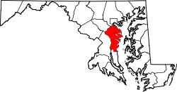
Skidmore is an unincorporated community in Anne Arundel County, Maryland, United States. [1] The community is the western terminus of the Chesapeake Bay Bridge as well as the location of Sandy Point State Park. Sandy Point Shoal Light was listed on the National Register of Historic Places in 2002. [2]

Unincorporated area Region of land not governed by own local government

In law, an unincorporated area is a region of land that is not governed by a local municipal corporation; similarly an unincorporated community is a settlement that is not governed by its own local municipal corporation, but rather is administered as part of larger administrative divisions, such as a township, parish, borough, county, city, canton, state, province or country. Occasionally, municipalities dissolve or disincorporate, which may happen if they become fiscally insolvent, and services become the responsibility of a higher administration. Widespread unincorporated communities and areas are a distinguishing feature of the United States and Canada. In most other countries of the world, there are either no unincorporated areas at all, or these are very rare; typically remote, outlying, sparsely populated or uninhabited areas.

Anne Arundel County, Maryland county in Maryland, United States

Anne Arundel County, also notated as AA or A.A. County, is a county located in the U.S. state of Maryland. As of the 2010 United States Census, its population was 537,656, a population increase of just under 10% since 2000. Its county seat is Annapolis, which is also the capital of the state. The county is named for Lady Anne Arundell (1615–1649), a member of the ancient family of Arundells in Cornwall, England, and the wife of Cecilius Calvert, 2nd Baron Baltimore (1605–1675), founder and first Lord Proprietor of the colony Province of Maryland.

Maryland State of the United States of America

Maryland is a state in the Mid-Atlantic region of the United States, bordering Virginia, West Virginia, and the District of Columbia to its south and west; Pennsylvania to its north; and Delaware to its east. The state's largest city is Baltimore, and its capital is Annapolis. Among its occasional nicknames are Old Line State, the Free State, and the Chesapeake Bay State. It is named after the English queen Henrietta Maria, known in England as Queen Mary.

Related Research Articles

National Register of Historic Places listings in Michigan Wikimedia list article

This is a list of properties on the National Register of Historic Places in the U.S. state of Michigan.

Georgetown, Maryland Unincorporated community in Maryland, United States

Georgetown is an unincorporated community in Cecil and Kent counties in Maryland, United States. The community was laid out in 1736. Georgetown was named for Prince George who later became King of the United Kingdom. Georgetown is located at the point Maryland Route 213 crosses the Sassafras River, which forms the county line, north of Galena and south of Cecilton.

Old Town Chinatown Neighborhood in Portland, Oregon, United States

Old Town Chinatown is the official Chinatown of the Northwest section of Portland, Oregon. The Willamette River forms its eastern boundary, separating it from the Lloyd District and the Kerns and Buckman neighborhoods. It includes the Portland Skidmore/Old Town Historic District and the Portland New Chinatown/Japantown Historic District, which are listed on the National Register of Historic Places.

1010 Common

1010 Common, located at 1010 Common Street in the Central Business District of New Orleans, Louisiana, is a 31-story, 438-foot (134 m)-tall skyscraper. The building, designed by Skidmore, Owings & Merrill and completed in 1970, is an example of the international style typical of the time. It is located adjacent to the 14-story Latter Center Garage & Annex.

Sandy Point Shoal Light lighthouse in Maryland, United States

Sandy Point Shoal Light is a brick three story lighthouse on a caisson foundation that was erected in 1883. It lies about 0.6 mi (0.97 km) off Sandy Point, north of the Chesapeake Bay Bridge, from whose westbound span it is readily visible.

East Point Light lighthouse in New Jersey, United States

The East Point Light, known as the Maurice River Light before 1913, is a lighthouse located in Heislerville, New Jersey on the Delaware Bay at the mouth of the Maurice River in Maurice River Township, Cumberland County, New Jersey, United States. The lighthouse was built in 1849 and is the second oldest in New Jersey, with only the Sandy Hook Light, which was built in 1764, being older. The light was inactive from 1941 and was nearly destroyed by fire in 1971. The light was reinstated by the United States Coast Guard in 1980. Exterior restoration was completed in 1999.

Prudence Island Light lighthouse in Rhode Island, United States

The Prudence Island Lighthouse, more commonly known locally as the Sandy Point Lighthouse, is located on Prudence Island, Rhode Island and is the oldest lighthouse tower in the state. Sandy Point is nicknamed Chibacoweda, meaning "little place separated by a passage", because the location is a little more than one mile offshore.

Sherwood, Maryland Unincorporated community in Maryland, United States

Sherwood is an unincorporated community in Talbot County, Maryland, United States. Sherwood is located along Maryland Route 33 on the eastern shore of the Chesapeake Bay south of Claiborne and north of Tilghman Island. The United States Postal Service has assigned Sherwood the ZIP Code 21665. The Sandy, a log canoe ported in Sherwood, was listed on the National Register of Historic Places in 1985.

Sandy Spring Friends Meetinghouse

The Sandy Spring Friends Meetinghouse is a historic building located at Sandy Spring, Montgomery County, Maryland. It is a large, Flemish bond brick, Federal-style Quaker Meeting House built in 1817. The meetinghouse is on two acres deeded by James Brooke in the 1750s, for the use of the Quaker Meeting. Nearby is the cemetery where he and many of his descendants were buried.

Sandy Point Farmhouse

The Sandy Point Farmhouse is a historic home at Sandy Point State Park, Anne Arundel County, Maryland, United States. It is a five-part plan consisting of a two-story central block connected to two wings by single-story hyphens. It was built in an 18th-century style in the 19th century and typical of Maryland domestic architecture. The house was constructed about 1815 for John Gibson, a member of the Annapolis elite and a relative of Samuel Ogle, an 18th-century Governor of Maryland.

Buckingham Archeological Site is an archaeological site near Berlin in Worcester County, Maryland. It is one of the few known Woodland period village sites in the coastal marsh areas of the Atlantic Coast section of Maryland. The site falls within the general vicinity of an Assateague Indian town. It is located four miles east of the Sandy Point Site, both including the southernmost reported occurrence of Townsend Series ceramics on the coastal section of the Eastern Shore.

The Sandy Point Site, or Sandy Point Archeological Site, is an archaeological site near Ocean City in Worcester County, Maryland. It contains the southernmost component of the Townsend Series on the Delmarva Peninsula. It is also one of the few known Woodland period village sites in this area. These traits are shared by the nearby Buckingham Archeological Site.

Merry Point, Virginia Unincorporated community in Virginia, United States

Merry Point is an unincorporated community in Lancaster County in the U. S. state of Virginia.

Sandy Run is an unincorporated community in Calhoun County, South Carolina, United States. Its elevation is 154 feet (47 m). Sandy Run is best known for hosting the United States Marine Corps semi-annual Mud Run. Sandy Run is named after a local stream, Sandy Run, which flows through Sandy Run and neighboring communities, Gaston and Swansea which flows into the Congaree River.

National Register of Historic Places listings in northern Worcester County, Massachusetts Wikimedia list article

This is a list of the National Register of Historic Places (NRHP) designated in northern Worcester County, Massachusetts. It includes listings from all Worcester County communities through which Massachusetts Route 2 passes, and those that lie to their north. This includes the communities of Ashburnham, Ashby, Athol, Fitchburg, Gardner, Harvard, Lancaster, Leominster, Lunenburg, Phillipston, Royalston, Templeton, Westminster, and Winchendon. National Register listings for other communities in the county are listed elsewhere.

Dancing Point

Dancing Point is a historic property on the north bank of the James River in rural Charles City County, Virginia. Located off Sandy Point Road and projecting into the river, the property has archaeological sites dating to the early colonial period of Virginia's history that may shed light on the interaction between the early settlers of nearby Jamestown and the surrounding Native American communities; it is known to the be site of the 1619 Smith's Hundred settlement. The property is more recently notable for a Post-Modern landscape design by Thomas Church, executed in the 1970s, that is believed to be his only surviving commission in the state. A house from the same period was designed by Robert W. Stewart.

American Republic Insurance Company Headquarters Building

The American Republic Insurance Company Headquarters Building is a historic building located in downtown Des Moines, Iowa, United States. It was completed in 1965 for the insurance company's headquarters and it continues to serve that purpose. It was designed by the prominent Chicago architect Gordon Bunshaft of the architectural firm Skidmore, Owings & Merrill LLP. The Modernist building has no widows on its east and west elevations. The windows on the north and south elevations allow in daylight and keep out radiant heat. The eight-story building rises to the height of 107.34 feet (32.72 m). It was listed on the National Register of Historic Places in 2015.

References

  1. "Geographic Names Information System". Skidmore (Populated Place). U.S. Geological Survey. 2009-01-29.
  2. National Park Service (2008-04-15). "National Register Information System". National Register of Historic Places . National Park Service.