Selby-on-the-Bay, Maryland | |
---|---|
Former census-designated place | |
Coordinates: 38°54′27″N76°31′10″W / 38.90750°N 76.51944°W | |
Country | United States |
State | Maryland |
County | Anne Arundel |
Area | |
• Total | 4.7 sq mi (12.2 km2) |
• Land | 3.2 sq mi (8.4 km2) |
• Water | 1.5 sq mi (3.8 km2) |
Elevation | 20 ft (6 m) |
Population (2000) | |
• Total | 3,674 |
• Density | 1,139.5/sq mi (440.0/km2) |
Time zone | UTC−5 (Eastern (EST)) |
• Summer (DST) | UTC−4 (EDT) |
FIPS code | 24-71050 |
GNIS feature ID | 1867300 |
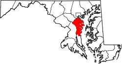
Selby-on-the-Bay (often just called Selby) is a census-designated place (CDP) in Anne Arundel County, Maryland, United States, for the 2000 census, at which time its population was 3,674. It was added to the Mayo CDP for the 2010 census.
Selby-on-the-Bay is located at 38°54′27″N76°31′10″W / 38.90750°N 76.51944°W (38.907513, −76.519476). [1]
According to the United States Census Bureau, the CDP had a total area of 4.7 square miles (12 km2), of which 3.2 square miles (8.3 km2) is land and 1.5 square miles (3.9 km2) (31.34%) is water.
As of the census [2] of 2000, there were 3,674 people, 1,398 households, and 1,034 families residing in the CDP. The population density was 1,139.5 inhabitants per square mile (440.0/km2). There were 1,480 housing units at an average density of 459.0 per square mile (177.2/km2). The racial makeup of the CDP was 96.27% White, 1.22% African American, 0.16% Native American, 0.44% Asian, 0.27% from other races, and 1.63% from two or more races. Hispanic or Latino of any race were 1.22% of the population.
There were 1,398 households, out of which 34.9% had children under the age of 18 living with them, 61.7% were married couples living together, 8.8% had a female householder with no husband present, and 26.0% were non-families. 19.8% of all households were made up of individuals, and 6.6% had someone living alone who was 65 years of age or older. The average household size was 2.63 and the average family size was 3.02.
In the CDP, the population was spread out, with 25.3% under the age of 18, 6.0% from 18 to 24, 33.1% from 25 to 44, 24.9% from 45 to 64, and 10.8% who were 65 years of age or older. The median age was 38 years. For every 100 females, there were 101.0 males. For every 100 females age 18 and over, there were 100.0 males.
The median income for a household in the CDP was $66,477, and the median income for a family was $72,174. Males had a median income of $45,368 versus $35,114 for females. The per capita income for the CDP was $29,356. About 1.9% of families and 2.6% of the population were below the poverty line, including 1.0% of those under age 18 and 8.2% of those age 65 or over.
Oroville East or Kelly Ridge is a census-designated place (CDP) in Butte County, California, United States. The population was 8,280 at the 2010 census, down from 8,680 at the 2000 census. Most citizens are dependent on the commerce of Oroville, and the vast majority of high school students in Kelly Ridge attend Las Plumas High School. The community of Kelly Ridge sits at Lake Oroville and offers direct access to boating, camping, fishing and a variety of water sports.
Bayview-Montalvin is a former census-designated place (CDP) in Contra Costa County, California, United States. The population was 5,004 at the 2000 census.
Empire is a census-designated place (CDP) in Stanislaus County, California, United States. The population was 4,189 at the 2010 census, up from 3,903 at the 2000 census. It is part of the Modesto Metropolitan Statistical Area. Influenced by the Mexican culture, Empire is agriculturally active, and is home to the new Empire Community Park.
Olga is an unincorporated community and census-designated place (CDP) in Lee County, Florida, United States. The population was 2,270 at the 2020 census, up from 1,952 at the 2010 census. It is part of the Cape Coral-Fort Myers, Florida Metropolitan Statistical Area.
Nassau Village-Ratliff is a census-designated place (CDP) in Nassau County, Florida, United States. The population was 5,561 at the 2020 census, up from 5,337 at the 2010 census. It is part of the Jacksonville, Florida Metropolitan Statistical Area.
South Highpoint is a census-designated place (CDP) in Pinellas County, Florida, United States. The population was 5,195 at the 2010 census.
Hawaiian Beaches is a census-designated place (CDP) in Hawaiʻi County, Hawaiʻi, United States located in the District of Puna. The population was 4,280 at the 2010 census, up from 3,709 at the 2000 census.
Hillsmere Shores was a census-designated place (CDP) in Anne Arundel County, Maryland, United States. It is a suburb of Annapolis. The population was 2,977 at the 2000 census. It was included in the Annapolis Neck CDP at the 2010 census. Built in phases, beginning in 1960, the community has been home to The Key School, a non-sectarian private school, since the 1960s.
Mayo is a census-designated place (CDP) in Anne Arundel County, Maryland, United States. The population was 8,298 in the 2010 census. The Mayo CDP of 2010 includes all of the area that used to be counted as the Selby-on-the-Bay CDP. The beach in Mayo used to be a popular weekend resort.
Overlea is an unincorporated community and census-designated place in Baltimore County, Maryland, United States. The population was 12,275 at the 2010 census. Students attend Overlea High School. Area roads include Belair Road and Kenwood Avenue.
Algonquin is a census-designated place (CDP) in Dorchester County, Maryland, United States. The population was 1,241 at the 2010 census. The community was named for the Algonquin people, one of the Native American tribes in the East.
Chester is a census-designated place on Kent Island in Queen Anne's County, Maryland, United States. The population was 3,723 at the 2000 census.
Kent Narrows is a census-designated place and town in Queen Anne's County, Maryland, United States. As of the 2020 census, the town had a population of 612.
Crown Heights is a hamlet and census-designated place (CDP) in Dutchess County, New York, United States. The population was 2,840 at the 2010 census. It is part of the Poughkeepsie–Newburgh–Middletown, NY Metropolitan Statistical Area as well as the larger New York–Newark–Bridgeport, NY-NJ-CT-PA Combined Statistical Area.
Perry Heights is a census-designated place in Stark County, Ohio, United States. The population was 8,391 at the 2020 census. It is part of the Canton–Massillon metropolitan area.
Branchdale is a census-designated place (CDP) in Schuylkill County, Pennsylvania, United States. The population was 436 at the 2000 census.
Donaldson is a census-designated place (CDP) in Frailey Township, Schuylkill County, Pennsylvania, United States. The population was 325 at the 2000 census.
Lake Wynonah is a census-designated place (CDP) in Schuylkill County, Pennsylvania, United States. The population was 1,961 at the 2000 census, and 2,640 at the 2010 census. Lake Wynonah is a gated community with two lakes, Fawn Lake and Lake Wynonah, and as of July 2008, there are over 1200 homes and 1500 members. It is in South Manheim and Wayne Townships.
Springetts Manor-Yorklyn was a census-designated place (CDP) in York County, Pennsylvania, United States. The population was 4,156 at the 2000 census. The area was delineated as the Yorklyn CDP for the 2010 census.
Clearwater is a census-designated place (CDP) in Aiken County, South Carolina. It lies near North Augusta, South Carolina, and is part of the Augusta, Georgia metropolitan area. Clearwater is located in historic Horse Creek Valley. The population was 4,370 at the time of the 2010 census.