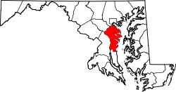
Harundale, Maryland | |
---|---|
Coordinates: 39°09′10″N76°36′53″W / 39.15278°N 76.61472°W | |
Country | United States |
State | Maryland |
County | Anne Arundel |
Time zone | UTC-5 (Eastern (EST)) |
• Summer (DST) | UTC-4 (EDT) |
Harundale (pronounced HAIR-un-DALE) is an unincorporated community in Anne Arundel County, Maryland, United States. [1] In 1947, the Byrne Organization made news when it set up a prefabrication shop on the 300-acre site and churned out parts for all 1,200 homes at once. The houses featured welded steel frames which formed the basis of a structure using other materials. Outside walls were a choice of brick, shingle, or aluminum siding over redwood. Inside walls were plaster.
The houses were constructed in two different styles with three or four rooms on a concrete slab, which sold for $6,900. The community was one of largest prefabricated developments in America. Their construction marked the start of phenomenal post-World War II suburbanization of previously rural Anne Arundel County. Most homes were three-bedroom and were front facing the street. A very few were side facing the street and a small number were two-bedroom units. The Governor Ritchie Highway split the community into East and West sections. The West section consisted of primarily rental units, whereas the East section homes were owned. Heating was by infloor radiant heat. The community had its own artesian well water plant. It shared an elementary school with the community of Glen Gardens in Glen Bernie and was therefore called “Glen”dale”. Community street names were all of British derivation. They ran alphabetically from North to South on both the East and West sides but were different on each side.
The needs of the new community's more than 5,000 people were first served by a strip shopping center. Harundale Mall, reportedly the first enclosed shopping mall east of the Mississippi River, was opened in 1958.
James Wilson Rouse was an American businessman and founder of The Rouse Company. Rouse was a pioneering American real estate developer, urban planner, civic activist, and later, free enterprise-based philanthropist. He received the Presidential Medal of Freedom, the highest civilian award, for his lifetime achievements.
Anne Arundel County, also notated as AA or A.A. County, is located in the U.S. state of Maryland. As of the 2020 United States census, its population was 588,261, an increase of just under 10% since 2010. Its county seat is Annapolis, which is also the capital of the state. The county is named for Anne Arundell, Lady Baltimore, a member of the ancient family of Arundells in Cornwall, England, and the wife of Cecilius Calvert, 2nd Baron Baltimore (1605–1675), founder and first lord proprietor of the colony Province of Maryland.
Annapolis is the capital city of the U.S. state of Maryland and the county seat of, and only incorporated city in, Anne Arundel County. Situated on the Chesapeake Bay at the mouth of the Severn River, 25 miles (40 km) south of Baltimore and about 30 miles (50 km) east of Washington, D.C., Annapolis forms part of the Baltimore–Washington metropolitan area. The 2020 census recorded its population as 40,812, an increase of 6.3% since 2010.
Glen Burnie is an unincorporated town and census-designated place (CDP) in Anne Arundel County, Maryland, United States. It is a suburb of Baltimore. The population was 72,891 at the 2020 census.
Dale City is a census-designated place (CDP) in Prince William County, Virginia, United States, located 25 miles south west of Washington, D.C. It is an annex of Woodbridge, Virginia. As of 2020, the total population was 72,088.
The West End is a part of Richmond, Virginia. Definitions of the bounds of the West End vary, it may include only the western part of the city of Richmond or extend as far as western Henrico County. As there is no one municipal organization that represents this specific region, the boundaries are loosely defined as being north of the James River, west of I-195, and south of Broad Street. Historically, the Richmond neighborhoods of the Fan and the Museum District were a part of the West End. A primary conduit through the West End is Interstate 64.
Maryland Route 100 is a major east–west highway connecting U.S. Route 29 in Ellicott City and MD 177 in Pasadena. MD 100 also connects to Interstate 95 (I-95), US 1, the Baltimore–Washington Parkway, and I-97. The highway connects Howard County to the west with Anne Arundel County and the Chesapeake Bay to the east. MD 100 also provides access to the Baltimore–Washington International Airport (BWI) and the Arundel Mills shopping mall.
Maryland Route 2 is the longest state highway in the U.S. state of Maryland. The 79.24-mile (127.52 km) route runs from Solomons Island in Calvert County north to an intersection with U.S. Route 1 /US 40 Truck in Baltimore. The route runs concurrent with MD 4 through much of Calvert County along a four-lane divided highway known as Solomons Island Road, passing through rural areas as well as the communities of Lusby, Port Republic, Prince Frederick, and Huntingtown. In Sunderland, MD 2 splits from MD 4 and continues north as two-lane undivided Solomons Island Road into Anne Arundel County, still passing through rural areas. Upon reaching Annapolis, the route runs concurrent with US 50/US 301 to the north of the city. Between Annapolis and Baltimore, MD 2 runs along the Governor Ritchie Highway, a multilane divided highway that heads through suburban areas, passing through Arnold, Severna Park, Pasadena, Glen Burnie, and Brooklyn Park. In Baltimore, the route heads north on city streets and passes through the downtown area of the city.
Arundel Mills is a shopping mall located in unincorporated Anne Arundel County, Maryland. It is 59.3% owned by Simon Property Group, who manages the mall. With its 1,930,820 sq ft (179,379 m2) GLA, it is the largest mall in the state of Maryland. Developed by The Mills Corporation, the mall is located at the intersection of Maryland Route 100 and the Baltimore-Washington Parkway in northwestern Anne Arundel County. The anchor stores are Cinemark Theatres, Books-A-Million, The Children's Place, TJ Maxx, Burlington, Off Broadway Shoe Warehouse, Sun and Ski Sports, Old Navy, MD Furniture, Bass Pro Shops, Saks Fifth Avenue, Ulta Beauty, Dave & Buster's, Yard House, and Primark.
Hanover is an unincorporated community in the Baltimore/Annapolis area in northwestern Anne Arundel County and eastern Howard County in the U.S. state of Maryland, located south of Baltimore.
Curtis Bay is a residential / commercial / industrial neighborhood in the southern portion of the City of Baltimore, Maryland, United States.
Harundale Mall, in Glen Burnie, Anne Arundel County, Maryland, United States at the intersection of Ritchie Highway and Aquahart Road, was the first enclosed, air-conditioned mall built east of the Mississippi River.
Lafayette Park is an neighborhood located east of Downtown Detroit. It contains a residential area of some 4,900 people and covers 0.07 sq mi.
LocalLink 75 is a bus route operated by the Maryland Transit Administration in Baltimore and its suburbs. The line currently runs from the Patapsco Light Rail Stop to Parkway Center in Anne Arundel County, via BWI Airport and Arundel Mills. Weekend trips and some weekday trips on this line terminate at Arundel Mills. The line operates between BWI Airport and downtown Baltimore during hours when the light rail is not operating.
Maryland Route 178 is a state highway in the U.S. state of Maryland. Known as Generals Highway, the highway runs 8.06 miles (12.97 km) from MD 450 in Parole north to Veterans Highway near Millersville. MD 178 connects Annapolis with Crownsville in central Anne Arundel County. The highway is indirectly named for George Washington, who traveled the highway in 1783 on his way to Annapolis to resign his commission in the Continental Army at the conclusion of the American Revolutionary War. MD 178 was planned as early as 1910 as part of a western route between Baltimore and Annapolis. However, most of the highway south of MD 3 was not built until the early 1930s. The portion south of MD 3 served as a primary segment in the western corridor connecting Baltimore–Annapolis, until the construction of Interstate 97 (I-97) in the late 1980s.
The community of Forest Park consists of almost 2900 private residential properties, plus apartments, condominiums, commercial properties, city-owned parks and schools, in approximately 1.4 square miles (3.6 km2) of the Northland area of northeast Columbus, Ohio. These properties adjoin a total of 132 distinct streets and courts maintained by the City of Columbus. The community's approximate center is near the intersection of Karl Road and Sandalwood Place in Columbus.
The Norwayne Historic District, or Norwayne Subdivision, is an historic residential subdivision, originally built for World War II defense workers. It is located in Westland, Michigan and roughly bounded by Palmer Road on the north, Wildwood Road on the west, Merriman Road on the east, and Glenwood Road and the Wayne County Lower Rouge Parkway on the south. It was listed on the National Register of Historic Places in 2013.
Hanningtons was a department store located in the English coastal city of Brighton and Hove. Prominently situated in a central position in Brighton, it had an unbroken history of trading for nearly 200 years until its closure in 2001. It was the city's oldest, largest and most diverse department store: its 70 departments offered clothes and household goods of all types, and services ranging from funeral arrangement to carpet-cleaning. "Famous" and "prestigious", it was known locally as the "Harrods of Brighton". It remained in family ownership until the 1960s, and subsequent owners ran the business according to the principles of the Hannington family.
Anne Arundel County Public Library (AACPL) is a public library system located in central Maryland. Established in 1921 as the Annapolis and Anne Arundel County Public Library, Inc, the system now includes 16 locations throughout Anne Arundel County, Maryland.