Snelltown, Maryland

Last updated
Snelltown, Maryland
USA Maryland location map.svg
Red pog.svg
Snelltown
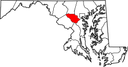
Location in Maryland
Coordinates: 39°07′29″N76°50′14″W / 39.12472°N 76.83722°W / 39.12472; -76.83722
Country Flag of the United States.svg  United States of America
State Flag of Maryland.svg  Maryland
County Flag of Howard County, Maryland.svg Howard
Elevation
168 m (551 ft)
Time zone UTC-5 (EST)
  Summer (DST) UTC-4 (EDT)
ZIP code
20723
Area code 240 and 301

Snelltown is an unincorporated community located near the southern tip of Howard County, Maryland.

Contents

History

Snelltown is a historic African American community settled by emancipated slaves of the Snell family located in North Laurel, Maryland. [1] A small graveyard containing the town's founders remains on a lot. [2]

Today

In the mid 1990s a land development company started to individually buy out the family properties and acquire estates with dozens of heirs without contact information. Each have been subdivided and developed as the Kings Arms subdivision. [3]

See also

Related Research Articles

Howard County, Maryland County in Maryland, US

Howard County is a county in the central part of the U.S. state of Maryland. As of the 2010 census, the population was 287,085. Its county seat is Ellicott City.

Arbutus, Maryland Census-designated place in Maryland, United States

Arbutus is an unincorporated community and a census-designated place in Baltimore County, Maryland, United States. The population was 20,483 at the 2010 census. The census area also contains the communities of Halethorpe and Relay, in which all three names were used during the 1960 census when the area had a population of 22,402. Residents of Arbutus are often called Arbutians or Arbutusians.

Woodlawn, Baltimore County, Maryland Place in Maryland, United States

Woodlawn is an unincorporated community and census-designated place in Baltimore County, Maryland, United States. The population was 37,879 at the 2010 census. It is home to the headquarters of the Social Security Administration (SSA) and the Centers for Medicare and Medicaid Services (CMS). It is bordered by Catonsville on the south, by the Patapsco River and Howard County on the west, by Randallstown and Lochearn to the north, and by the City of Baltimore to the east. Parts of Woodlawn are sometimes informally referred to as Security, Maryland, due to the importance of the SSA's headquarters as well as nearby Security Boulevard and Security Square Mall.

Jessup, Maryland Census-designated place in Maryland

Jessup is an unincorporated community and census-designated place in Howard and Anne Arundel counties, about 10 miles (16 km) southwest of Baltimore, Maryland, United States. The population was 7,137 at the 2010 census.

Clarksville, Maryland Unincorporated community in Maryland

Clarksville is an unincorporated community in Howard County, Maryland; the second highest-earning county in the United States according to the U.S. Census Bureau. The community is named for William Clark, a farmer who owned much of the land on which the community now lies and served as a postal stop that opened on the 4th of July 1851.

Hickory Ridge, Columbia, Maryland Village in Maryland, United States

Hickory Ridge is one of the 10 villages in Columbia, Maryland, United States, located to the west of the Town Center with a 2014 population of 13,000 in 4,659 housing units. The village overlays the former postal community of Elioak. It was first occupied in 1974. Neighborhoods in the village are Hawthorn, Clary's Forest, and Clemens Crossing. The name Hickory Ridge is derived from the 1753 land grant patented by Greenberry Ridgley and Richard Davis named "Hickory Ridge" and the 1749 slave plantation "Hickory Ridge" in nearby Highland that resides on the tract.

West Friendship, Maryland Place in Maryland

West Friendship is a semi-rural unincorporated community in western Howard County, Maryland, United States. West Friendship is located at the junction of Interstate 70 and Maryland Route 32. Frederick Road is a main thoroughfare.

Highland, Maryland Census-designated place in Maryland

Highland is an unincorporated community and census-designated place in Howard County, Maryland, United States. As of the 2010 census it had a population of 1,034. It uses the 20777 zip code.

Ilchester, Maryland Census-designated place in Maryland

Ilchester is an unincorporated community and census-designated place in Howard County, Maryland, United States. The population was 23,476 at the 2010 census. It was named after the village of Ilchester in the English county of Somerset.

Paternal Gift Farm, Maryland community in Howard County, Maryland, United States

Paternal Gift Farm is an historic farm converted to an unincorporated community located in Howard County, Maryland, United States in the Highland, Maryland ZIP code of 20777. The Paternal Gift Farm, Inc is its homeowners' association, and all homeowners are members.

Forest Park, Baltimore Neighborhood of Baltimore in Maryland, United States

Forest Park is a region of Northwest Baltimore, Maryland located west of Reisterstown Road, south of Northern Parkway, and east of the Baltimore City/County line. In Baltimore, the region is referred to by locals simply as "Forest Park" and includes the neighborhoods of Ashburton, Callaway-Garrison, Central Forest Park, Dolfield, Dorchester, East Arlington, Forest Park, Grove Park, Hanlon Longwood, Howard Park, Garwyn Oaks, Purnell, West Arlington, West Forest Park, and Windsor Hills.

Dayton, Maryland Place in Maryland

Dayton is an unincorporated community located in Howard County, Maryland, United States.

Daniels, Maryland Place

Daniels is a ghost town straddling the Patapsco River east of Woodstock and north of Old Ellicott City in Baltimore and Howard counties, Maryland, United States. It is the location of the Daniels Mill, a site listed on the National Register of Historic Places. Daniels is the home town of former Howard County Executive and State Senator James N. Robey. A postal office operated in the community from 1 March 1943 to 31 August 1971.

Hopewell is an unincorporated community in Howard County, Maryland, United States. It lies at an elevation of 361 feet. The name is derived from the Laswells' Hopewell 200 acre original land tract patented on Dec. 6, 1728 for Thomas Davis.

Alpha is an unincorporated community in Howard County, Maryland, United States. A postal office operated from 27 February 1884 to 15 June 1915.

Elioak is an unincorporated community in Howard County, Maryland, United States. It was the home of the "Pushpin Farm", a 200-acre slave plantation purchased in 1724 in the Howard District of Anne Arundel County by Col. Edward Dorsey and which is the site of many prominent Dorsey family graves. The postal community was named after the Elioak plantation built by Owen Dorsey, Judge of the Baltimore Orphans' Court. A postal office operated in the community from 12 June 1893 to 15 September 1922. Local farm orchards were known for prize winning apples and pears. Local families such as the Kahler, Miller, and Worthington claimed Elioak as home while they served in World War I. After the war, the name fell out of use.

Howard County Public Library

Howard County Library System (HCLS), established in 1940, is a public library system located in central Maryland. HCLS delivers equal opportunity in education to students of all ages in Howard County, Maryland.

Ivory, Maryland Place in Maryland

Ivory is an unincorporated community located at the northwest tip of Howard County, Maryland, United States. It is located between modern Glenelg and West Friendship.

Hilton is an unincorporated community located in Howard County in the state of Maryland, United States.

Jonestown is an unincorporated community in Howard County, Maryland, United States.

References

  1. Alice Cornelison; Silas E. Craft Sr.; Lillie Price. History of Blacks In Howard County. p. 286.
  2. "Howard County Cemeteries" . Retrieved 10 January 2015.
  3. "HO-997" (PDF). Retrieved 10 January 2016.

Coordinates: 39°07′30″N76°50′15″W / 39.124911°N 76.837432°W / 39.124911; -76.837432