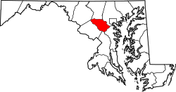
Gary, Maryland

Last updated

Gary is an unincorporated community in Howard County, Maryland, United States. A postal stop operated between February 2, 1892, and June 13, 1918. [1] The town is located at the crossroads of Sharp and Tridelphia Road near modern Woodbine, Maryland. [2]

In 1898, Elbert Henry Gary almost renamed Gary, Indiana to prevent confusion with Gary, Maryland [3]

Related Research Articles

Clarksville, Maryland Unincorporated community in Maryland

Clarksville is an unincorporated community in Howard County, Maryland; the second highest-earning county in the United States according to the U.S. Census Bureau. The community is named for William Clark, a farmer who owned much of the land on which the community now lies and served as a postal stop that opened on the 4th of July 1851.

Oakland Mills, Columbia, Maryland Village in Maryland, United States

Oakland Mills is one of the 10 villages in Columbia, Maryland, United States. It is located immediately east of Town Center, across U.S. Route 29.

Highland, Maryland Census-designated place in Maryland

Highland is an unincorporated community and census-designated place in Howard County, Maryland, United States. As of the 2010 census it had a population of 1,034. It uses the 20777 zip code.

Dayton, Maryland Place in Maryland

Dayton is an unincorporated community located in Howard County, Maryland, United States.

Daniels, Maryland Place

Daniels is a ghost town straddling the Patapsco River east of Woodstock and north of Old Ellicott City in Baltimore and Howard counties, Maryland, United States. It is the location of the Daniels Mill, a site listed on the National Register of Historic Places. Daniels is the home town of former Howard County Executive and State Senator James N. Robey. A postal office operated in the community from 1 March 1943 to 31 August 1971.

Cooksville is an unincorporated community in Howard County, Maryland, United States. As of 2016, the population was 631. The town was founded by Thomas Cook in 1802. The crossroads town was anchored by the Joshua Roberts Tavern, where General Lafayette visited in 1824. The inn was destroyed by fire, rebuilt, and demolished a second time. Thomas Cook exchanged his stake in Cooksville with Thomas Beale Dorsey for the 231-acre Round About Hills slave plantation. A Post Office opened on the 4th of July 1851, the same year Howard County was formed from a portion of Anne Arundel County. Roberts Inn was listed on the National Register of Historic Places in 1973.

Glenwood, Howard County, Maryland

Glenwood is an unincorporated community in Howard County, Maryland, United States. It is located between Baltimore and Washington, D.C., therefore attracting commuters to those employment centers. The community features acres of open space and is districted to Bushy Park Elementary, Glenwood and Folly Quarter Middle, and Glenelg High schools. Union Chapel was listed on the National Register of Historic Places in 1975 and Round About Hills was added in 2008. The population in 2020 was approximately 3,416.

Daisy, Maryland Place in Maryland

Daisy is an unincorporated community located at the northwest tip of Howard County, Maryland, United States.

Atholton is an unincorporated community in Howard County, Maryland, United States. A postal office operated from May 26, 1897, to November 1900 and again from 1903 to July 1917.

Alberton is an unincorporated community in Howard County, Maryland, United States. A postal office operated in the community from 3 February 1854 to 1 March 1943.

Alpha is an unincorporated community in Howard County, Maryland, United States. A postal office operated from 27 February 1884 to 15 June 1915.

Clarkson is an unincorporated community in Howard County, Maryland, United States. A postal office operated in the community from 14 September 1889 to 31 October 1931. Clarkson was the site of strategic simulations by the U.S. Army in 1922 training manuals.

Elioak is an unincorporated community in Howard County, Maryland, United States. It was the home of the "Pushpin Farm", a 200-acre slave plantation purchased in 1724 in the Howard District of Anne Arundel County by Col. Edward Dorsey and which is the site of many prominent Dorsey family graves. The postal community was named after the Elioak plantation built by Owen Dorsey, Judge of the Baltimore Orphans' Court. A postal office operated in the community from 12 June 1893 to 15 September 1922. Local farm orchards were known for prize winning apples and pears. Local families such as the Kahler, Miller, and Worthington claimed Elioak as home while they served in World War I. After the war, the name fell out of use.

Elysville is an unincorporated community in Howard County, Maryland, United States. A postal stop operated between February 22, 1834, and February 3, 1854.

Florence is an unincorporated community in Howard County, Maryland, United States. A post office operated in Florence between June 17, 1868, and March 31, 1906. Governor Edwin Warfield taught in the neighborhood one room schoolhouse.

High Ridge is an unincorporated community in Howard County, Maryland, United States. A postal stop operated from May 25, 1892, through December 1895 and until May 1899 as "Highridge".

Howard County Public Library

Howard County Library System (HCLS), established in 1940, is a public library system located in central Maryland. HCLS delivers equal opportunity in education to students of all ages in Howard County, Maryland.

Ivory, Maryland Place in Maryland

Ivory is an unincorporated community located at the northwest tip of Howard County, Maryland, United States. It is located between modern Glenelg and West Friendship.

Inwood is an unincorporated community in Howard County, Maryland, United States. The crossroads settlement was settled around Woodlawn, home of Dr. Edwin Warfield, which has been removed for the Gary J. Arthur Community Center and Cooksville Library. The town once featured a general store, blacksmith shop and residential homes. The neighborhood postal service is now consolidated around Cooksville. Inwood is a very small historic town located between Cooksville and Glenwood.

Guilford Road

Guilford Road is a historic road north of Savage, Maryland that traverses Anne Arundel and Howard Counties in an area that was first settled by English colonists in the mid-1600s. Today's Guilford road is a series of disconnected segments bisected multiple times by the construction of Maryland Route 32.

References

  1. "Checklist of Maryland Post Offices" (PDF). Smithsonian National Postal Museum. 12 July 2007. Archived from the original (PDF) on 18 May 2014. Retrieved 17 May 2014.
  2. Howard's Roads to the Past. Howard County Sesquicentennial Celebration Committee, 2001. 2001. p. 18.
  3. Fred D. Cavinder. More Amazing Tales from Indiana. p. 89.

39°15′36″N77°00′32″W / 39.2601054°N 77.0088668°W / 39.2601054; -77.0088668