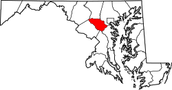
Town Center, Columbia, Maryland

Last updated
Town Center
Downtown Columbia
Village
Columbia Town Center
Metropolitan Columbia.jpg
Intersection of Broken Land Parkway and Town Center Avenue
DowntownColumbia.png
Downtown Columbia featuring the Town Center and the Villages of Wilde Lake and Harper's Choice.
Country United States
State Maryland
City Columbia
Established1974 [1]
Founded by James Rouse
Named for Columbia's city center
Website www.columbiatowncenter.org

Town Center is one of the ten villages in Columbia, Maryland, United States, first occupied in 1974. [2] The Town Center is a non-contiguous, diverse area, and the most urban-like, ranging from multi-level high density apartments, homes and office buildings to single family homes. [3]

Contents

The six residential neighborhoods in the village include Amesbury Hill, Banneker, Creighton's Run, Lakefront, Vantage Point, and Warfield Triangle. [3]

Names and history

The town center is constructed on the grounds of Oakland Manor, a former slave plantation. Construction started in 1966, with sidewalks linking major amenities added in 1984. [4]

Original attractions

Columbia Exhibit Center is the facility built to market the project to visitors. The building was designed by the firm of Gehry, Walsh and O'Malley. The site hosted 215,000 in its first year. [5]

Vantage Point is in the tract patented by John Dorsey as Dorsey's Adventure in 1688. The name comes from a poem by Robert Frost, and the street names are from Frost and William Cullen Bryant. [3] It contains a house, Historic Oakland, built in 1811 by Charles Sterrett Ridgely. The Town Center village offices are in Historic Oakland. Oliver's Carriage House, a stable built by Robert Oliver, is on the grounds and is currently home to Kittamaqundi Community, a non-denominational religious congregation. [3]

Amesbury Hill was originally set aside as an estate area for Rouse Company executives and was part of the Mercer Tract. Mercer Tract was owned by the parents of Lucy Mercer, the personal secretary to Franklin Delano Roosevelt. [3] Creighton's Run, developed in 1979, was named for the boss of the construction company. [3]

Banneker was first occupied in 1992, named for Banneker Road. The road was named for Benjamin Banneker. [3] [6]

Vantage House is a 13-story Life Care Retirement Community built in place of an 18th-century historical residence and opened in October 1990. [3] [7] [8]

Redevelopment efforts

The Town Center is also referred to as "Downtown Columbia" due to its central location within Columbia, as well as the new urbanism-style redevelopment project under construction since 2010. [9] The new development also created four new distinct neighborhood areas:

Services and entertainment

The Mall in Columbia PF Changs.jpg
The Mall in Columbia

The lakefront of 27-acre (110,000 m2) Lake Kittamaqundi with the iconic People Tree sculpture, is the heart of the village, and the whole town. The lake's name is a Piscataway Indian word described by the Columbia Association as "meeting place", or "Place of the Old Great Beaver" by Native American research. [10] [11] In the summer, the Columbia Association offers live entertainment and/or movies daily at the Kittamaqundi lakefront. [12] [13]

The Mall in Columbia, a large shopping and entertainment mall, is located within Town Center. [14]

The Central Library of Howard County opened in 1981, and is located at the intersection of Little Patuxent Parkway and South Entrance Road.

Public transit

Columbia Town Center is a major hub for the Regional Transportation Agency of Central Maryland bus service. The central station is located at the Columbia Mall, directly west of the Main Entrance, Restaurant Row, and Sears. MTA and Metrobus provide service to this location as well.

In 2016, Howard County launched its first bike share pilot program for Columbia. The bike share will span across the Town Center from Howard County General Hospital at Cedar Lane to Blandair Park in Oakland Mills Village. [15]

Related Research Articles

<span class="mw-page-title-main">Columbia, Maryland</span> Planned community

Columbia is a census-designated place in Howard County, Maryland, United States. It is a planned community consisting of 10 self-contained villages. The census-designated place had a population of 104,681 at the 2020 census, making it the second most populous community in Maryland after Baltimore. Columbia, located between Baltimore and Washington, D.C., is officially part of the Baltimore metropolitan area.

James Wilson Rouse was an American businessman and founder of The Rouse Company. Rouse was a pioneering American real estate developer, urban planner, civic activist, and later, free enterprise-based philanthropist. He received the Presidential Medal of Freedom, the highest civilian award, for his lifetime achievements.

<span class="mw-page-title-main">Wilde Lake, Columbia, Maryland</span> Village in Maryland, United States

Wilde Lake is a man-made drainage reservoir dug in 1966 and also named after the surrounding "village" of neighborhoods located in Columbia, Maryland, just north and west of Columbia Town Center. The village was the first part of Columbia's "New Town" to be built in the late 1960s, James W. Rouse and Frazar B. Wilde formally opened the neighborhood on June 21, 1967. The lake and village are named for Frazar B. Wilde, a past chairman of the board of Connecticut General Life Insurance Company and former employer of James Rouse. In 1963, the company agreed to fund the secret land purchases and, in return, acquired an equity participation. This arrangement was subsequently formalized by the creation of The Howard Research and Development Corporation, the joint venture established to develop Columbia.

<span class="mw-page-title-main">The Rouse Company</span> American real estate development company

The Rouse Company, founded by Hunter Moss and James W. Rouse in 1939, was a publicly held shopping mall and community developer from 1956 until 2004, when General Growth Properties (GGP) purchased the company.

<span class="mw-page-title-main">River Hill, Columbia, Maryland</span> Village in Maryland, United States

River Hill is the last and westernmost village to be developed in the town of Columbia, Maryland, United States, though some residents maintain addresses in Clarksville. The village is home to 6,520 residents in 2,096 housing units in 2014. The area was used as a game preserve by James Rouse to entertain clients and personal hunting during the buildout of the Columbia project. In 1976, County Executive Edward L. Cochran selected the 784-acre parcel owned by Howard Research and Development for an alternate location for a county landfill; a task force selected Alpha Ridge Landfill instead. Residential construction started in 1990. It is bounded by Maryland Route 108 and Maryland Route 32, and is centered on Trotter Road. The village is divided into two neighborhoods: Pheasant Ridge and Pointers Run, with about 6,500 residents.

<span class="mw-page-title-main">Kings Contrivance, Columbia, Maryland</span> Village in Maryland, United States

Kings Contrivance is a village in the planned community of Columbia, Maryland, United States and is home to approximately 11,000 residents. It is Columbia's southernmost village, and was the eighth of Columbia's ten villages to be developed. Kings Contrivance consists of the neighborhoods of Macgill's Common, Huntington and Dickinson, and includes single-family homes, townhouses, apartments and a Village Center.

<span class="mw-page-title-main">Oakland Mills, Columbia, Maryland</span> Village in Maryland, United States

Oakland Mills is one of the 10 villages in Columbia, Maryland, United States. It is located immediately east of Town Center, across U.S. Route 29.

<span class="mw-page-title-main">Hickory Ridge, Columbia, Maryland</span> Village in Maryland, United States

Hickory Ridge is one of the 10 villages in Columbia, Maryland, United States, located to the west of the Town Center with a 2014 population of 13,000 in 4,659 housing units. The village overlays the former postal community of Elioak. It was first occupied in 1974. Neighborhoods in the village are Hawthorn, Clary's Forest, and Clemens Crossing. The name Hickory Ridge is derived from the 1749 estate "Hickory Ridge" in nearby Highland, which later became the family home of the nephew of hospital and university founder Johns Hopkins.

<span class="mw-page-title-main">Long Reach, Columbia, Maryland</span> Village in Maryland, United States

Long Reach, one of ten villages composing Columbia, Maryland, United States, is found in the northeast part of Columbia along Maryland Route 108. Started in 1971, it is one of the oldest villages, and comprises four neighborhoods: Jeffers Hill, Kendall Ridge, Locust Park, and Phelps Luck. The village, with an approximate population of 15,600, is governed by five elected village board members through "Long Reach Community Association, Inc." The Village Office is located in Stonehouse, the community center, which opened in 1974.

<span class="mw-page-title-main">Pleasant Plains (Washington, D.C.)</span> Neighborhood of Washington, D.C.

Pleasant Plains is a neighborhood in central Washington, D.C. largely occupied by Howard University. For this reason it is also sometimes referred to as Howard Town or, less frequently, Howard Village.

<span class="mw-page-title-main">Dorsey's Search, Columbia, Maryland</span> Village in Maryland, United States

Dorsey's Search is a parcel of land patented by John Dorsey of Hockley-in-the-hole (1645–1714) in Baltimore County. The 479-acre (194 ha) property adjacent to the north branch of the Patuxent river was surveyed by Richard Beard in December 1684, and granted to Dorsey in March 1696. The property lying between "Long Reach" and "Elk Ridge" was resurveyed in March 1723 to include 750 acres (300 ha). After several generations of inheritance, a series of legal disputes were held over the land by Rezin Hammond and Richard Ridgley in 1820. In 1827 the property exchanged hands to Robert Oliver, builder of Oakland Mill, who combined it with multiple properties totaling 2,300 acres (930 ha). George Gaither acquired the property in 1838. John Dorsey's grandson, "Patuxent" John Dorsey of "Dorsey's Search" built Dorsey Hall at the site.

<span class="mw-page-title-main">Owen Brown, Columbia, Maryland</span> Village in Maryland, United States

Owen Brown is one of the ten villages in Columbia, Maryland, United States, established in 1972. Neighborhoods in the village include Dasher Green, Elkhorn and Hopewell. Owen Brown lies south and east of the town center.

<span class="mw-page-title-main">Harper's Choice, Columbia, Maryland</span> Village in Maryland, United States

Harper's Choice is one of the ten villages that comprise Columbia, Maryland, United States. It lies in the northwest part of Columbia and consists of the neighborhoods of Longfellow, Swansfield, and Hobbit's Glen and had a December 1998 population of 8,695.

<span class="mw-page-title-main">Lake Elkhorn</span> Reservoir in Columbia, Maryland, USA

Lake Elkhorn is a 37-acre (150,000 m2) reservoir located in the Owen Brown area of Columbia, Maryland. It is Columbia's third and largest lake. Its main features are a small dam and a park with a picnic pavilion and a two-mile (3 km) walking path around the lake. The path was built in 1982 and is surrounded by a park and townhouses. The lake, which was built in 1974, is named for the Elkhorn branch of the Little Patuxent River. In 1969, Spiro Agnew proclaimed the arrival of the first Columbia based scientific firm, Hittman Associates that relocated for favorable lease rates from Howard Research and Development. Hittman in turn was contracted by the EPA using Wilde Lake as an example to recommend reuse of storm water runoff from all of Columbia's reservoir systems for residential drinking water to save on development costs. The lake is overseen by the Columbia Association. The lake's location behind many townhouses, though considered an attractive feature to homeowners, has raised concern following the drowning of a small child on September 2, 2005. A drowning also occurred in 1980, and a maintenance worker drowned in March 1991. A movement was started soon after to erect a fence around playground next to the lake, but the community was split over this need, and a consultant concluded a fence was not necessary. The lake remained free of fatal incidents until October 8, 2013, when a body of a 32-year-old was found dead in the lake.

<span class="mw-page-title-main">Lake Kittamaqundi</span> Reservoir in Columbia, Maryland, United States

Lake Kittamaqundi is a man made 27-acre (110,000 m2) reservoir located in Columbia, Maryland in the vicinity of the Mall in Columbia as well as Merriweather Post Pavilion. It is also adjacent to offices and visible from US-29.

<span class="mw-page-title-main">Oakland Manor</span> Historic house in Maryland, United States

Oakland or Oakland Manor is a Federal style stone manor house commissioned in 1810 by Charles Sterrett Ridgely in the Howard District of Anne Arundel County Maryland. The lands that became Oakland Manor were patented by John Dorsey as "Dorsey's Adventure" in 1688 which was willed to his grandson Edward Dorsey. In 1785, Luther Martin purchased properties named "Dorsey's Adventure", "Dorsey's Inheritance", "Good for Little", "Chew's Vineyard", and "Adam the First" to make the 2300 acre "Luther Martin's Elkridge Farm".

Arlington is a historic slave plantation located in Columbia, Howard County, Maryland, now part of the Fairway Hills Golf Course.

Located Cooksville in Howard County, Maryland, United States, Poverty Discovered, "Summer Hill Farm"

Morton Hoppenfeld was an American urban planner who worked for the Rouse Company on the development of the Village of Cross Keys in Columbia, Maryland, and Darling Harbour in Sydney, Australia.

<span class="mw-page-title-main">Howard County Center of African American Culture</span> Historic site

The Howard County Center of African American Culture is located in Columbia, Maryland. The museum host exhibitions and event about African American history.

References

  1. "History". Columbia Town Center. Retrieved February 11, 2022.
  2. "Map" Archived 2009-08-05 at the Wayback Machine , columbiavillages.org, accessed May 30, 2009
  3. 1 2 3 4 5 6 7 8 9 "Town Center", towncenter.columbiavillages.org, accessed May 30, 2009
  4. Keith F Girard (October 20, 1984). "Columbia Developer Offers $100,000 for Sidewalks: 3,000 Feet of Paths Would Link Buildings". The Washington Post.
  5. Joseph Rocco Mitchell, David L. Stebenne. New City Upon a Hill. p. 81.
  6. 1 2 "How Streets were Named and other Interesting Facts", columbiamaryland.com, accessed May 30, 2009
  7. Joseph Rocco Mitchel, David L Stebenne. New City Upon a Hill. p. 145.
  8. "HO-551 Eye of the Camel" (PDF). Retrieved 4 January 2015.
  9. "Downtown Columbia Plan" (PDF). Columbia Association. Howard County Maryland Department of Planning and Zoning. February 1, 2010. Retrieved March 14, 2022.
  10. "Lake Kittamaqundi", columbiamaryland.com, accessed May 30, 2009
  11. Handbook of American Indians North of Mexico, Volume II. p. 708.
  12. Cooper, Rachel."Columbia's Lakefront Summer Festival Movies", dc.about.com, accessed May 30, 2009
  13. "Columbia Lakefront Festival", lakefrontfestival.com, accessed May 30, 2009
  14. "The Mall", themallincolumbia.com, accessed May 30, 2009
  15. Waseem, Fatimah (April 22, 2016). "Pilot bike share wheels its way to Downtown Columbia". The Baltimore Sun. Retrieved February 19, 2022.

39°13′0″N76°51′18″W / 39.21667°N 76.85500°W / 39.21667; -76.85500