A ZIP Code is a postal code used by the United States Postal Service (USPS). Introduced in 1963, the basic format consists of five digits. In 1983, an extended ZIP+4 code was introduced; it includes the five digits of the ZIP Code, followed by a hyphen and four digits that designate a more specific location.

Bowie is a city in Prince George's County, Maryland, United States. The population was 54,727 at the 2010 U.S. Census. Bowie has grown from a small railroad stop to the largest municipality in Prince George's County, and the fifth most populous city and third largest city by area in the U.S. state of Maryland. In 2014 CNN Money ranked Bowie 28th in its Best Places to Live in America list.

Landover is an unincorporated community and census-designated place in Prince George's County, Maryland, United States. Landover is located within very close proximity to Washington D.C. although it does not directly border Washington D.C. unlike its neighboring communities, Chapel Oaks and Fairmount Heights, which directly border Washington D.C. and go all the way up to/ touch the Maryland/ D.C. line. As of the 2010 census it had a population of 23,078.

Lanham is an unincorporated community and census-designated place in Prince George's County, Maryland. As of the 2010 United States Census it had a population of 10,157. The New Carrollton station as well as an Amtrak station are across the Capital Beltway in New Carrollton, Maryland. Doctors Community Hospital is located in Lanham.

Clarksville is an unincorporated community in Howard County, Maryland; the second highest-earning county in the United States according to the U.S. Census Bureau. The community is named for William Clark, a farmer who owned much of the land on which the community now lies and served as a postal stop that opened on the 4th of July 1851.

John Andrew Jackson Creswell was an American politician and abolitionist from Maryland, who served as United States Representative, United States Senator, and as Postmaster General of the United States appointed by President Ulysses S. Grant. Creswell is considered to be one of the ablest, if not the best, Postmaster General in United States history. Creswell modernized the U.S. Postal system to adapt to an expanding demand for increased postal routes throughout the Western states and remain competitive worldwide. Creswell also integrated the U.S. Postal system appointing both male and female African American postmasters throughout the United States, giving them significant positions of federal authority. Sweeping and constructive reforms of the U.S. Postal system took place during Creswell's tenure, including securing fair competition among Star Route carriages, and the abolishment of the franking system. Creswell developed a codified classification system of offenses against postal laws. Creswell streamlined and reduced postal costs making the United States Postal System run efficiently creating a fair pricing system domestically, and reducing international mailing prices. Creswell developed and implemented the United States first penny postcard.

Dorsey, Maryland, is an unincorporated community along the border of eastern Howard County and northwestern Anne Arundel County in Maryland, United States. It is located south of Elkridge, north of Savage, and close to Baltimore-Washington International Airport (BWI). It is in the southern part of the Baltimore metropolitan area.

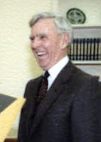
William F. Bolger was the 65th Postmaster General of the United States from March 15, 1978 to January 1, 1985. He was born in Waterbury, Connecticut. Bolger served in the United States Army Air Forces during World War II. He took courses in accounting at George Washington University. He was the second career postal employee to attain the rank of Postmaster General. After leaving the Postal Service, he served as president of the Air Transport Association of America.

Daniels is a ghost town straddling the Patapsco River east of Woodstock and north of Old Ellicott City in [[Baltimore County, Maryland|Baltimore] and Howard counties, Maryland, United States. It is the location of the Daniels Mill, a site listed on the National Register of Historic Places. Daniels is the home town of former Howard County Executive and State Senator James N. Robey. A postal office operated in the community from 1 March 1943 to 31 August 1971.
Ednor is an unincorporated community in Montgomery County, Maryland, United States.
Atholton is an unincorporated community in Howard County, Maryland, United States. A postal office operated from May 26, 1897 to November 1900 and again from 1903 to July 1917.
Botterill is an unincorporated community in Howard County, Maryland, United States. A postal office operated from 15 July 1891 to 31 March 1896.
Clarkson is an unincorporated community in Howard County, Maryland, United States. A postal office operated in the community from 14 September 1889 to 31 October 1931. Clarkson was the site of strategic simulations by the U.S. Army in 1922 training manuals.
Elioak is an unincorporated community in Howard County, Maryland, United States. It was the home of the "Pushpin Farm", a 200-acre slave plantation purchased in 1724 in the Howard District of Anne Arundel County by Col. Edward Dorsey and which is the site of many prominent Dorsey family graves. The postal community was named after the Elioak plantation built by Owen Dorsey, Judge of the Baltimore Orphans' Court. A postal office operated in the community from 12 June 1893 to 15 September 1922. Local farm orchards were known for prize winning apples and pears. Local families such as the Kahler, Miller, and Worthington claimed Elioak as home while they served in World War I. After the war, the name fell out of use.
Elysville is an unincorporated community in Howard County, Maryland, United States. A postal stop operated between February 22, 1834, and February 3, 1854.
Florence is an unincorporated community in Howard County, Maryland, United States. A postal stop operated in Florence between June 17, 1868 and March 31, 1906. Governor Edwin Warfield taught in the neighborhood one room schoolhouse.
Gary is an unincorporated community in Howard County, Maryland, United States. A postal stop operated between February 2, 1892 and June 13, 1918. The town is located at the crossroads of Sharp and Tridelphia Road near modern Woodbine, Maryland.
Gordon is an unincorporated community in Howard County, Maryland, United States. A postal stop operated at this location from December 21, 1893 to April 15, 1895.
High Ridge is an unincorporated community in Howard County, Maryland, United States. A postal stop operated from May 25, 1892, through December 1895 and until May 1899 as "Highridge".

TB is an unincorporated community in Prince George's County, in the U.S. state of Maryland, near the intersection of highways MD 5 and US 301.


