Glenwood, Howard County, Maryland

Last updated

Union Chapel Union Chapel Glenwood MD Jan 11.JPG
Union Chapel

Glenwood is an unincorporated community in Howard County, Maryland, United States. [1] It is located between Baltimore and Washington, D.C., therefore attracting commuters to those employment centers. The community features acres of open space and is districted to Bushy Park Elementary, Glenwood and Folly Quarter Middle, and Glenelg High schools. Union Chapel was listed on the National Register of Historic Places in 1975 and Round About Hills was added in 2008. [2] The population in 2020 was approximately 3,416. [3]

Contents

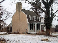
The area was settled in the early 18th century by the Ridgley and Warfield families forming large tobacco plantations: "Bushy Park", "Longwood", "Ellerslie" and others. In 1822, James B. Matthews purchased a 200-acre farm and stone home from Caleb Dorsey. He opened a post office on July 30, 1841, giving the area the name "Matthews Store" in the Howard District of Anne Arundel County, which operated until January 1874. [4] [5] The Union Chapel was built in 1833. The Howard District of Anne Arundel county became the newly formed Howard County. Despite southern sympathies, the Civil War ended slave labor on the local farms. The Phrenakosmian Hall was opened, renamed to the Howard Institute serving 25 children. On January 13, 1874, the Glenwood postal stop opened. [4] It was renamed to Glenwood by James Matthew's son, Professor Lycurgus Matthews. [6] [7]

In 1995, Glenwood land developer Randolph Ayersman made national news after police found that profits from drug sales were being used to buy and develop properties under A&A contracting in Glenwood. [8] [9]

Government

Government services are provided by Howard County. The Howard County Fire and Rescue Archived October 13, 2020, at the Wayback Machine Station 13 - Glenwood [10] is located adjacent to Western Regional Park Archived October 17, 2020, at the Wayback Machine .

Glenwood is home to the Gary J. Arthur community center Archived October 16, 2020, at the Wayback Machine and the Glenwood branch Archived November 11, 2023, at the Wayback Machine of the Howard County library Archived October 24, 2020, at the Wayback Machine .

The United States Postal Service provides postal mail service from the Glenwood Post Office. [11]

Economy

Glenwood is primarily a residential community consisting of 1,088 households [12] which are primarily single-family homes on larger lots. The majority of retail and commerce for Glenwood is situated along the Maryland Route 97 corridor that runs north–south through the community.

The private Cattail Creek Country Club Archived September 15, 2020, at the Wayback Machine is located in Glenwood, and features an 18-hole, par 72 golf course designed by Willard Byrd, [13] and 7 clay tennis courts.

The average household income in Glenwood is $305,598, making it one of the wealthiest communities in the United States. [14]

Education

Residents of Glenwood fall within the Howard County Public School System, and are served by Bushy Park Elementary School Archived October 25, 2020, at the Wayback Machine , Glenwood Middle School, and Glenelg High School.

See also

Related Research Articles

<span class="mw-page-title-main">Howard County, Maryland</span> County in Maryland, United States

Howard County is located in the U.S. state of Maryland. As of the 2020 census, the population was 334,529. Since there are no incorporated municipalities, there is no incorporated county seat either. Therefore, its county seat is the unincorporated community of Ellicott City. Howard County is included in the Baltimore-Columbia-Towson, MD Metropolitan Statistical Area, which is part of the larger Washington–Baltimore combined statistical area.

<span class="mw-page-title-main">Anne Arundel County, Maryland</span> County in Maryland, United States

Anne Arundel County, also notated as AA or A.A. County, is located in the U.S. state of Maryland. As of the 2020 United States census, its population was 588,261, an increase of just under 10% since 2010. Its county seat is Annapolis, which is also the capital of the state. The county is named for Anne Arundell, Lady Baltimore, a member of the ancient family of Arundells in Cornwall, England, and the wife of Cecilius Calvert, 2nd Baron Baltimore (1605–1675), founder and first lord proprietor of the colony Province of Maryland.

<span class="mw-page-title-main">Elkridge, Maryland</span> Census-designated place in Maryland, United States of America

Elkridge is an unincorporated community and census-designated place (CDP) in Howard County, Maryland, United States. The population was 15,593 at the 2010 census. Founded early in the 18th century, Elkridge is adjacent to two other counties, Anne Arundel and Baltimore.

<span class="mw-page-title-main">Laurel, Maryland</span> City in Maryland, United States

Laurel is a city in Maryland, United States, located midway between Washington, D.C. and Baltimore on the banks of the Patuxent River. While the city limits are entirely in northern Prince George's County, outlying developments extend into Anne Arundel, Montgomery and Howard counties. Founded as a mill town in the early 19th century, Laurel expanded local industry and was later able to become an early commuter town for Washington and Baltimore workers following the arrival of the Baltimore and Ohio Railroad in 1835. Largely residential today, the city maintains a historic district centered on its Main Street, highlighting its industrial past.

<span class="mw-page-title-main">Clarksville, Maryland</span> Unincorporated community in Maryland

Clarksville is an unincorporated community in Howard County, Maryland; the second highest-earning county in the United States according to the U.S. Census Bureau. The community is named for William Clark, a farmer who owned much of the land on which the community now lies and served as a postal stop that opened on the 4th of July 1851.

Dorsey, Maryland, is an unincorporated community along the border of eastern Howard County and northwestern Anne Arundel County in Maryland, United States. It is located south of Elkridge, north of Savage, and close to Baltimore-Washington International Airport (BWI). It is in the southern part of the Baltimore metropolitan area.

<span class="mw-page-title-main">Hanover, Maryland</span> Unincorporated community in Maryland, United States

Hanover is an unincorporated community in the Baltimore/Annapolis area in northwestern Anne Arundel County and eastern Howard County in the U.S. state of Maryland, located south of Baltimore.

<span class="mw-page-title-main">Glenelg High School</span> Public high school in Glenelg, Maryland, United States

Glenelg High School is a public high school in Glenelg, Maryland, United States. Glenelg HS is located in the western portion of Howard County, Maryland and is part of the Howard County Public School System, which is among the highest-ranked in the nation.

West Friendship is a semi-rural unincorporated community in western Howard County, Maryland, United States. West Friendship is located at the junction of Interstate 70 and Maryland Route 32. Frederick Road is a main thoroughfare.

Glenelg is an unincorporated community in Howard County, Maryland, United States. It is located in the 21737 ZIP Code, and is part of the 410 area code. It is the home town of Glenelg High School.

Dayton is an unincorporated community located in Howard County, Maryland, United States.

Glenwood is a census-designated place (CDP) in Buffalo County, Nebraska, United States. It conforms to the unincorporated area known as Glenwood Park. It is part of the Kearney, Nebraska Micropolitan Statistical Area. The population was 466 at the 2010 census.

Charles Alexander Warfield (1751–1813) was a prominent American in the Howard District of Anne Arundel County Maryland. He was president of the board of regents of the University of Maryland from 1812 to 1813.

The Carr's Mill Landfill is a controversial landfill in Howard County, Maryland in the United States. Its official address is 15900 Carrs Mill Road in Lisbon, Maryland.

Elioak is an unincorporated community in Howard County, Maryland, United States. It was the home of the "Pushpin Farm", a 200-acre slave plantation purchased in 1724 in the Howard District of Anne Arundel County by Col. Edward Dorsey and which is the site of many prominent Dorsey family graves. The postal community was named after the Elioak plantation built by Owen Dorsey, Judge of the Baltimore Orphans' Court. A postal office operated in the community from 12 June 1893 to 15 September 1922. Local farm orchards were known for prize winning apples and pears. Local families such as the Kahler, Miller, and Worthington claimed Elioak as home while they served in World War I. After the war, the name fell out of use.

Ivory is an unincorporated community located at the northwest tip of Howard County, Maryland, United States. It is located between modern Glenelg and West Friendship.

Inwood is an unincorporated community in Howard County, Maryland, United States. The crossroads settlement was settled around Woodlawn, home of Dr. Edwin Warfield, which has been removed for the Gary J. Arthur Community Center and Cooksville Library. The town once featured a general store, blacksmith shop and residential homes. The neighborhood postal service is now consolidated around Cooksville. Inwood is a very small historic town located between Cooksville and Glenwood.

Bushy Park is a historic slave plantation located at Glenwood, Howard County, Maryland, United States. It is located on a 3,940 acre land patent named "Ridgley's Great Park".

Glenwood Middle School is located in the western portion of Howard County, Maryland. It is built on land settled in the early 18th century by the Ridgley and Warfield families forming large slave plantations such as "Bushy Park", "Longwood", "Ellerslie" and others.

<span class="mw-page-title-main">Seth A. Howard</span> American politician

Seth Adam Howard is an American politician who has served as a member of the Maryland House of Delegates from District 30B since 2015.

References

  1. "Geographic Names Information System". Glenwood (Populated Place). U.S. Geological Survey. January 29, 2009. Archived from the original on July 25, 2008. Retrieved January 31, 2009.
  2. "National Register Information System". National Register of Historic Places . National Park Service. April 15, 2008.
  3. "Glenwood Population & Demographics, Median Income - Point2". www.point2homes.com. Archived from the original on November 11, 2023. Retrieved October 12, 2020.
  4. 1 2 "Checklist of Maryland Post Offices" (PDF). Smithsonian National Postal Museum. July 12, 2007. Archived from the original (PDF) on August 15, 2013. Retrieved May 17, 2014.
  5. Baltimore Sun. August 16, 1841. p. 2.{{cite news}}: Missing or empty |title= (help)
  6. "Bloomsberg". Archived from the original on August 21, 2013. Retrieved April 5, 2014.
  7. Howard County Historical Society. Images of America, Howard County. p. 28.
  8. "CRIME AND JUSTICE: Developer Accused Of Money Laundering". The Washington Post. August 12, 1995.
  9. "An Upwardly Mobile Md. Marijuana Ring's Business Goes Bust". The Washington Post. June 29, 1995.
  10. "Howard County, Maryland > Departments > Fire and Rescue > Fire Stations". www.howardcountymd.gov. Archived from the original on October 16, 2020. Retrieved October 12, 2020.
  11. "PO Locator | USPS". tools.usps.com. Archived from the original on October 15, 2020. Retrieved October 12, 2020.
  12. "21738 ZIP Code Demographics & Rankings". maryland.hometownlocator.com. Archived from the original on January 23, 2021. Retrieved October 12, 2020.
  13. "Cattail Creek Country Club, Glenwood, MD". GolfLink. Retrieved October 12, 2020.
  14. "21738 ZIP Code Demographics & Rankings". maryland.hometownlocator.com. Archived from the original on January 23, 2021. Retrieved October 12, 2020.

39°17′15″N77°01′41″W / 39.28750°N 77.02806°W / 39.28750; -77.02806