East Columbia Business District, Columbia, Maryland

Last updated
East Columbia

Columbia Crossing
Business District
Ascend One.jpg
The Howard County Government Campus in East Columbia
Nickname(s): 
"Dobbin", "Snowden"
Country United States
State Maryland
City Columbia
Named for Location east of the Town Center

The East Columbia Business District is a section of the planned community of Columbia, Maryland, United States that features a number of large shopping centers and office parks. This district also includes the Columbia Gateway Business Park, which is home to more than 50 companies employing over 17,000 individuals. [1] The business district provides shopping resources for much of Northeastern Howard County. Many locals refer to the area simply as "Dobbin" or "Snowden" due to the major roadways that serve it.

Contents

History

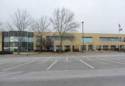
During the early 1980s, Maryland Route 175, later known as Rouse Parkway, was extended from the Columbia Town Center to the Maryland Route 108 interchange as a four-lane divided highway. Starting in the 1970s, Columbia's first major business park, the Columbia Gateway Business Park, was developed, eventually comprising 630 acres. [2] Additional major retail developments took place, including Dobbin Center in 1983 and Snowden Square Shopping Center in the early 1990s. In 1997, one of the largest shopping centers, Columbia Crossing, opened on the north side of Route 175 and Dobbin Road. [3] Another large shopping center, Gateway Overlook, opened at the intersection of Routes 175 and 108 in 2007. A Wegmans supermarket opened on McGaw Road in 2012. [4]

Colleges

Numerous educational institutions have satellite campuses located in the Columbia Gateway Business Park:

Shopping centers

Major companies

The Columbia Gateway Business Park is home to a number of major companies including: [1]

Related Research Articles

Columbia, Maryland Place in Maryland, United States

Columbia is a census-designated place in Howard County, Maryland, United States, and is one of the principal communities of the Baltimore–Washington metropolitan area. It is a planned community consisting of 10 self-contained villages.

Catonsville, Maryland Census-designated place in Maryland, United States

Catonsville is a census-designated place (CDP) in Baltimore County, Maryland, United States. The population was 41,567 at the 2010 census. The community lies to the west of Baltimore along the city's border. Catonsville contains the majority of the University of Maryland, Baltimore County (UMBC), a major public research university with close to 14,000 students.

Owings Mills, Maryland Census-designated place in Maryland, US

Owings Mills is an unincorporated community and census-designated place in Baltimore County, Maryland, United States. It is a suburb of Baltimore. The population was 30,622 at the 2010 census. Owings Mills is home to the northern terminus of the Baltimore Metro Subway, and housed the Owings Mills Mall until its closure in 2015. It is also home to the Baltimore Ravens' headquarters facility, and the studios for Maryland Public Television. In 2008, CNNMoney.com named Owings Mills number 49 of the "100 Best Places to Live and Launch".

Elkridge, Maryland Census-designated place in Maryland, United States of America

Elkridge is an unincorporated community and census-designated place (CDP) in Howard County, Maryland, United States. The population was 15,593 at the 2010 census. Founded early in the 18th century, Elkridge is located at the confluence of three counties, the other two being Anne Arundel and Baltimore counties.

Ellicott City, Maryland Census-designated place in Maryland, United States

Ellicott City is an unincorporated community and census-designated place in, and the county seat of, Howard County, Maryland, United States. Part of the Baltimore metropolitan area, its population was 65,834 at the 2010 census, qualifying it as the largest unincorporated county seat in the country.

Laurel, Maryland City in Maryland, United States

Laurel is a city in Maryland, United States, located almost midway between Washington and Baltimore on the banks of the Patuxent River. While the city limits are entirely in northern Prince George's County, outlying developments extend into Anne Arundel, Montgomery and Howard counties. Founded as a mill town in the early 19th century, Laurel expanded local industry and was later able to become an early commuter town for Washington and Baltimore workers following the arrival of the Baltimore and Ohio Railroad in 1835. Largely residential today, the city maintains a historic district centered on its Main Street, highlighting its industrial past.

Maryland Transit Administration

The Maryland Transit Administration (MTA) is a state-operated mass transit administration in Maryland, and is part of the Maryland Department of Transportation. It is better known as MTA Maryland to avoid confusion with other cities' transit agencies who share the initials MTA. The MTA operates a comprehensive transit system throughout the Baltimore-Washington Metropolitan Area. There are 80 bus lines serving Baltimore's public transportation needs, along with other services that include the Light Rail, Metro Subway, and MARC Train. With nearly half the population of Baltimore residents lacking access to a car, the MTA is an important part of the regional transit picture. The system has many connections to other transit agencies of Central Maryland, Washington, D.C., Northern Virginia, and south-central Pennsylvania : WMATA, Charm City Circulator, Regional Transportation Agency of Central Maryland, Annapolis Transit, Rabbit Transit, Ride-On, and TransIT.

Baltimore–Washington Parkway Highway in Maryland, United States

The Baltimore–Washington Parkway is a highway in the U.S. state of Maryland, running southwest from Baltimore to Washington, D.C. The road begins at an interchange with U.S. Route 50 (US 50) near Cheverly in Prince George's County at the Washington, D.C. border, and continues northeast as a parkway maintained by the National Park Service (NPS) to MD 175 near Fort Meade, serving many federal institutions. This portion of the parkway is dedicated to Gladys Noon Spellman, a representative of Maryland's 5th congressional district, and has the unsigned Maryland Route 295 (MD 295) designation. Commercial vehicles, including trucks, are prohibited within this stretch. This section is administered by the NPS's Greenbelt Park unit. After leaving park service boundaries the highway is maintained by the state and signed with the MD 295 designation. This section of the parkway passes near Baltimore–Washington International Thurgood Marshall Airport. Upon entering Baltimore, the Baltimore Department of Transportation takes over maintenance of the road and it continues north to an interchange with Interstate 95 (I-95). Here, the Baltimore–Washington Parkway ends and MD 295 continues north unsigned on Russell Street, which carries the route north into downtown Baltimore. In downtown Baltimore, MD 295 follows Paca Street northbound and Greene Street southbound before ending at US 40.

Maryland Route 100 Highway in Maryland

Maryland Route 100 is a major east–west highway connecting U.S. Route 29 in Ellicott City and MD 177 in Pasadena. MD 100 also connects to Interstate 95 (I-95), US 1, the Baltimore–Washington Parkway, and I-97. The highway connects Howard County to the west with Anne Arundel County and the Chesapeake Bay to the east. MD 100 also provides access to the Baltimore–Washington International Airport (BWI) and the Arundel Mills shopping mall.

Maryland Route 175

Maryland Route 175 is a state highway in the U.S. state of Maryland. The highway runs 17.01 miles (27.37 km) from Little Patuxent Parkway in Columbia east to MD 3 in Millersville. MD 175 is a major highway through the large unincorporated community of Columbia; the highway connects U.S. Route 29 next to Columbia Town Center with Interstate 95 (I-95) and an industrial area on the eastern side of Howard County. MD 175 also connects Fort Meade with Jessup and Odenton in western Anne Arundel County, where it links MD 295 and MD 32 with the eastern part of the U.S. Army base.

Long Reach, Columbia, Maryland Village in Maryland, United States

Long Reach, one of ten villages composing Columbia, Maryland, United States, is found in the northeast part of Columbia along Maryland Route 108. Started in 1971, it is one of the oldest villages, and comprises four neighborhoods: Jeffers Hill, Kendall Ridge, Locust Park, and Phelps Luck. The village, with an approximate population of 17,000, is governed by five elected village board members through "Long Reach Community Association, Inc." The Village Office is located in Stonehouse, the community center, which opened in 1974.

Maryland Route 108 is a state highway in the U.S. state of Maryland. The highway runs 34.23 miles (55.09 km) from MD 27 in Damascus to MD 175 in Columbia. MD 108 is an S-shaped highway that winds through the northern Montgomery County and central Howard County. The highway connects the Montgomery County communities of Laytonsville, Olney, Sandy Spring, and Ashton with the Howard County villages of Highland and Clarksville. MD 108 serves as the northern edge of Columbia and connects several of the planned community's suburban villages.

Highland, Maryland Census-designated place in Maryland

Highland is an unincorporated community and census-designated place in Howard County, Maryland, United States. As of the 2010 census it had a population of 1,034. It uses the 20777 zip code.

U.S. Route 29 is a north–south United States highway that runs for 1,036 miles (1,667 km) from the western suburbs of Baltimore, Maryland, to Pensacola, Florida. In the U.S. state of Maryland, US 29 is a major highway that emerges from Washington, D.C., and runs north into eastern Montgomery County, stretching over 25.859 miles (41.62 km) through the state and terminating at Maryland Route 99 outside of Ellicott City. It serves the cities of Columbia and Ellicott City and provides the westernmost north–south route between Washington, D.C., and Baltimore.

Village of Cross Keys Planned community in Maryland, United States

Village of Cross Keys is a privately owned upscale area of Baltimore, Maryland. It is located off Maryland Route 25 between Northern Parkway and Coldspring Lane and is home to luxury condos and upscale small shops. Baltimore financier and mall developer James Rouse, founder of The Rouse Company, purchased the Frederick Law Olmsted, Jr.-designed Baltimore Country Club Golf Course near his Roland Park home for $1,700,000 in 1963, site unseen. The 5,000-person village was built on the historic property in 1965. Micheal D. Spear was the development director, later becoming CEO of the Rouse Company. It was the first in a series of planned communities developed by Rouse. Office space was occupied by Rouse until the company moved to its next development in Columbia, Maryland. The retail component of the village has declined with competition from Towson Town Center to the north and Harbor East to the South. The retail property was acquired by Ashkenazy Acquisition Corp in 2012.

Howard Street (Baltimore) Street in Baltimore, United States

Howard Street is a major north-south street through the central part of the city of Baltimore, Maryland. About 2 12 miles (4 km) long, the street begins at the north end of I-395 near Oriole Park at Camden Yards and ends near Johns Hopkins University, where it splits. To the right, it becomes Artmuseum Drive, the one-block home of the Baltimore Museum of Art. To the left, it becomes San Martin Drive, which winds road along the western perimeter of the Johns Hopkins University campus and ends at University Parkway. Howard Street is named in honor of former Maryland governor John Eager Howard. Two other streets in Baltimore, John and Eager Streets, are also named after him.

Fulton, Maryland Census-designated place in Maryland

Fulton is an unincorporated community and census-designated place located in southern Howard County, Maryland, United States. As of the 2010 census it had a population of 2,049.

Mondawmin Mall is a three-level shopping mall in West Baltimore, Maryland, United States. The mall was a development of the Mondawmin Corporation, a firm set up in 1952 by James Rouse and Hunter Moss under the Moss-Rouse Company. When it first opened in October 1956, it had an open-air plan and was called the Mondawmin Center. It was later enclosed and renamed the Mondawmin Mall. Mondamin was the name of a Native American corn god mentioned in Henry Wadsworth Longfellow's poem "The Song of Hiawatha."

Medfield, Baltimore Neighborhood of Baltimore in Maryland, United States

Medfield is a neighborhood located in north Baltimore, Maryland, United States of America. It is located to the north of the trendy Hampden neighborhood and south of affluent Roland Park neighborhood. Its unofficial boundaries are Coldspring Lane to the north; Jones Falls Expressway to the west; Falls Road/Hickory Avenue to the east; and West 41st Street to the south.

The Rotunda is a mixed-use property in northern Baltimore, Maryland in the popular neighborhood of Hampden, adjacent to the neighborhoods of Roland Park, and Wyman Park and near the campus of the Johns Hopkins University. The property features retail, office, and residential components including: 150,000 ft² of retail space, 140,000 ft² of office space, 379 apartments and over 1100 off-street parking spaces, including a multi-level parking garage featuring several electric car charging stations.

References

  1. 1 2 "Columbia Gateway" (PDF). General Growth Properties. General Growth Properties, Inc.
  2. "Columbia Gateway Business Park, Columbia, MD". The Baltimore Sun .
  3. Lee, Edward (June 19, 1997). "Last 5 buildings approved for Columbia Crossing Retailers would occupy 4 acres of floor space". The Baltimore Sun.
  4. Pichaske, Pete (17 June 2012). "Long-awaited Wegmans opens in Columbia". The Baltimore Sun.

Coordinates: 39°12′29″N76°48′46″W / 39.20806°N 76.81278°W / 39.20806; -76.81278