Breckenridge Reservoir

Last updated
Breckenridge Reservoir
Breckenridge Reservoir.jpg
USA Virginia location map.svg
Red pog.svg
Breckenridge Reservoir
Usa edcp relief location map.png
Red pog.svg
Breckenridge Reservoir
Location Prince William / Stafford counties, Virginia, US
Coordinates 38°32′10″N77°23′30″W / 38.536233°N 77.39165°W / 38.536233; -77.39165 Coordinates: 38°32′10″N77°23′30″W / 38.536233°N 77.39165°W / 38.536233; -77.39165
Type reservoir
Primary inflows Chopawamsic Creek
Primary outflows Chopawamsic Creek
Basin  countriesUnited States
Max. length1 mi (1.6 km)
Max. width.1 mi (0.16 km)
Surface elevation132 ft (40 m)

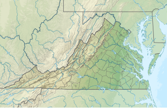
Breckenridge Reservoir is a small reservoir on Chopawamsic Creek in Prince William and Stafford counties, Virginia. The reservoir's western shore is the Marine Corps Base Quantico and the eastern shore is a part of Prince William Forest Park, which is a unit of the National Park Service. The reservoir is open to fishing along with a Virginia fishing license and Marine Corps Base Quantico permit. Primitive campsites and a hiking trail are on the Prince William Forest Park side of the reservoir. Reservoir storage volume is approximately 22,500,000 cubic feet (517 acre-feet) with a surface area of about 1,820,000 square feet (41.9 acres). [1]
Related Research Articles

Quantico, Virginia Town in Virginia, United States

Quantico is a town in Prince William County, Virginia, United States. The population was 480 at the 2010 census. Quantico is approximately 35 miles southwest of Washington, DC, bordered by the Potomac River to the east and the Quantico Creek to the north. The word Quantico is a derivation of the name of a Doeg village recorded by English colonists as Pamacocack.

Prince William County, Virginia County in Virginia

Prince William County is located on the Potomac River in the Commonwealth of Virginia in the United States. As of the 2010 census, the population was 402,002, on July 1, 2019, the population was estimated to be 470,335, making it Virginia's second-most populous county. Its county seat is the independent city of Manassas.

Marine Corps Base Quantico CDP in Virginia, United States

Marine Corps Base Quantico is a United States Marine Corps installation located near Triangle, Virginia, covering nearly 55,148 acres (86.169 sq mi) of southern Prince William County, Virginia, northern Stafford County, and southeastern Fauquier County. Used primarily for training purposes, MCB Quantico is known as the "Crossroads of the Marine Corps".

Oliver P. Smith

Oliver Prince Smith was a U.S. Marine four star general and decorated combat veteran of World War II and the Korean War. He is most noted for commanding the 1st Marine Division during the Battle of Chosin Reservoir, where he said "Retreat, hell! We're not retreating, we're just advancing in a different direction." He retired at the rank of four-star general, being advanced in rank for having been specially commended for heroism in combat.

Quantico National Cemetery

Quantico National Cemetery is a national cemetery in Triangle, Virginia for veterans who served in the United States Armed Forces. Adjacent to and originally part of Marine Corps Base Quantico, it was established as a national cemetery in 1983 with an area of 725 acres (293 ha).

Prince William Forest Park 17,000 acres in Virginia (US) maintained by the National Park Service

Prince William Forest Park was established as Chopawamsic Recreational Demonstration Area in 1936. Its location is in Triangle, Virginia, adjacent to the Marine Corps Base Quantico. The park is the largest protected natural area in the Washington, D.C. metropolitan region at over 16,000 acres (6,500 ha). Today, the park is a window into the past and serves as an example of what much of the East Coast once looked like centuries ago.

Quantico Creek

Quantico Creek is a 13.7-mile-long (22.0 km) partially tidal tributary of the Potomac River in eastern Prince William County, Virginia. Quantico Creek rises southeast of Independent Hill, flows through Prince William Forest Park and Dumfries and empties into the Potomac at Possum Point.

Marine Corps Marathon

The Marine Corps Marathon (MCM) is an annual marathon held in Washington, D.C. and Arlington, Virginia. The mission of the MCM is to promote physical fitness, generate community goodwill, and showcase the organizational skills of the United States Marine Corps.

National Register of Historic Places listings in Virginia

Buildings, sites, districts, and objects in Virginia listed on the National Register of Historic Places:

Joplin, Virginia Ghost town in Virginia

Joplin is an uninhabited unincorporated community in Prince William County, Virginia. The town was located on land taken to form Chopawamsic Recreational Demonstration Area and is now part of Prince William Forest Park, a National Park Service property located adjacent to Marine Corps Base Quantico. The remains of the town, now just a collection of homes, lies on a stretch of Va. 619, Joplin Road, about 3 miles west of Dumfries.

Wilson Lake (Kansas)

Wilson Lake is a reservoir in the U.S. state of Kansas, on the border of Russell County and Lincoln County. Built and managed by the U.S. Army Corps of Engineers for flood control, it is also used for wildlife management and recreation. Several parks are located along its shoreline, including Wilson State Park.

National Museum of the Marine Corps

The National Museum of the Marine Corps is the historical museum of the United States Marine Corps. Located in Triangle, Virginia near MCB Quantico, the museum opened on November 10, 2006, and is now one of the top tourist attractions in the state, drawing over 500,000 people annually.

Chopawamsic Creek

Chopawamsic Creek is a 6.8-mile-long (10.9 km) tributary of the Potomac River in Prince William and Stafford counties, Virginia. Chopawamsic Creek is formed by the confluence of the North and South Branches of Chopawamsic Creek and empties into the Potomac River south of Quantico at the Marine Corps Base Quantico's Air Station. Breckenridge Reservoir lies at the stream's confluence with the North and South Branches. Along with its North Branch, Chopawamsic Creek forms part of the boundary between Prince William and Stafford counties. The North Branch flows through part of the Chopawamsic Backcountry Area in Prince William Forest Park.

El Dorado Lake

El Dorado Lake is a reservoir on the Walnut River 0.5 miles (0.80 km) northeast of El Dorado in the Flint Hills region of Kansas. Built and managed by the U.S. Army Corps of Engineers, it is used for flood control, recreation, and water supply. El Dorado State Park is located on its shore.

John Redmond Reservoir

John Redmond Reservoir is a reservoir on the Neosho River in eastern Kansas. Built and managed by the U.S. Army Corps of Engineers, it is used for flood control, recreation, water supply, and wildlife management. It borders the Flint Hills National Wildlife Refuge to the northwest.

Virginia State Route 619 (Prince William County)

State Route 619 in Prince William County, Virginia is a secondary state highway. SR 619 provides a cross-county connector as well as a major artery for commuters. SR 619 is known by four names: Linton Hall Road, Bristow Road, Joplin Road, and Fuller Heights Road. There are also two short concurrencies: one with SR 234 Old in Independent Hill, and one with Fuller Military Road on the border of Marine Corps Base Quantico.

Kanopolis Lake

Kanopolis Lake is a reservoir in Ellsworth County in the Smoky Hills of central Kansas, about 31 miles southwest of Salina and a few miles southeast of the town of Kanopolis. The lake is formed by Kanopolis Dam. Completed in 1948 as a flood control and water conservation project of the United States Army Corps of Engineers, the dam impounds the Smoky Hill River.

Council Grove Lake

Council Grove Lake is a reservoir on the Neosho River in east-central Kansas. Built and managed by the U.S. Army Corps of Engineers, it is used for flood control, recreation, and water supply.

References

  1. Wicklein, S.M. (2012). Bathymetric contours of Breckenridge Reservoir, Quantico, Virginia. Reston, Va.: U.S. Department of the Interior, U.S. Geological Survey. Retrieved 5 October 2015.