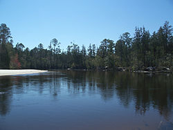
List of rivers of Florida

Last updated

This is a list of streams and rivers in the U.S. state of Florida . With one exception, the streams and rivers of Florida all originate on the Coastal plain. That exception is the Apalachicola River, which is formed by the merger of the Chattahoochee River, which originates in the Appalachian Mountains, and the Flint River, which originates in the Piedmont. Most streams and rivers in Florida start from swamps, while some originate from springs or lakes. Many of the streams and rivers are underground for part of their courses. The Everglades, sometimes called the "river of grass", is a very wide and shallow river that originates from Lake Okeechobee. Most of Florida's streams and rivers drain into the Gulf of Mexico. Drainage on the east coast of Florida is dominated by the St. Johns River, which, with the swamps that form its headwaters, extends parallel to the coast from inland of Fort Pierce to Jacksonville. [1]

Contents

By drainage basin

Atlantic coast

St. Johns River in Blue Spring State Park. St Johns River.jpg
St. Johns River in Blue Spring State Park.
Ocklawaha River Starkes Ferry Ocklawaha River north01.jpg
Ocklawaha River
Halifax River Halifax River 1 (Florida).jpg
Halifax River
St. Lucie River St. lucie river from sp.jpg
St. Lucie River

Rivers are listed as they enter the ocean from north to south. Tributaries are listed as they enter their main stem from downstream to upstream.

Alachua Sink

Water enters Paynes Prairie Basin from a number of sources. Historically it drained only into Alachua Sink. Water entering the Alachua Sink flows into the Floridan aquifer. [2] (Various sources stating that water entering the Alachua Sink flows to the Santa Fe River may be based on a story told by a Seminole guide to a white explorer in 1823, that a Seminole who had drowned in the sink was later found in the river. [3] ) In 1927, Camps Canal was built, which linked the basin to the Orange Lake through the River Styx and ultimately to the Atlantic Ocean.

Lake Okeechobee

Lake Okeechobee drains into the Atlantic Ocean via the St. Lucie River, the West Palm Beach Canal, the Hillsboro Canal, the North New River Canal, and the Miami Canal, and into the Gulf of Mexico via the Caloosahatchee Canal which connects to the head of the Caloosahatchee River. The major input of water into Lake Okeechobee comes from the north, via the Kissimmee River. Rivers are listed as they enter Lake Okeechobee from west to east. Tributaries are listed as they enter their main stem from downstream to upstream.

Gulf coast

Apalachicola River in Torreya State Park Torreyapark04.jpg
Apalachicola River in Torreya State Park
Caloosahatchee River Caloosahatchee.JPG
Caloosahatchee River
Blackwater River in Blackwater River State Park FL Blackwater River SP02.jpg
Blackwater River in Blackwater River State Park
St. Marks River St Marks River at Newport, Florida.jpg
St. Marks River

Rivers are listed as they enter the gulf from south to north, then west. Tributaries are listed as they enter their main stem from downstream to upstream.

Alphabetically

FlaWaterwaysMap.png

See also

Related Research Articles

<span class="mw-page-title-main">Weeki Wachee, Florida</span> Unincorporated community in Florida, United States

Weeki Wachee is an unincorporated community and former city located in Hernando County, Florida, United States. As of the 2020 census, the community has a total population of 16. The 12,000-acre (4,900 ha) Weeki Wachee Preserve and the Weeki Wachee Springs park are located in the area. The park includes water rides, animal shows, mermaid costume shows, and manatee watching. The communities of Weeki Wachee Gardens and Spring Hill are nearby.

<span class="mw-page-title-main">Lake Okeechobee</span> Natural freshwater lake in Florida, United States

Lake Okeechobee, also known as Florida's Inland Sea, is the largest freshwater lake in the U.S. state of Florida. It is the tenth largest natural freshwater lake among the 50 states of the United States and the second-largest natural freshwater lake contained entirely within the contiguous 48 states, after Lake Michigan.

<span class="mw-page-title-main">Caloosahatchee River</span> River on the southwest coast of Florida, US

The Caloosahatchee River is a river on the southwest Gulf Coast of Florida in the United States, approximately 67 miles (108 km) long. It drains rural areas on the northern edge of the Everglades, east of Fort Myers. An important link in the Okeechobee Waterway, a manmade inland waterway system of southern Florida, the river forms a tidal estuary along most of its course and has become the subject of efforts to restore and preserve the Everglades.

<span class="mw-page-title-main">Nature Coast</span> Region in Florida

The Nature Coast is an informal, unofficial region of the U.S. state of Florida. The broadest definition of the Nature Coast includes the eight counties that abut the Gulf of Mexico along the Big Bend Coast defined by geologists: from west to east, Wakulla, Jefferson, Taylor, Dixie, Levy, Citrus, Hernando, and Pasco counties.

<span class="mw-page-title-main">Rainbow Springs</span>

Rainbow Springs, formerly known as Blue Spring, is a first-magnitude artesian spring formation in Marion County, Florida, United States, several miles north of the city of Dunnellon. Rainbow Springs is the focal point of Rainbow Springs State Park. The spring formation is the fourth-largest in Florida, and produces over 490 million gallons of water daily. Rainbow Springs forms the headwaters of the Rainbow River, which empties into the Withlacoochee River.

<span class="mw-page-title-main">Aucilla River</span> River in Florida and Georgia, United States

The Aucilla River rises in Brooks County, Georgia, USA, close to Thomasville, and passes through the Big Bend region of Florida, emptying into the Gulf of Mexico at Apalachee Bay. Some early maps called it the Ocilla River. It is 89 miles (143 km) long and has a drainage basin of 747 square miles (1,930 km2). Tributaries include the Little Aucilla and Wacissa Rivers. In Florida, the Aucilla River forms the eastern border of Jefferson County, separating it from Madison County on the northern part, and from Taylor County to the south.

<span class="mw-page-title-main">Florida Trail</span> A US National Scenic trail

The Florida Trail is one of eleven National Scenic Trails in the United States. It currently runs 1,500 miles (2,400 km), from Big Cypress National Preserve to Fort Pickens at Gulf Islands National Seashore, Pensacola Beach. Also known as the Florida National Scenic Trail, the Florida Trail provides permanent non-motorized recreation opportunity for hiking and other compatible activities and is within an hour of most Floridians. The Florida National Scenic Trail is designated as a National Scenic Trail by the National Trails System Act of 1968.

<span class="mw-page-title-main">Big Bend (Florida)</span> Region of the state Florida, United States

The Big Bend of Florida, United States, is an informally-named geographic region of North Florida where the Florida Panhandle transitions to the Florida Peninsula south and east of Tallahassee. The region is known for its vast woodlands and marshlands and its low population density relative to much of the state. The area is home to the largest single spring in the United States, the Alapaha Rise, and the longest surveyed underwater cave in the United States, the 32-mile (51 km) Wakulla-Leon Sinks cave system.

<span class="mw-page-title-main">St. Lucie River</span> River in the United States of America

The St. Lucie River is a 35-mile-long (56 km) estuary linked to a coastal river system in St. Lucie and Martin counties in the Florida, United States. The St. Lucie River and St. Lucie Estuary are an "ecological jewel" of the Treasure Coast, central to the health and well-being of the surrounding communities. The river is part of the larger Indian River Lagoon system, the most diverse estuarine environment in North America with more than 4,000 plant and animal species, including manatees, oysters, dolphins, sea turtles and seahorses.

<span class="mw-page-title-main">Suwannee River Water Management District</span> Responsible for managing groundwater and surface water

The Suwannee River Water Management District (SRWMD) is responsible for managing groundwater and surface water resources in a 15-county region in north-central Florida, United States. It is the smallest of five Florida water management districts. Its district headquarters are in Live Oak, Florida.

The following is an alphabetical list of articles related to the U.S. state of Florida.

<span class="mw-page-title-main">Tsala Apopka Lake</span> Chain of lakes in Central Florida, US

Tsala Apopka Lake is a chain of lakes located within a bend in the Withlacoochee River in Citrus County in north central Florida. This area is known historically as the Cove of the Withlacoochee.

<span class="mw-page-title-main">Safety Harbor culture</span> Archaeological culture practiced by Native Americans living on the central Gulf coast Florida

The Safety Harbor culture was an archaeological culture practiced by Native Americans living on the central Gulf coast of the Florida peninsula, from about 900 CE until after 1700. The Safety Harbor culture is defined by the presence of Safety Harbor ceramics in burial mounds. The culture is named after the Safety Harbor site, which is close to the center of the culture area. The Safety Harbor site is the probable location of the chief town of the Tocobaga, the best known of the groups practicing the Safety Harbor culture.

The Surface Water Improvement and Management Act of 1987 was a law passed by the Florida Legislature in order to protect surface waters of, which include estuaries, rivers, lakes, and streams. The act created the Surface Water Improvement and Management Program, which seeks to control nonpoint source pollution.

References

  1. Clewell, Andre F. (1991). "Physical Environment". In Livingston, Robert J. (ed.). The Rivers of Florida. New York: Springer-Verlag. pp. 17–18. ISBN   0-387-97363-X.
  2. "Orange Creek Basin". Saint Johns River Water Management District. Retrieved 2021-09-03.
  3. Meindl, Christopher (1996). "View of Paynes Prairie: Biography of a Wetland". The Florida Geographer. p. 57. Retrieved 2021-09-03 via FAU Digital Library.
  4. "Kissimmee Upper Basin" (PDF). South Florida Water Management District. Retrieved April 10, 2019.
  5. "Kissimmee Lower Basin" (PDF). South Florida Water Management District. Retrieved April 10, 2019.