Pithlachascotee River

Last updated • 1 min readFrom Wikipedia, The Free Encyclopedia
Pithlachascotee River
"Cotee River"
US 19 Bridge; Port Richey to New Port Richey.jpg
The US 19 bridge over the Pithlachascotee River between Port Richey(left) and New Port Richey.
Pithlachascotee River
Location
Country United States
State Florida
County Pasco
District SWFWMD
Physical characteristics
SourceStarkey park
  location Shady Hills, Florida
  coordinates 28°22′08″N82°31′58″W / 28.36889°N 82.53278°W / 28.36889; -82.53278
Mouth Gulf of Mexico
  location
Port Richey, Florida
  coordinates
28°16′40″N82°44′37″W / 28.27778°N 82.74361°W / 28.27778; -82.74361
Length23 mi (37 km)
Discharge 
  location10.5mi upstream from mouth
  average25.42 cu ft/s (0.720 m3/s)
Basin features
Tributaries 
  rightFive Mile Creek,
A view of the winding Pithlachascotee River from James E. Grey Preserve View from James E. Grey Preserve.jpg
A view of the winding Pithlachascotee River from James E. Grey Preserve

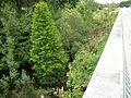
The Pithlachascotee River, often called the Cotee or "Cootie" River, [1] [2] [3] is a blackwater river in Pasco County, Florida.

Contents

Originating near Crews Lake, the river flows for over 23 miles (37 km) [4] to the south and west, flowing through the Starkey Wilderness Park before turning northwest through downtown New Port Richey, entering the Gulf of Mexico at Miller's Bayou. A Florida State Canoe Trail runs along the river.

On a chart representing the west coast of Florida accompanying the annual report of the U.S. Coast Survey for 1851, the name is translated as "Boat Building River". The whole word signifies the place where canoes were chopped or dug out. The Seminole used canoes dug out of cypress trunks. It is derived from the Creek pithlo (canoe), and chaskita (to chop out). [5]

List of crossings

CrossingCarriesImageLocationCoordinates
Headwaters 28°22′08″N82°31′58″W / 28.36889°N 82.53278°W / 28.36889; -82.53278
140018 Florida 52.svg SR 52 Pithlachascotee River North of FL 52.JPG Fivay Junction 28°19′45″N82°32′11″W / 28.32917°N 82.53639°W / 28.32917; -82.53639
140080
140081
Toll Florida 589.svg SR 589
Suncoast Parkway
SB Suncoast Pkwy-Trail over Pithlachascotee River.JPG 28°18′33″N82°33′01″W / 28.30917°N 82.55028°W / 28.30917; -82.55028
power line road Starkey Wilderness Park 28°17′33″N82°35′05″W / 28.29250°N 82.58472°W / 28.29250; -82.58472
Wilderness RoadStarkey Wilderness Park 28°15′25″N82°38′35″W / 28.25694°N 82.64306°W / 28.25694; -82.64306
144048Starkey Boulevard Starkey Boulevard; Pithlachascotee River Bridge (Ledge).JPG New Port Richey 28°15′20″N82°39′03″W / 28.25556°N 82.65083°W / 28.25556; -82.65083
144026
144050
Pasco County Road 1 FL.svg CR 1
Little Road
Pasco CR 1; Little Road Bridges.JPG New Port Richey 28°14′23″N82°40′26″W / 28.23972°N 82.67389°W / 28.23972; -82.67389
ford?Nova CourtNew Port Richey 28°14′13″N82°41′14″W / 28.23694°N 82.68722°W / 28.23694; -82.68722
144025
144049
Pasco County Road 77 FL.svg CR 77
Rowan Road
Rowan Road Bridge over Pithlachascotee River; North from median.jpg New Port Richey 28°14′15″N82°41′38″W / 28.23750°N 82.69389°W / 28.23750; -82.69389
140064Madison Street Madison Street Bridge Streetlight.jpg New Port Richey 28°14′30″N82°42′56″W / 28.24167°N 82.71556°W / 28.24167; -82.71556
140050 Pasco County Road 595 FL.svg CR 595
Grand Boulevard
Grand Boulevard-Pithlachascotee River Bridge from Dock.JPG New Port Richey 28°14′24″N82°43′10″W / 28.24000°N 82.71944°W / 28.24000; -82.71944
140021 Pasco County Road 595A FL.svg CR 595A
Main Street
NPR Main Street Bridge Tower.JPG New Port Richey 28°15′01″N82°43′22″W / 28.25028°N 82.72278°W / 28.25028; -82.72278
140005 US 19.svg US 19 US 19 Bridge; Port Richey to New Port Richey.jpg Port Richey 28°16′10″N82°43′33″W / 28.26944°N 82.72583°W / 28.26944; -82.72583
Outflow of Miller's Bayou 28°16′21″N82°43′40″W / 28.27250°N 82.72778°W / 28.27250; -82.72778
Mouth 28°16′40″N82°44′37″W / 28.27778°N 82.74361°W / 28.27778; -82.74361

References

  1. Cannon, Jeff (2009). Hudson. Images of America. Mount Pleasant, SC: Arcadia Publishing. p. 41. ISBN   9780738567815 . Retrieved 2011-10-18.
  2. Ford, Norman D. (1969). Norman Ford's Florida. New York: Harian Publications. p. 180. Retrieved 2011-10-18.
  3. Henshall, James Alexander (1884). Camping and Cruising in Florida. Cincinnati, OH: Robert Clarke & Co. p.  230 . Retrieved 2011-10-18. Cootie River.
  4. U.S. Geological Survey. National Hydrography Dataset high-resolution flowline data. The National Map, accessed April 18, 2011
  5. Simpson, J. Clarence (1956). Mark F. Boyd (ed.). Florida Place-Names of Indian Derivation. Tallahassee, Florida: Florida Geological Survey.