
Charlotte County is a U.S. county located in southwestern Florida. As of the 2020 census, the population was 186,847. Its county seat is Punta Gorda.

DeSoto County is a county located in the Florida Heartland region of the U.S. state of Florida. As of the 2020 census, the population was 33,976. Its county seat is Arcadia. DeSoto County comprises the Arcadia, Florida Micropolitan Statistical Area, which is included in the North Port-Bradenton, Florida Combined Statistical Area.

Pasco County is a county located on the west central coast of the U.S. state of Florida. According to the 2020 census, the population was 561,691, making it the eleventh-most populous county in the state. Its county seat is Dade City, and its largest city is Zephyrhills. The county is named after Samuel Pasco.

Sarasota County is a county located in Southwest Florida. At the 2020 US census, the population was 434,006. Its county seat is Sarasota and its largest city is North Port. Sarasota County is part of the North Port–Bradenton–Sarasota, FL metropolitan statistical area. The county includes barriers islands with beaches and beach communities. It is home to colleges, a network of libraries, and various parks and preserves. Hurricane Milton made landfall in the county in 2024.

North Port is a city located in Sarasota County, Florida, United States. The population was 74,793 at the 2020 US Census, up from 57,357 at the 2010 US Census. It is a principal city in the North Port–Bradenton–Sarasota, Florida Metropolitan Statistical Area.

Venice is a city in Sarasota County, Florida, United States. The city includes what locals call "Venice Island", a portion of the mainland that is accessed via bridges over the artificially created Intracoastal Waterway. The city is located in Southwest Florida. As of the 2020 Census, the city had a population of 25,463, up from 20,748 at the 2010 Census. Venice is part of the North Port–Bradenton–Sarasota, Florida Metropolitan Statistical Area.

The Seminole Gulf Railway is a short line freight and passenger excursion railroad headquartered in Fort Myers, Florida, that operates two former CSX Transportation railroad lines in Southwest Florida. The company's Fort Myers Division, which was previously the southernmost segment of CSX's Fort Myers Subdivision, runs from Arcadia south to North Naples via Punta Gorda, Fort Myers, Estero, and Bonita Springs. The company's other line, the Sarasota Division, runs from Oneco south through Sarasota. Seminole Gulf acquired the lines in November 1987 and operates its own equipment. The company's first train departed Fort Myers on November 14, 1987.

Ballona Creek is an 8.5-mile (13.7 km) channelized stream in southwestern Los Angeles County, California, United States, that was once a "year-round river lined with sycamores and willows". The urban watercourse begins in the Mid-City neighborhood of Los Angeles, flows through Culver City and Del Rey, and passes the Ballona Wetlands Ecological Preserve, the sailboat harbor Marina del Rey, and the small beachside community of Playa del Rey before draining into Santa Monica Bay. The Ballona Creek drainage basin carries water from the Santa Monica Mountains on the north, from the Baldwin Hills to the south, and as far as the Harbor Freeway (I-110) to the east.
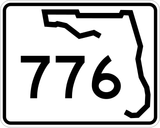
State Road 776 (SR 776) is a 25-mile-long (40 km) state highway serving southern Sarasota County and northwestern Charlotte County, Florida. It acts as a loop road of U.S. Route 41 (US 41) that bypasses North Port.

Ridley Creek is a tributary of the Delaware River in Chester and Delaware counties, Pennsylvania in the United States.

The Withlacoochee River or Crooked River is a river in central Florida, in the United States. It originates in the Green Swamp, east of Polk City, flowing west, then north, then northwest and finally west again before emptying into the Gulf of Mexico near Yankeetown. The river is 141 miles (227 km) long and has a drainage basin of 1,170 square miles (3,000 km2).

The Sarasota metropolitan area is a metropolitan area located in Southwest Florida. The metropolitan area is defined by the Office of Management and Budget (OMB) as the North Port–Bradenton–Sarasota Metropolitan Statistical Area, a metropolitan statistical area (MSA) consisting of Manatee County and Sarasota County. The principal cities listed by the OMB for the MSA are North Port, Bradenton, Sarasota, Lakewood Ranch, and Venice. At the 2020 census, the MSA had a population of 833,716. The Census Bureau estimates that its population was 910,108 in 2023.

The Myakka River is a river in southwestern Florida. It arises near the Hardee-Manatee county line and flows southwest and then southeast through Manatee, Sarasota and Charlotte counties to Charlotte Harbor, an arm of the Gulf of Mexico. The river is 72 miles (116 km) long and has a drainage basin of 602 square miles, of which 314.7 square miles (815 km2) lies in Sarasota county. The last 20 miles (32 km) of the river is tidal and brackish.

The Flushing River, also known as Flushing Creek, is a waterway that flows northward through the borough of Queens in New York City, New York, U.S. It runs mostly within Flushing Meadows–Corona Park, emptying into the Flushing Bay and the East River. The river runs through a valley that may have been a larger riverbed before the last Ice Age, and it divides Queens into western and eastern halves. Until the 20th century, the Flushing Creek was fed by three tributaries: Mill Creek and Kissena Creek on the eastern bank, and Horse Brook on the western bank.

Kissena Creek is a buried stream located in the neighborhoods of Flushing, Fresh Meadows, Hillcrest, and Kew Gardens Hills in the New York City borough of Queens. Kissena Creek originates in a now-filled swamp within Kew Gardens Hills and Pomonok in central Queens, flowing east to Hillcrest. The creek then travels mostly north and west, largely flowing beneath Kissena Park Golf Course, Kissena Park, Kissena Corridor Park, and Queens Botanical Garden, before merging with the Flushing River in Flushing Meadows–Corona Park.
Lemon Bay is a long, narrow and shallow body of water covering 8,000 acres in Charlotte County, Florida and Sarasota County, Florida. It is protected as the Lemon Bay Aquatic Preserve, designated in 1986. It is one of five Charlotte Harbor Aquatic Preserves. The bay is fed by one Gulf pass, Stump Pass, and seven tributaries and includes areas of mangrove, marsh grass, and seagrass. It provides habitat for bird, invertebrate and fish species and offers fishing, kayaking, birding, wading and beachcombing opportunities.
Myakkahatchee Creek Environmental Park is a 168-acre (68 ha) heavily wooded park in North Port, Florida, north of Interstate 75.
Hook Creek is a stream on the South Shore of Long Island, in New York, United States. The creek travels through both the New York City borough of Queens and the Town of Hempstead in Nassau County.
