South Florida

Last updated
South Florida
Miami skyline 20080516.png
Anhinga Trail boardwalk.JPG
South Beach 20080315.jpg
Ft Lauderdale Skyline.jpg
Miami Freedom Tower by Tom Schaefer.jpg
Mallory Square.JPG
South Florida locator map.png
CountryFlag of the United States.svg  United States
StateFlag of Florida.svg  Florida
Largest cityFlag of Miami, Florida.svg Miami
Population
 (2020)
9,484,409 [1]

South Florida, sometimes colloquially shortened to SoFlo, is the southernmost region of the U.S. state of Florida. It is one of Florida's three most commonly referred to directional regions; the two others are Central Florida and North Florida. South Florida is the southernmost part of the continental United States and the only region of the continental U.S. that includes some areas with a tropical climate.

Contents

South Florida is dominated by the Miami metropolitan area and the Everglades. It also contains the Florida Keys; three U.S. national parks: Biscayne, Dry Tortugas, and Everglades; and multiple cities. While the term most commonly refers to the Miami metro’s tri-county area, interpretations vary on the inclusion of some other parts of Florida within the South Florida region, such as the inclusion of Southwest Florida and the Treasure Coast.

Composition

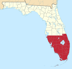
As with all vernacular regions, South Florida has no official boundaries or status and is defined differently by different sources. A 2007 study of Florida's regions by Ary Lamme and Raymond K. Oldakowski found that Floridians surveyed identified "South Florida" as comprising the southernmost sections of peninsular Florida, meaning from Jupiter, Florida south. That area includes the Miami metropolitan area, defined as Miami-Dade, Broward, and Palm Beach counties, the Florida Keys, and the interior region known as the Glades.

Southwest Florida, representing the state's southern Gulf Coast, has emerged as a directional vernacular region. Respondents from as far northwest as the Tampa Bay area identified their region as being in Southwest or Central Florida. [2] Confusing the matter further, the University of South Florida, named in part because of its status as the state's southernmost public university at the time of its 1957 founding, is located in Tampa Florida State Road 70 bisects approximately the southern third of Florida from west to east. However, Tampa is not considered South Florida region. [3]

Enterprise Florida, the state's economic development agency, identifies "Southeast Florida" as one of eight economic regions used by the agency and other state and outside entities, including the Florida Department of Transportation. Some entities alternately designate this region "South Florida". [4] Its definition includes much of the same territory as Lamme and Oldakowski's report, except the Gulf Coast and much of the interior Glades region.. It includes Monroe County and the three metropolitan counties of Miami-Dade, Broward, and Palm Beach, as well as the three "Treasure Coast" counties of Indian River, St. Lucie, and Martin to the north. [5]

Demographics

The demographics of South Florida residents can be segmented as following:

Population %Place of Birth
32.2%State of Florida
33.0%Elsewhere in the U.S.
34.8%Outside of the U.S.

Over 87.2% of all foreigners residing in South Florida come from Latin America.

Political affiliations

South Florida is politically diverse, with multiple congressional districts in the region supporting both the Democratic and Republican parties. As evidenced by the 2020 United States presidential election, supporters of the Democratic Party are mostly concentrated in urban areas, as well as areas to the west of and including downtown Key West, rural communities surrounding Immokalee, and the areas surrounding Belle Glade, while supporters of the Republican Party reside in the most costal regions of the Miami area north of Pompano Beach, most of the Everglades, most of the regions between Port St. Lucie and Riviera Beach, Southwest Florida, and a supermajority of the region's inland and rural areas. [6]

Cities

A U.S. Geological Survey satellite image of the Miami metropolitan area in April 2007 South florida satellite image cut from wiki.png
A U.S. Geological Survey satellite image of the Miami metropolitan area in April 2007

Largest cities in South Florida by population:

City2020 population [7] 2010 population [8] 2000 populationCounty
Miami 442,241399,457362,470Miami-Dade
Hialeah 223,109224,669226,419Miami-Dade
Fort Lauderdale 182,760165,521152,397Broward
Pembroke Pines 171,178154,750137,427Broward
Hollywood 153,067140,768139,368Broward
Miramar 134,721122,04172,739Broward
Coral Springs 134,394121,096117,549Broward
Miami Gardens 111,640107,167124,656Miami-Dade
West Palm Beach 117,41599,91982,103Palm Beach
Pompano Beach 112,04699,84578,191Broward
Davie 105,69191,99275,720Broward
Miami Beach 82,89087,77987,933Miami-Dade
Plantation 91,75084,95582,934Broward
Sunrise 97,33584,43985,787Broward
Boca Raton 97,42284,39274,764Palm Beach
Deerfield Beach 86,85975,01864,585Broward
Boynton Beach 80,38068,21760,389Palm Beach
Lauderhill 74,48266,88757,585Broward
Weston 68,10765,33349,286Broward
Delray Beach 66,84660,52260,020Palm Beach
Homestead 80,73760,51231,909Miami-Dade
Tamarac 71,89760,42755,588Broward
North Miami 60,19158,78659,880Miami-Dade
Wellington 61,63756,50838,216Palm Beach
Jupiter 61,04755,15639,328Palm Beach
Margate 58,71253,28453,909Broward
Coconut Creek 57,83352,90943,566Broward

Culture

Miami accent

The Miami accent is a regional accent of the American English dialect spoken in South Florida, particularly in Miami-Dade, Broward, Palm Beach, and Monroe counties. The accent was born in central Miami, but has expanded to the rest of South Florida in the decades since the 1960s. The Miami accent is most prevalent in American-born South Floridian youth. [9] [10] [11]

The Miami accent is based on a fairly standard American accent but with some changes very similar to dialects in the Mid-Atlantic (especially the New York area dialect, Northern New Jersey English, and New York Latino English.) Unlike Virginia Piedmont, Coastal Southern American, and Northeast American dialects, the "Miami accent" is rhotic; it also incorporates a rhythm and pronunciation heavily influenced by Spanish (wherein rhythm is syllable-timed). [12]

Politics

Cape Florida Light, a lighthouse constructed in 1825 on Cape Florida at the south end of Key Biscayne Cape Florida Light, a lighthouse on Cape Florida at the south end of Key Biscayne in Miami-Dade County, Florida LCCN2011630335.tif
Cape Florida Light, a lighthouse constructed in 1825 on Cape Florida at the south end of Key Biscayne

Lamme and Oldakowski identify several demographic, political, and cultural elements that characterize South Florida and distinguish it from other areas of the state. Many of its differences appear to be driven by its proportionately higher level of migration from the northern U.S. states and from the Caribbean and Latin America, particularly in the densely populated Miami area. [13] Politically, South Florida is more liberal than the rest of the state. While less than 10% of people in either North or Central Florida felt their area was liberal, over a third of South Floridians described their region as such. [14] 38% characterized the area as conservative; 26% as moderate. [14] This tracks with South Florida's demographics, and Lamme and Oldakowski's findings parallel Barney Warf and Cynthia Waddell's research on Florida's political geography during the 2000 Presidential election. [14] [15] The economy in South Florida is very similar to that in Central Florida. Compared to the more diversified economy in North Florida, tourism is by far the most significant industry in South and Central Florida, with a much smaller but vibrant agricultural industry. [16]

Cuisine

Lamme and Oldakowski's survey also found some cultural indicators distinguishing South Florida. South Florida is the only region of the state where ethnic foods are as popular as general American cuisine. [17] Floribbean cuisine is a fusion cuisine which developed in South Florida, drawing influence from Floridian, Caribbean, Asian and Latin American cuisines. Additionally, while there was little geographical variation for most styles of music, there was regional variation for both country and Latin music. Country was significantly less popular in South Florida than in North or Central Florida, while Latin was more popular than in the other regions. [17]

Urban planning

The Anthony J. Catanese Center for Urban and Environmental Solutions at Florida Atlantic University notes the unusual growth pattern of South Florida. Unlike many areas with centralized cities surrounded by development, most of South Florida is preserved natural area and designated agricultural reserves, with development restricted to a dense, narrow strip along the coast. The developed area is highly urbanized and increasingly continuous and decentralized, with no particular dominant core cities. The center projects this pattern to continue in the future. [18]

Partition proposals

The partition of Florida as proposed by the South Miami's mayor and its city commission in 2014 Florida2StateSolution2014.png
The partition of Florida as proposed by the South Miami's mayor and its city commission in 2014

There have been several proposals for partitioning the state of Florida to form a separate state of South Florida. Such proposals have usually been made as political statement rather than serious attempts at secession. Reasons often stated are cultural, ethnic, economic, and financial frustrations with the state government in Tallahassee, which is in North Florida. [19]

In 2008, the North Lauderdale City Commission passed a resolution calling for a new state of South Florida to be formed from Palm Beach, Broward, Miami-Dade and Monroe Counties. [20] [19]

In 2014, South Miami's city commission passed a resolution in favor of splitting the state in half, with a northern boundary drawn to include the counties of Brevard, Orange, Polk, Hillsborough, and Pinellas, which roughly includes parts of Tampa Bay and Orlando areas. In total, the proposed State of South Florida would have included 24 counties. [21] [22] [23]

See also

Notes

  1. "County Population". www.census.gov.
  2. Lamme & Oldakowsi, p. 329.
  3. "USF History". usf.edu. University of South Florida. Retrieved April 23, 2020.
  4. "Charting the Course" uses "the term 'Southeast' Florida interchangeably with 'South' Florida" for this region; p. 3.
  5. "Charting the Course", p. 2–3.
  6. Park, Alice; Smart, Charlie; Taylor, Rumsey; Watkins, Miles (2021-02-02). "An Extremely Detailed Map of the 2020 Election". The New York Times. ISSN   0362-4331 . Retrieved 2022-10-25.
  7. Bureau of Economic and Business Research (2011). "Florida Population: Census Summary 2010". University of Florida.{{cite web}}: |author= has generic name (help)
  8. Bureau of Economic and Business Research (2021). "Florida Population: Census Summary 2020". University of Florida. Archived from the original on 2020-09-27. Retrieved 2017-04-18.{{cite web}}: |author= has generic name (help)
  9. Haggin, Patience (27 August 2013). "Miami Accents: Why Locals Embrace That Heavy "L" Or Not". Wlrn.org. Retrieved 10 July 2018.
  10. Watts, Gabriella (26 August 2013). "Miami Accents: How 'Miamah' Turned Into A Different Sort Of Twang". Wlrn.org. Retrieved 10 July 2018.
  11. "English in the 305 has its own distinct Miami sound - Lifestyle - MiamiHerald.com". Miamiherald.com. Retrieved 10 July 2018.
  12. "'Miami Accent' Takes Speakers By Surprise". Articles – Sun-Sentinel.com . June 13, 2004. Archived from the original on 2012-08-20. Retrieved 2012-10-08.
  13. Lamme & Oldakowsi, p. 330.
  14. 1 2 3 Lamme & Oldakowsi, p. 336.
  15. Warf & Waddell, pp. 88.
  16. Lamme & Oldakowsi, pp. 336–337.
  17. 1 2 Lamme & Oldakowsi, p. 337.
  18. "Charting the Course", p. 3.
  19. 1 2 Morelli, Keith (May 8, 2008). "2 Broward Cities Plant Seeds of Secession". The Tampa Tribune . Archived from the original on September 8, 2017. Retrieved November 23, 2016.
  20. Huriash, Lisa J. (May 6, 2008). "North Lauderdale wants to split Florida into two states". Sun-Sentinel .
  21. Cutway, Adrienne. "Officials want South Florida to break off into its own state". Sun-sentinel.com. Retrieved 10 July 2018.
  22. Cutway, Adrienne. "Officials want South Florida to break off into its own state". Orlandosentinel.com. Retrieved 10 July 2018.
  23. "Officials want to create 51st state in South Florida". Archived from the original on 2014-10-22. Retrieved 2014-10-22.

Related Research Articles

<span class="mw-page-title-main">Broward County, Florida</span> County in Florida, United States

Broward County is a county in the southeastern part of Florida, located in the Miami metropolitan area. It is Florida's second-most populous county after Miami-Dade County and the 17th-most populous in the United States, with 1,944,375 residents as of the 2020 census. Its county seat and largest city is Fort Lauderdale, which had a population of 182,760 as of 2020.

<span class="mw-page-title-main">Everglades</span> Flooded grassland in Florida, United States

The Everglades is a natural region of flooded grasslands in the southern portion of the U.S. state of Florida, comprising the southern half of a large drainage basin within the Neotropical realm. The system begins near Orlando with the Kissimmee River, which discharges into the vast but shallow Lake Okeechobee. Water leaving the lake in the wet season forms a slow-moving river 60 miles (97 km) wide and over 100 miles (160 km) long, flowing southward across a limestone shelf to Florida Bay at the southern end of the state. The Everglades experiences a wide range of weather patterns, from frequent flooding in the wet season to drought in the dry season. Throughout the 20th century, the Everglades suffered significant loss of habitat and environmental degradation.

<span class="mw-page-title-main">Florida City, Florida</span> City in Florida

Florida City is a city in Miami-Dade County, Florida, United States. It is the southernmost municipality in the South Florida metropolitan area. Florida City is primarily a Miami suburb and a major agricultural area. As of the 2020 census, it had a population of 13,085, up from 11,245 in 2010.

<span class="mw-page-title-main">First Coast</span> Region in Florida, United States

Florida's First Coast, or simply the First Coast, is a region of the U.S. state of Florida, located on the Atlantic coast of North Florida. The First Coast refers to the same general area as the directional region of Northeast Florida. It roughly comprises the five counties surrounding Jacksonville: Duval, Baker, Clay, Nassau, and St. Johns, as well as other nearby counties such as Flagler and Putnam. The name originated in a marketing campaign in the 1980s, and has become part of Florida's regional vernacular.

<span class="mw-page-title-main">Miami metropolitan area</span> Metropolis in the U.S. state of Florida

The Miami metropolitan area, also known as South Florida, SoFlo, SoFla, the Gold Coast, the Tri-County Area, or Greater Miami, and officially the Miami–Fort Lauderdale–West Palm Beach Metropolitan Statistical Area, is a coastal metropolitan area in southeastern Florida. It is the ninth-largest metropolitan statistical area (MSA) in the United States, the second-largest metropolitan area in the Southern United States, and the largest metropolitan area in Florida. With a population of 6.14 million, its population exceeds 31 of the nation's 50 states as of 2022. It comprises the three most populated counties in the state, Miami-Dade County, Broward County, and Palm Beach County, which rank as the first, second, and third-most populous counties in the state, respectively. Miami-Dade County, with 2,716,940 people in 2019, is the seventh-most populous county in the United States.

<span class="mw-page-title-main">Central Florida</span> Region in Florida, United States

Central Florida is a region of the U.S. state of Florida. Different sources give different definitions for the region, but as its name implies it is usually said to comprise the central part of the state, including the Tampa Bay area and the Greater Orlando area, though in recent times the Tampa Bay area has often been described as its own region, with "central Florida" becoming more synonymous with the Orlando area.

<span class="mw-page-title-main">Treasure Coast</span> Region in Florida

The Treasure Coast is a region in the southeast of the U.S. state of Florida. It borders the Atlantic Ocean and comprises Indian River, Martin, and St. Lucie counties. The region, whose name refers to the Spanish Treasure Fleet that was lost in a 1715 hurricane, evidently emerged from residents' desire to distinguish themselves from the Gold Coast to the south.

<span class="mw-page-title-main">Southwest Florida</span> Region in Florida

Southwest Florida is the region along the southwest Gulf coast of the U.S. state of Florida. The area is known for its beaches, subtropical landscape, and winter resort economy.

<span class="mw-page-title-main">Florida State Road 7</span> State highway in Florida, United States

Florida State Road 7 (SR 7) is a major north–south artery in South Florida connecting U.S. Highway 41 in the Little Havana section of Miami with 60th Street in Loxahatchee. All but the northernmost 6.5 miles (10.5 km) is instead signed as US 441, and has been since 1950.

<span class="mw-page-title-main">Biscayne Aquifer</span>

The Biscayne Aquifer, named after Biscayne Bay, is a surficial aquifer. It is a shallow layer of highly permeable limestone under a portion of South Florida. The area it underlies includes Broward County, Miami-Dade County, Monroe County, and Palm Beach County, a total of about 4,000 square miles (10,000 km2).

The Glades culture is an archaeological culture in southernmost Florida that lasted from about 500 BCE until shortly after European contact. Its area included the Everglades, the Florida Keys, the Atlantic coast of Florida north through present-day Martin County and the Gulf coast north to Marco Island in Collier County. It did not include the area around Lake Okeechobee, which was part of the Belle Glade culture.

<span class="mw-page-title-main">Miami Rock Ridge</span> Geological formation in Florida, USA

The Miami Rock Ridge is an oolitic, continuous outcrop of limestone, part of the Miami Formation, which formerly encompassed a large extent of southernmost South Florida; as part of an ecosystem it formed portions of the Everglades. The traditional base of the elevation, which rises 7 to 8.6 m above sea level, ranges from northern Miami-Dade County—the approximate latitude of North Miami Beach—southward to the upper Florida Keys and extends southwestward into Everglades National Park, creating a karst-dominated landscape. A series of tidal channels, dubbed transverse glades, formed within valleys in the ridge and served as conduits for freshwater from the Everglades, thereby modulating the estuarine environment of Biscayne Bay. One of these glades enclosed the Miami River, a section of whose course featured a 6-foot-2.5-inch (1.892 m) waterfall and 450-foot-long (140 m) rapids until 1908, when it was progressively bypassed by the Miami Canal and partly dredged. Being one of the few areas sited above pre-drainage sea level, the Miami Rock Ridge was heavily exploited for agriculture and real estate.

Transportation in Florida includes a variety of options, including Interstate Highways, U.S. Highways, and Florida State Roads; Amtrak and commuter rail services; airports, public transportation, and sea ports, in a number of the state's counties and regions.

The following is an alphabetical list of articles related to the U.S. state of Florida.

<span class="mw-page-title-main">Effects of the 1947 Fort Lauderdale hurricane in Florida</span>

The 1947 Fort Lauderdale hurricane had widespread impacts in Florida. It produced significant flooding, damage to vegetation, and beach erosion in the Miami metropolitan area. After forming off West Africa on September 2, the storm moved on a parabolic path that brought it through The Bahamas as a Category 3 hurricane on September 16, eventually striking the city of Fort Lauderdale in South Florida as a powerful Category 4 hurricane on the following day. The hurricane later crossed the state, entered the Gulf of Mexico near Naples less than 24 hours later, and went on to strike Louisiana before dissipating on September 21.

<span class="mw-page-title-main">Halifax area</span> Region in Florida

The Halifax area or simply Daytona is a region of the U.S. state of Florida, comprising the area around Daytona Beach. It is roughly coextensive with the Daytona Beach metropolitan area and Volusia County. There have been a number of attempts to establish a regional identity for Daytona, including dubbing it the "Surf Coast" and "Fun Coast". The name "Halifax area" refers to the Halifax River, which runs through Daytona Beach and other nearby municipalities.

<span class="mw-page-title-main">North Florida</span> Region in Florida

North Florida, sometimes shortened to NorFlo, is a region of the U.S. state of Florida comprising the northernmost part of the state. Along with South Florida and Central Florida, it is one of Florida's three most common "directional" regions. It includes Jacksonville and nearby localities in Northeast Florida, an interior region known as North Central Florida, and the Florida Panhandle.

<span class="mw-page-title-main">Transportation in South Florida</span> Overview of transportation in South Florida

The Greater Miami area, composed of the three counties of Miami-Dade, Broward, and Palm Beach, also known collectively as South Florida, is home to a wide variety of public and private transportation systems. These include heavy rail mass transit (Metrorail), commuter rail (Tri-Rail), automated guideway transit (Metromover), highways, two major airports and seaports, as well as three county-wide bus networks, which cover the entire urbanized area of South Florida. Census and ridership data show that Miami has the highest public transportation usage of any city in Florida, as about 17% of Miamians use public transportation on a regular basis, compared to about 4% of commuters in the South Florida metropolitan area. The majority of public transportation in Miami is operated by Miami-Dade Transit (MDT), which is currently the largest transit system in Florida and was the 14th largest transit system in the United States in 2011.

<span class="mw-page-title-main">2012 United States presidential election in Florida</span> Election in Florida

The 2012 United States presidential election in Florida took place on November 6, 2012, as part of the 2012 general election in which all 50 states plus the District of Columbia participated. Florida voters chose 29 electors to represent them in the Electoral College via a popular vote pitting incumbent Democratic President Barack Obama and his running mate, Vice President Joe Biden, against Republican challenger and former Massachusetts Governor Mitt Romney and his running mate, Congressman Paul Ryan.

References