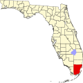
Ponce-Davis, Florida | |
---|---|
Coordinates: 25°41′38″N80°16′26″W / 25.694°N 80.274°W | |
Country | United States |
State | Florida |
County | Miami-Dade |
Government | |
• Governing body | Miami-Dade County |
• Mayor | Daniella Levine Cava |
Time zone | UTC-5 (Eastern (EST)) |
• Summer (DST) | UTC-4 (EDT) |
ZIP code | 33143 |
Area code(s) | 305, 786 |
Ponce-Davis is an unincorporated community in Miami-Dade County, Florida, United States.
The community is named for Ponce De Leon Road (Southwest 49th Avenue), the primary north-south road in the community, and for Davis Drive (Southwest 80th Street), the primary east-west road.
Ponce-Davis borders Coral Gables to the north, east, and south, the city of South Miami to the west, and the unincorporated community of High Pines to the northwest. [1]
Ponce-Davis is mostly residential and consists mainly of single-family homes; there are no commercial districts within the community.
In 2018, the neighboring city of Coral Gables, Florida made a proposal to annex Ponce-Davis and High Pines. In 2019 Miami-Dade County rejected this proposal along with a similar proposal to annex the unincorporated community of Little Gables. [2] [3]
Ponce-Davis is home to Our Lady of Lourdes Academy, a Catholic all-girls high school.
Coral Gables is a city in Miami-Dade County, Florida, United States. The city is part of the Miami metropolitan area of South Florida and is located 7 miles (11 km) southwest of Downtown Miami. As of the 2020 U.S. census, it had a population of 49,248.
Florida City is a city in Miami-Dade County, Florida, United States. It is the southernmost municipality in the South Florida metropolitan area. Florida City is primarily a Miami suburb and a major agricultural area. As of the 2020 census, it had a population of 13,085, up from 11,245 in 2010.
Pinecrest is a suburban village in Miami-Dade County, Florida, United States. The village is part of the Miami metropolitan area of South Florida. As of the 2020 census, the population was 18,388.
South Miami is a city in Miami-Dade County, Florida, United States. The city is part of the Miami metropolitan area of South Florida. The population was 12,026 as of the 2020 census.
State Road 959, known locally as West 57th Avenue and Red Road, is a 5.381-mile-long (8.660 km) north-south Florida state highway located in south Miami-Dade County west of Downtown Miami. It runs from U.S. 1 at the south end at the South Miami-Coral Gables border to Perimeter Road, just south of the runway of the Miami International Airport at its north end.
Palmetto Bay is a suburban incorporated village in Miami-Dade County, Florida, United States. Palmetto Bay includes two neighborhoods that were former census-designated places, Cutler and East Perrine. The village is part of the Miami metropolitan area of South Florida. The population was 24,439 as of the 2020 US census.
Sunset Drive, also known as Southwest 72nd Street is a 12.5-mile-long (20.1 km) east–west arterial road traversing the southwestern suburbs of Miami, Florida, from the northwestern portions of the Kendall area to Coral Gables. A central portion of Sunset Drive is maintained by the Florida Department of Transportation as State Road 986, which runs from the Homestead Extension (HEFT) underpass to Southwest 69th Avenue and is signed through South Miami to US 1.
Bird Road, co-signed State Road 976 from the Homestead Extension of Florida's Turnpike in Westwood Lakes, Florida to U.S. Route 1 in Miami, is a 13.7-mile (22.0 km) main east–west road running south of Downtown Miami in Miami-Dade County, Florida.
Coral Way, co-signed State Road 972 between Douglas Road and US 1 in Miami, is a 16.4-mile-long (26.4 km) primary east-west street that extends from Southwest 157th Avenue in western Miami-Dade County to Brickell Avenue in the Brickell neighborhood of Downtown Miami, Florida.
State Road 953, locally known as Le Jeune Road, is a 11.735 miles (18.886 km) long north–south street in Miami-Dade County, Florida running a few miles west of central Miami from U.S. Route 1 in Coral Gables to State Road 916 in Opa-locka. It is also known as West 42nd Avenue on the greater Miami grid plan and East 8th Avenue in the Hialeah grid plan.
Red Road, also known as West 57th Avenue, is a 20.6-mile (33.2 km) main north-south street running west of downtown Miami in Miami-Dade County, Florida and into Broward County. Red Road is signed as State Road 959 from U.S. 1 to the south end of the Miami International Airport, and State Road 823 from U.S. 27 to the Broward County line.
Ludlam Road, also West 67th Avenue, is a 21.8-mile (35.1 km) north–south street that runs west of downtown Miami in Miami-Dade County, Florida.
Galloway Road, also known as West 87th Avenue, is a north–south route through the western areas of suburban Miami-Dade County, Florida, from the Black Point area south of Cutler Bay almost to the Broward County line north of Miami Lakes. It exists in seven different unconnected segments that total 27.5 miles (44.3 km) in length, acting as connecting roads, neighborhood streets, and arterial routes. Approximately 9.5 miles (15.3 km) of Galloway Road, between Pinecrest and Doral, is designated as State Road 973.
Old Cutler Road is an off-grid plan, 14.9-mile (24.0 km) main northeast–southwest road running south of downtown Miami in Miami-Dade County, Florida, United States.
Coral Way is a neighborhood within Miami, Florida that is defined by Coral Way, a road established by Coral Gables founder George E. Merrick during the 1920s. It is located in Miami-Dade County, Florida.
Miami-Dade County is a county located in the southeastern part of the U.S. state of Florida. The county had a population of 2,701,767 as of the 2020 census, making it the most populous county in Florida and the seventh-most populous county in the United States. It is Florida's third largest county in terms of land area with 1,946 square miles (5,040 km2). The county seat is Miami, the core of the nation's ninth-largest and world's 65th-largest metropolitan area with a 2020 population of 6.138 million people, exceeding the population of 31 of the nation's 50 states as of 2022.
Douglas Road, also West 37th Avenue on the greater Miami grid plan and Northwest 88th Avenue in Miramar, is a 20.4-mile (32.8 km) north–south thoroughfare running west of downtown Miami in Miami-Dade County and Broward County, Florida. It changes names and becomes Pine Island Road, at the intersection with Sheridan Street.
Little Gables is an unincorporated community in Miami-Dade County, Florida. The name "Little Gables" comes from the community being located between the cities of Coral Gables and Miami.
High Pines is an unincorporated community in Miami-Dade County, Florida.